Steps Water

Lake, Pool, Pond, Freshwater Marsh in Somerset Somerset West and Taunton

England

Steps Water

Service Road behind the main street in Taunton This is the service road behind the main street in Taunton and it also provides access for delivery vehicles to the nearby Morrisons superstore.
Service Road behind the main street in Taunton Credit: Mike Crowe

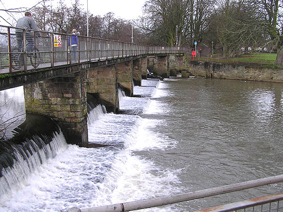
Steps Water is a multi-faceted water body located in Somerset, England. It consists of a lake, pool, pond, and a freshwater marsh, providing a diverse and rich habitat for various flora and fauna.

The lake is the largest feature of Steps Water, covering a vast area with its calm, still waters. It is fed by natural springs and rainfall, ensuring a constant supply of fresh water. The lake serves as a breeding ground for fish and supports a variety of aquatic plants, creating a thriving ecosystem.

Adjacent to the lake is a smaller pool, characterized by its shallow depth and gentle currents. This pool serves as a watering hole for birds and other wildlife, attracting a wide range of species throughout the year. Its clear waters and surrounding vegetation make it an ideal spot for observing and studying aquatic life.

The pond at Steps Water is relatively small in size but is teeming with life. It is home to a plethora of amphibians, including frogs, toads, and newts. The pond's still waters provide a safe breeding ground for these creatures, with lily pads and reeds dotting its surface.

Lastly, the freshwater marsh is an essential component of Steps Water's ecosystem. It is characterized by its wet, spongy terrain and abundant plant life, including marsh marigolds and sedges. The marsh acts as a natural filter, purifying the water and providing a habitat for numerous bird species, such as herons and kingfishers.

Steps Water's combination of a lake, pool, pond, and freshwater marsh offers a diverse range of habitats for countless species. It serves as a haven for wildlife enthusiasts, researchers, and nature lovers, providing a unique opportunity to observe and appreciate the wonders of the natural world.

If you have any feedback on the listing, please let us know in the comments section below.

Steps Water Images

Images are sourced within 2km of 51.015671/-3.1126966 or Grid Reference ST2224. Thanks to Geograph Open Source API. All images are credited.

Service Road behind the main street in Taunton This is the service road behind the main street in Taunton and it also provides access for delivery vehicles to the nearby Morrisons superstore.
Service Road behind the main street in Taunton
This is the service road behind the main street in Taunton and it also provides access for delivery vehicles to the nearby Morrisons superstore.
Swans on the River Tone The view point is the access bridge for the cattle market/auction site which is visible at centre right. Priory Bridge can be seen in the background.
Swans on the River Tone
The view point is the access bridge for the cattle market/auction site which is visible at centre right. Priory Bridge can be seen in the background.
Vivary Park, Taunton This elaborate fountain is in the centre of the park.  The fort-like building in the background is the barracks.
Vivary Park, Taunton
This elaborate fountain is in the centre of the park. The fort-like building in the background is the barracks.
Taunton Carnival Theatreland, the 2005 entry from Harlequins Carnival Club of Ilminster leaves the Priory Bridge Road assembly area during Taunton Carnival procession.
Taunton Carnival
Theatreland, the 2005 entry from Harlequins Carnival Club of Ilminster leaves the Priory Bridge Road assembly area during Taunton Carnival procession.
Taunton Carnival A view over Priory Bridge Road car park, in use as the assembly area for Taunton Carnival 2005. As the skies darken, last minute checks are being made on the floats and the majorettes are preparing to practise their routine.
Taunton Carnival
A view over Priory Bridge Road car park, in use as the assembly area for Taunton Carnival 2005. As the skies darken, last minute checks are being made on the floats and the majorettes are preparing to practise their routine.
Taunton Carnival As the moon rises, a police motor cyclist keeps an eye on some of the carnival floats preparing for the 2005 Taunton Carnival procession.
Taunton Carnival
As the moon rises, a police motor cyclist keeps an eye on some of the carnival floats preparing for the 2005 Taunton Carnival procession.
Taunton Carnival It's rush, rush, rush as start time approaches!  This is a view of some of the carnival floats in the Priory Bridge Road assembly area as they prepare for the 2005 Taunton Carnival procession.
Taunton Carnival
It's rush, rush, rush as start time approaches! This is a view of some of the carnival floats in the Priory Bridge Road assembly area as they prepare for the 2005 Taunton Carnival procession.
Taunton Carnival The 2005 entry form Phoenix Carnival club leaves the assembly area as it starts its journey along the Taunton Carnival procession route.
Taunton Carnival
The 2005 entry form Phoenix Carnival club leaves the assembly area as it starts its journey along the Taunton Carnival procession route.
Taunton Carnival Admiring crowds line the route as the 2005 entry form Gemini Carnival Club starts on its way along the Taunton Carnival procession.  This is a tableau float and the poses will be maintained for the duration of the procession, approximately two hours.
Taunton Carnival
Admiring crowds line the route as the 2005 entry form Gemini Carnival Club starts on its way along the Taunton Carnival procession. This is a tableau float and the poses will be maintained for the duration of the procession, approximately two hours.
Taunton School An independent boarding and day school for boys set in beautiful grounds close to the town centre.
Taunton School
An independent boarding and day school for boys set in beautiful grounds close to the town centre.
New bridge over the rail tracks. For years the A3065 suffered holdups due to the level crossing on the main line to Devon and Cornwall, which used to be shut for more than 30% of the time. Now a new bridge has just been completed and extensive improvements around the site will include a Park and Ride. The red arch of the bridge can be seen in the centre of the picture.
New bridge over the rail tracks.
For years the A3065 suffered holdups due to the level crossing on the main line to Devon and Cornwall, which used to be shut for more than 30% of the time. Now a new bridge has just been completed and extensive improvements around the site will include a Park and Ride. The red arch of the bridge can be seen in the centre of the picture.
The County Ground, Taunton Somerset are playing Hampshire in a four day county fixture. The Ian Botham Stand opposite is named after one of Somerset's most illustrious former players.
The County Ground, Taunton
Somerset are playing Hampshire in a four day county fixture. The Ian Botham Stand opposite is named after one of Somerset's most illustrious former players.
River Tone Looking down from the footbridge at the riverside path alongside the supermarket car park. A popular spot for feeding swans, ducks and gulls.
River Tone
Looking down from the footbridge at the riverside path alongside the supermarket car park. A popular spot for feeding swans, ducks and gulls.
St. Mary Magdalene, Taunton The parish church of St.Mary Magdalene, Taunton
St. Mary Magdalene, Taunton
The parish church of St.Mary Magdalene, Taunton
Christmas Lights, Taunton A view of the cross at the top of North Street, Taunton, with festive lights in the background.
Christmas Lights, Taunton
A view of the cross at the top of North Street, Taunton, with festive lights in the background.
St. James's church, Taunton
Tudor Inn, Taunton Dates back to the 1600's when Judge Jeffrys of "Bloody Assize" infamy, was believed to have stayed here.
Tudor Inn, Taunton
Dates back to the 1600's when Judge Jeffrys of "Bloody Assize" infamy, was believed to have stayed here.
French Weir, River Tone
Show me another place!

Steps Water is located at Grid Ref: ST2224 (Lat: 51.015671, Lng: -3.1126966)

Administrative County: Somerset

District: Somerset West and Taunton

Police Authority: Avon and Somerset

What 3 Words

///master.void.wipe. Near Taunton, Somerset

Related Wikis

St John the Evangelist, Taunton

The Church of St John the Evangelist, Taunton is a Church of England parish church in Taunton, Somerset. It is a grade I listed building. == History... ==

The Castle School, Taunton

The Castle School is a co-educational secondary school in Taunton, Somerset, England. It had 1,189 pupils aged 11 to 16 in 2017, and has had specialist...

BBC Radio Somerset

BBC Radio Somerset is the BBC's local radio station serving the county of Somerset, England. It broadcasts on FM, AM, DAB, digital TV and via BBC Sounds...

Taunton Shire Hall

Taunton Shire Hall is a municipal building on Shuttern in Taunton, Somerset. The Shire Hall, which serves as a Crown Court, is a Grade II listed building...

Taunton bus station

Taunton bus station was situated on Tower Street, Taunton, Somerset, England. It was opened by the Western National Omnibus Company in 1953 and closed...

County Hall, Taunton

County Hall is a municipal building in The Crescent, Taunton, Somerset, England. The structure, which is the offices and meeting place of Somerset Council...

Museum of Somerset

The Museum of Somerset is located in the 12th-century great hall of Taunton Castle, in Taunton in the county of Somerset, England. The museum is run by...

Taunton Castle

Taunton Castle is a castle built to defend the town of Taunton, Somerset, England. It has origins in the Anglo Saxon period and was later the site of a...

Nearby Amenities

Located within 500m of 51.015671,-3.1126966
Traffic Signals
Crossing: traffic_signals
Crossing Ref: toucan
Lat/Long: 51.0152751/-3.1177874
Traffic Signals
Lat/Long: 51.0156215/-3.1088695
Mini Roundabout
Direction: clockwise
Lat/Long: 51.0139653/-3.106545
Mini Roundabout
Direction: clockwise
Lat/Long: 51.0142945/-3.1062531
Traffic Signals
Lat/Long: 51.0134101/-3.1113431
Traffic Signals
Lat/Long: 51.0134571/-3.1112672
Speed Camera
Maxspeed: 30 mph
Lat/Long: 51.0132989/-3.1111645
Barrier: bollard
Lat/Long: 51.0146056/-3.1095403
Traffic Signals
Lat/Long: 51.0151501/-3.1188947
Post Box
Mapillary: 3763317120461771
Operator: Royal Mail
Operator Wikidata: Q638098
Post Box Type: pillar
Ref: TA1 131
Survey Date: 2020-03-26
Lat/Long: 51.0147994/-3.1157595
Mini Roundabout
Direction: clockwise
Lat/Long: 51.0166242/-3.1169203
Turning Circle
Lat/Long: 51.0167805/-3.1064891
Traffic Signals
Lat/Long: 51.0153835/-3.1073751
Turning Circle
Lat/Long: 51.0113912/-3.1119207
Addr City: Taunton
Addr Housename: County Hall
Addr Postcode: TA1 4DY
Door: automatic
Entrance: yes
Level: 0
Wheelchair: yes
Lat/Long: 51.01341/-3.106775
Crossing
Crossing: unmarked
Crossing Markings: no
Lat/Long: 51.0143157/-3.1132295
Traffic Calming: choker
Lat/Long: 51.0115601/-3.1136781
Crossing
Crossing Island: yes
Lat/Long: 51.0127844/-3.1134268
Crossing
Crossing Island: yes
Lat/Long: 51.0128003/-3.1131416
Give Way
Direction: backward
Lat/Long: 51.0128865/-3.1132974
Entrance: yes
Lat/Long: 51.0145785/-3.1062462
Barrier: lift_gate
Bicycle: yes
Foot: yes
Lat/Long: 51.0139807/-3.1061639
Cycleway: asl
Lat/Long: 51.0141224/-3.1124176
Crossing
Crossing: traffic_signals
Crossing Ref: pelican
Lat/Long: 51.0142583/-3.1126801
Crossing
Crossing: traffic_signals
Crossing Ref: pelican
Lat/Long: 51.0143629/-3.1127539
Leisure: playground
Wheelchair: yes
Lat/Long: 51.0172378/-3.1110642
Crossing
Button Operated: yes
Check Date Crossing: 2022-12-28
Crossing: traffic_signals
Crossing Island: no
Crossing Ref: pelican
Tactile Paving: yes
Lat/Long: 51.0167443/-3.1061007
Barrier: bollard
Bicycle: yes
Foot: yes
Lat/Long: 51.0167677/-3.1063747
Cycleway: asl
Lat/Long: 51.0143688/-3.1127863
Give Way
Direction: forward
Lat/Long: 51.0133599/-3.1088517
Barrier: cycle_barrier
Bicycle: yes
Foot: yes
Lat/Long: 51.0189336/-3.1105842
Give Way
Direction: forward
Lat/Long: 51.0131202/-3.1086592
Crossing
Crossing Island: yes
Lat/Long: 51.0133409/-3.1114411
Give Way
Lat/Long: 51.0131992/-3.1136628
Give Way
Lat/Long: 51.0136902/-3.1162119
Give Way
Lat/Long: 51.0138809/-3.1172079
Give Way
Lat/Long: 51.01393/-3.117179
Give Way
Lat/Long: 51.014163/-3.1182191
Give Way
Lat/Long: 51.0149933/-3.1166015
Give Way
Lat/Long: 51.0118624/-3.1134461
Give Way
Direction: backward
Lat/Long: 51.0127582/-3.1130699
Give Way
Lat/Long: 51.0116009/-3.1100578
Tangier
Is In: Taunton
Place: suburb
Lat/Long: 51.0160424/-3.1087732
Bus Stop
Tesco (SE-bound)
Bus: yes
Naptan AtcoCode: 3600SOA10042
Naptan Bearing: SE
Naptan CommonName: Tesco
Naptan Indicator: SE-bound
Naptan NaptanCode: sotajajg
Naptan PlusbusZoneRef: TAUNTON
Naptan Street: Wellington Road
Naptan Verified: no
Network: The Buses of Somerset
Network Wikidata: Q17018973
Operator: First South West
Operator Wikidata: Q5454172
Public Transport: platform
Ref: 3;22;22A;22B;X22
Lat/Long: 51.0144949/-3.1134766
Bus Stop
Aylands Road (NW-bound)
Bus: yes
Naptan AtcoCode: 3600SOA10041
Naptan Bearing: NW
Naptan CommonName: Aylands Road
Naptan Indicator: NW-bound
Naptan NaptanCode: sotajaja
Naptan PlusbusZoneRef: TAUNTON
Naptan Street: Wellington Road
Naptan Verified: no
Network: The Buses of Somerset
Network Wikidata: Q17018973
Operator: First South West
Operator Wikidata: Q5454172
Public Transport: platform
Ref: 3;22;22A;22B;X22
Lat/Long: 51.0144871/-3.1139478
Bus Stop
Parkfield Drive (E-bound)
Bus: yes
Naptan AtcoCode: 3600SOA56522
Naptan Bearing: E
Naptan CommonName: Parkfield Drive
Naptan Indicator: E-bound
Naptan NaptanCode: sotdmpwa
Naptan PlusbusZoneRef: TAUNTON
Naptan Street: Parkfield Drive
Naptan Verified: no
Public Transport: platform
Shelter: no
Lat/Long: 51.0125882/-3.1146853
Bus Stop
Parkfield Drive (W-bound)
Bus: yes
Naptan AtcoCode: 3600SOA56523
Naptan Bearing: W
Naptan CommonName: Parkfield Drive
Naptan Indicator: W-bound
Naptan NaptanCode: sotdmpwd
Naptan PlusbusZoneRef: TAUNTON
Naptan Street: Parkfield Drive
Naptan Verified: no
Public Transport: platform
Shelter: no
Lat/Long: 51.0124161/-3.1150179
Leisure: slipway
Lat/Long: 51.016576/-3.1057465
Barrier: bollard
Bicycle: yes
Bollard: removable
Foot: yes
Material: plastic
Lat/Long: 51.0187848/-3.1125868
Barrier: cycle_barrier
Bicycle: yes
Foot: yes
Lat/Long: 51.0188319/-3.1102056
Give Way
Lat/Long: 51.0122685/-3.1095153
Give Way
Direction: forward
Lat/Long: 51.0131474/-3.110552
Give Way
Lat/Long: 51.0147224/-3.1062999
Post Box
Brand: Royal Mail
Brand Wikidata: Q638098
Collection Times: Mo-Fr 09:00; Sa 07:00
Operator: Royal Mail
Operator Wikidata: Q638098
Ref: TA1 631
Lat/Long: 51.018791/-3.1126263
Post Box
Collection Times: Mo-Fr 09:00; Sa 07:00
Mapillary: 1168365153645399
Operator: Royal Mail
Operator Wikidata: Q638098
Post Box Mounting: brick_wall
Post Box Type: wall
Ref: TA1 37
Survey Date: 2020-03-01
Lat/Long: 51.0197184/-3.1108379
Bus Stop
Somerset College 1 (E-bound)
Bus: yes
Naptan AtcoCode: 3600SOA14259
Naptan Bearing: E
Naptan CommonName: Somerset College 1
Naptan Indicator: E-bound
Naptan NaptanCode: sotdmpgm
Naptan PlusbusZoneRef: TAUNTON
Naptan Street: Wellington Road
Naptan Verified: no
Public Transport: platform
Lat/Long: 51.0155915/-3.1184492
Bus Stop
Tesco Superstore (NE-bound)
Bus: yes
Public Transport: platform
Lat/Long: 51.0149527/-3.1111473
Bus Stop
Tesco Superstore (SW-bound)
Bus: yes
Public Transport: platform
Lat/Long: 51.0149122/-3.1109623
Bus Stop
County Hall (SW-bound)
Bus: yes
Direction: 240
Naptan AtcoCode: 3600SOA10040
Naptan Bearing: SW
Naptan CommonName: County Hall
Naptan Indicator: SW-bound
Naptan NaptanCode: sotajdat
Naptan PlusbusZoneRef: TAUNTON
Naptan Street: Park Street
Naptan Verified: no
Network: The Buses of Somerset
Network Wikidata: Q17018973
Operator: First South West
Operator Wikidata: Q5454172
Public Transport: platform
Ref: P&R;3;7;22;22A;X22;101
Shelter: yes
Lat/Long: 51.0135524/-3.1075769
Bus Stop
County Hall (NE-bound)
Bus: yes
Direction: 65
Naptan AtcoCode: 3600SOA30070
Naptan Bearing: NE
Naptan CommonName: County Hall
Naptan Indicator: NE-bound
Naptan NaptanCode: sotajdap
Naptan PlusbusZoneRef: TAUNTON
Naptan Street: Park Street
Naptan Verified: no
Network: The Buses of Somerset
Network Wikidata: Q17018973
Operator: First South West
Operator Wikidata: Q5454172
Public Transport: platform
Ref: P&R;3;7;22;22A;X22;101
Shelter: yes
Lat/Long: 51.0136114/-3.1077245
Traffic Signals
Traffic Signals: signal
Traffic Signals Direction: forward
Lat/Long: 51.0143855/-3.1121666
Give Way
Lat/Long: 51.0143488/-3.1132133
Give Way
Direction: backward
Lat/Long: 51.0121532/-3.1167879
Entrance: main
Wheelchair: yes
Lat/Long: 51.0158828/-3.1188993
Cafe
The Weir
Addr City: Taunton
Addr Country: GB
Addr County: Somerset
Addr Parentstreet: French Weir Avenue
Addr Postcode: TA1 1AW
Addr Street: French Weir Park
Fhrs Id: 953459
Outdoor Seating: yes
Lat/Long: 51.0174876/-3.1128007
Bench
Lat/Long: 51.0179331/-3.1133846
Bench
Lat/Long: 51.0176985/-3.1109882
Bench
Lat/Long: 51.0181026/-3.1117297
Traffic Signals
Traffic Signals: signal
Traffic Signals Direction: forward
Lat/Long: 51.0143795/-3.1128674
Traffic Signals
Traffic Signals: signal
Traffic Signals Direction: forward
Lat/Long: 51.014094/-3.1123785
Payment Terminal
Coinstar
Brand: Coinstar
Brand Wikidata: Q5141641
Payment Coins: yes
Lat/Long: 51.0154327/-3.1120296
Post Box
Operator: Royal Mail
Operator Wikidata: Q638098
Lat/Long: 51.0139188/-3.1062645
Entrance: main
Lat/Long: 51.0146977/-3.1070957
Community Centre
The Sangha House
Addr City: Taunton
Addr Country: GB
Addr County: Somerset
Addr Floor: 1
Addr Housename: Mitre House
Addr Postcode: TA1 4BH
Addr Street: Tower Street
Website: https://www.thesanghahouse.co.uk
Lat/Long: 51.0141403/-3.1067236
Loolabells Floristry
Addr City: Taunton
Addr Country: GB
Addr County: Somerset
Addr Floor: 0
Addr Housename: Mitre House
Addr Postcode: TA1 4BH
Addr Street: Tower Street
Contact Facebook: Loolabells-floristry-1433710090075978
Contact Instagram: loolabellsfloristry
Email: loolabellsfloristry@gmail.com
Opening Hours: Tu-Fr 09:30-15:00; Sa 09:30-14:30
Phone: +44 7853 185560
Shop: florist
Website: https://www.loolabellsfloristry.co.uk
Lat/Long: 51.0140695/-3.1066706
Parcel Locker
Brand: InPost
Brand Wikidata: Q3182097
Opening Hours: 24/7
Operator: InPost
Parcel Mail In: yes
Parcel Pickup: yes
Lat/Long: 51.0154273/-3.1121105
Bus Stop
Parkfield Road (E)
Bus: yes
Naptan AtcoCode: 3600SOA56754
Naptan Bearing: NE
Naptan CommonName: Parkfield Road
Naptan Indicator: NE-bound
Naptan NaptanCode: sotdpgpd
Naptan PlusbusZoneRef: TAUNTON
Naptan Street: Parkfield Road
Naptan Verified: no
Network: The Buses of Somerset
Network Wikidata: Q17018973
Operator: First South West
Operator Wikidata: Q5454172
Public Transport: platform
Ref: 1E;7
Lat/Long: 51.0130164/-3.1125549
Bus Stop
Parkfield Road (W)
Bus: yes
Naptan AtcoCode: 3600SOA56755
Naptan Bearing: SW
Naptan CommonName: Parkfield Road
Naptan Indicator: SW-bound
Naptan NaptanCode: sotdpgpg
Naptan PlusbusZoneRef: TAUNTON
Naptan Street: Parkfield Road
Naptan Verified: no
Network: The Buses of Somerset
Network Wikidata: Q17018973
Operator: First South West
Operator Wikidata: Q5454172
Public Transport: platform
Ref: 1E;7
Lat/Long: 51.012932/-3.1124905
The data included in this document is from www.openstreetmap.org. The data is made available under ODbL.

Have you been to Steps Water?

Leave your review of Steps Water below (or comments, questions and feedback).