Beckhead Tarn
Lake, Pool, Pond, Freshwater Marsh in Cumberland Copeland
England
Beckhead Tarn

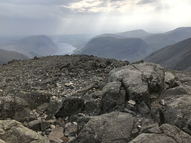
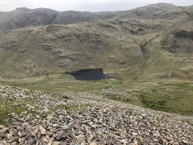
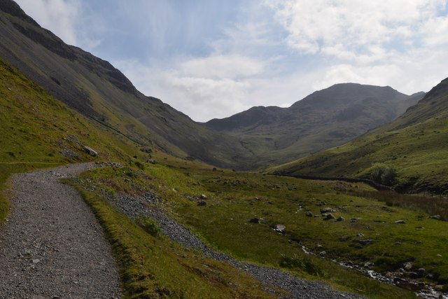
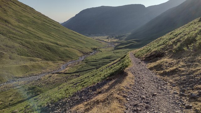
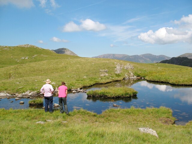
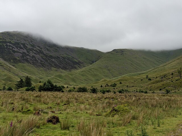
Beckhead Tarn is a picturesque freshwater lake located in the county of Cumberland, England. Nestled amidst the rolling hills and verdant meadows, this natural beauty spot offers a tranquil retreat for both locals and visitors alike.
Covering an area of approximately 10 acres, Beckhead Tarn is a relatively small yet charming body of water. Its crystal-clear waters reflect the surrounding landscape, creating a breathtaking sight. The lake is fed by several small streams that meander through the nearby woods, ensuring a constant flow of fresh water.
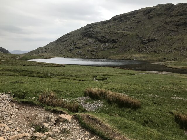
Surrounded by a diverse range of flora and fauna, Beckhead Tarn is a haven for wildlife enthusiasts. The lake is home to numerous species of fish, including perch, roach, and tench, making it a popular destination for anglers. The surrounding marshland provides a suitable habitat for a variety of bird species, such as swans, ducks, and herons. Visitors can often spot these majestic creatures gracefully gliding across the water or taking flight from the reedy edges of the lake.
The tranquil atmosphere of Beckhead Tarn makes it an ideal spot for outdoor activities. Canoeing and kayaking are popular pastimes, allowing visitors to explore the calm waters while being surrounded by the beauty of nature. The surrounding walking trails offer an opportunity to take in the breathtaking views and observe the abundant wildlife.
With its natural beauty and diverse ecosystem, Beckhead Tarn is a true gem in the heart of Cumberland. Whether you seek a peaceful spot for reflection or an active day of outdoor adventure, this freshwater lake is sure to captivate all who visit.
If you have any feedback on the listing, please let us know in the comments section below.
Beckhead Tarn Images
Images are sourced within 2km of 54.485277/-3.2282273 or Grid Reference NY2010. Thanks to Geograph Open Source API. All images are credited.


Beckhead Tarn is located at Grid Ref: NY2010 (Lat: 54.485277, Lng: -3.2282273)
Administrative County: Cumbria
District: Copeland
Police Authority: Cumbria
What 3 Words
///found.extremely.educates. Near Keswick, Cumbria
Nearby Locations
Related Wikis
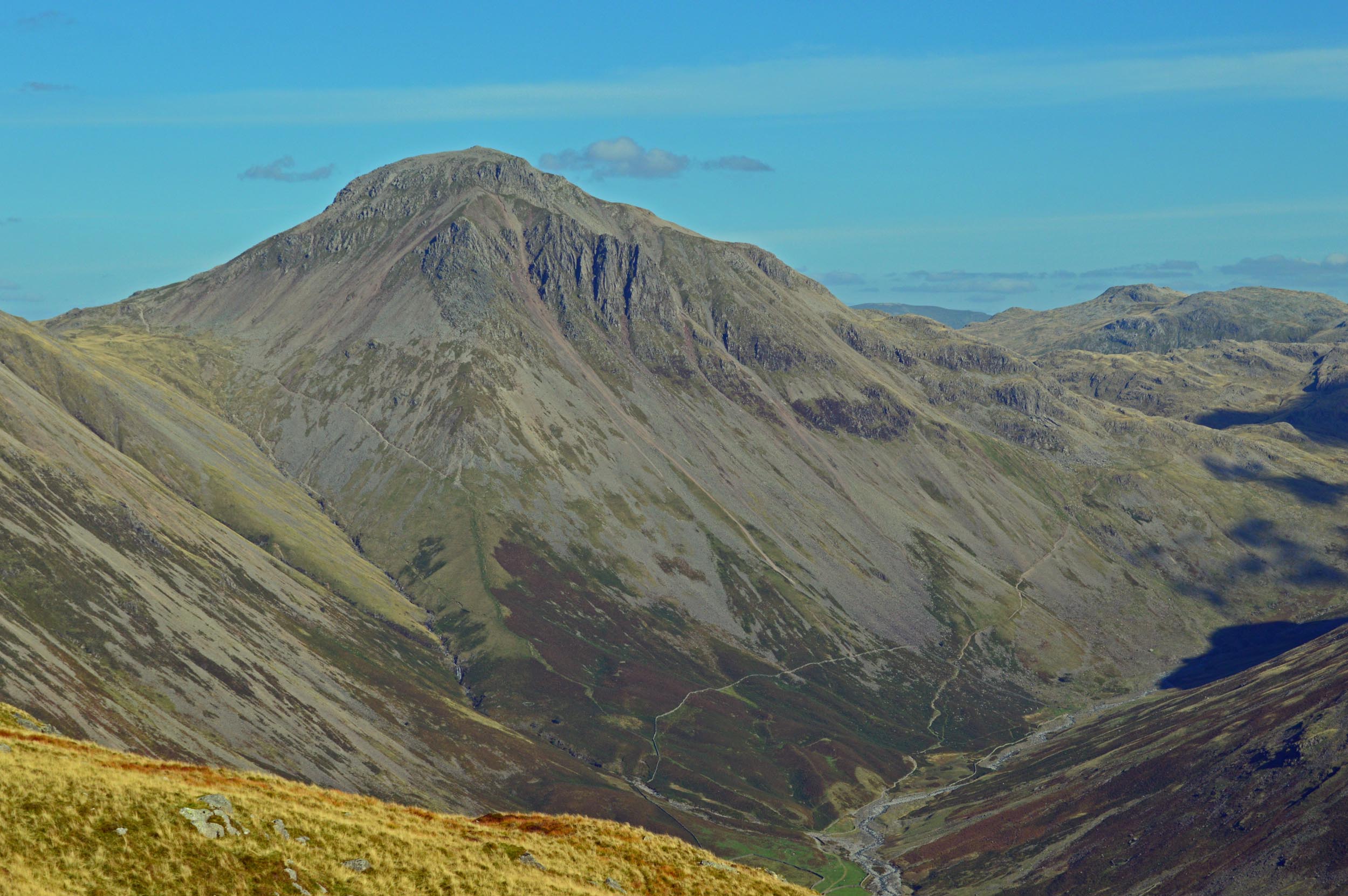
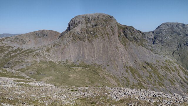
Great Gable
Great Gable is a mountain in the Lake District, United Kingdom. It is named after its appearance as a pyramid from Wasdale, though it is dome-shaped from...

Green Gable
Green Gable is a fell in the English Lake District often traversed by walkers en route to its more famous neighbour Great Gable. It can be ascended from...

Kirk Fell
Kirk Fell is a fell in the Western part of the English Lake District. It is situated between Great Gable and Pillar on the long ring of fells surrounding...

Brandreth
Brandreth is a fell in the English Lake District. It stands between Great Gable and Haystacks in the Western Fells. == Topography == The Western Fells...
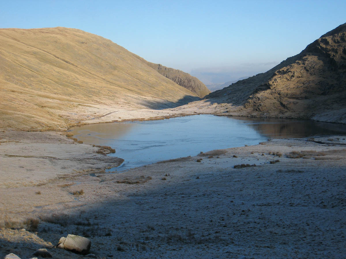
Styhead Tarn
Styhead Tarn is a tarn in the English Lake District, near the top of the Sty Head pass at the head of Borrowdale. It is on the route from Wasdale to Borrowdale...

Base Brown
Base Brown is a fell in England's Lake District, near the head of the Borrowdale Valley. It forms one side of the Seathwaite Valley, and on the western...

Blackbeck Tarn
Blackbeck Tarn is a small tarn in Cumbria, England, situated near the summit of Haystacks in the Buttermere Valley. At an elevation of 486 m (1,594 ft...

Cumbria
Cumbria ( KUM-bree-ə) is a ceremonial county in North West England. It borders the Scottish council areas of Dumfries and Galloway and Scottish Borders...
Nearby Amenities
Located within 500m of 54.485277,-3.2282273Have you been to Beckhead Tarn?
Leave your review of Beckhead Tarn below (or comments, questions and feedback).