Auchintaple Loch

Lake, Pool, Pond, Freshwater Marsh in Angus

Scotland

Auchintaple Loch

Hill road heading towards Auchintaple Loch The road lies immediately to the south of Badandun Hill and has descended over its slopes.
Auchintaple Loch can be seen in the middle distance; farther away at the centre of the image, is Mount Blair.
Hill road heading towards Auchintaple Loch Credit: Trevor Littlewood

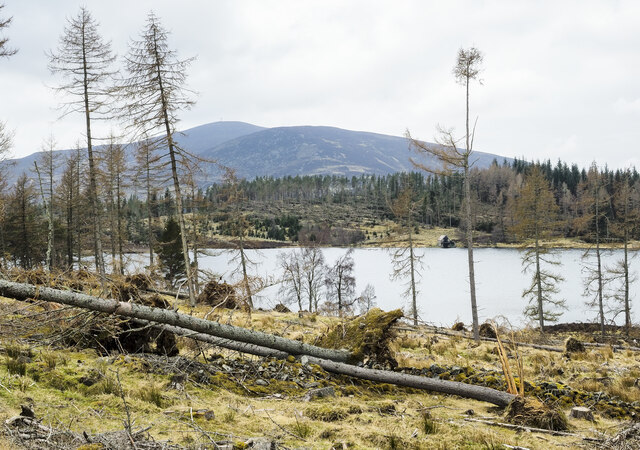
Auchintaple Loch is a small freshwater loch located in the Angus region of Scotland. Covering an area of approximately 20 acres, it is nestled amidst picturesque surroundings, surrounded by rolling hills and lush greenery. The loch is situated within the Auchintaple Estate, which is known for its stunning natural beauty.

The water in Auchintaple Loch is sourced from various streams and springs in the vicinity, ensuring a constant flow of fresh and clean water. The loch is relatively shallow, with a maximum depth of around 10 feet, and is fed by a small inlet stream at one end.

The surrounding landscape of Auchintaple Loch is rich in vegetation, offering a diverse habitat for various species of flora and fauna. The loch is surrounded by reed beds and marshy areas, providing a perfect nesting ground for waterfowl and other wetland birds. It is not uncommon to spot species such as swans, ducks, geese, and herons in and around the loch.

The tranquil atmosphere of Auchintaple Loch makes it a popular spot for fishing enthusiasts. The loch is home to a variety of fish species, including brown trout, pike, and perch. Anglers can enjoy a peaceful day by the water, casting their lines and trying their luck in the hopes of catching a prized fish.

Overall, Auchintaple Loch offers a serene and idyllic setting for nature lovers and those seeking a peaceful retreat amidst nature's beauty. Whether it's birdwatching, fishing, or simply enjoying the tranquility of the surroundings, this small freshwater loch has something to offer to everyone.

If you have any feedback on the listing, please let us know in the comments section below.

Auchintaple Loch Images

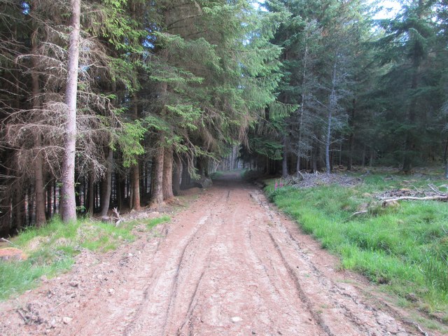
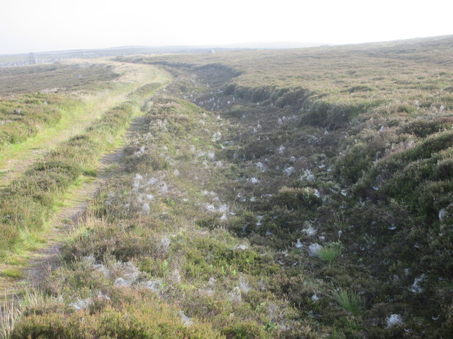
Images are sourced within 2km of 56.767433/-3.3166709 or Grid Reference NO1964. Thanks to Geograph Open Source API. All images are credited.
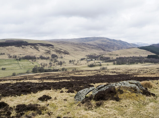
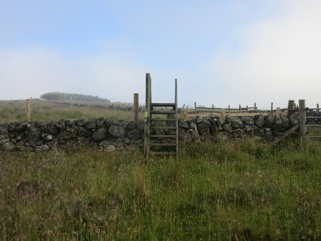
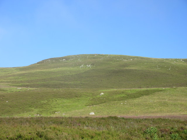
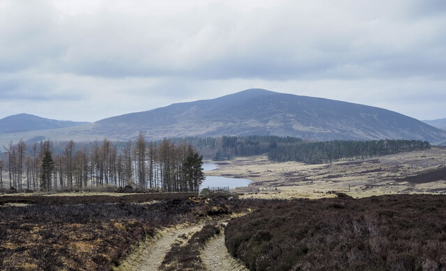
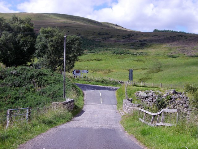
Hill road heading towards Auchintaple Loch The road lies immediately to the south of Badandun Hill and has descended over its slopes.
Auchintaple Loch can be seen in the middle distance; farther away at the centre of the image, is Mount Blair.
Hill road heading towards Auchintaple Loch
The road lies immediately to the south of Badandun Hill and has descended over its slopes. Auchintaple Loch can be seen in the middle distance; farther away at the centre of the image, is Mount Blair.
Coniferous plantation laid waste The plantation close to Auchintaple Loch had already largely been clear-felled but some trees had been left standing. Winter storms then felled some of those - there's one such in the foreground. The smouldering fires simply add to the sense of destruction.
Coniferous plantation laid waste
The plantation close to Auchintaple Loch had already largely been clear-felled but some trees had been left standing. Winter storms then felled some of those - there's one such in the foreground. The smouldering fires simply add to the sense of destruction.
Going off to start a fire! The vehicle leaving the north-west top of Lindalla Hill, is carrying two estate workers whose mission is to begin a heather fire on the ground to the right side of the image as part of the owning estate's land management, presumably for grouse shooting. The resulting fire can be seen here - <a title="https://www.geograph.org.uk/photo/7151422" href="https://www.geograph.org.uk/photo/7151422">Link</a> .
Going off to start a fire!
The vehicle leaving the north-west top of Lindalla Hill, is carrying two estate workers whose mission is to begin a heather fire on the ground to the right side of the image as part of the owning estate's land management, presumably for grouse shooting. The resulting fire can be seen here - Link .
Heather burning along line of wall Heather burning to the north-west of the minor hill, Lindalla.
Mount Blair lies in the distance.
Heather burning along line of wall
Heather burning to the north-west of the minor hill, Lindalla. Mount Blair lies in the distance.
Forter Castle, Glenisla Forter Castle dates from 1560; it clearly fell into disrepair as a sympathetic rebuild was made in the 1990s.
A notice at the gate emphasises that it's private - no doubt it's appearance has made tourists think it to be an antiquity open to the public!
It's available currently as a luxury holiday let.
Forter Castle, Glenisla
Forter Castle dates from 1560; it clearly fell into disrepair as a sympathetic rebuild was made in the 1990s. A notice at the gate emphasises that it's private - no doubt it's appearance has made tourists think it to be an antiquity open to the public! It's available currently as a luxury holiday let.
Moorland with embedded rocks beside hill road The hill road, now also the route used by a long distance path, the Cateran Trail, rises from the Forter area in Glen Isla to this location close to The Knaps. The moorland in view is on the road's north-west side, at a gate.
Beyond, the view is across Glen Isla to Duchray Hill.
Moorland with embedded rocks beside hill road
The hill road, now also the route used by a long distance path, the Cateran Trail, rises from the Forter area in Glen Isla to this location close to The Knaps. The moorland in view is on the road's north-west side, at a gate. Beyond, the view is across Glen Isla to Duchray Hill.
Minor road heading into Glen Isla The road heading north from Little Forter with Badandun Hill rising in the distance.
Minor road heading into Glen Isla
The road heading north from Little Forter with Badandun Hill rising in the distance.
Plantation below hill road The grassy slope descends from a hill road on the south side of Carn an Fhidhleir. Below the plantation is the Forter area of Glen Isla; The restored Forter Castle can be discerned there.
Plantation below hill road
The grassy slope descends from a hill road on the south side of Carn an Fhidhleir. Below the plantation is the Forter area of Glen Isla; The restored Forter Castle can be discerned there.
Windthrown trees on east side of Auchintaple Loch The plantation had already been clear-felled but as happens regularly a few trees had been left standing; the winter storms of 2021 into 2022 knocked over many of those.
Mount Blair is in the distance.
Windthrown trees on east side of Auchintaple Loch
The plantation had already been clear-felled but as happens regularly a few trees had been left standing; the winter storms of 2021 into 2022 knocked over many of those. Mount Blair is in the distance.
Cateran Trail stile Ladder-type stile on the Cateran Trail.
Cateran Trail stile
Ladder-type stile on the Cateran Trail.
Cateran Trail through woodland A twisting section of the Cateran Trail through woodland east of Auchintaple Loch.
Cateran Trail through woodland
A twisting section of the Cateran Trail through woodland east of Auchintaple Loch.
Cateran Trail cobwebs Early morning cobwebs by the side of the Cateran Trail.
Cateran Trail cobwebs
Early morning cobwebs by the side of the Cateran Trail.
Southern side of Badandun Hill Southern heights of Badandun Hill viewed from the east.
Southern side of Badandun Hill
Southern heights of Badandun Hill viewed from the east.
Bridge of Forter On a damp day after heavy rain.
Bridge of Forter
On a damp day after heavy rain.
Unhelpful road sign at Folda Strong winds (or vandals) have set all the pointers in the same direction!
See <a title="https://www.geograph.org.uk/photo/1535665" href="https://www.geograph.org.uk/photo/1535665">Link</a>  for how it should look.
Forter Castle has not been moved.
Unhelpful road sign at Folda
Strong winds (or vandals) have set all the pointers in the same direction! See Link for how it should look. Forter Castle has not been moved.
Creag Loisgte, off B951 With a fence climbing further up to an outlying mini-summit (Creag na Cuigeil, 653m) NE of Mt Blair. [Creag Loisgte ~ burnt rock] [Creag na Cuigeil ~ Rock of the distaff (a staff holding flax fibres for spinning)]
Creag Loisgte, off B951
With a fence climbing further up to an outlying mini-summit (Creag na Cuigeil, 653m) NE of Mt Blair. [Creag Loisgte ~ burnt rock] [Creag na Cuigeil ~ Rock of the distaff (a staff holding flax fibres for spinning)]
Meikle Forter and Forter Castle From B951 in Upper Glen Isla.
Meikle Forter and Forter Castle
From B951 in Upper Glen Isla.
Stone bridge over Balloch Burn (B951) With a junction for Forter Castle (to right ahead); part of the Cateran Trail.
Stone bridge over Balloch Burn (B951)
With a junction for Forter Castle (to right ahead); part of the Cateran Trail.
Show me another place!

Auchintaple Loch is located at Grid Ref: NO1964 (Lat: 56.767433, Lng: -3.3166709)

Unitary Authority: Angus

Police Authority: Tayside

What 3 Words

///deflection.writing.fidgeting. Near Alyth, Perth & Kinross

Nearby Locations

Auchintaple Loch

Related Wikis

Auchintaple Loch

Auchintaple Loch also known as Auchenchapel Loch, is a small shallow freshwater loch that is located in Glen Isla in Angus, Scotland. == See also == List...

Folda, Angus

Folda is a hamlet in Glen Isla, Angus, Scotland. It is situated on the River Isla, twelve miles north-west of Kirriemuir and eleven miles north of Blairgowrie...

Little Forter

Little Forter is a hamlet in Glen Isla, Angus, Scotland. It is on the River Isla, 13 miles (21 kilometres) north-west of Kirriemuir and 11 miles (18 kilometres...
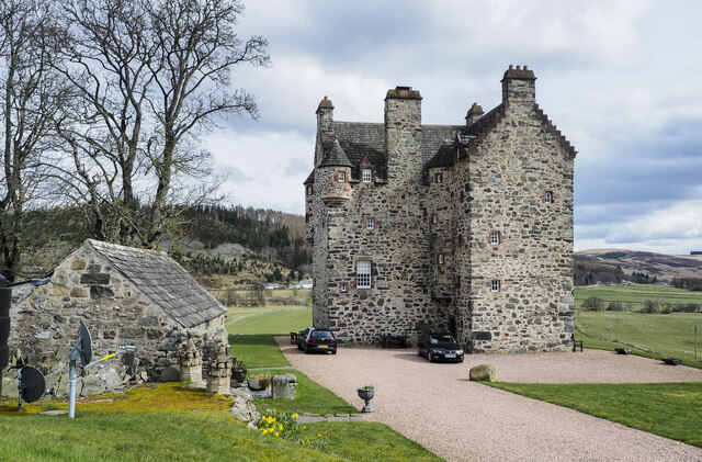
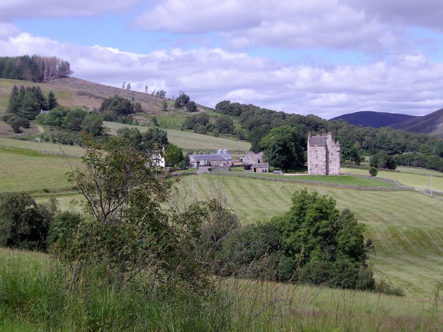
Forter Castle

Forter Castle is located in Glenisla, Perthshire, Scotland. It was built in 1560 by James Ogilvy, the 5th Lord of Airlie. In 1640, it was burned by Archibald...
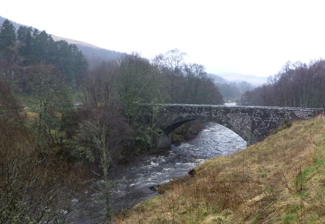
Brewlands Bridge

Brewlands Bridge is a hamlet in Glen Isla, Angus, Scotland. It is lies situated on the River Isla, eleven miles north-west of Kirriemuir and ten miles...

Mount Blair (Scotland)

Mount Blair is a large hill on the Perth and Kinross and Angus border, Scotland, in the southern foothills of the Grampian Mountains. It lies between the...

Auchinleish

Auchinleish is a village in Angus, Scotland. == References ==

Kirkton of Glenisla

Kirkton of Glenisla consists of a church and graveyard, a hotel, hall and several homes forming the largest concentration of habitation in Glenisla, Angus...

Nearby Amenities

Located within 500m of 56.767433,-3.3166709
Auchen Chapel
Historic: ruins
Lat/Long: 56.7703387/-3.3125154
Ford: yes
Lat/Long: 56.765994/-3.3136211
The data included in this document is from www.openstreetmap.org. The data is made available under ODbL.

Have you been to Auchintaple Loch?

Leave your review of Auchintaple Loch below (or comments, questions and feedback).