Grafton

Settlement in Gloucestershire Wychavon

England

Grafton

Bredon Hill crest path, 13 Gradual descent south-east towards Ashton.
The distinctive outline of Dumbleton/Alderton Hill can be seen clearly as well as the Cotswold crest beyond.
This picture represents the completion of Hectad SO93 by the photographer, ie. a Geograph in every one of the 100 squares.
Bredon Hill crest path, 13 Credit: Jonathan Billinger

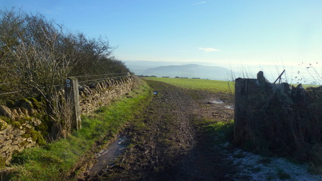
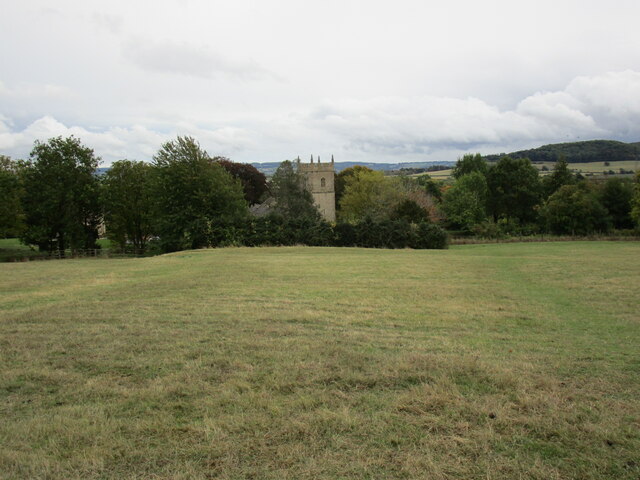
Grafton is a small village located in the county of Gloucestershire, England. Situated near the River Avon, it is nestled in the picturesque Cotswolds region, renowned for its rolling hills and traditional stone-built houses. Grafton is approximately 5 miles southeast of the market town of Chipping Campden and 20 miles northeast of the city of Gloucester.

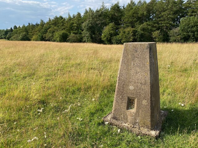
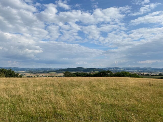
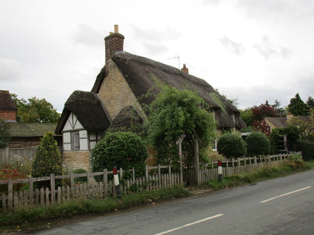
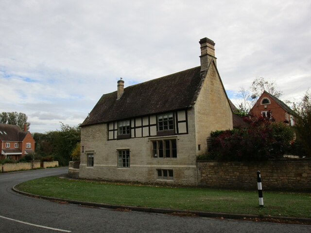
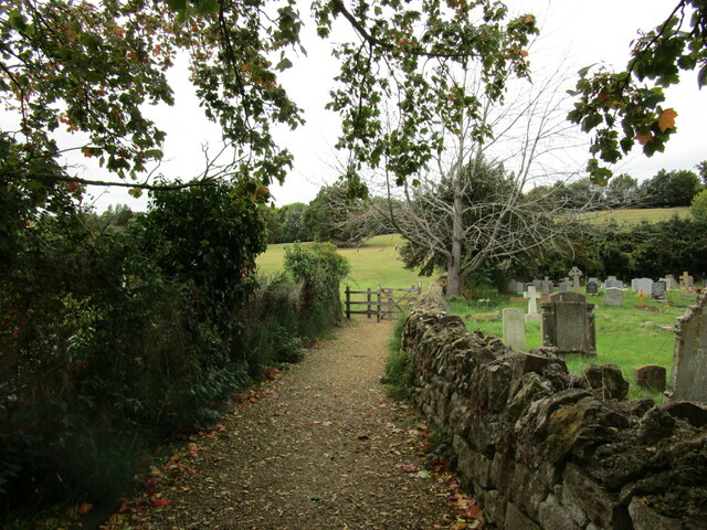
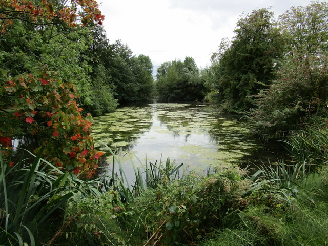
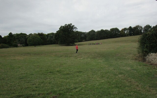
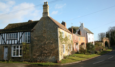
The village of Grafton is known for its tranquility and natural beauty, making it a popular destination for visitors seeking a peaceful retreat. The surrounding countryside offers ample opportunities for outdoor activities such as hiking and cycling, with numerous scenic trails and paths to explore. The village itself is characterized by a charming blend of historic cottages, many of which date back to the 17th and 18th centuries.

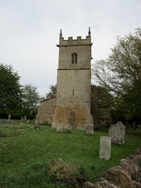
Grafton also boasts a strong sense of community, with a range of amenities and local businesses serving its residents. The village is home to a quaint parish church, as well as a village hall that hosts various social events throughout the year. Additionally, there are several traditional pubs and tearooms where visitors can enjoy a taste of local cuisine and hospitality.

With its idyllic rural setting and close proximity to other notable towns and attractions in Gloucestershire, Grafton offers a delightful blend of natural beauty, historic charm, and community spirit, making it a truly enchanting place to visit or call home.

If you have any feedback on the listing, please let us know in the comments section below.
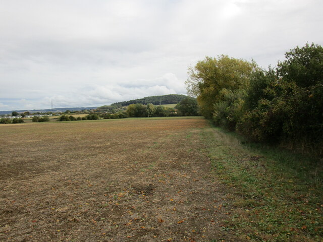
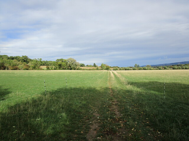
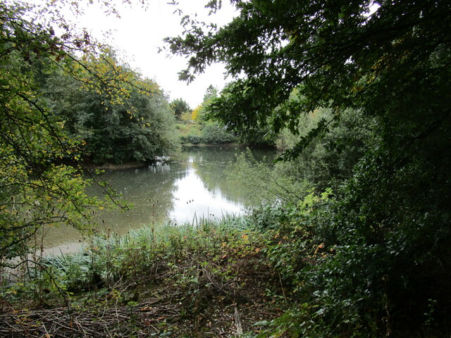
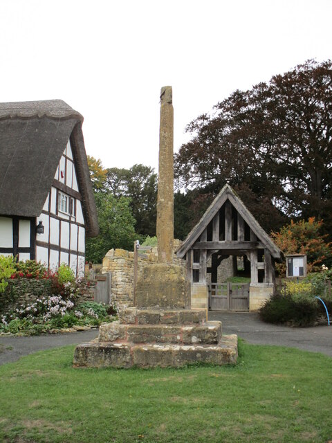
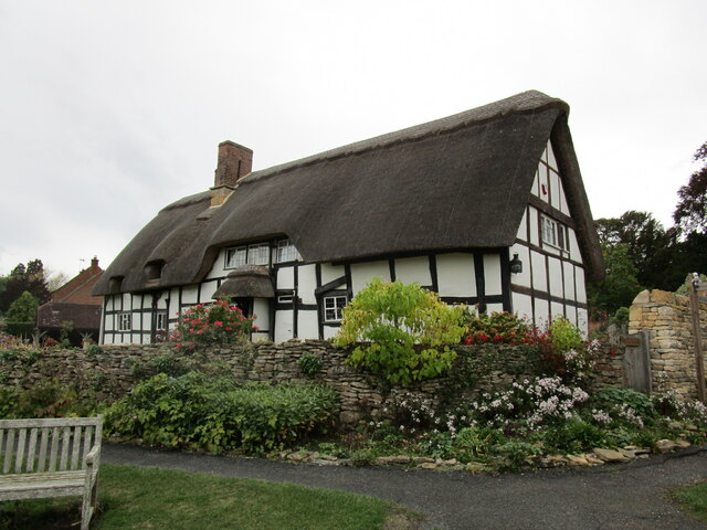
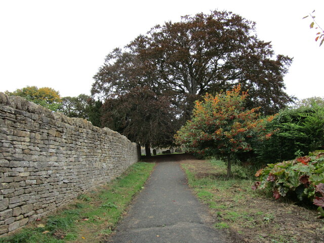
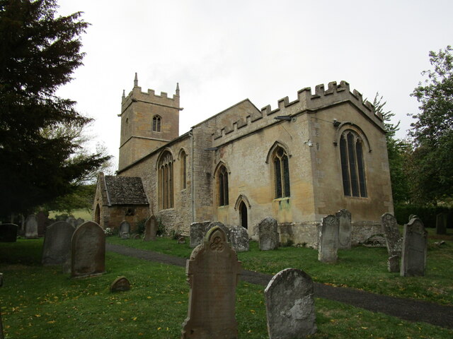
Grafton Images

Images are sourced within 2km of 52.034066/-2.022563 or Grid Reference SO9837. Thanks to Geograph Open Source API. All images are credited.

Bredon Hill crest path, 13 Gradual descent south-east towards Ashton.
The distinctive outline of Dumbleton/Alderton Hill can be seen clearly as well as the Cotswold crest beyond.
This picture represents the completion of Hectad SO93 by the photographer, ie. a Geograph in every one of the 100 squares.
Bredon Hill crest path, 13
Gradual descent south-east towards Ashton. The distinctive outline of Dumbleton/Alderton Hill can be seen clearly as well as the Cotswold crest beyond. This picture represents the completion of Hectad SO93 by the photographer, ie. a Geograph in every one of the 100 squares.
Holcomb Nap Trig Point Flush Bracket S3790
View from Holcomb Nap Trig Point Flush Bracket S3790
Cross Cottage, Ashton under Hill Dates from the seventeenth century <span class="nowrap"><a title="https://historicengland.org.uk/listing/the-list/list-entry/1349961?section=official-list-entry" rel="nofollow ugc noopener" href="https://historicengland.org.uk/listing/the-list/list-entry/1349961?section=official-list-entry">Link</a><img style="margin-left:2px;" alt="External link" title="External link - shift click to open in new window" src="https://s1.geograph.org.uk/img/external.png" width="10" height="10"/></span>
Cross Cottage, Ashton under Hill
Dates from the seventeenth century LinkExternal link
Field edge near Ashton under Hill Looking towards Dumbleton Hill.
Field edge near Ashton under Hill
Looking towards Dumbleton Hill.
Footpath to Ashton under Hill
Harrowed field near Grafton
Flooded pit near Beckford Now part of a nature reserve.
Flooded pit near Beckford
Now part of a nature reserve.
The Old House, Beckford Dates from the sixteenth century <span class="nowrap"><a title="https://historicengland.org.uk/listing/the-list/list-entry/1349950?section=official-list-entry" rel="nofollow ugc noopener" href="https://historicengland.org.uk/listing/the-list/list-entry/1349950?section=official-list-entry">Link</a><img style="margin-left:2px;" alt="External link" title="External link - shift click to open in new window" src="https://s1.geograph.org.uk/img/external.png" width="10" height="10"/></span>
The Old House, Beckford
Dates from the sixteenth century LinkExternal link
Village cross, Ashton under Hill Dates from the fifteenth century <span class="nowrap"><a title="https://historicengland.org.uk/listing/the-list/list-entry/1167161?section=official-list-entry" rel="nofollow ugc noopener" href="https://historicengland.org.uk/listing/the-list/list-entry/1167161?section=official-list-entry">Link</a><img style="margin-left:2px;" alt="External link" title="External link - shift click to open in new window" src="https://s1.geograph.org.uk/img/external.png" width="10" height="10"/></span>
Village cross, Ashton under Hill
Dates from the fifteenth century LinkExternal link
Walnut Thatch, Ashton under Hill Dates from the sixteenth century <span class="nowrap"><a title="https://historicengland.org.uk/listing/the-list/list-entry/1349960?section=official-list-entry" rel="nofollow ugc noopener" href="https://historicengland.org.uk/listing/the-list/list-entry/1349960?section=official-list-entry">Link</a><img style="margin-left:2px;" alt="External link" title="External link - shift click to open in new window" src="https://s1.geograph.org.uk/img/external.png" width="10" height="10"/></span>
Walnut Thatch, Ashton under Hill
Dates from the sixteenth century LinkExternal link
Footpath to the church, Ashton under Hill
St Barbara's church, Ashton under Hill Has twelfth century origins though most of what is visible in this picture dates from the early sixteenth and seventeenth centuries <span class="nowrap"><a title="https://historicengland.org.uk/listing/the-list/list-entry/1081663?section=official-list-entry" rel="nofollow ugc noopener" href="https://historicengland.org.uk/listing/the-list/list-entry/1081663?section=official-list-entry">Link</a><img style="margin-left:2px;" alt="External link" title="External link - shift click to open in new window" src="https://s1.geograph.org.uk/img/external.png" width="10" height="10"/></span>
St Barbara's church, Ashton under Hill
Has twelfth century origins though most of what is visible in this picture dates from the early sixteenth and seventeenth centuries LinkExternal link
Footpath alongside the churchyard, Ashton under Hill
Reservoir at Ashton under Hill
St Barbara's church, Ashton under Hill The west tower dates from the thirteenth century with an upper stage of about 1500 <span class="nowrap"><a title="https://historicengland.org.uk/listing/the-list/list-entry/1081663?section=official-list-entry" rel="nofollow ugc noopener" href="https://historicengland.org.uk/listing/the-list/list-entry/1081663?section=official-list-entry">Link</a><img style="margin-left:2px;" alt="External link" title="External link - shift click to open in new window" src="https://s1.geograph.org.uk/img/external.png" width="10" height="10"/></span>
St Barbara's church, Ashton under Hill
The west tower dates from the thirteenth century with an upper stage of about 1500 LinkExternal link
View over Ashton under Hill St Barbara's church in the centre of the picture.
View over Ashton under Hill
St Barbara's church in the centre of the picture.
Here they come! Children from Ashton under Hill First School about to race down the hill above the church. Some made spectacular dives and are clearly training to be professional footballers!
Here they come!
Children from Ashton under Hill First School about to race down the hill above the church. Some made spectacular dives and are clearly training to be professional footballers!
Show me another place!

Grafton is located at Grid Ref: SO9837 (Lat: 52.034066, Lng: -2.022563)

Administrative County: Worcestershire

District: Wychavon

Police Authority: West Mercia

What 3 Words

///spices.rephrase.washable. Near Bredon, Worcestershire

Nearby Locations

Grafton Ash Coppice

Related Wikis

Grafton, Worcestershire

Grafton is a hamlet in Worcestershire, England, situated between the villages of Beckford and Ashton under Hill, south-east of Bredon Hill. The name Grafton...

Ashton under Hill

Ashton under Hill is a village and civil parish in the Wychavon district of Worcestershire in England. It is situated at the foot of Bredon Hill. According...

Beckford Nature Reserve

Beckford Nature Reserve is near Beckford, in Worcestershire, England, situated immediately north of the village. The nature reserve was created from a...

Beckford Priory

Beckford Priory was a medieval house of Augustinian Canons, historically within Gloucestershire, presently in Worcestershire, England. It was founded in...

Beckford railway station

Beckford railway station was a station on the Midland Railway between Great Malvern and Evesham. It was designed by the architect George Hunt and opened...

Ashton-under-Hill railway station

Ashton-under-Hill railway station was a station on the Midland Railway between Great Malvern and Evesham. It served Ashton under Hill in Worcestershire...

Beckford, Worcestershire

Beckford is a small village on the main Cheltenham to Evesham Road, five miles north-east of Tewkesbury, on the Worcestershire—Gloucestershire border....

Conderton

Conderton is a small hamlet in the Wychavon district of Worcestershire, England. == Toponymy == The name Conderton is derived from the Old English Cantware...

Nearby Amenities

Located within 500m of 52.034066,-2.022563
Grafton
Place: hamlet
Wikidata: Q5592516
Lat/Long: 52.0339193/-2.0219752
Public Bookcase
Booth: K6
Disused Amenity: telephone
Public Bookcase Type: phone_box
Source: survey
Lat/Long: 52.0332683/-2.0210277
Barrier: kissing_gate
Lat/Long: 52.0356968/-2.0289796
Post Box
Collection Times: Mo-Fr 16:30; Sa 10:00; Su off
Drive Through: no
Operator: Royal Mail
Post Box Type: lamp
Ref: GL20 32
Royal Cypher: EIIR
Royal Cypher Wikidata: Q33102113
Source: survey
Lat/Long: 52.0332325/-2.0210042
Barrier: stile
Lat/Long: 52.0350454/-2.027635
Fixme: incomplete
Lat/Long: 52.0342281/-2.0232694
Middle Farm Grain Dryer
Power: pole
Source: bing
Transformer: distribution
Voltage Primary: 11000
Lat/Long: 52.03253/-2.0212778
Power: pole
Source: bing
Lat/Long: 52.0312445/-2.0202345
Power: pole
Source: bing
Lat/Long: 52.0307164/-2.0196819
Defibrillator
Defibrillator Location: inside disused telephone box / public bookcase
Emergency: defibrillator
Operator: Community Heartbeat
Ref: CHT-14-1201
Source: survey
Lat/Long: 52.0332707/-2.0210378
East Worcestershire Water Works
Power: pole
Transformer: distribution
Voltage Primary: 11000
Lat/Long: 52.0372079/-2.0207052
Power: pole
Lat/Long: 52.0366403/-2.0208246
Power: pole
Lat/Long: 52.0356387/-2.0210351
Upper Farm
Power: pole
Transformer: distribution
Voltage Primary: 11000
Lat/Long: 52.0347089/-2.0212591
Power: pole
Lat/Long: 52.03477/-2.0206274
Location Transition: yes
Power: pole
Lat/Long: 52.0342601/-2.0203753
Middle Farm
Location Transition: yes
Power: pole
Transformer: distribution
Voltage Primary: 11000
Lat/Long: 52.0332973/-2.0198911
Power: pole
Lat/Long: 52.03286/-2.0201647
Power: pole
Lat/Long: 52.0324871/-2.0203954
Power: pole
Lat/Long: 52.0317668/-2.0208366
Power: pole
Lat/Long: 52.0302222/-2.0191227
Lower Farm
Power: pole
Transformer: distribution
Voltage Primary: 11000
Lat/Long: 52.0321756/-2.023669
Power: pole
Lat/Long: 52.03145/-2.0233177
Power: pole
Lat/Long: 52.0308303/-2.023028
Power: pole
Lat/Long: 52.0302725/-2.0227665
Power: pole
Lat/Long: 52.0307259/-2.0216232
The data included in this document is from www.openstreetmap.org. The data is made available under ODbL.

Have you been to Grafton?

Leave your review of Grafton below (or comments, questions and feedback).