Ennerdale Water

Lake, Pool, Pond, Freshwater Marsh in Cumberland Copeland

England

Ennerdale Water

Weir at outflow of Ennerdale Water
Weir at outflow of Ennerdale Water Credit: Graeme Yuill

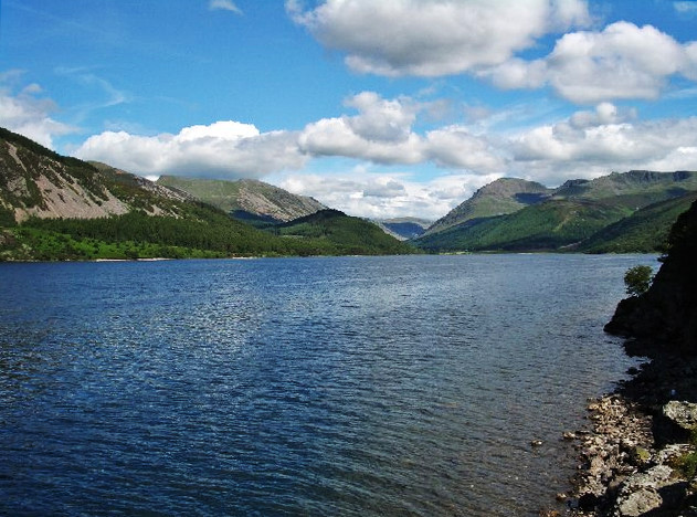
Ennerdale Water, located in the county of Cumberland in northwest England, is a picturesque lake nestled within the stunning Ennerdale Valley. With its abundant natural beauty and tranquil surroundings, it has become a popular destination for both locals and tourists alike.

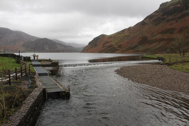
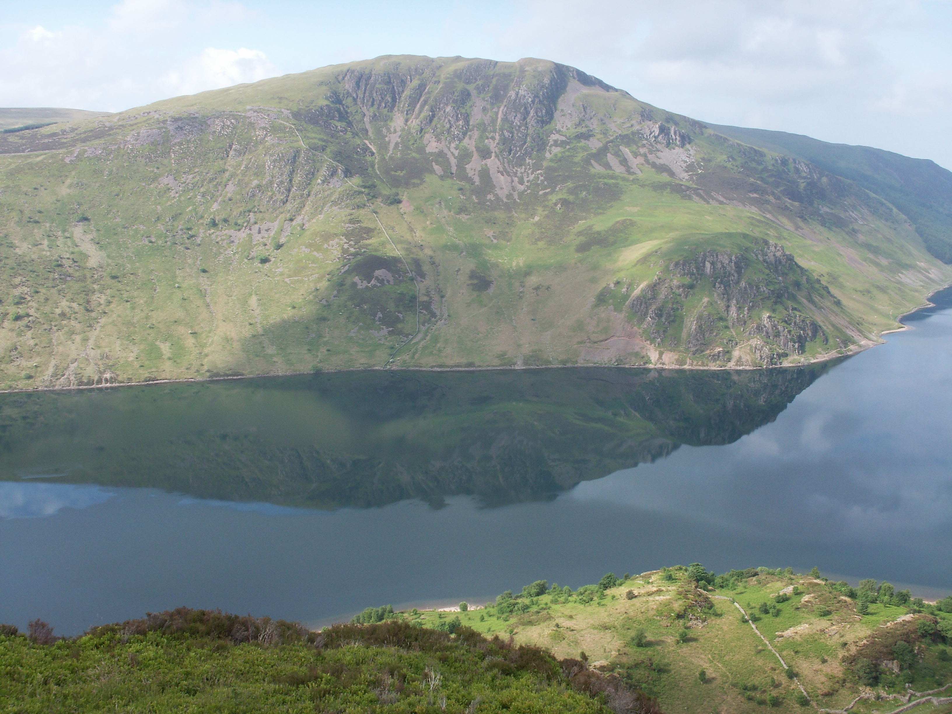
Ennerdale Water boasts a surface area of approximately 2.5 square kilometers, making it one of the smaller lakes in the region. Fed by several streams and rivers, including the River Liza, the lake's waters remain fresh and clear throughout the year. Its depth reaches a maximum of around 45 meters, providing ample space for a variety of aquatic life.

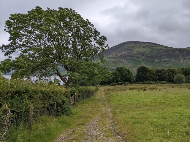
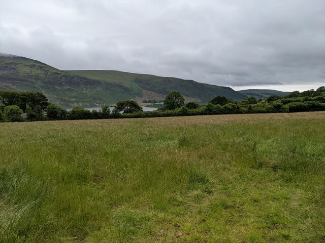
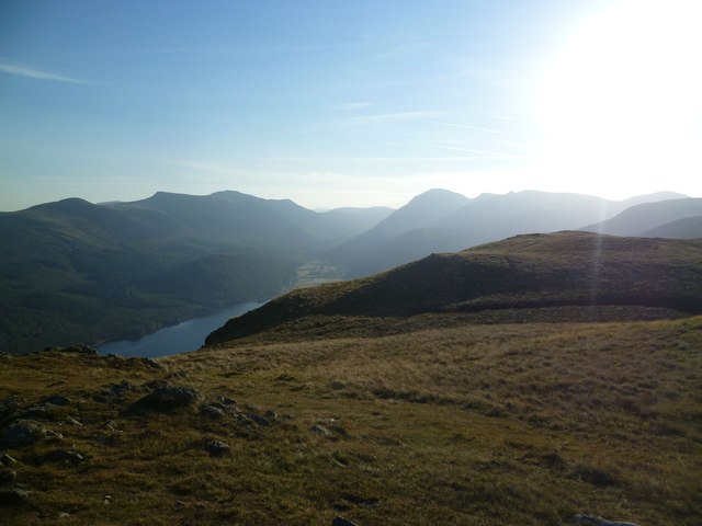
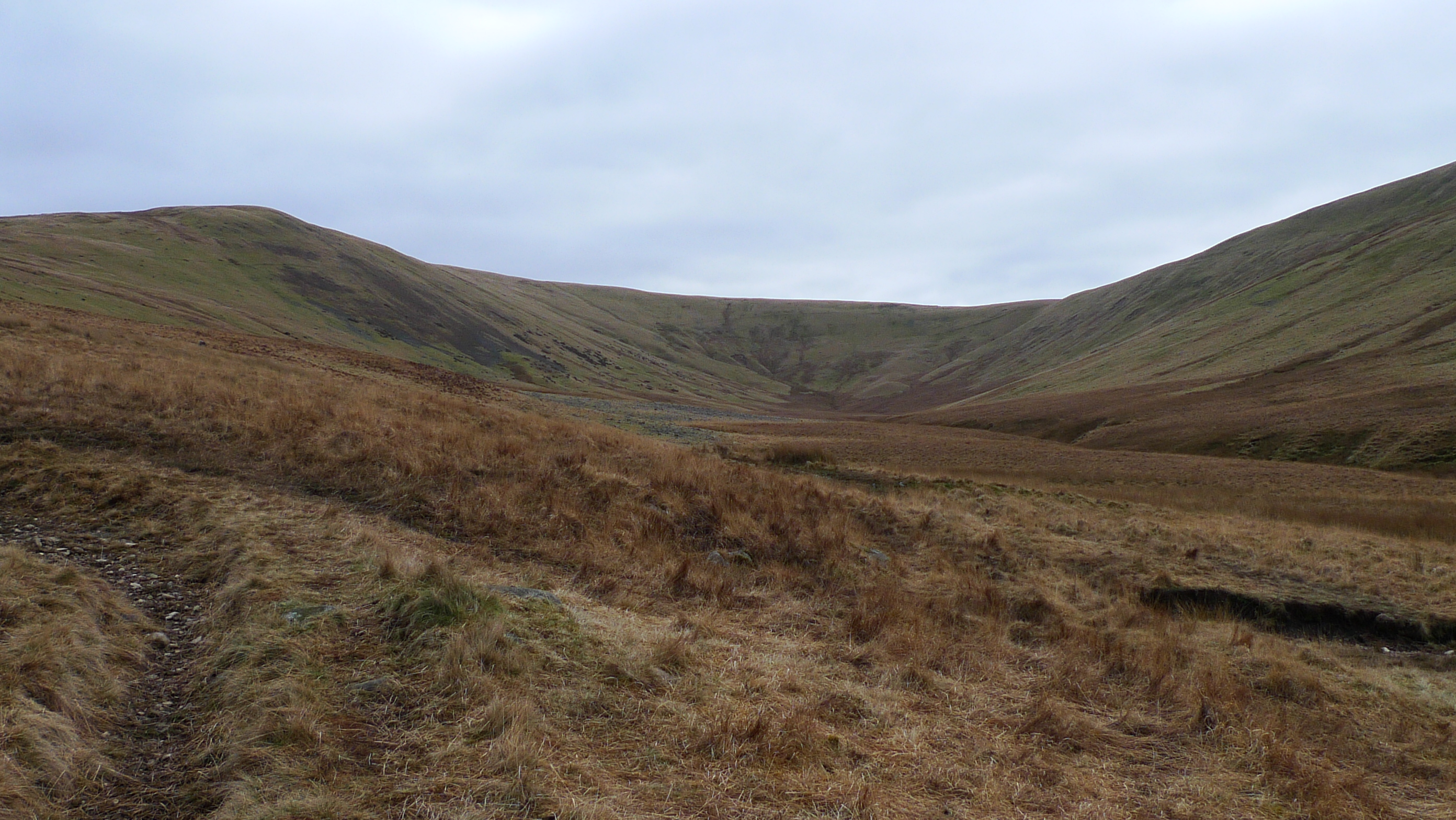
Surrounded by enchanting woodlands and rolling hills, Ennerdale Water offers a scenic backdrop for visitors to enjoy. The area is home to diverse flora and fauna, including native species such as red squirrels, otters, and rare birds like the ring ouzel. The lake's shores are also adorned with beautiful wildflowers during the summer months, adding to its natural charm.

Ennerdale Water is a haven for outdoor enthusiasts, offering a range of activities such as hiking, fishing, and boating. The surrounding Ennerdale Forest provides numerous trails for walkers and hikers to explore, with stunning viewpoints along the way. Anglers can try their luck at catching trout or salmon, while boating enthusiasts can take to the calm waters to appreciate the serene surroundings.

In recent years, efforts have been made to restore Ennerdale Water to its natural state by reducing human intervention. This has allowed the lake and its surroundings to flourish, providing an idyllic and unspoiled retreat for those seeking a peaceful escape in the heart of the Cumberland countryside.

If you have any feedback on the listing, please let us know in the comments section below.

Ennerdale Water Images

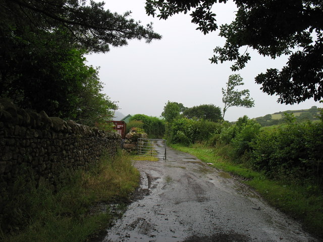
Images are sourced within 2km of 54.522797/-3.3809712 or Grid Reference NY1015. Thanks to Geograph Open Source API. All images are credited.

Weir at outflow of Ennerdale Water
A bridleway leading to Ennerdale Water
Looking towards Croftfoot
A field near Ennerdale Water
Ennerdale Pano
Ennerdale Pano
Start of the River Ehan, Ennerdale Waters The river's source is at the west end of Ennerdale Water: it runs west through Ennerdale Bridge

<span class="nowrap"><a title="https://en.wikipedia.org/wiki/River_Ehen" rel="nofollow ugc noopener" href="https://en.wikipedia.org/wiki/River_Ehen">Link</a><img style="margin-left:2px;" alt="External link" title="External link - shift click to open in new window" src="https://s1.geograph.org.uk/img/external.png" width="10" height="10"/></span>
Start of the River Ehan, Ennerdale Waters
The river's source is at the west end of Ennerdale Water: it runs west through Ennerdale Bridge LinkExternal link
Violet Ground Beetle By the Ennerdale fence under Whoap. The beetle though a common sight on the fells startled as it scurried over the grass  flashing violet.
Violet Ground Beetle
By the Ennerdale fence under Whoap. The beetle though a common sight on the fells startled as it scurried over the grass flashing violet.
Ascending Crag Fell Looking towards Boat How from the flanks of Crag Fell
Ascending Crag Fell
Looking towards Boat How from the flanks of Crag Fell
Above Revelin Crag The fellside falls away steeply 1300' above Ennerdale Lake
Above Revelin Crag
The fellside falls away steeply 1300' above Ennerdale Lake
Weir at Enerdale Water
Angler's Crag Bowness Knott in the distance across Ennerdale Water
Angler's Crag
Bowness Knott in the distance across Ennerdale Water
Farm track at Whins On some maps this is shown as a public road. But it is signed 'Unsuitable for motor vehicles', and I would certainly not have risked my own car along here! Bridleway, for horses and walkers, fine - but I suspect that otherwise you would need a 4x4 to get along here. (This track emerges one square to the west, at NY088166.)
Farm track at Whins
On some maps this is shown as a public road. But it is signed 'Unsuitable for motor vehicles', and I would certainly not have risked my own car along here! Bridleway, for horses and walkers, fine - but I suspect that otherwise you would need a 4x4 to get along here. (This track emerges one square to the west, at NY088166.)
On Crag Fell Looking up Ennerdale
On Crag Fell
Looking up Ennerdale
Weir at Ennerdale Water The track over Anglers Crag clearly visible
Weir at Ennerdale Water
The track over Anglers Crag clearly visible
Lakeside footpath Ennerdale Water Part of the Coast to Coast long distance walk
Lakeside footpath Ennerdale Water
Part of the Coast to Coast long distance walk
Crag Fell Summit Cairn Crag Fell summit cairn looking over to the Great Bourne to Red Pike ridge. 

Name: Crag Fell
Hill number: 2476
Height: 523m / 1716ft
Area: Lake District - Western Fells
Class: Hu,5,W,B
Grid ref: NY 09725 14385
Summit feature: cairn
Drop: 114m
Col: 409m  NY101136
Crag Fell Summit Cairn
Crag Fell summit cairn looking over to the Great Bourne to Red Pike ridge. Name: Crag Fell Hill number: 2476 Height: 523m / 1716ft Area: Lake District - Western Fells Class: Hu,5,W,B Grid ref: NY 09725 14385 Summit feature: cairn Drop: 114m Col: 409m NY101136
River Ehen and Ennerdale Water
Crag Fell Crag Fell summit
Crag Fell
Crag Fell summit
Show me another place!

Ennerdale Water is located at Grid Ref: NY1015 (Lat: 54.522797, Lng: -3.3809712)

Administrative County: Cumbria

District: Copeland

Police Authority: Cumbria

What 3 Words

///animates.sunblock.reaction. Near Frizington, Cumbria

Related Wikis

Ennerdale Water

Ennerdale Water is the most westerly lake in the Lake District National Park in Cumbria, England. It is a glacial lake, with a maximum depth of 150 feet...

Crag Fell

Crag Fell is a hill in the English Lake District. It is part of the Lank Rigg group, standing above Ennerdale Water in the Western Fells. The craggy northern...

Great Borne

Great Borne is a fell in the English Lake District with a height of 616 m (2,021 ft). It is a rather secluded hill situated at the western end of the long...

Whoap

Whoap is a hill located near the western edge of the English Lake District, standing at 511 m. It is part of the Lank Rigg group and is separated from...

Nearby Amenities

Located within 500m of 54.522797,-3.3809712
Barrier: stile
Foot: designated
Lat/Long: 54.5202933/-3.3864486
Bench
Backrest: yes
Colour: gray
Material: stone
Seats: 3
Tourism: viewpoint
Lat/Long: 54.5253888/-3.3799325
Bench
Backrest: yes
Lat/Long: 54.5249039/-3.3770202
Bench
Backrest: yes
Lat/Long: 54.524975/-3.3771624
Ford: yes
Lat/Long: 54.5272491/-3.3818433
Bowness
Place: locality
Lat/Long: 54.5272268/-3.3803847
Bowness Point
Place: locality
Lat/Long: 54.5256125/-3.3815039
Bench
Backrest: yes
Lat/Long: 54.5250021/-3.3771312
Information: board
Tourism: information
Lat/Long: 54.5250442/-3.3768328
The data included in this document is from www.openstreetmap.org. The data is made available under ODbL.

Have you been to Ennerdale Water?

Leave your review of Ennerdale Water below (or comments, questions and feedback).