Babbington

Settlement in Nottinghamshire Broxtowe

England

Babbington

Nottingham Canal near Cossall Common
Nottingham Canal near Cossall Common Credit: David Martin

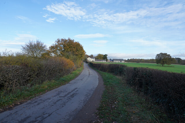
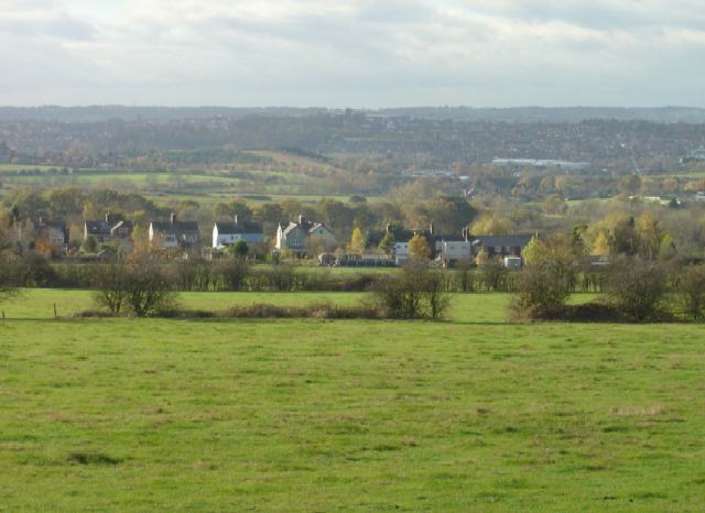
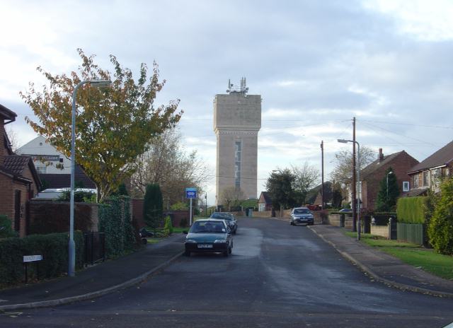
Babbington is a small village located in the county of Nottinghamshire, England. Situated approximately 8 miles northwest of Nottingham city center, it falls within the Broxtowe borough. The village is nestled amidst the picturesque countryside, offering residents and visitors a peaceful and idyllic setting.

Babbington is known for its rich history, dating back to the medieval times. The village is home to several historical landmarks, including the Grade II listed Babbington Hall, a 17th-century manor house. This impressive building showcases stunning architecture and is surrounded by beautifully landscaped gardens.

The village also boasts a strong sense of community, with a close-knit population of around 500 residents. Babbington is home to a range of amenities, including a primary school, a village hall, and a local pub, providing residents with essential services and a place to socialize.

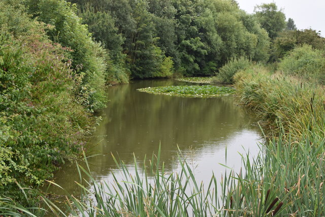
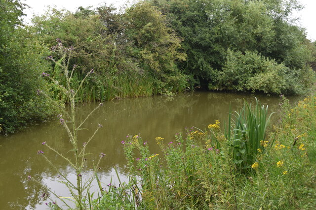
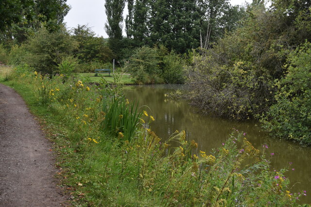
Nature enthusiasts will appreciate the abundance of outdoor activities and green spaces available in and around Babbington. The nearby Hemlock Stone Country Park offers picturesque walks and stunning views, while the Nottinghamshire countryside provides opportunities for hiking, cycling, and horse riding.

Although Babbington is a small village, it benefits from its close proximity to Nottingham city. This allows residents easy access to a wider range of amenities, including shopping centers, restaurants, and cultural attractions.

Overall, Babbington is a charming village that combines historical significance with natural beauty. Its peaceful atmosphere and strong community spirit make it an appealing place to live or visit for those seeking a tranquil rural retreat.

If you have any feedback on the listing, please let us know in the comments section below.
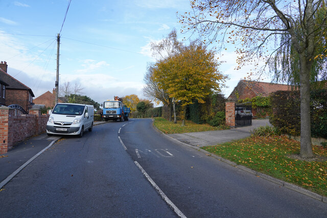
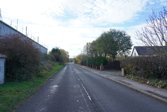
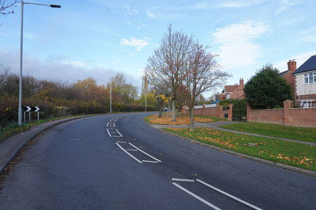
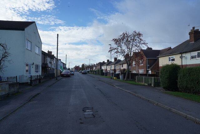
Babbington Images

Images are sourced within 2km of 52.986126/-1.270062 or Grid Reference SK4943. Thanks to Geograph Open Source API. All images are credited.

Nottingham Canal near Cossall Common
Nottingham Canal near Cossall Marsh
Pegasus Crossing on Shilo Way A dedicated road crossing for horse riders, complete with high-level push buttons to avoid the need to dismount.
Pegasus Crossing on Shilo Way
A dedicated road crossing for horse riders, complete with high-level push buttons to avoid the need to dismount.
Nottingham Canal near Cossall Marsh Here, looking towards a small side branch. There is a low-level wooden footbridge just out of sight to the left.
Nottingham Canal near Cossall Marsh
Here, looking towards a small side branch. There is a low-level wooden footbridge just out of sight to the left.
Postbox on Maws Lane
Church Lane Church Lane as it goes through Cossall is a very twisty road and the road works on it do not help traffic flow.
Church Lane
Church Lane as it goes through Cossall is a very twisty road and the road works on it do not help traffic flow.
Coronation Road To the left are industrial buildings, to the right are some houses and fields.
Coronation Road
To the left are industrial buildings, to the right are some houses and fields.
Awsworth Lane Awsworth Lane at this point is just on the edge of the village of the same name.
Awsworth Lane
Awsworth Lane at this point is just on the edge of the village of the same name.
Station Road Though it is called Station Road there does not appear to be any station nearby.
Station Road
Though it is called Station Road there does not appear to be any station nearby.
Robinettes Lane Robinettes Lane is a cul-de-sac lane leading to a farm.
Robinettes Lane
Robinettes Lane is a cul-de-sac lane leading to a farm.
Bennerley Viaduct One of only two remaining wrought iron viaducts in England, Bennerley Viaduct was built in 1877 for the Great Northern Railway Company to carry the railway between Derby and Asworth Junction across the Erewash Valley. It closed in 1968 as part of the Beeching cuts. It has survived several attempts to demolish it and is now a grade II* listed structure and is on the Heritage at risk register. Restoration work to create a public walk and cycleway started in 2020.
Bennerley Viaduct
One of only two remaining wrought iron viaducts in England, Bennerley Viaduct was built in 1877 for the Great Northern Railway Company to carry the railway between Derby and Asworth Junction across the Erewash Valley. It closed in 1968 as part of the Beeching cuts. It has survived several attempts to demolish it and is now a grade II* listed structure and is on the Heritage at risk register. Restoration work to create a public walk and cycleway started in 2020.
Underneath Bennerley Viaduct One of only two remaining wrought iron viaducts in England, Bennerley Viaduct was built in 1877 for the Great Northern Railway Company. For more details see <a href="https://www.geograph.org.uk/photo/7043154">SK4743 : Bennerley Viaduct</a>.
Underneath Bennerley Viaduct
One of only two remaining wrought iron viaducts in England, Bennerley Viaduct was built in 1877 for the Great Northern Railway Company. For more details see SK4743 : Bennerley Viaduct.
Bennerley Viaduct One of only two remaining wrought iron viaducts in England, Bennerley Viaduct was built in 1877 for the Great Northern Railway Company. 
The scrubland in front of the viaduct was most recently a British Coal distribution depot and prior to that the site of Bennerley Ironworks.
Bennerley Viaduct
One of only two remaining wrought iron viaducts in England, Bennerley Viaduct was built in 1877 for the Great Northern Railway Company. The scrubland in front of the viaduct was most recently a British Coal distribution depot and prior to that the site of Bennerley Ironworks.
Bennerley Viaduct One of only two remaining wrought iron viaducts in England, Bennerley Viaduct was built in 1877 for the Great Northern Railway Company to carry the railway between Derby and Asworth Junction across the Erewash Valley. It closed in 1968 as part of the Beeching cuts. It has survived several attempts to demolish it and is now a grade II* listed structure and is on the Heritage at risk register. Restoration work to create a public walk and cycleway started in 2020.
Bennerley Viaduct
One of only two remaining wrought iron viaducts in England, Bennerley Viaduct was built in 1877 for the Great Northern Railway Company to carry the railway between Derby and Asworth Junction across the Erewash Valley. It closed in 1968 as part of the Beeching cuts. It has survived several attempts to demolish it and is now a grade II* listed structure and is on the Heritage at risk register. Restoration work to create a public walk and cycleway started in 2020.
Bennerley Viaduct Information Board With the viaduct beyond. For detail of the board see <a href="https://www.geograph.org.uk/photo/7043440">SK4743 : Bennerley Viaduct Information Board</a> and for more on the viaduct see <a href="https://www.geograph.org.uk/photo/7043437">SK4743 : Bennerley Viaduct</a>.
Bennerley Viaduct Information Board
With the viaduct beyond. For detail of the board see SK4743 : Bennerley Viaduct Information Board and for more on the viaduct see SK4743 : Bennerley Viaduct.
Bennerley Viaduct Information Board See also <a href="https://www.geograph.org.uk/photo/7043439">SK4743 : Bennerley Viaduct Information Board</a>
Bennerley Viaduct Information Board
The Nottingham Canal in Awsworth This section of the canal still in water but little remains of the canal north of here, it having been mostly destroyed by open cast mining.
The Nottingham Canal in Awsworth
This section of the canal still in water but little remains of the canal north of here, it having been mostly destroyed by open cast mining.
Show me another place!

Babbington is located at Grid Ref: SK4943 (Lat: 52.986126, Lng: -1.270062)

Administrative County: Nottinghamshire

District: Broxtowe

Police Authority: Nottinghamshire

What 3 Words

///glare.ship.shirt. Near Kimberley, Nottinghamshire

Nearby Locations

Babbington

Related Wikis

Babbington

Babbington is a hamlet in Nottinghamshire, England. It is located 2 miles south of Kimberley, close to the M1 motorway. It is part of Kimberley civil parish...
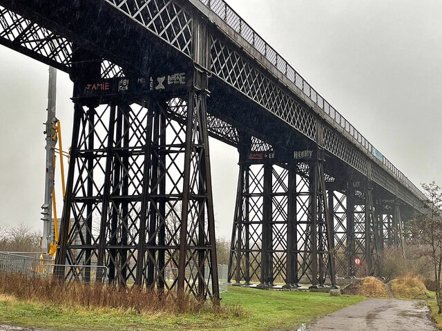
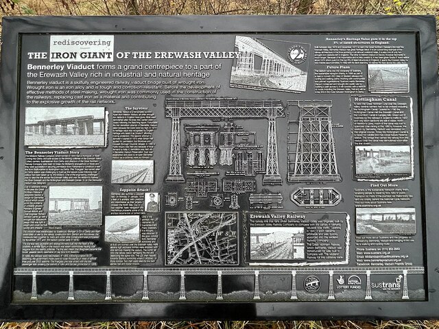
Giltbrook Viaduct

Giltbrook Viaduct was a railway viaduct built in the Erewash Valley between Awsworth and Giltbrook in Nottinghamshire. It was demolished in 1973 to make...

Awsworth

Awsworth is a village and civil parish in the Borough of Broxtowe, Nottinghamshire, England. Its population of 2,577 in the 2001 Census and 2,517 in that...

Swingate, Nottinghamshire

Swingate is a small English village positioned between of Kimberley and Babbington, in the Broxtowe district, in the county of Nottinghamshire. == History... ==

Nearby Amenities

Located within 500m of 52.986126,-1.270062
Babbington
Place: hamlet
Wikidata: Q4837589
Wikipedia: en:Babbington
Lat/Long: 52.9871169/-1.2677055
Animal Boarding
Babbington Hall Kennels and Cattery
Addr City: Nottingham
Addr Housename: Babbington Hall
Addr Postcode: NG16 2SS
Addr Street: Westby Lane
Animal Boarding: cat;dog
Website: https://www.babbington-hall.co.uk/
Lat/Long: 52.9890221/-1.2718078
Cafe
Babbington Hall Kennels and Cattery
Addr City: Nottingham
Addr Housename: Babbington Hall
Addr Postcode: NG16 2SS
Addr Street: Westby Lane
Fhrs Id: 566243
Shop: pet
Website: https://www.babbington-hall.co.uk/
Lat/Long: 52.9890814/-1.2715792
Animal Shelter
Babbington Rescue
Addr City: Nottingham
Addr Postcode: NG16 2SS
Addr Street: Westby Lane
Website: https://www.babbington-rescue.org.uk/
Lat/Long: 52.9891168/-1.2719804
Addr Housename: Horseshoe Cottage
Addr Housenumber: 25
Addr Place: Babbington
Addr Postcode: NG16 2SS
Fixme: Location approximate
Source: survey
Source Addr Postcode: OS Open Data Codepoint
Lat/Long: 52.9872528/-1.2708209
Barrier: kissing_gate
Fixme: double check this
Source: survey
Lat/Long: 52.9882309/-1.2696396
Barrier: kissing_gate
Source: survey
Lat/Long: 52.9883633/-1.2690289
Barrier: stile
Material: wood
Source: survey
Step Count: 2
Stile: stepover
Lat/Long: 52.9885159/-1.2738595
Addr Housenumber: 23
Addr Place: Babbington
Addr Postcode: NG16 2SS
Fixme: Location approximate - number written on dustbin at end of driveway
Source: survey
Source Addr Postcode: OS Open Data Codepoint
Lat/Long: 52.9875185/-1.2712194
Post Box
Collection Times: Mo-Fr 16:00; Sa 10:30
Post Box Type: wall
Ref: NG16 140
Royal Cypher: EVIIR
Royal Cypher Wikidata: Q33102324
Source: survey
Lat/Long: 52.9883945/-1.2701106
Barrier: stile
Material: wood
Note: may be 2 steps
Source: survey
Step Count: 1
Lat/Long: 52.9834135/-1.2682691
Barrier: stile
Source: survey
Lat/Long: 52.9841708/-1.2633784
Power: pole
Source: survey
Lat/Long: 52.9875848/-1.2722843
Barrier: stile
Material: wood
Source: survey
Step Count: 1
Stile: stepover
Lat/Long: 52.9849112/-1.2706446
Barrier: stile
Material: wood
Note: very overgrown
Source: survey
Step Count: 2
Lat/Long: 52.9827771/-1.2668086
Fixme: continue
Lat/Long: 52.9879233/-1.2717348
Barrier: kissing_gate
Source: survey
Lat/Long: 52.9890652/-1.2666981
Grit Bin
Source: survey
Lat/Long: 52.9876503/-1.2722749
Barrier: stile
Note: one you pull apart
Source: survey
Stile: ramblers_gate
Lat/Long: 52.9876141/-1.2726896
Guidepost: hiking
Information: guidepost
Source: survey
Tourism: information
Lat/Long: 52.9876131/-1.2726584
Barrier: kissing_gate
Source: survey
Lat/Long: 52.9899401/-1.267885
Barrier: stile
Material: wood
Source: survey
Step Count: 2
Lat/Long: 52.9836107/-1.2686443
Barrier: stile
Material: wood
Source: survey
Step Count: 1
Stile: stepover
Lat/Long: 52.9847661/-1.2705522
Power: pole
Source: Bing
Lat/Long: 52.9820898/-1.2705114
Power: pole
Source: Bing
Lat/Long: 52.9847908/-1.2699889
Power: pole
Source: Bing
Lat/Long: 52.9830781/-1.2692568
Power: pole
Source: Bing
Lat/Long: 52.984252/-1.2694058
Power: pole
Source: Bing
Lat/Long: 52.9827647/-1.2696606
Power: pole
Source: Bing
Lat/Long: 52.9864803/-1.2716643
Fixme: not sure all these lines join at this ple
Power: pole
Source: Bing
Lat/Long: 52.9836318/-1.2687111
Power: pole
Source: survey
Source Geometry: Bing
Lat/Long: 52.984507/-1.2674211
Power: pole
Source: survey
Source Geometry: Bing
Lat/Long: 52.9865913/-1.2646143
Power: pole
Source: survey
Source Geometry: Bing
Lat/Long: 52.9854989/-1.2661849
Fixme: location approx
Power: pole
Source: survey
Lat/Long: 52.9855852/-1.2711463
Fixme: continue
Lat/Long: 52.9862995/-1.2682827
Fixme: approx positions
Information: notice_board
Tourism: information
Lat/Long: 52.9872592/-1.2688001
Cossall Colliery Sidings Junction
Historic Railway: junction
Railway: site
Lat/Long: 52.9869393/-1.275513
The data included in this document is from www.openstreetmap.org. The data is made available under ODbL.

Have you been to Babbington?

Leave your review of Babbington below (or comments, questions and feedback).