Babbacombe

Settlement in Devon

England

Babbacombe

Barriers, Torquay coach station Defining a pedestrian walkway (also shown in <a href="https://www.geograph.org.uk/photo/7586956">SX9164 : Pedestrian route, Torquay Coach Station</a> ) while building work continues on a new structure <a href="https://www.geograph.org.uk/photo/7594441">SX9164 : New building, Torquay Coach Station</a> off to the right.
Barriers, Torquay coach station Credit: Derek Harper

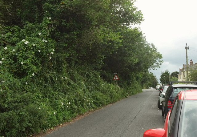
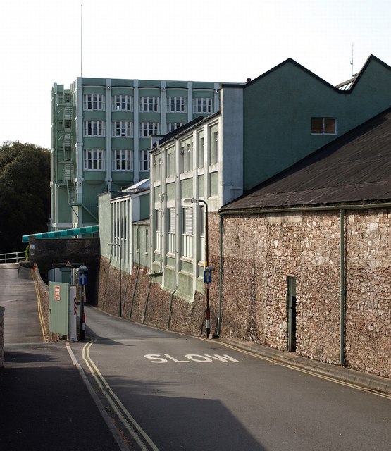
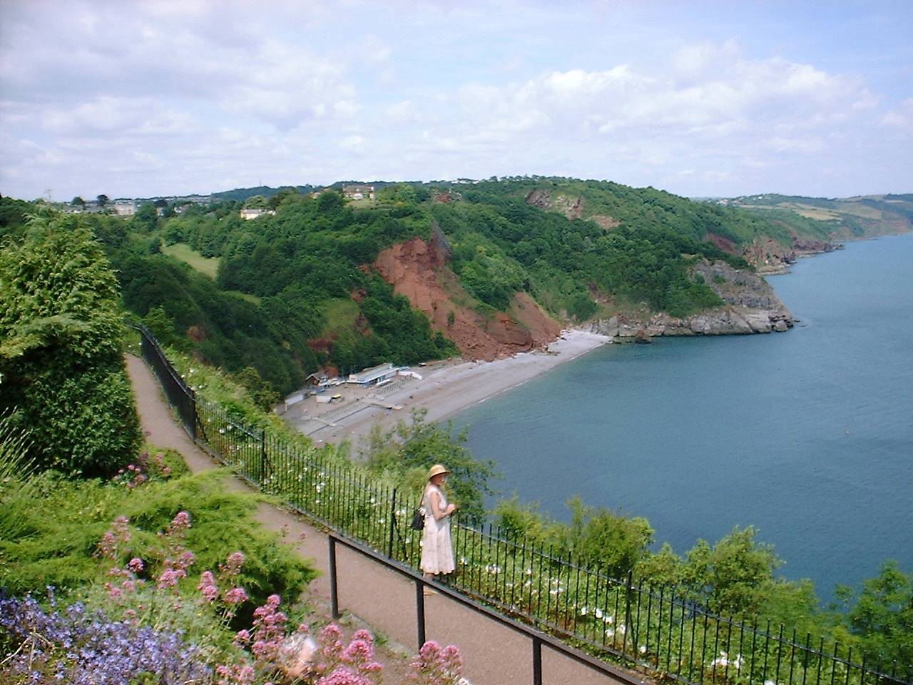
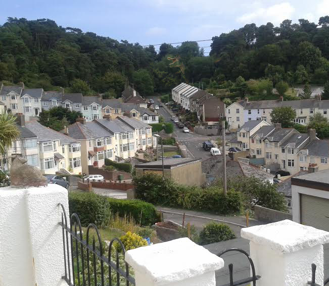
Babbacombe is a picturesque village located in the county of Devon, England. Situated on the south coast of the country, it is part of the larger Torquay area and is known for its stunning natural beauty and charming seaside atmosphere.

The village is nestled on the edge of Babbacombe Bay, offering breathtaking views of the English Channel. Its sandy beaches and crystal-clear waters make it a popular destination for tourists and locals alike, especially during the summer months when visitors can enjoy swimming, sunbathing, and various water sports.

Babbacombe is also renowned for its iconic attraction, Babbacombe Model Village. Established in 1963, this miniature world showcases intricately detailed models of buildings, landscapes, and famous landmarks from around the world. It provides visitors with a fascinating glimpse into different cultures and historical periods.

In addition to its natural beauty and tourist attractions, Babbacombe offers a range of amenities and services. The village boasts a variety of shops, cafes, and restaurants, where visitors can indulge in local cuisine and purchase unique souvenirs. The surrounding area also offers numerous walking trails and outdoor activities for those seeking adventure or relaxation amidst the stunning coastal scenery.

With its idyllic setting, rich history, and vibrant community, Babbacombe is a must-visit destination for anyone seeking a quintessential English seaside experience.

If you have any feedback on the listing, please let us know in the comments section below.

Babbacombe Images

Images are sourced within 2km of 50.476754/-3.509378 or Grid Reference SX9365. Thanks to Geograph Open Source API. All images are credited.

Barriers, Torquay coach station Defining a pedestrian walkway (also shown in <a href="https://www.geograph.org.uk/photo/7586956">SX9164 : Pedestrian route, Torquay Coach Station</a> ) while building work continues on a new structure <a href="https://www.geograph.org.uk/photo/7594441">SX9164 : New building, Torquay Coach Station</a> off to the right.
Barriers, Torquay coach station
Defining a pedestrian walkway (also shown in SX9164 : Pedestrian route, Torquay Coach Station ) while building work continues on a new structure SX9164 : New building, Torquay Coach Station off to the right.
Houses, Lymington Road, Torquay The houses are shown in very different lighting at <a href="https://www.geograph.org.uk/photo/6106637">SX9164 : Lymington Road, Torquay</a> .
Houses, Lymington Road, Torquay
The houses are shown in very different lighting at SX9164 : Lymington Road, Torquay .
Welsh coach, Torquay coach station Coracle Coaches are based in Carmarthen. This is a Volvo B8R/Plaxton Panther.
Welsh coach, Torquay coach station
Coracle Coaches are based in Carmarthen. This is a Volvo B8R/Plaxton Panther.
House and quarry, Dainton A house tucked away on the hillside above Daison Cottages, and an old quarry face shown at <a href="https://www.geograph.org.uk/photo/7403807">SX9165 : Old quarry, Daison</a>.
House and quarry, Dainton
A house tucked away on the hillside above Daison Cottages, and an old quarry face shown at SX9165 : Old quarry, Daison.
December daffodils, Torquay At the edge of Memorial Gardens, and beside Upper Union Street.
December daffodils, Torquay
At the edge of Memorial Gardens, and beside Upper Union Street.
Steps on path from Lyme View Road The path drops to meet Perinville Road.
Steps on path from Lyme View Road
The path drops to meet Perinville Road.
Steps on path from Lyme View Road A different angle from <a href="https://www.geograph.org.uk/photo/6918505">SX9265 : Steps on path from Lyme View Road</a>, and the backdrop changes from the sea to All Saints' Church.
Steps on path from Lyme View Road
A different angle from SX9265 : Steps on path from Lyme View Road, and the backdrop changes from the sea to All Saints' Church.
Lyme View Close, Babbacombe A short cul-de-sac with good views.
Lyme View Close, Babbacombe
A short cul-de-sac with good views.
Lyme View Road, Babbacombe It's the houses that get the view, rather than the road, though there are glimpses in between. At the bend is a right turn into Seaton Close.
Lyme View Road, Babbacombe
It's the houses that get the view, rather than the road, though there are glimpses in between. At the bend is a right turn into Seaton Close.
House on Lyme View Road Beside a path that drops past Locks Close to Perinville Road.
House on Lyme View Road
Beside a path that drops past Locks Close to Perinville Road.
View from Lyme View Road A service road drops to run behind the terrace shown on the left of <a href="https://www.geograph.org.uk/photo/6918614">SX9265 : Lyme View Road, Babbacombe</a>. Meanwhile, a path runs beside it and continues downhill behind houses on Locks Close to reach Perinville Road. Beyond are buildings on Walls Hill Road.
View from Lyme View Road
A service road drops to run behind the terrace shown on the left of SX9265 : Lyme View Road, Babbacombe. Meanwhile, a path runs beside it and continues downhill behind houses on Locks Close to reach Perinville Road. Beyond are buildings on Walls Hill Road.
Lyme View Road, Babbacombe In the dip are two left turns: Locks Hill and Charmouth Close.
Lyme View Road, Babbacombe
In the dip are two left turns: Locks Hill and Charmouth Close.
Houses at Babbacombe A view between houses on Lyme View Road. The next houses are on Perinville Road, and then buildings around the junction of St Anne's Road, Babbacombe Road and Babbacombe Downs Road, with the theatre behind the tree in the centre.
Houses at Babbacombe
A view between houses on Lyme View Road. The next houses are on Perinville Road, and then buildings around the junction of St Anne's Road, Babbacombe Road and Babbacombe Downs Road, with the theatre behind the tree in the centre.
Lyme View Road The road leaves Reddenhill Road, curving up into a large housing estate.
Lyme View Road
The road leaves Reddenhill Road, curving up into a large housing estate.
Trees alongside Reddenhill Road, Babbacombe Houses on the west side of the road face a wooded hillside.
Trees alongside Reddenhill Road, Babbacombe
Houses on the west side of the road face a wooded hillside.
Houses on Reddenhill Road, Babbacombe The houses facing the trees shown in <a href="https://www.geograph.org.uk/photo/6918922">SX9265 : Trees alongside Reddenhill Road, Babbacombe</a>.
Houses on Reddenhill Road, Babbacombe
The houses facing the trees shown in SX9265 : Trees alongside Reddenhill Road, Babbacombe.
Trees alongside Reddenhill Road, Babbacombe A reverse view of <a href="https://www.geograph.org.uk/photo/6918922">SX9265 : Trees alongside Reddenhill Road, Babbacombe</a>. Great bindweed flowers are prominent.
Trees alongside Reddenhill Road, Babbacombe
A reverse view of SX9265 : Trees alongside Reddenhill Road, Babbacombe. Great bindweed flowers are prominent.
Crossroads, Reddenhill Road, Babbacombe Reddenhill Road is the main road here; on the left is Cary Avenue, and on the right, Perinville Road.
Crossroads, Reddenhill Road, Babbacombe
Reddenhill Road is the main road here; on the left is Cary Avenue, and on the right, Perinville Road.
Show me another place!

Babbacombe is located at Grid Ref: SX9365 (Lat: 50.476754, Lng: -3.509378)

Unitary Authority: Torbay

Police Authority: Devon and Cornwall

What 3 Words

///oppose.bliss.foods. Near Torquay, Devon

Related Wikis

Babbacombe Theatre

The Babbacombe Theatre is a theatre in Babbacombe in Torquay, South Devon, England. Refurbished in 2009, the venue has been part of the Bay’s tourism industry...

RAF Hospital Torquay

The RAF Hospital Torquay (also known as the RAF Officer's Convalescent Hospital), was a medical facility run by the Royal Air Force (RAF) in the Torquay...

Oddicombe Beach

Oddicombe Beach is a popular beach, noted for its interesting breccia cliffs, below the Babbacombe district of Torbay, Devon in England. The beach includes...

Babbacombe Cliff Railway

Babbacombe Cliff Railway, also known as the Babbacombe Cliff Lift, is a funicular railway in the town of Torquay in the English county of Devon. It links...

Long Quarry Point

Long Quarry Point is a coastal promontory below Wall's Hill in Torquay, Devon, England. The site is part of the Hope's Nose to Wall's Hill Site of Special...

Ellacombe, Devon

Ellacombe is a district of Torquay, Devon. Ellacombe is home to Ellacombe Primary school, which is known to be the only place in Torquay that still has...

Gleneagles Hotel, Torquay

The Gleneagles Hotel was a hotel in Torquay, Devon, England. The 41-bed establishment, which opened in the 1960s, was the inspiration for Fawlty Towers...

St Marychurch Town Hall

St Marychurch Town Hall is a municipal building in Fore Street, St Marychurch, Devon, England. The town hall, which is now used as a block of apartments...

Nearby Amenities

Located within 500m of 50.476754,-3.509378
Source: PGS
Lat/Long: 50.4776624/-3.503005
Source: PGS
Lat/Long: 50.4778708/-3.5038616
Source: PGS
Lat/Long: 50.478374/-3.5044531
Source: PGS
Lat/Long: 50.4786629/-3.5045738
Source: PGS
Lat/Long: 50.47875/-3.5047015
Source: PGS
Lat/Long: 50.4788141/-3.5052689
Source: PGS
Lat/Long: 50.4789981/-3.505618
Source: PGS
Lat/Long: 50.4791848/-3.5063214
Source: PGS
Lat/Long: 50.4792303/-3.5077218
Source: PGS
Lat/Long: 50.4791237/-3.5097915
Source: PGS
Lat/Long: 50.4792755/-3.5103443
Source: PGS
Lat/Long: 50.4795889/-3.5109672
Source: PGS
Lat/Long: 50.4798207/-3.5116886
Source: PGS
Lat/Long: 50.4796446/-3.5118793
Source: PGS
Lat/Long: 50.4797827/-3.5121187
Source: PGS
Lat/Long: 50.479924/-3.5122401
Source: PGS
Lat/Long: 50.4800444/-3.5123736
Source: PGS
Lat/Long: 50.4801575/-3.5124825
Source: PGS
Lat/Long: 50.4805148/-3.5129529
Recycling
Lat/Long: 50.4772561/-3.510762
Bus: yes
Public Transport: stop_position
Lat/Long: 50.4749683/-3.5129351
Post Box
Brand: Royal Mail
Brand Wikidata: Q638098
Brand Wikipedia: en:Royal Mail
Collection Times: Mo-Fr 09:00; Sa 07:00; Su off
Drive Through: no
Operator: Royal Mail
Operator Wikidata: Q638098
Post Box Type: pillar
Postal Code: TQ1
Ref: TQ1 382D
Royal Cypher: EIIR
Royal Cypher Wikidata: Q33102113
Source: survey;streetlevel imagery;aerial imagery
Lat/Long: 50.4748422/-3.5126358
Babbacombe
Is In: Devon, England, UK
Place: suburb
Lat/Long: 50.4766042/-3.5096563
Bus Stop
Lyme View Road
Bus: yes
Naptan AtcoCode: 1190TOA01066
Naptan Bearing: E
Naptan CommonName: Lyme View Road
Naptan NaptanCode: tbyjdag
Naptan PlusbusZoneRef: NABT
Naptan Street: Lyme View Road
Naptan Verified: no
Public Transport: platform
Source: naptan_import
Lat/Long: 50.4760356/-3.5143933
Bus Stop
Ansteys Cove
Bench: no
Bin: no
Bus: yes
Lit: yes
Naptan AtcoCode: 1190TOA10470
Naptan Bearing: N
Naptan CommonName: Ansteys Cove
Naptan Indicator: Opp
Naptan NaptanCode: tbygmjd
Naptan Street: Babbacombe Road
Naptan Verified: no
Public Transport: platform
Shelter: no
Source: naptan_import
Tactile Paving: no
Lat/Long: 50.4727665/-3.5066858
Bus Stop
Ansteys Cove
Bench: yes
Bin: no
Bus: yes
Lit: yes
Naptan AtcoCode: 1190TOA10472
Naptan Bearing: S
Naptan CommonName: Ansteys Cove
Naptan Crossing: Babbacombe Road
Naptan NaptanCode: tbygmjm
Naptan Street: Acre Lane
Naptan Verified: no
Public Transport: platform
Shelter: yes
Source: naptan_import
Tactile Paving: no
Lat/Long: 50.4737204/-3.5066457
Bus Stop
Babbacombe Pottery
Bench: no
Bin: no
Bus: yes
Lit: yes
Naptan AtcoCode: 1190TOA10473
Naptan Bearing: SE
Naptan CommonName: Babbacombe Pottery
Naptan Crossing: Warwick Close
Naptan Indicator: Opp
Naptan NaptanCode: tbygmda
Naptan Street: Perinville Road
Naptan Verified: no
Public Transport: platform
Shelter: no
Source: naptan_import
Tactile Paving: no
Lat/Long: 50.4755642/-3.50917
Bus Stop
Babbacombe Business Park
Bench: no
Bin: no
Bus: yes
Lit: yes
Naptan AtcoCode: 1190TOA10474
Naptan Bearing: SE
Naptan CommonName: Babbacombe Business Park
Naptan Landmark: Old Babbacombe Pottery Site
Naptan NaptanCode: tbygmad
Naptan Street: Babbacombe Road
Naptan Verified: no
Public Transport: platform
Shelter: no
Source: naptan_import
Tactile Paving: no
Lat/Long: 50.4764751/-3.5106091
Bus Stop
The Old Coach House
Bus: yes
Naptan AtcoCode: 1190TOA10475
Naptan Bearing: N
Naptan CommonName: The Old Coach House
Naptan Crossing: St Anne's Road
Naptan Indicator: Opp
Naptan NaptanCode: tbygjtd
Naptan PlusbusZoneRef: NABT
Naptan Street: Babbacombe Downs Road
Naptan Verified: no
Public Transport: platform
Source: naptan_import
Lat/Long: 50.4778054/-3.5127516
Bus Stop
Babbacombe Shops
Bench: no
Bin: no
Bus: yes
Lit: yes
Naptan AtcoCode: 1190TOA10486
Naptan Bearing: SW
Naptan CommonName: Babbacombe Shops
Naptan Crossing: Babbacombe Road
Naptan NaptanCode: tbygjmt
Naptan PlusbusZoneRef: NABT
Naptan Street: St James Place
Naptan Verified: no
Public Transport: platform
Shelter: no
Source: naptan_import
Tactile Paving: no
Lat/Long: 50.4780386/-3.5141826
Bus Stop
Babbacombe Shops
Bench: yes
Bin: yes
Bus: yes
Lit: yes
Naptan AtcoCode: 1190TOA10487
Naptan Bearing: E
Naptan CommonName: Babbacombe Shops
Naptan Crossing: Babbacombe Road
Naptan NaptanCode: tbygjpj
Naptan PlusbusZoneRef: NABT
Naptan Street: St Anne's Road
Naptan Verified: no
Public Transport: platform
Shelter: yes
Source: naptan_import
Tactile Paving: no
Lat/Long: 50.4777955/-3.5135124
Bus Stop
All Saint's Church
Bus: yes
Naptan AtcoCode: 1190TOA10832
Naptan Bearing: NE
Naptan CommonName: All Saint's Church
Naptan Crossing: St Anne's Road
Naptan NaptanCode: tbygjap
Naptan PlusbusZoneRef: NABT
Naptan Street: Reddenhill Road
Naptan Verified: no
Public Transport: platform
Source: naptan_import
Lat/Long: 50.4774456/-3.5162073
Bus Stop
Perinville Road
Bus: yes
Naptan AtcoCode: 1190TOA10833
Naptan Bearing: SE
Naptan CommonName: Perinville Road
Naptan Crossing: St Anne's Road
Naptan NaptanCode: tbygjda
Naptan PlusbusZoneRef: NABT
Naptan Street: Reddenhill Road
Naptan Verified: no
Public Transport: platform
Source: naptan_import
Lat/Long: 50.4770706/-3.515998
Bus Stop
Perinville Road
Bus: yes
Naptan AtcoCode: 1190TOA10834
Naptan Bearing: W
Naptan CommonName: Perinville Road
Naptan Crossing: St Annes Road
Naptan NaptanCode: tbygjaw
Naptan PlusbusZoneRef: NABT
Naptan Street: Reddenhill Road
Naptan Verified: no
Public Transport: platform
Source: naptan_import
Lat/Long: 50.4769985/-3.5160098
Bus Stop
Perinville Road
Bus: yes
Naptan AtcoCode: 1190TOA10835
Naptan Bearing: SE
Naptan CommonName: Perinville Road
Naptan Crossing: Lyme View Road
Naptan NaptanCode: tbygjpd
Naptan PlusbusZoneRef: NABT
Naptan Street: Locks Hill
Naptan Verified: no
Public Transport: platform
Source: naptan_import
Lat/Long: 50.4766939/-3.5138437
Bus Stop
Locks Hill
Bus: yes
Naptan AtcoCode: 1190TOA10837
Naptan Bearing: S
Naptan CommonName: Locks Hill
Naptan Crossing: Langstone Close
Naptan NaptanCode: tbygjwj
Naptan Street: Locks Hill
Naptan Verified: no
Public Transport: platform
Source: naptan_import
Lat/Long: 50.4751079/-3.5120031
Bus Stop
Lyme View Road
Bus: yes
Naptan AtcoCode: 1190TOA10839
Naptan Bearing: SE
Naptan CommonName: Lyme View Road
Naptan Crossing: Locks Hill
Naptan NaptanCode: tbygjpm
Naptan PlusbusZoneRef: NABT
Naptan Street: Seaton Close
Naptan Verified: no
Public Transport: platform
Source: naptan_import
Lat/Long: 50.4761204/-3.5157562
Bench
Backrest: yes
Lat/Long: 50.476843/-3.5036244
Waterway: waterfall
Lat/Long: 50.479841/-3.5129032
Entrance: yes
Lat/Long: 50.4788325/-3.5120515
New Quarry
Place: locality
Source: OS OpenData StreetView
Lat/Long: 50.4780782/-3.5048642
Crossing
Crossing: marked
Crossing Island: no
Source: Bing
Tactile Paving: yes
Lat/Long: 50.478684/-3.5152559
Cafe
Angels Tea Rooms
Indoor Seating: yes
Outdoor Seating: yes
Lat/Long: 50.47912/-3.5134343
Fast Food
Drakes
Cuisine: fish_and_chips
Lat/Long: 50.4782163/-3.5141431
Fast Food
Hanbury's
Cuisine: fish_and_chips
Lat/Long: 50.4784703/-3.5146345
Headland View
Addr City: Torquay
Addr Postcode: TQ1 3LN
Guest House: bed_and_breakfast
Source Postcode: ONS_Postcode_Directory
Tourism: guest_house
Website: https://www.headlandview.com/
Lat/Long: 50.4793412/-3.5139475
Seabreeze
Addr City: Torquay
Addr Postcode: TQ1 3LN
Guest House: bed_and_breakfast
Source Postcode: ONS_Postcode_Directory
Tourism: guest_house
Website: https://www.seabreezebabbacombe.co.uk/
Lat/Long: 50.4793152/-3.5138634
Pub
The Buccaneer Inn
Addr City: Torquay
Addr Postcode: TQ1 3LN
Indoor Seating: yes
Outdoor Seating: yes
Source Postcode: ONS_Postcode_Directory
Website: https://www.thebuccaneerinn.co.uk/
Wikidata: Q79684493
Lat/Long: 50.4792168/-3.5136461
The Downs
Addr City: Torquay
Addr Postcode: TQ1 3LN
Guest House: bed_and_breakfast
Internet Access: wlan
Source Postcode: ONS_Postcode_Directory
Tourism: guest_house
Website: https://www.downshotel.co.uk/
Lat/Long: 50.479279/-3.5137602
Babbacombe Bay House
Addr City: Torquay
Addr Postcode: TQ1 3LN
Internet Access: wlan
Note: Not sure if trading
Source Postcode: ONS_Postcode_Directory
Tourism: apartment
Lat/Long: 50.479393/-3.514086
Ele: 86
Natural: peak
Source: OS1
Lat/Long: 50.4757827/-3.5063947
Home to Oscar Wilde
Information: blue_plaque
Tourism: information
Lat/Long: 50.4781711/-3.512187
Direction: NE
Tourism: viewpoint
Lat/Long: 50.4768908/-3.5035877
Direction: NE
Tourism: viewpoint
Lat/Long: 50.4798953/-3.5138619
Information: guidepost
Tourism: information
Lat/Long: 50.4777213/-3.5159948
Information: guidepost
Tourism: information
Lat/Long: 50.479797/-3.5138533
Information: guidepost
Tourism: information
Lat/Long: 50.4794938/-3.5131109
Bench
Backrest: yes
Lat/Long: 50.4770494/-3.5043865
Bench
Lat/Long: 50.4798515/-3.5126485
Pharmacy
Babbacombe Pharmacy
Addr City: Torquay
Addr Housenumber: 100
Addr Postcode: TQ1 3NT
Addr Street: Reddenhill Road
Dispensing: yes
Drive Through: no
Healthcare: pharmacy
Opening Hours: Mo-Fr 09:00-17:30, Sa 09:17:00
Survey Date: 2019-05-18
Lat/Long: 50.4779903/-3.5158613
Post Box
Brand: Royal Mail
Brand Wikidata: Q638098
Brand Wikipedia: en:Royal Mail
Collection Times: Mo-Fr 17:30; Sa 12:30; Su off
Drive Through: no
Operator: Royal Mail
Operator Wikidata: Q638098
Post Box Design: type_a
Post Box Type: pillar
Ref: TQ1 104
Royal Cypher: EIIR
Royal Cypher Wikidata: Q33102113
Source: survey;streetlevel imagery;aerial imagery
Survey Date: 2023-12-03
Lat/Long: 50.4780861/-3.5155913
Post Box
Brand: Royal Mail
Brand Wikidata: Q638098
Brand Wikipedia: en:Royal Mail
Collection Times: Mo-Fr 09:00; Sa 07:00; Su off
Drive Through: no
Operator: Royal Mail
Operator Wikidata: Q638098
Post Box Design: type_b
Post Box Type: pillar
Ref: TQ1 74D
Royal Cypher: EIIR
Royal Cypher Wikidata: Q33102113
Source: survey;streetlevel imagery;aerial imagery
Survey Date: 2022-10-15
Lat/Long: 50.4779826/-3.5138132
Leveson Vernon Harcourt 1888
Historic: memorial
Lat/Long: 50.4796015/-3.5084198
Source: PGS
Lat/Long: 50.4791557/-3.5100709
Generator Method: photovoltaic
Generator Output Electricity: yes
Generator Source: solar
Generator Type: solar_photovoltaic_panel
Location: roof
Power: generator
Lat/Long: 50.4724136/-3.5079024
Generator Method: photovoltaic
Generator Output Electricity: yes
Generator Source: solar
Generator Type: solar_photovoltaic_panel
Location: roof
Power: generator
Lat/Long: 50.4723582/-3.5081787
Generator Method: photovoltaic
Generator Output Electricity: yes
Generator Source: solar
Generator Type: solar_photovoltaic_panel
Location: roof
Power: generator
Lat/Long: 50.4723564/-3.5082216
Generator Method: photovoltaic
Generator Output Electricity: yes
Generator Source: solar
Generator Type: solar_photovoltaic_panel
Location: roof
Power: generator
Lat/Long: 50.4751589/-3.5143156
Generator Method: photovoltaic
Generator Output Electricity: yes
Generator Source: solar
Generator Type: solar_photovoltaic_panel
Location: roof
Power: generator
Lat/Long: 50.475147/-3.5143531
Generator Method: photovoltaic
Generator Output Electricity: yes
Generator Source: solar
Generator Type: solar_photovoltaic_panel
Location: roof
Power: generator
Lat/Long: 50.4759697/-3.5127116
Generator Method: photovoltaic
Generator Output Electricity: yes
Generator Source: solar
Generator Type: solar_photovoltaic_panel
Location: roof
Power: generator
Lat/Long: 50.4747168/-3.5119566
Generator Method: photovoltaic
Generator Output Electricity: yes
Generator Source: solar
Generator Type: solar_photovoltaic_panel
Location: roof
Power: generator
Lat/Long: 50.4741304/-3.5119204
Generator Method: photovoltaic
Generator Output Electricity: yes
Generator Source: solar
Generator Type: solar_photovoltaic_panel
Location: roof
Power: generator
Lat/Long: 50.4751623/-3.5092972
Generator Method: photovoltaic
Generator Output Electricity: yes
Generator Source: solar
Generator Type: solar_photovoltaic_panel
Location: roof
Power: generator
Lat/Long: 50.4751751/-3.509328
Generator Method: photovoltaic
Generator Output Electricity: yes
Generator Source: solar
Generator Type: solar_photovoltaic_panel
Location: roof
Power: generator
Lat/Long: 50.4751879/-3.5092905
Generator Method: photovoltaic
Generator Output Electricity: yes
Generator Source: solar
Generator Type: solar_photovoltaic_panel
Location: roof
Power: generator
Lat/Long: 50.4754627/-3.5092234
Generator Method: photovoltaic
Generator Output Electricity: yes
Generator Source: solar
Generator Type: solar_photovoltaic_panel
Location: roof
Power: generator
Lat/Long: 50.4754252/-3.5082417
Generator Method: photovoltaic
Generator Output Electricity: yes
Generator Source: solar
Generator Type: solar_photovoltaic_panel
Location: roof
Power: generator
Lat/Long: 50.4756198/-3.5077415
Generator Method: photovoltaic
Generator Output Electricity: yes
Generator Source: solar
Generator Type: solar_photovoltaic_panel
Location: roof
Power: generator
Lat/Long: 50.4756915/-3.5077442
Generator Method: photovoltaic
Generator Output Electricity: yes
Generator Source: solar
Generator Type: solar_photovoltaic_panel
Location: roof
Power: generator
Lat/Long: 50.4761208/-3.5115368
Generator Method: photovoltaic
Generator Output Electricity: yes
Generator Source: solar
Generator Type: solar_photovoltaic_panel
Location: roof
Power: generator
Lat/Long: 50.47697/-3.514954
Generator Method: photovoltaic
Generator Output Electricity: yes
Generator Source: solar
Generator Type: solar_photovoltaic_panel
Location: roof
Power: generator
Lat/Long: 50.4732133/-3.5124157
Generator Method: photovoltaic
Generator Output Electricity: yes
Generator Source: solar
Generator Type: solar_photovoltaic_panel
Location: roof
Power: generator
Lat/Long: 50.4743144/-3.5105073
Generator Method: photovoltaic
Generator Output Electricity: yes
Generator Source: solar
Generator Type: solar_photovoltaic_panel
Location: roof
Power: generator
Lat/Long: 50.4743297/-3.5104483
Generator Method: photovoltaic
Generator Output Electricity: yes
Generator Source: solar
Generator Type: solar_photovoltaic_panel
Location: roof
Power: generator
Lat/Long: 50.475563/-3.5103679
Generator Method: photovoltaic
Generator Output Electricity: yes
Generator Source: solar
Generator Type: solar_photovoltaic_panel
Location: roof
Power: generator
Lat/Long: 50.475598/-3.510447
Taxi
Price First Taxis Ltd - 01803 322 322
Access: yes
Addr City: Torquay
Addr Housename: Price First Taxis Ltd
Addr Housenumber: 145
Addr Postcode: TQ1 3NT
Addr Street: Reddenhill Road
Operator: Price First Taxis
Lat/Long: 50.4782389/-3.5154308
Bench
Backrest: yes
Lat/Long: 50.4749892/-3.5034906
Post Box
Brand: Royal Mail
Brand Wikidata: Q638098
Brand Wikipedia: en:Royal Mail
Collection Times: Mo-Fr 09:00; Sa 07:00; Su off
Operator: Royal Mail
Operator Wikidata: Q638098
Post Box Design: type_b
Post Box Mounting: brick_pillar
Post Box Type: wall
Ref: TQ1 79D
Royal Cypher: EIIR
Royal Cypher Wikidata: Q33102113
Source: survey;streetlevel imagery;aerial imagery
Lat/Long: 50.4747733/-3.5080036
William Hill
Addr City: Torquay
Addr Housenumber: 73
Addr Postcode: TQ1 3SN
Addr Street: Babbacombe Road
Brand: William Hill
Brand Wikidata: Q4053147
Brand Wikipedia: en:William Hill (bookmaker)
Shop: bookmaker
Lat/Long: 50.4786443/-3.5153616
Bench
Backrest: yes
Survey Date: 2022-10-15
Lat/Long: 50.4785395/-3.5076913
Life Ring
Emergency: life_ring
Survey Date: 2022-10-15
Lat/Long: 50.4789975/-3.5097385
Waste Basket
Survey Date: 2022-10-15
Lat/Long: 50.4776196/-3.5132579
Leisure: picnic_table
Survey Date: 2022-10-15
Lat/Long: 50.4768011/-3.5033558
Bench
Backrest: no
Survey Date: 2022-10-15
Lat/Long: 50.4784316/-3.5070655
Life Ring
Emergency: life_ring
Survey Date: 2022-10-15
Lat/Long: 50.479285/-3.5085277
Fire Hydrant
Emergency: fire_hydrant
Fire Hydrant Type: underground
Survey Date: 2022-10-15
Lat/Long: 50.4787831/-3.5087035
Waste Basket
Survey Date: 2022-10-15
Waste: dog_excrement
Lat/Long: 50.4789674/-3.5094463
Waste Basket
Survey Date: 2022-10-15
Lat/Long: 50.4778362/-3.5135682
Fire Hydrant
Emergency: fire_hydrant
Fire Hydrant Type: underground
Survey Date: 2022-10-15
Lat/Long: 50.4768924/-3.511864
Fire Hydrant
Emergency: fire_hydrant
Fire Hydrant Type: underground
Survey Date: 2022-10-15
Lat/Long: 50.4731288/-3.506496
Life Ring
Emergency: life_ring
Survey Date: 2022-10-15
Lat/Long: 50.4799523/-3.5123987
Bus Stop
Naptan AtcoCode: 1190TOA10840
Naptan NaptanCode: tbygjpw
Lat/Long: 50.4749673/-3.5128583
The data included in this document is from www.openstreetmap.org. The data is made available under ODbL.

Have you been to Babbacombe?

Leave your review of Babbacombe below (or comments, questions and feedback).