Almond Pool East

Lake, Pool, Pond, Freshwater Marsh in West Lothian

Scotland

Almond Pool East

Poultry farm, Stepend
Poultry farm, Stepend Credit: JThomas

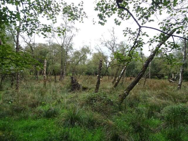
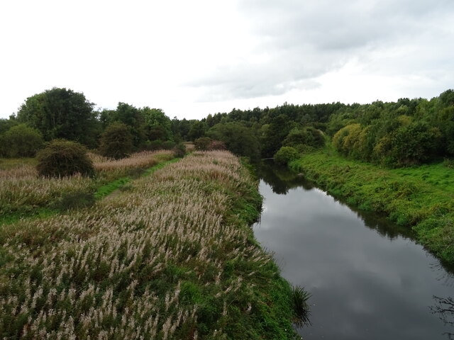
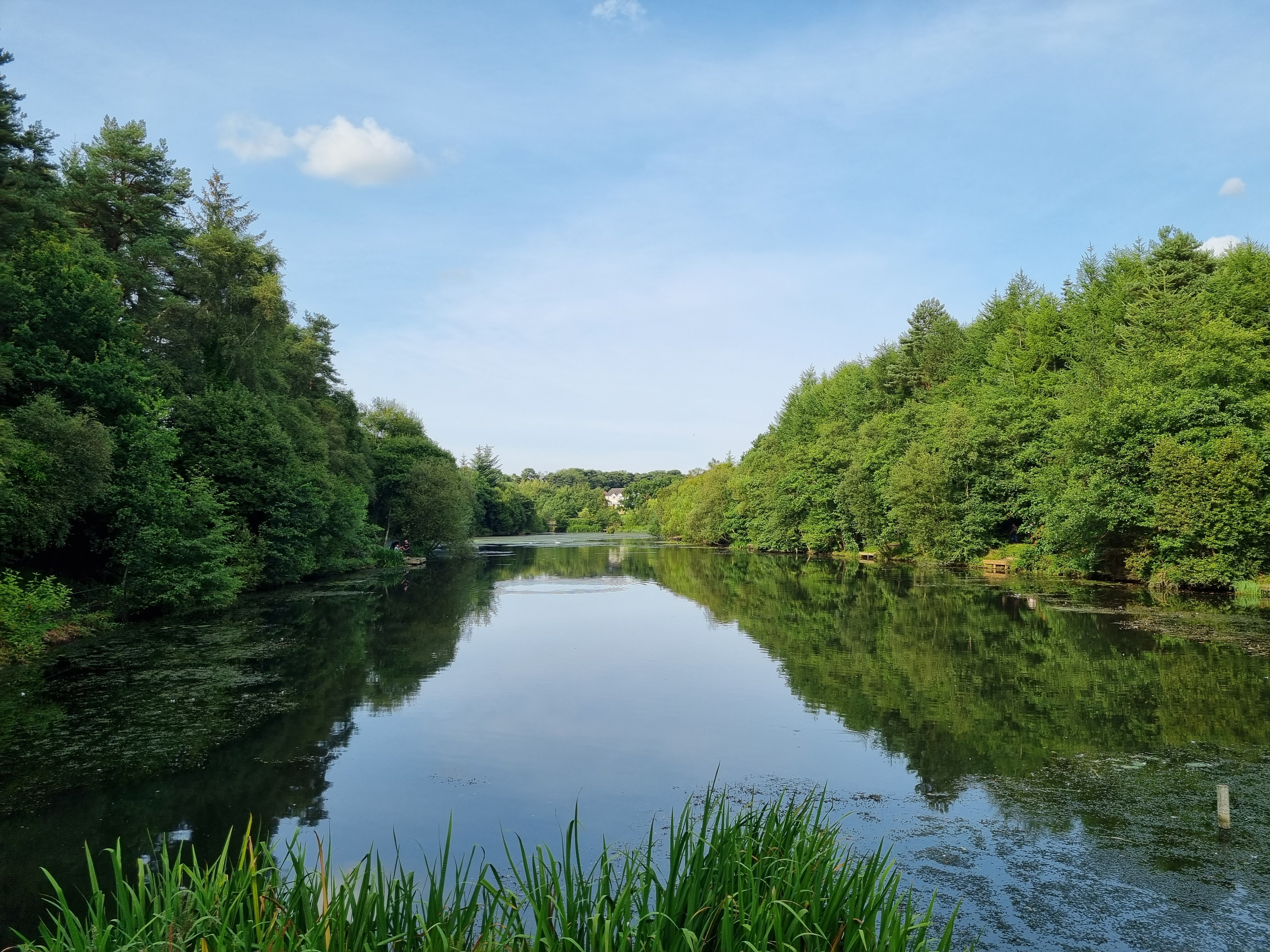
Almond Pool East is a picturesque freshwater marsh located in West Lothian, Scotland. Nestled within the Almond Valley, this tranquil oasis is a haven for both wildlife and nature enthusiasts alike. The pool is surrounded by lush greenery and offers a serene escape from the hustle and bustle of everyday life.

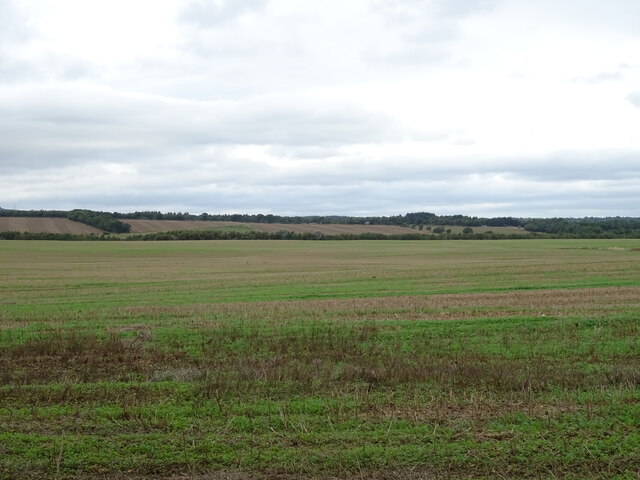
Covering an area of approximately 10 acres, Almond Pool East is a shallow body of water that serves as a vital habitat for various species of plants and animals. The pool is fed by the River Almond, which meanders through the surrounding landscape, providing a constant flow of fresh water. This, in turn, creates the ideal conditions for the growth of aquatic vegetation, including reeds and water lilies, which thrive in the shallows.

The pool is home to a diverse range of wildlife, making it a popular spot for birdwatching enthusiasts. A variety of water birds can be spotted here, including swans, ducks, and herons. Additionally, the pool attracts numerous species of dragonflies and damselflies, which flit and hover above the water's surface.

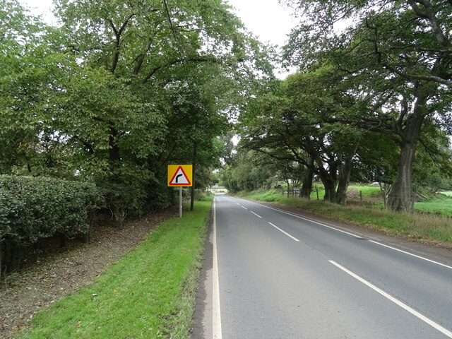
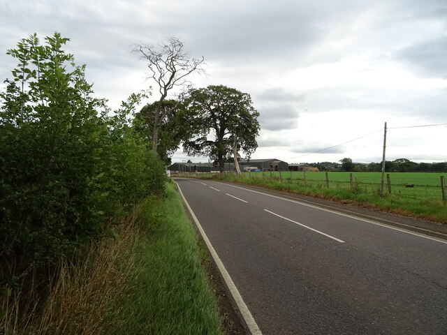
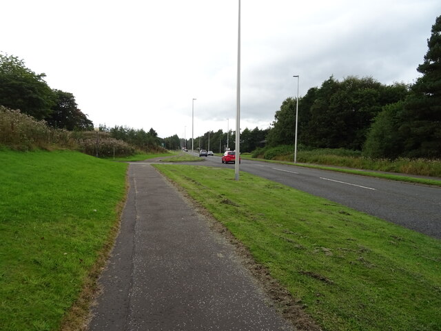
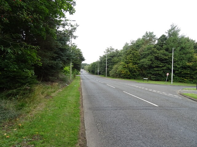
For those looking to explore the area, a network of walking trails surrounds Almond Pool East, providing visitors with the opportunity to immerse themselves in the natural beauty of the marshland. The trails offer stunning views of the pool and its surrounding landscape, making it a favorite spot for photographers and nature lovers.

Overall, Almond Pool East is a peaceful and biodiverse freshwater marsh, offering visitors the chance to connect with nature and observe a wide range of wildlife in their natural habitat.

If you have any feedback on the listing, please let us know in the comments section below.

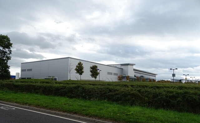
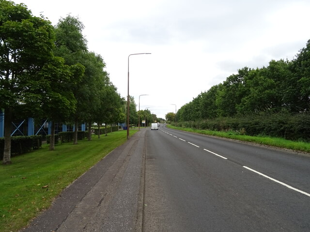
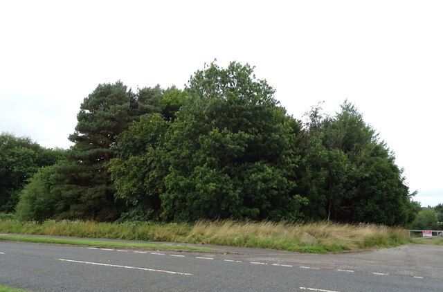
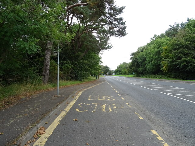
Almond Pool East Images

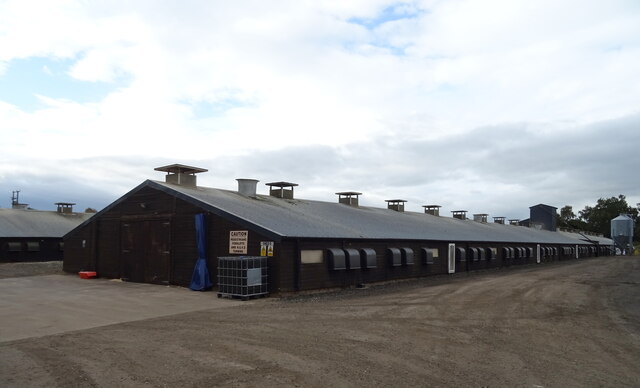
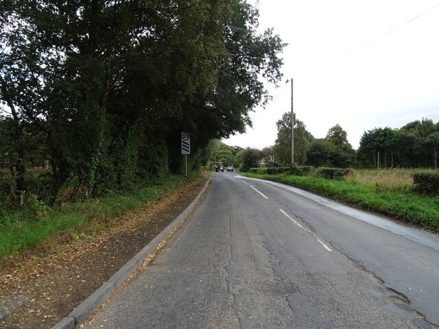
Images are sourced within 2km of 55.882419/-3.5602721 or Grid Reference NT0266. Thanks to Geograph Open Source API. All images are credited.

Poultry farm, Stepend
Woodland, Stepend
Woodland, Stepend
Minor road, Stepend Towards Livingston.
Minor road, Stepend
Towards Livingston.
B7015, Stepend Towards Fauldhouse.
B7015, Stepend
Towards Fauldhouse.
Stubble field near Gavieside Off the B7015.
Stubble field near Gavieside
Off the B7015.
B7015 towards Livingston
Gavieside Farm
Gavieside Farm
Gavieside Farm
Gavieside Farm
Alba Business Park
Alba Business Park
B7015 towards Livingston
Woodland beside the B7015, Kirkton
Bus stop on the B7015
Path beside Simpson Parkway (B7015)
Business unit, Kirkton
The River Almond Looking upstream from the Simpson Parkway bridge on the B7015.
The River Almond
Looking upstream from the Simpson Parkway bridge on the B7015.
Simpson Parkway (B7015) Looking north.
Simpson Parkway (B7015)
Looking north.
Bus stop and shelter on Simpson Parkway (A705)
House beside Simpson Parkway (A705)
Show me another place!

Almond Pool East is located at Grid Ref: NT0266 (Lat: 55.882419, Lng: -3.5602721)

Unitary Authority: West Lothian

Police Authority: The Lothians and Scottish Borders

What 3 Words

///herb.oath.parade. Near Seafield, West Lothian

Related Wikis

Almond Valley Light Railway

The Almond Valley Light Railway is a 2 ft 6 in (762 mm) narrow gauge heritage railway running at the Almond Valley Heritage Trust site at Livingston, Scotland...

Museum of the Scottish Shale Oil Industry

The Museum of the Scottish Shale Oil Industry was created in 1990, to preserve the history of the shale industry in West Lothian and beyond. It is sited...

Starlaw distillery

Starlaw distillery (sometimes known as Glen Turner distillery) is a grain whisky distillery located at Bathgate in West Lothian, Scotland. The distillery...

Eliburn

Eliburn is an area, primarily residential, in Livingston, West Lothian, Scotland. Eliburn is bordered by Deans to the north, Ladywell to the east and Livingston...

Nearby Amenities

Located within 500m of 55.882419,-3.5602721
Crossing
Bicycle: yes
Crossing: traffic_signals
Lat/Long: 55.881271/-3.5552255
Traffic Signals
Lat/Long: 55.8856844/-3.5576665
Parking
Lat/Long: 55.8826496/-3.558033
Traffic Signals
Lat/Long: 55.8813411/-3.5555038
Kirkton Larinier Fish Pass
Fish Pass: yes
Lat/Long: 55.8842813/-3.5552796
Bus Stop
Layby: yes
Naptan AtcoCode: 6290LTR02
Naptan Bearing: NW
Naptan CommonName: Toll Roundabout
Naptan Indicator: before
Naptan Landmark: Toll Roundabout
Naptan NaptanCode: 95624676
Naptan Street: A705
Lat/Long: 55.8854783/-3.5605103
Railway: switch
Lat/Long: 55.8847063/-3.5556045
Crossing
Bicycle: yes
Crossing: traffic_signals
Lat/Long: 55.8814468/-3.5557588
Information: map
Tourism: information
Lat/Long: 55.8843426/-3.5571696
Crossing
Bicycle: yes
Crossing: traffic_signals
Crossing Ref: toucan
Lat/Long: 55.8856949/-3.5577384
Crossing
Bicycle: yes
Crossing: traffic_signals
Crossing Ref: toucan
Lat/Long: 55.8857834/-3.5577364
Bus Stop
Layby: yes
Naptan AtcoCode: 6290LTR01
Naptan Bearing: E
Naptan CommonName: Toll Roundabout
Naptan Indicator: after
Naptan Landmark: Toll Roundabout
Naptan NaptanCode: 95624985
Naptan Street: A705
Lat/Long: 55.8857955/-3.5596448
Crossing
Bicycle: yes
Crossing: traffic_signals
Lat/Long: 55.8812078/-3.5556514
Crossing
Crossing Island: yes
Lat/Long: 55.8856012/-3.5601415
Give Way
Lat/Long: 55.8856943/-3.5581166
Addr City: Livingston
Addr Housenumber: 10
Addr Postcode: EH54 7ES
Addr Street: Thirlfield Wynd
Lat/Long: 55.8857389/-3.5561878
Addr City: Livingston
Addr Housenumber: 11
Addr Postcode: EH54 7ER
Addr Street: Thirlfield Wynd
Lat/Long: 55.8854451/-3.5549345
Addr City: Livingston
Addr Housenumber: 12
Addr Postcode: EH54 7ES
Addr Street: Thirlfield Wynd
Lat/Long: 55.885732/-3.5562862
Addr City: Livingston
Addr Housenumber: 13
Addr Postcode: EH54 7ER
Addr Street: Thirlfield Wynd
Lat/Long: 55.8854668/-3.5547497
Addr City: Livingston
Addr Housenumber: 14
Addr Postcode: EH54 7ES
Addr Street: Thirlfield Wynd
Lat/Long: 55.8856989/-3.5564429
Addr City: Livingston
Addr Housenumber: 15
Addr Postcode: EH54 7ER
Addr Street: Thirlfield Wynd
Lat/Long: 55.8854735/-3.5546545
Addr City: Livingston
Addr Housenumber: 16
Addr Postcode: EH54 7ES
Addr Street: Thirlfield Wynd
Lat/Long: 55.8856324/-3.5566668
Addr City: Livingston
Addr Housenumber: 17
Addr Postcode: EH54 7ER
Addr Street: Thirlfield Wynd
Lat/Long: 55.8855242/-3.554476
Addr City: Livingston
Addr Housenumber: 18
Addr Postcode: EH54 7ES
Addr Street: Thirlfield Wynd
Lat/Long: 55.885574/-3.5568754
Addr City: Livingston
Addr Housenumber: 2
Addr Postcode: EH54 7ES
Addr Street: Thirlfield Wynd
Lat/Long: 55.8858008/-3.5554785
Addr City: Livingston
Addr Housenumber: 20
Addr Postcode: EH54 7ES
Addr Street: Thirlfield Wynd
Lat/Long: 55.8854485/-3.5568664
Addr City: Livingston
Addr Housenumber: 22
Addr Postcode: EH54 7ES
Addr Street: Thirlfield Wynd
Lat/Long: 55.8853503/-3.5567923
Addr City: Livingston
Addr Housenumber: 24
Addr Postcode: EH54 7ES
Addr Street: Thirlfield Wynd
Lat/Long: 55.8852485/-3.5567414
Addr City: Livingston
Addr Housenumber: 26
Addr Postcode: EH54 7ES
Addr Street: Thirlfield Wynd
Lat/Long: 55.8851544/-3.5567376
Addr City: Livingston
Addr Housenumber: 28
Addr Postcode: EH54 7ES
Addr Street: Thirlfield Wynd
Lat/Long: 55.8850537/-3.5566466
Addr City: Livingston
Addr Housenumber: 30
Addr Postcode: EH54 7ES
Addr Street: Thirlfield Wynd
Lat/Long: 55.884959/-3.5566417
Addr City: Livingston
Addr Housenumber: 32
Addr Postcode: EH54 7ES
Addr Street: Thirlfield Wynd
Lat/Long: 55.885272/-3.5563659
Addr City: Livingston
Addr Housenumber: 34
Addr Postcode: EH54 7ES
Addr Street: Thirlfield Wynd
Lat/Long: 55.8853735/-3.5564315
Addr City: Livingston
Addr Housenumber: 36
Addr Postcode: EH54 7ES
Addr Street: Thirlfield Wynd
Lat/Long: 55.8854624/-3.5564269
Addr City: Livingston
Addr Housenumber: 38
Addr Postcode: EH54 7ES
Addr Street: Thirlfield Wynd
Lat/Long: 55.8855301/-3.5560823
Addr City: Livingston
Addr Housenumber: 4
Addr Postcode: EH54 7ES
Addr Street: Thirlfield Wynd
Lat/Long: 55.8857796/-3.5556521
Addr City: Livingston
Addr Housenumber: 40
Addr Postcode: EH54 7ES
Addr Street: Thirlfield Wynd
Lat/Long: 55.8855253/-3.5558801
Addr City: Livingston
Addr Housenumber: 42
Addr Postcode: EH54 7ES
Addr Street: Thirlfield Wynd
Lat/Long: 55.8855417/-3.5557824
Addr City: Livingston
Addr Housenumber: 44
Addr Postcode: EH54 7ES
Addr Street: Thirlfield Wynd
Lat/Long: 55.8855729/-3.5554331
Addr City: Livingston
Addr Housenumber: 46
Addr Postcode: EH54 7ES
Addr Street: Thirlfield Wynd
Lat/Long: 55.885449/-3.5553783
Addr City: Livingston
Addr Housenumber: 48
Addr Postcode: EH54 7ES
Addr Street: Thirlfield Wynd
Lat/Long: 55.8853994/-3.5553273
Addr City: Livingston
Addr Housenumber: 5
Addr Postcode: EH54 7ER
Addr Street: Thirlfield Wynd
Lat/Long: 55.885811/-3.5551095
Addr City: Livingston
Addr Housenumber: 50
Addr Postcode: EH54 7ES
Addr Street: Thirlfield Wynd
Lat/Long: 55.8853227/-3.5551982
Addr City: Livingston
Addr Housenumber: 52
Addr Postcode: EH54 7ES
Addr Street: Thirlfield Wynd
Lat/Long: 55.885231/-3.5555545
Addr City: Livingston
Addr Housenumber: 54
Addr Postcode: EH54 7ES
Addr Street: Thirlfield Wynd
Lat/Long: 55.8851951/-3.5557402
Addr City: Livingston
Addr Housenumber: 56
Addr Postcode: EH54 7ES
Addr Street: Thirlfield Wynd
Lat/Long: 55.885137/-3.5559207
Addr City: Livingston
Addr Housenumber: 58
Addr Postcode: EH54 7ES
Addr Street: Thirlfield Wynd
Lat/Long: 55.8850864/-3.5561343
Addr City: Livingston
Addr Housenumber: 6
Addr Postcode: EH54 7ES
Addr Street: Thirlfield Wynd
Lat/Long: 55.8857714/-3.5558307
Addr City: Livingston
Addr Housenumber: 60
Addr Postcode: EH54 7ES
Addr Street: Thirlfield Wynd
Lat/Long: 55.8850734/-3.556327
Addr City: Livingston
Addr Housenumber: 64
Addr Postcode: EH54 7ES
Addr Street: Thirlfield Wynd
Lat/Long: 55.8848011/-3.5563552
Addr City: Livingston
Addr Housenumber: 66
Addr Postcode: EH54 7ES
Addr Street: Thirlfield Wynd
Lat/Long: 55.8848247/-3.5561441
Addr City: Livingston
Addr Housenumber: 68
Addr Postcode: EH54 7ES
Addr Street: Thirlfield Wynd
Lat/Long: 55.8848718/-3.5559682
Addr City: Livingston
Addr Housenumber: 70
Addr Postcode: EH54 7ES
Addr Street: Thirlfield Wynd
Lat/Long: 55.8849091/-3.5557674
Addr City: Livingston
Addr Housenumber: 72
Addr Postcode: EH54 7ES
Addr Street: Thirlfield Wynd
Lat/Long: 55.8849683/-3.5555821
Addr City: Livingston
Addr Housenumber: 74
Addr Postcode: EH54 7ES
Addr Street: Thirlfield Wynd
Lat/Long: 55.8850013/-3.5554259
Addr City: Livingston
Addr Housenumber: 76
Addr Postcode: EH54 7ES
Addr Street: Thirlfield Wynd
Lat/Long: 55.8850516/-3.555269
Addr City: Livingston
Addr Housenumber: 78
Addr Postcode: EH54 7ES
Addr Street: Thirlfield Wynd
Lat/Long: 55.8851076/-3.5551274
Addr City: Livingston
Addr Housenumber: 8
Addr Postcode: EH54 7ES
Addr Street: Thirlfield Wynd
Lat/Long: 55.885752/-3.5559896
Addr City: Livingston
Addr Housenumber: 80
Addr Postcode: EH54 7ES
Addr Street: Thirlfield Wynd
Lat/Long: 55.885318/-3.5541474
Addr City: Livingston
Addr Housenumber: 9
Addr Postcode: EH54 7ER
Addr Street: Thirlfield Wynd
Lat/Long: 55.8856719/-3.5550562
Addr City: Livingston
Addr Housenumber: 26
Addr Postcode: EH54 7EW
Addr Street: Westcroft Court
Lat/Long: 55.8865557/-3.5577093
Addr City: Livingston
Addr Housenumber: 28
Addr Postcode: EH54 7EW
Addr Street: Westcroft Court
Lat/Long: 55.8864213/-3.5576467
Addr City: Livingston
Addr Housenumber: 30
Addr Postcode: EH54 7EW
Addr Street: Westcroft Court
Lat/Long: 55.886322/-3.5575763
Addr City: Livingston
Addr Housenumber: 32
Addr Postcode: EH54 7EW
Addr Street: Westcroft Court
Lat/Long: 55.8862178/-3.5574888
Addr City: Livingston
Addr Housenumber: 34
Addr Postcode: EH54 7EW
Addr Street: Westcroft Court
Lat/Long: 55.8863496/-3.5572455
Addr City: Livingston
Addr Housenumber: 36
Addr Postcode: EH54 7EW
Addr Street: Westcroft Court
Lat/Long: 55.8864258/-3.5570142
Bench
Backrest: no
Material: wood
Lat/Long: 55.8829119/-3.5598231
Bench
Backrest: no
Material: wood
Lat/Long: 55.8832744/-3.5573038
Almond Pool East
Board Type: nature
Information: board
Tourism: information
Lat/Long: 55.8829326/-3.559866
Bench
Lat/Long: 55.8823402/-3.5590848
Almondhaugh Halt
Operator: Almond Valley Heritage Centre
Platforms: 1
Public Transport: station
Railway: station
Train: yes
Usage: tourism
Lat/Long: 55.8847771/-3.5553551
Brass Rubbing Trail
Artwork Type: installation
Material: brass
Start Date: 2020
Tourism: artwork
Lat/Long: 55.8844896/-3.5554779
Leisure: picnic_table
Lat/Long: 55.8847043/-3.5552654
Leisure: picnic_table
Lat/Long: 55.8846382/-3.555429
Railway: switch
Lat/Long: 55.8848473/-3.5550821
Crossing
Bicycle: yes
Crossing: traffic_signals
Crossing Ref: toucan
Lat/Long: 55.8856576/-3.5577651
Traffic Signals
Lat/Long: 55.8856577/-3.5575704
Crossing
Bicycle: yes
Crossing: traffic_signals
Crossing Ref: toucan
Lat/Long: 55.885727/-3.5576295
Crossing
Bicycle: yes
Crossing: traffic_signals
Crossing Ref: toucan
Lat/Long: 55.8857078/-3.557534
The data included in this document is from www.openstreetmap.org. The data is made available under ODbL.

Have you been to Almond Pool East?

Leave your review of Almond Pool East below (or comments, questions and feedback).