Loch nan Clach Geala

Lake, Pool, Pond, Freshwater Marsh in Caithness

Scotland

Loch nan Clach Geala

Shieling Hut in Helshetter Strath The remains of a shieling hut in the area known as The Glens at the head of Helshetter Strath.
Shieling Hut in Helshetter Strath Credit: david glass

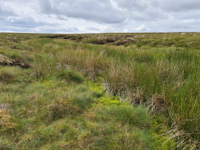
Loch nan Clach Geala, located in Caithness, Scotland, is a picturesque freshwater marsh that encompasses an area of approximately 70 hectares. Also known as the "Lake of the White Stones," the loch is renowned for its stunning natural beauty and unique ecological features.

Surrounded by rolling hills and heather-clad moorland, Loch nan Clach Geala boasts a diverse range of plant and animal species. The loch itself is relatively shallow, with an average depth of around 2 meters, and is fed by several small streams that flow from the surrounding hills.

The marshy edges of the loch are characterized by an abundance of reeds, sedges, and other aquatic plants, providing a vital habitat for a wide variety of bird species. Birdwatchers flock to the area to catch a glimpse of rare species such as the great crested grebe, whooper swan, and the elusive black-throated diver.

The loch is also home to a range of fish species, including brown trout and perch, making it a popular spot for anglers. Fishing is permitted with the appropriate licenses, and the tranquil setting provides a serene backdrop for a day spent casting a line.

For those seeking outdoor adventures, Loch nan Clach Geala offers opportunities for kayaking and canoeing. Exploring the calm waters of the loch, visitors can immerse themselves in the peaceful surroundings and take in the breathtaking views of the surrounding landscape.

Overall, Loch nan Clach Geala is a hidden gem in Caithness, providing a haven for wildlife enthusiasts, anglers, and nature lovers alike. Its unique blend of stunning scenery and abundant wildlife make it a must-visit destination for anyone exploring the Scottish Highlands.

If you have any feedback on the listing, please let us know in the comments section below.

Loch nan Clach Geala Images

Images are sourced within 2km of 58.492199/-3.7924264 or Grid Reference NC9557. Thanks to Geograph Open Source API. All images are credited.

Shieling Hut in Helshetter Strath The remains of a shieling hut in the area known as The Glens at the head of Helshetter Strath.
Shieling Hut in Helshetter Strath
The remains of a shieling hut in the area known as The Glens at the head of Helshetter Strath.
Tributary of the Allt Gleann Chorcaill The burns on this higher moorland are boggy and wide, so we had to go south in order to get past it.
Tributary of the Allt Gleann Chorcaill
The burns on this higher moorland are boggy and wide, so we had to go south in order to get past it.
Burn from Loch a' Chlèirich This flows into the Smigel Burn and Strath Halladale. It was wide and boggy here, difficult to cross even in this very dry period.
Burn from Loch a' Chlèirich
This flows into the Smigel Burn and Strath Halladale. It was wide and boggy here, difficult to cross even in this very dry period.
Sheiling in Helshetter Strath The remains of a building, probably a sheiling. Unmarked on the OS map.
Sheiling in Helshetter Strath
The remains of a building, probably a sheiling. Unmarked on the OS map.
Aspens in Gleann Chorcaill A small group of Aspens, very scarce in this area, survive on a rocky outcrop where they cannot be grazed by deer.
Aspens in Gleann Chorcaill
A small group of Aspens, very scarce in this area, survive on a rocky outcrop where they cannot be grazed by deer.
Gleann Chorcaill The Sandside Burn flows through this narrow glen.
Gleann Chorcaill
The Sandside Burn flows through this narrow glen.
Lochan a' Ghlinne The lochan at the head of the Sandside Burn.
Lochan a' Ghlinne
The lochan at the head of the Sandside Burn.
Lochan a' Ghlinne The source of the Sandside Burn at the head of Gleann Chorcaill.
Lochan a' Ghlinne
The source of the Sandside Burn at the head of Gleann Chorcaill.
Peatland in the Caithness Flow Country From this watershed water flows in three directions: West to Strath Halladale, North to the Sandside Burn and East to the Thurso River basin.
Peatland in the Caithness Flow Country
From this watershed water flows in three directions: West to Strath Halladale, North to the Sandside Burn and East to the Thurso River basin.
Gleann Chorcaill The upper reaches of the Sandside Burn before the glen narrows to a ravine.
Gleann Chorcaill
The upper reaches of the Sandside Burn before the glen narrows to a ravine.
Sean Airigh Summit A remote hill on the west side of Sandside Estate, with the Ben Griams in the distance.
Sean Airigh Summit
A remote hill on the west side of Sandside Estate, with the Ben Griams in the distance.
Moorland on Sandside Estate Blanket bog sloping down to the Sandside Burn.
Moorland on Sandside Estate
Blanket bog sloping down to the Sandside Burn.
Moorland on Sandside Estate Blanket bog in the upper catchment of the Sandside Burn.
Moorland on Sandside Estate
Blanket bog in the upper catchment of the Sandside Burn.
Sutherland Moorland Blanket bog west of Sean Airigh.
Sutherland Moorland
Blanket bog west of Sean Airigh.
Sutherland Moorland Blanket bog south west of Sean Airigh.
Sutherland Moorland
Blanket bog south west of Sean Airigh.
Clachgeal Hill Blanket bog on the western slopes of Clachgeal Hill.
Clachgeal Hill
Blanket bog on the western slopes of Clachgeal Hill.
The Upper Catchment of the Smigel Burn This expanse of blanket bog drains to the Smigel Burn and onwards to the Halladale River.
The Upper Catchment of the Smigel Burn
This expanse of blanket bog drains to the Smigel Burn and onwards to the Halladale River.
Tributary of the Smigel Burn A small burn in the upper catchment of the Smigel Burn. The faint track through the heather was probably used to access the shielings.
Tributary of the Smigel Burn
A small burn in the upper catchment of the Smigel Burn. The faint track through the heather was probably used to access the shielings.
Show me another place!

Loch nan Clach Geala is located at Grid Ref: NC9557 (Lat: 58.492199, Lng: -3.7924264)

Unitary Authority: Highland

Police Authority: Highlands and Islands

What 3 Words

///reinvest.navigate.cheer. Near Reay, Highland

Related Wikis

Achiemore, Strath Halladale

Achiemore is a hamlet in Strath Halladale in Sutherland, in the Highland council area of Scotland. Achiemore is situated to the north of Smigel Burn on...

Upper Bighouse

Upper Bighouse is a remote linear crofting township, which lies on the west bank of the Halladale River in the former county of Sutherland. It is now in...

Croick

Croick (Scottish Gaelic: A' Chròic) is a small crofting village, located in the right bank of the River Halladale in Forsinard, eastern Sutherland, Scottish...

Strath Halladale

Strath Halladale is a strath in the traditional county of Sutherland in the north of Scotland down which the Halladale River flows to enter the Atlantic...

Dalhalvaig

Dalhalvaig (Scottish Gaelic: Dail Healabhaig) is a small crofting village, located in the right bank of the River Halladale in the Scottish council area...

Trantlebeg

Trantlebeg (Scottish Gaelic: Tranntail Beag) is a small village east of the Halladale River in Forsinard, east Sutherland, Scottish Highlands and is in...

Reay Parish Church

Reay Parish Church is a Church of Scotland parish church serving Reay, Caithness. It is one of the most northerly communities on the Scottish mainland...

Reay

Reay (Scottish Gaelic: Ràth) is a village which has grown around Sandside Bay on the north coast of the Highland council area of Scotland. It is within...

Have you been to Loch nan Clach Geala?

Leave your review of Loch nan Clach Geala below (or comments, questions and feedback).