Gosberton Clough

Settlement in Lincolnshire South Holland

England

Gosberton Clough

Cabbages near Risegate
Cabbages near Risegate Credit: Jonathan Thacker

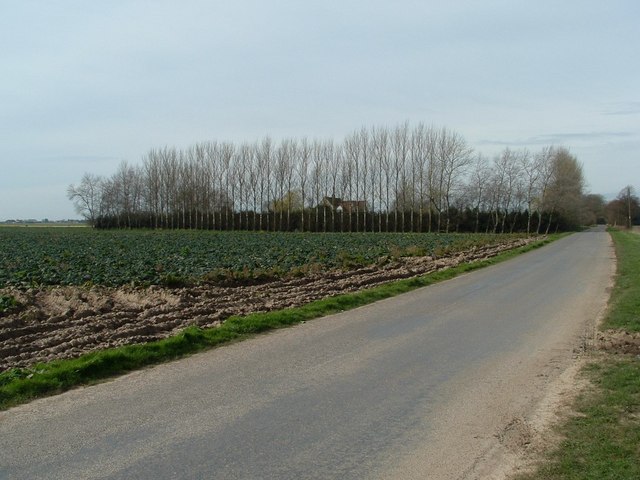
Gosberton Clough is a charming village located in the county of Lincolnshire, England. Situated in the South Holland district, it is nestled in the heart of the picturesque Fens, known for its flat, fertile landscapes. The village is positioned approximately 14 miles south-east of the historic city of Lincoln and about 6 miles north of the market town of Spalding.

Gosberton Clough exudes a quaint and peaceful atmosphere, with its traditional architecture and well-manicured gardens. The village is predominantly residential, with a close-knit community that takes pride in its surroundings. The houses in Gosberton Clough range from quaint cottages to more modern homes, providing a diverse housing stock.

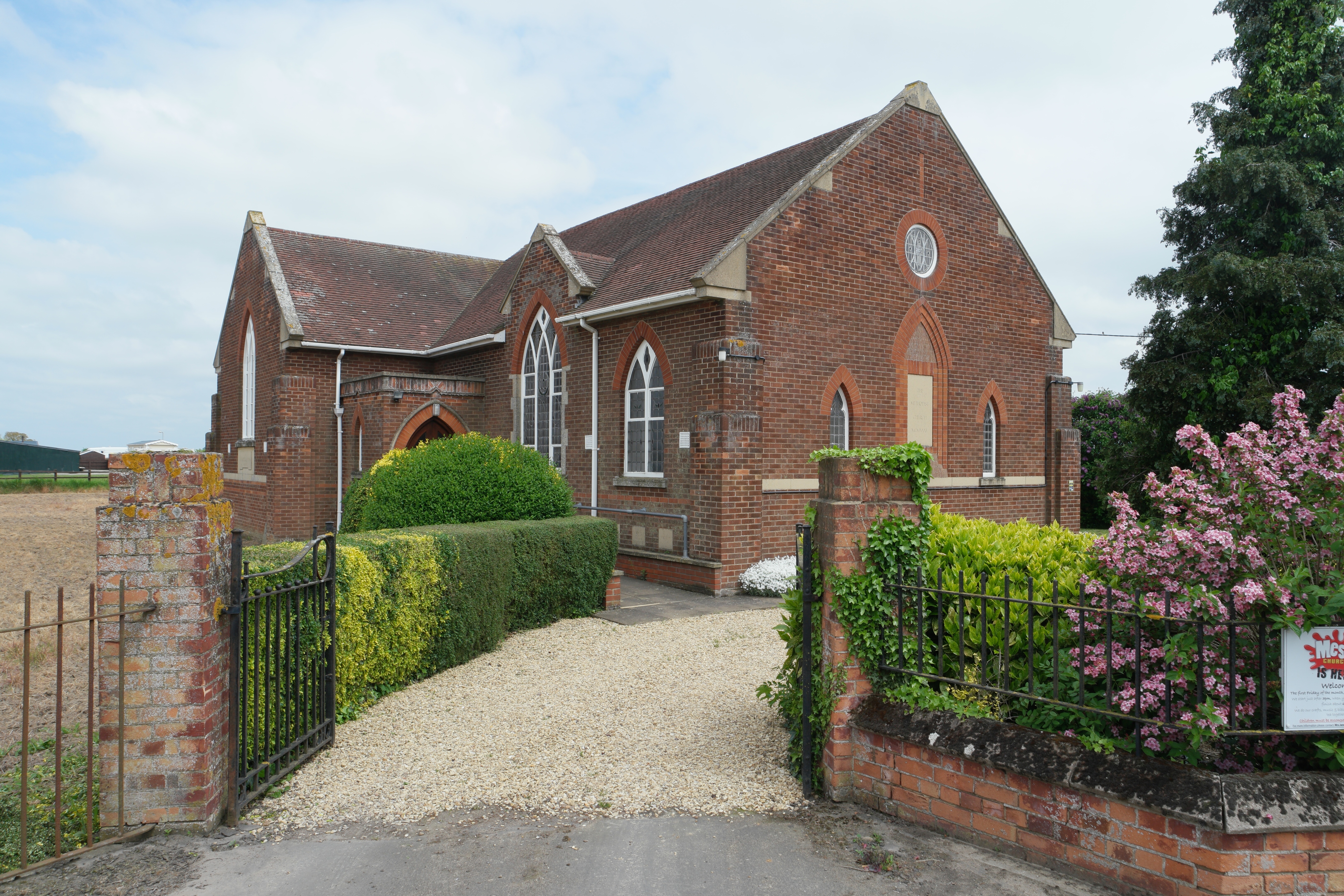
The village is blessed with a range of amenities, including a local primary school, a village hall, and a post office. There is also a charming church, St. Peter and St. Paul, which dates back to the 12th century and serves as a focal point for the community. The surrounding countryside offers numerous opportunities for outdoor activities such as walking, cycling, and birdwatching, with several nature reserves in the vicinity.

Despite its tranquil rural setting, Gosberton Clough benefits from its proximity to larger towns and cities, providing access to a wider range of amenities and employment opportunities. The village is well-connected to the rest of Lincolnshire via road networks, with nearby major routes including the A16 and A52.

Overall, Gosberton Clough offers a peaceful and idyllic lifestyle for its residents, with a strong sense of community and a picturesque setting that captures the beauty of the Lincolnshire countryside.

If you have any feedback on the listing, please let us know in the comments section below.

Gosberton Clough Images

Images are sourced within 2km of 52.852655/-0.230492 or Grid Reference TF1929. Thanks to Geograph Open Source API. All images are credited.

Cabbages near Risegate
Swalebank Farm Tall windbreak trees surround Swalebank Farm with a partially harvested brassica crop in the middle ground
Swalebank Farm
Tall windbreak trees surround Swalebank Farm with a partially harvested brassica crop in the middle ground
Track to Swale Bank Farm/Cobwebs Farm Known as both names?
Track to Swale Bank Farm/Cobwebs Farm
Known as both names?
Water, not polythene After some long-awaited heavy rain, the furrows in the fields in this area have become somewhat saturated.
Water, not polythene
After some long-awaited heavy rain, the furrows in the fields in this area have become somewhat saturated.
House on Chesboule Lane
Farmland off Chesboule Lane
Chesboule Lane heading north
Farmland off Chesboule Lane
Chesboule Lane heading north
Farmland, Vicarage Farm
Quadring Bank heading north
Swale Bank heading east
Blue loo and drying mud A portable toilet on the edge of a cabbage field on Chesboule Lane near Risegate, Lincs. Cabbage harvesting is labour intensive with everyone being individually cut by hand hence the need for a toilet
Blue loo and drying mud
A portable toilet on the edge of a cabbage field on Chesboule Lane near Risegate, Lincs. Cabbage harvesting is labour intensive with everyone being individually cut by hand hence the need for a toilet
Field of cabbages off Chesboule Lane, Risegate
Road junction and finger post
Farm buildings As seen on the Horizon in <a href="https://www.geograph.org.uk/photo/5609356">TF2130 : Broccoli, as far as the eye can see</a>
Farm buildings
Rigbolt House and moated site: aerial 2021
St Gilbert and St Hugh's Church, Gosberton Clough, Lincs Unusual Wood and render church out in the fens.
St Gilbert and St Hugh's Church, Gosberton Clough, Lincs
Unusual Wood and render church out in the fens.
Show me another place!

Gosberton Clough is located at Grid Ref: TF1929 (Lat: 52.852655, Lng: -0.230492)

Division: Parts of Holland

Administrative County: Lincolnshire

District: South Holland

Police Authority: Lincolnshire

What 3 Words

///dustbin.caramel.indirect. Near Gosberton, Lincolnshire

Nearby Locations

Gosberton Clough Gosberton

Related Wikis

Gosberton Clough

Gosberton Clough is a village in the civil parish of Gosberton and the South Holland district of Lincolnshire, England. It is 30 miles (50 km) south-east...

Risegate

Risegate is a village in the civil parish of Gosberton and the South Holland district of Lincolnshire, England. It is 30 miles (50 km) south-east from...

Quadring Fen

Quadring Fen is a hamlet in the South Holland district of Lincolnshire, England. It is situated 2 miles (3.2 km) south from the A52 road, 5 miles (8.0...

Westhorpe, Lincolnshire

Westhorpe is a hamlet in the civil parish of Gosberton and the South Holland district of Lincolnshire, England. It is 30 miles (50 km) south-east from...

Gosberton railway station

Gosberton railway station was a station in Gosberton, Lincolnshire. It was opened in 1882 and closed for passengers on 11 September 1961 and freight on...

South Forty-Foot Drain

The South Forty-Foot Drain, also known as the Black Sluice Navigation, is the main channel for the land-drainage of the Black Sluice Level in the Lincolnshire...

Quadring

Quadring is a small village and civil parish in the South Holland district of Lincolnshire. It lies on the A152, 2 miles (3.2 km) north-east of Gosberton...

A152 road

The A152 is a small non-primary A-road in Lincolnshire, from Donington to Surfleet linking the A52 and the A16, two major primary routes. Between Donington...

Nearby Amenities

Located within 500m of 52.852655,-0.230492
Bus Stop
Clough Bridge
Bus: yes
Naptan AtcoCode: 270000009766
Naptan Bearing: E
Naptan CommonName: Clough Bridge
Naptan Indicator: adj
Naptan Landmark: Clough Bridge
Naptan NaptanCode: linjdwam
Naptan Street: Clough Road
Naptan Verified: no
Public Transport: platform
Source: naptan_import
Lat/Long: 52.8515998/-0.2328557
Bus Stop
Clough Bridge
Bus: yes
Naptan AtcoCode: 2700LGCB6854
Naptan Bearing: W
Naptan CommonName: Clough Bridge
Naptan Indicator: opp
Naptan Landmark: Clough Bridge
Naptan NaptanCode: lingjatw
Naptan Street: Clough Road
Naptan Verified: no
Public Transport: platform
Source: naptan_import
Lat/Long: 52.8515016/-0.2329042
Bus Stop
Chopdike Drove
Naptan AtcoCode: 2700LGCR5557
Naptan Bearing: SW
Naptan CommonName: Chopdike Drove
Naptan Indicator: o/s
Naptan Landmark: Clough & Risegate School
Naptan Street: Chopdike Drove
Naptan Verified: no
Source: naptan_import
Lat/Long: 52.8513489/-0.2246464
Place Of Worship
Centenary Methodist Church
Denomination: methodist
Religion: christian
Source: Bing
Lat/Long: 52.852034/-0.2332413
Gosberton Clough
Place: village
Source: Bing
Lat/Long: 52.8521917/-0.2295515
Dovecote Farm
Place: farm
Source: Bing
Lat/Long: 52.8522823/-0.2271053
Surfleet Fen Bridge
Place: locality
Source: Bing
Lat/Long: 52.852182/-0.2340183
Primitive Gait
Building: residential
Source: Bing
Lat/Long: 52.8514705/-0.2311313
Arborowan Cottage
Place: isolated_dwelling
Source: Bing
Lat/Long: 52.8549271/-0.2365569
Entrance: yes
Lat/Long: 52.8512761/-0.2243721
Ashley
Place: isolated_dwelling
Source: Bing
Lat/Long: 52.8554171/-0.2320969
Noexit: yes
Lat/Long: 52.8549592/-0.2364389
The data included in this document is from www.openstreetmap.org. The data is made available under ODbL.

Have you been to Gosberton Clough?

Leave your review of Gosberton Clough below (or comments, questions and feedback).