Gosberton

Settlement in Lincolnshire South Holland

England

Gosberton

Earthworks on site in Quadring Eaudike: (1)
Earthworks on site in Quadring Eaudike: (1) Credit: Simon Tomson

Gosberton is a small village located in the South Holland district of Lincolnshire, England. Situated about 9 miles east of Spalding, it is part of the historic county of Lincolnshire and falls within the civil parish of Gosberton.

The village has a rich history that dates back to medieval times. It is believed to have been named after St. Guthlac, an Anglo-Saxon hermit who lived in the area during the 8th century. Gosberton was mentioned in the Domesday Book of 1086, highlighting its significance as an established settlement.

Today, Gosberton retains its rural charm and is known for its picturesque countryside and tranquil atmosphere. The village is characterized by its traditional architecture, with many buildings constructed in the local yellow limestone. The St. Peter and St. Paul Church, a prominent landmark, showcases stunning medieval features and is worth a visit for history enthusiasts.

Gosberton offers a range of amenities to its residents and visitors, including a primary school, medical center, post office, and several shops and pubs. The village also hosts community events throughout the year, fostering a close-knit and friendly atmosphere.

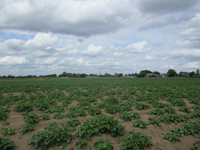
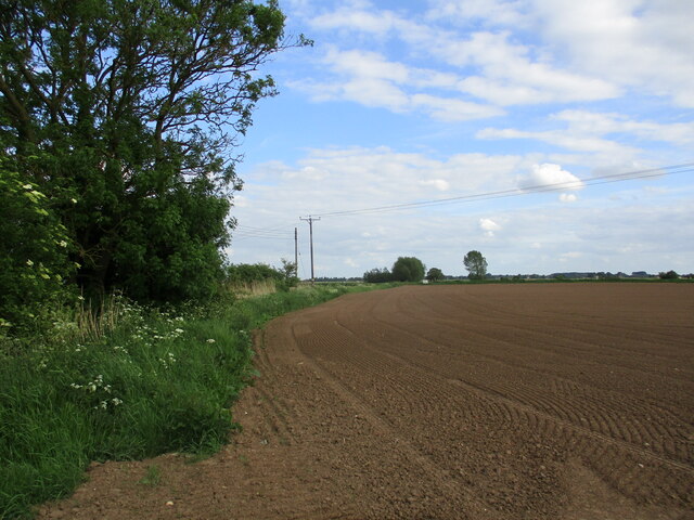
The surrounding area is predominantly agricultural, with fields of crops and livestock dotting the landscape. The village's proximity to the Lincolnshire Fens provides ample opportunities for outdoor activities, such as walking, cycling, and birdwatching.

Overall, Gosberton is a charming village that combines historical significance with a peaceful rural setting, making it an attractive destination for those seeking a tranquil escape or a glimpse into Lincolnshire's past.

If you have any feedback on the listing, please let us know in the comments section below.
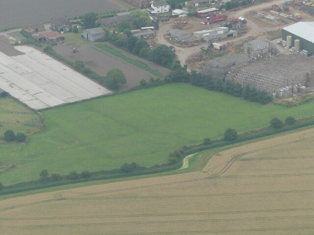
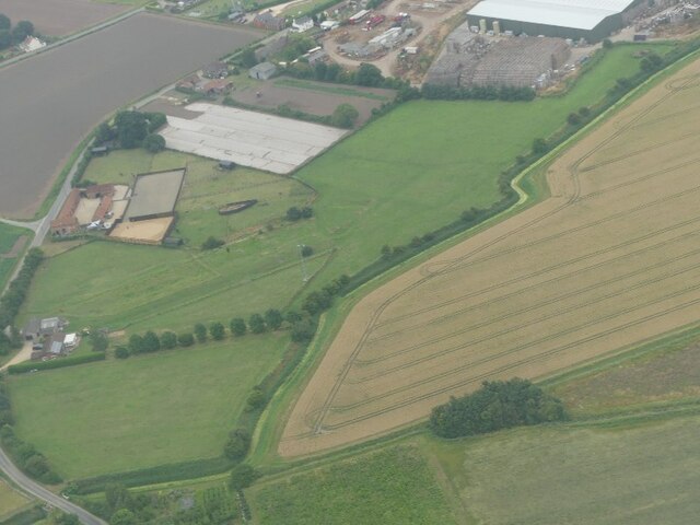
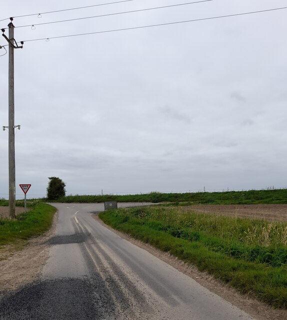
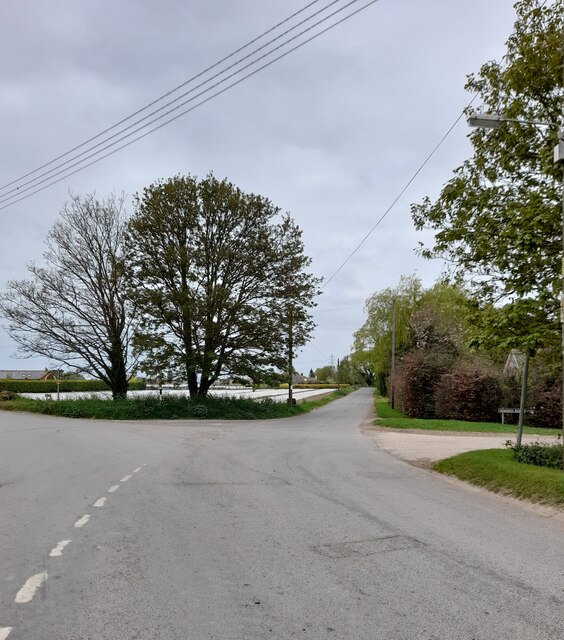
Gosberton Images

Images are sourced within 2km of 52.867811/-0.158277 or Grid Reference TF2431. Thanks to Geograph Open Source API. All images are credited.

Earthworks on site in Quadring Eaudike: (1)
Earthworks on site in Quadring Eaudike: (2)
Cressy Hall and Moated site near Gosberton: aerial 2021 See: <span class="nowrap"><a title="https://www.heritagegateway.org.uk/Gateway/Results_Single.aspx?uid=MLI86313&resourceID=1006" rel="nofollow ugc noopener" href="https://www.heritagegateway.org.uk/Gateway/Results_Single.aspx?uid=MLI86313&resourceID=1006">Link</a><img style="margin-left:2px;" alt="External link" title="External link - shift click to open in new window" src="https://s1.geograph.org.uk/img/external.png" width="10" height="10"/></span>
Cressy Hall and Moated site near Gosberton: aerial 2021
See: LinkExternal link
Road junction
Road junction
Road junction
Road junction
Road junction
Road junction
Quadring Road, Gosberton Looking towards Quadring.
Quadring Road, Gosberton
Looking towards Quadring.
Wargate Way, Gosberton The house on the corner dates from the eighteenth century <span class="nowrap"><a title="https://historicengland.org.uk/listing/the-list/list-entry/1064423?section=official-list-entry" rel="nofollow ugc noopener" href="https://historicengland.org.uk/listing/the-list/list-entry/1064423?section=official-list-entry">Link</a><img style="margin-left:2px;" alt="External link" title="External link - shift click to open in new window" src="https://s1.geograph.org.uk/img/external.png" width="10" height="10"/></span> as does that adjacent to it <span class="nowrap"><a title="https://historicengland.org.uk/listing/the-list/list-entry/1064424?section=official-list-entry" rel="nofollow ugc noopener" href="https://historicengland.org.uk/listing/the-list/list-entry/1064424?section=official-list-entry">Link</a><img style="margin-left:2px;" alt="External link" title="External link - shift click to open in new window" src="https://s1.geograph.org.uk/img/external.png" width="10" height="10"/></span>
Wargate Way, Gosberton
The house on the corner dates from the eighteenth century LinkExternal link as does that adjacent to it LinkExternal link
Gosberton Community Hall
Potato field off Cawood Lane
Risegate Eau at Cressy Bridge Risegate Eau is completely blocked with vegetation.
Risegate Eau at Cressy Bridge
Risegate Eau is completely blocked with vegetation.
Potato field and Spalding Road
Prepared field off Gosberton Bank
Gosberton Methodist Church
Co-op Food Store, Gosberton A former chapel.
Co-op Food Store, Gosberton
A former chapel.
The Bell Inn, Gosberton Dates from the early nineteenth century <span class="nowrap"><a title="https://historicengland.org.uk/listing/the-list/list-entry/1146579?section=official-list-entry" rel="nofollow ugc noopener" href="https://historicengland.org.uk/listing/the-list/list-entry/1146579?section=official-list-entry">Link</a><img style="margin-left:2px;" alt="External link" title="External link - shift click to open in new window" src="https://s1.geograph.org.uk/img/external.png" width="10" height="10"/></span>
The Bell Inn, Gosberton
Dates from the early nineteenth century LinkExternal link
Former shop, Gosberton
Church of St. Peter and St. Paul, Gosberton The spire dates from the fourteenth century <span class="nowrap"><a title="https://historicengland.org.uk/listing/the-list/list-entry/1064425?section=official-list-entry" rel="nofollow ugc noopener" href="https://historicengland.org.uk/listing/the-list/list-entry/1064425?section=official-list-entry">Link</a><img style="margin-left:2px;" alt="External link" title="External link - shift click to open in new window" src="https://s1.geograph.org.uk/img/external.png" width="10" height="10"/></span>
Church of St. Peter and St. Paul, Gosberton
The spire dates from the fourteenth century LinkExternal link
Show me another place!

Gosberton is located at Grid Ref: TF2431 (Lat: 52.867811, Lng: -0.158277)

Division: Parts of Holland

Administrative County: Lincolnshire

District: South Holland

Police Authority: Lincolnshire

What 3 Words

///necklaces.flood.curly. Near Gosberton, Lincolnshire

Nearby Locations

Gosberton

Related Wikis

A152 road

The A152 is a small non-primary A-road in Lincolnshire, from Donington to Surfleet linking the A52 and the A16, two major primary routes. Between Donington...

Quadring Eaudike

Quadring Eaudike is a hamlet in the South Holland district of Lincolnshire, England. It lies approximately 1 mile (2 km) east from the A152 road, and 2...

Gosberton

Gosberton is a village and civil parish in the South Holland district of Lincolnshire, England. It is situated 9 miles (14.5 km) south-west of Boston,...

Quadring

Quadring is a small village and civil parish in the South Holland district of Lincolnshire. It lies on the A152, 2 miles (3.2 km) north-east of Gosberton...

Westhorpe, Lincolnshire

Westhorpe is a hamlet in the civil parish of Gosberton and the South Holland district of Lincolnshire, England. It is 30 miles (50 km) south-east from...

Gosberton railway station

Gosberton railway station was a station in Gosberton, Lincolnshire. It was opened in 1882 and closed for passengers on 11 September 1961 and freight on...

Belnie

Belnie is a hamlet in the civil parish of Gosberton, Lincolnshire, England. == References ==

Risegate

Risegate is a village in the civil parish of Gosberton and the South Holland district of Lincolnshire, England. It is 30 miles (50 km) south-east from...

Nearby Amenities

Located within 500m of 52.867811,-0.158277
Gosberton
Is In: Lincolnshire, England, UK
Place: village
Source: npe
Lat/Long: 52.869059/-0.161089
Bus Stop
The Bell PH
Bus: yes
Naptan AtcoCode: 270000009034
Naptan Bearing: NW
Naptan CommonName: The Bell PH
Naptan Indicator: opp
Naptan Landmark: The Bell PH
Naptan NaptanCode: lingwpaw
Naptan Street: High Street
Naptan Verified: no
Public Transport: platform
Source: naptan_import
Lat/Long: 52.8691561/-0.1616264
Bus Stop
War Memorial
Bus: yes
Naptan AtcoCode: 270000009035
Naptan Bearing: NW
Naptan CommonName: War Memorial
Naptan Indicator: opp
Naptan Landmark: War Memorial
Naptan NaptanCode: lingwpda
Naptan Street: High Street
Naptan Verified: no
Public Transport: platform
Source: naptan_import
Lat/Long: 52.8672641/-0.1573086
Bus Stop
Primary School
Bus: yes
Naptan AtcoCode: 270000009036
Naptan Bearing: NW
Naptan CommonName: Primary School
Naptan Indicator: adj
Naptan Landmark: Primary School
Naptan NaptanCode: lingwpdg
Naptan Street: A152 High Street
Naptan Verified: no
Public Transport: platform
Source: naptan_import
Lat/Long: 52.8664485/-0.1557386
Bus Stop
The Five Bells PH
Bus: yes
Naptan AtcoCode: 270000009900
Naptan Bearing: SE
Naptan CommonName: The Five Bells PH
Naptan Indicator: opp
Naptan Landmark: The Five Bells PH
Naptan NaptanCode: linjgdtj
Naptan Street: Spalding Road
Naptan Verified: no
Public Transport: platform
Source: naptan_import
Lat/Long: 52.8655787/-0.1535767
Bus Stop
Salem Street
Bus: yes
Naptan AtcoCode: 270002701172
Naptan Bearing: W
Naptan CommonName: Salem Street
Naptan Indicator: adj
Naptan Landmark: Wargate Way
Naptan NaptanCode: linatwdg
Naptan Street: Salem Street
Naptan Verified: no
Public Transport: platform
Source: naptan_import
Lat/Long: 52.8678838/-0.1607442
Bus Stop
The Bell PH
Bus: yes
Naptan AtcoCode: 2700LGBI2405
Naptan Bearing: SE
Naptan CommonName: The Bell PH
Naptan Indicator: adj
Naptan Landmark: The Bell PH
Naptan NaptanCode: linapwpg
Naptan Street: High Street
Naptan Verified: no
Public Transport: platform
Source: naptan_import
Lat/Long: 52.8692628/-0.1615476
Bus Stop
The Five Bells PH
Bus: yes
Naptan AtcoCode: 2700LGFB2717
Naptan Bearing: NW
Naptan CommonName: The Five Bells PH
Naptan Indicator: adj
Naptan Landmark: The Five Bells PH
Naptan NaptanCode: linatmgd
Naptan Street: Spalding Road
Naptan Verified: no
Public Transport: platform
Source: naptan_import
Lat/Long: 52.865482/-0.1537145
Bus Stop
Primary School
Bus: yes
Naptan AtcoCode: 2700LGPS1007
Naptan Bearing: SE
Naptan CommonName: Primary School
Naptan Indicator: opp
Naptan Landmark: Primary School
Naptan NaptanCode: linagwdm
Naptan Street: A152 High Street
Naptan Verified: no
Public Transport: platform
Source: naptan_import
Lat/Long: 52.8665736/-0.1556888
Bus Stop
War Memorial
Bus: yes
Naptan AtcoCode: 2700LGWM2506
Naptan Bearing: SE
Naptan CommonName: War Memorial
Naptan Indicator: adj
Naptan Landmark: War Memorial
Naptan NaptanCode: linatdjd
Naptan Street: High Street
Naptan Verified: no
Public Transport: platform
Source: naptan_import
Lat/Long: 52.8675175/-0.1574167
Place Of Worship
Gosberton Methodist Church
Denomination: methodist
Religion: christian
Source: Bing
Lat/Long: 52.8680608/-0.1601297
Place Of Worship
cemetery chapel
Building: chapel
Place Of Worship: cemetery_chapel
Religion: christian
Source: Bing
Lat/Long: 52.8658719/-0.1620031
Turning Loop
Lat/Long: 52.8661009/-0.1565511
Pub
The Bell Inn
Addr City: Gosberton
Addr Country: GB
Addr Housenumber: 85
Addr Postcode: PE11 4NJ
Addr Street: High Street
Fhrs Authority: South Holland
Fhrs Id: 1226811
Fhrs Local Authority Id: 35550
Wikidata: Q26439699
Lat/Long: 52.8693192/-0.1616138
Trevor Sharpe Butchers
Addr City: Gosberton
Addr Country: GB
Addr Housenumber: 43
Addr Postcode: PE11 4NW
Addr Street: High Street
Fhrs Authority: South Holland
Fhrs Id: 243656
Fhrs Local Authority Id: 894
Shop: butcher
Lat/Long: 52.867271/-0.1569575
Kindergarten
Rainbow Playgroup
Addr City: Gosberton
Addr Country: GB
Addr Housename: Gosberton Youth Club
Addr Postcode: PE11 4NW
Addr Street: High Street
Fhrs Authority: South Holland
Fhrs Id: 243235
Fhrs Local Authority Id: 26704
Lat/Long: 52.8666638/-0.1557693
Tangles
Shop: hairdresser
Lat/Long: 52.8697806/-0.1624668
Top Cut
Shop: hairdresser
Lat/Long: 52.8696397/-0.1623273
Gosberton Village Store
Addr City: Gosberton
Addr Country: GB
Addr Housenumber: 2
Addr Postcode: PE11 4HG
Addr Street: Belchmire Lane
Fhrs Authority: South Holland
Fhrs Id: 243105
Fhrs Local Authority Id: 832
Shop: convenience
Lat/Long: 52.8656745/-0.1546347
Social Facility
Gosberton House Nursing Home
Addr City: Gosberton
Addr Country: GB
Addr Housenumber: 11
Addr Postcode: PE11 4EW
Addr Street: Westhorpe Road
Fhrs Authority: South Holland
Fhrs Id: 243363
Fhrs Local Authority Id: 5212
Social Facility: nursing_home
Lat/Long: 52.8692107/-0.1638776
Generator Method: photovoltaic
Generator Output Electricity: yes
Generator Source: solar
Generator Type: solar_photovoltaic_panel
Location: roof
Power: generator
Lat/Long: 52.8708018/-0.1637245
Generator Method: photovoltaic
Generator Output Electricity: yes
Generator Source: solar
Generator Type: solar_photovoltaic_panel
Location: roof
Power: generator
Lat/Long: 52.8704796/-0.16377
Generator Method: photovoltaic
Generator Output Electricity: yes
Generator Source: solar
Generator Type: solar_photovoltaic_panel
Location: roof
Power: generator
Lat/Long: 52.8708423/-0.1616109
Generator Method: photovoltaic
Generator Output Electricity: yes
Generator Source: solar
Generator Type: solar_photovoltaic_panel
Location: roof
Power: generator
Lat/Long: 52.8713312/-0.1612729
Generator Method: photovoltaic
Generator Output Electricity: yes
Generator Source: solar
Generator Type: solar_photovoltaic_panel
Location: roof
Power: generator
Lat/Long: 52.8707403/-0.1616672
Generator Method: photovoltaic
Generator Output Electricity: yes
Generator Source: solar
Generator Type: solar_photovoltaic_panel
Location: roof
Power: generator
Lat/Long: 52.8672188/-0.1597119
Generator Method: photovoltaic
Generator Output Electricity: yes
Generator Source: solar
Generator Type: solar_photovoltaic_panel
Location: roof
Power: generator
Lat/Long: 52.8667978/-0.1616404
Generator Method: photovoltaic
Generator Output Electricity: yes
Generator Source: solar
Generator Type: solar_photovoltaic_panel
Location: roof
Power: generator
Lat/Long: 52.8668059/-0.1616967
Generator Method: photovoltaic
Generator Output Electricity: yes
Generator Source: solar
Generator Type: solar_photovoltaic_panel
Location: roof
Power: generator
Lat/Long: 52.8671394/-0.1590494
Generator Method: photovoltaic
Generator Output Electricity: yes
Generator Source: solar
Generator Type: solar_photovoltaic_panel
Location: roof
Power: generator
Lat/Long: 52.8674373/-0.1559487
Generator Method: photovoltaic
Generator Output Electricity: yes
Generator Source: solar
Generator Type: solar_photovoltaic_panel
Location: roof
Power: generator
Lat/Long: 52.8679037/-0.1552031
Generator Method: photovoltaic
Generator Output Electricity: yes
Generator Source: solar
Generator Type: solar_photovoltaic_panel
Location: roof
Power: generator
Lat/Long: 52.8697559/-0.156048
Generator Method: photovoltaic
Generator Output Electricity: yes
Generator Source: solar
Generator Type: solar_photovoltaic_panel
Location: roof
Power: generator
Lat/Long: 52.8696847/-0.1565683
Generator Method: photovoltaic
Generator Output Electricity: yes
Generator Source: solar
Generator Type: solar_photovoltaic_panel
Location: roof
Power: generator
Lat/Long: 52.8696442/-0.1579202
The data included in this document is from www.openstreetmap.org. The data is made available under ODbL.

Have you been to Gosberton?

Leave your review of Gosberton below (or comments, questions and feedback).