Ayston
Settlement in Rutland
England
Ayston

Ayston is a small village located in the county of Rutland, in the East Midlands region of England. Situated about 4 miles east of the town of Uppingham, Ayston is a quaint and picturesque village that is known for its rural charm and historic architecture.
The village is surrounded by beautiful countryside, with rolling hills and lush green fields. It is home to a small population, with only a handful of houses and farms scattered throughout the area. The village has a close-knit community, and residents often engage in a range of social activities.
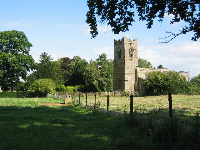
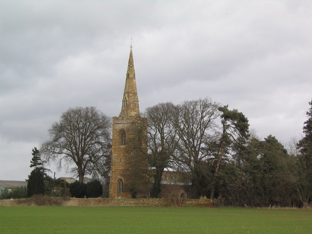
One of the main attractions in Ayston is the Church of St. Mary the Virgin, a Grade II listed building that dates back to the 13th century. The church features a stunning Norman doorway and a beautiful interior, making it a must-visit for history and architecture enthusiasts.
Ayston is also known for its tranquil atmosphere and peaceful surroundings, making it a popular destination for those seeking a break from the hustle and bustle of city life. The village offers plenty of opportunities for outdoor activities, such as walking, cycling, and horse riding, with numerous footpaths and bridleways crisscrossing the surrounding countryside.
Overall, Ayston is a charming village that offers a glimpse into the rural beauty of the Rutland countryside. With its historic buildings, scenic landscapes, and friendly community, it is a delightful place to visit or call home.
If you have any feedback on the listing, please let us know in the comments section below.
Ayston Images
Images are sourced within 2km of 52.599128/-0.729914 or Grid Reference SK8600. Thanks to Geograph Open Source API. All images are credited.


Ayston is located at Grid Ref: SK8600 (Lat: 52.599128, Lng: -0.729914)
Unitary Authority: Rutland
Police Authority: Leicestershire
What 3 Words
///messy.yourself.windpipe. Near Uppingham, Rutland
Nearby Locations
Related Wikis
Ayston
Ayston is a village and civil parish in the county of Rutland in the East Midlands of England. It is about one mile (1.6 km) north-west of Uppingham, close...
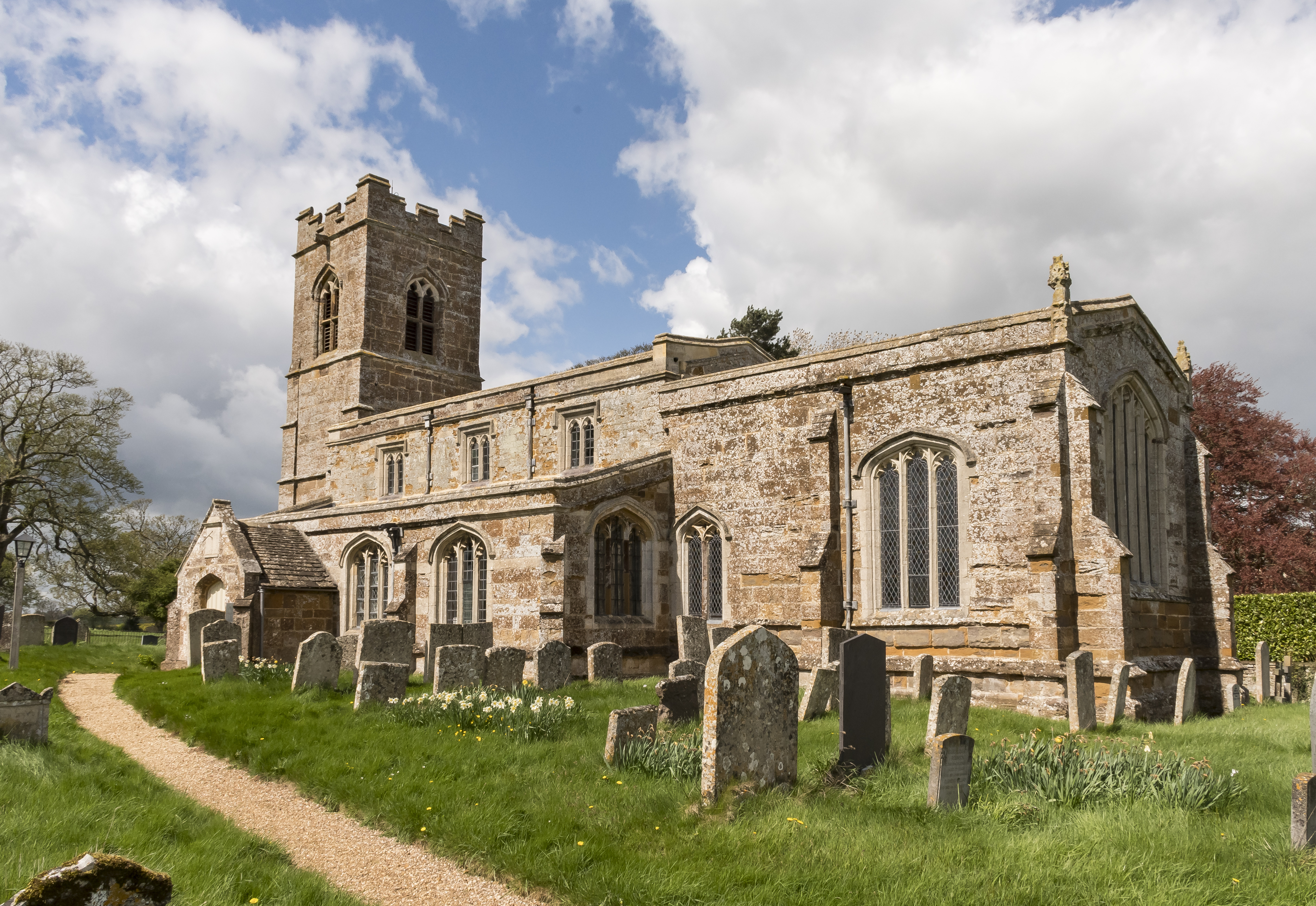
St Mary the Virgin's Church, Ayston
St Mary the Virgin's Church is a redundant Anglican church in the village of Ayston, Rutland, England. It is recorded in the National Heritage List for...
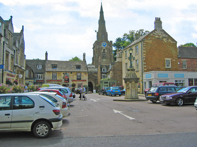
Uppingham
Uppingham is a market town in Rutland, England, off the A47 between Leicester and Peterborough, 6 miles (10 km) south of the county town, Oakham. It had...

Uppingham Rural District
Uppingham was a rural district in Rutland, England from 1894 to 1974, covering the south of the county. The rural district was formed by the Local Government...

Catmose College
Catmose College is a secondary academy school on Huntsmans Drive in Oakham, Rutland. The catchment area covers the county town of Oakham and surrounding...

Uppingham School
Uppingham School is a public school (English fee-charging boarding and day school for pupils 13-18) in Uppingham, Rutland, England, founded in 1584 by...
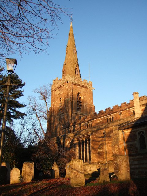
Church of St Peter and St Paul, Uppingham
The Church of St Peter and St Paul, Uppingham is the Church of England parish church of Uppingham, Rutland. It is part of the Diocese of Peterborough....
Church of St Peter and St Paul, Preston
The Church of St Peter and St Paul is a church in Preston, Rutland. It is a Grade II* listed building. == History == The church has a vestry, tower, north...
Nearby Amenities
Located within 500m of 52.599128,-0.729914Have you been to Ayston?
Leave your review of Ayston below (or comments, questions and feedback).