Lochan Druim an Dùin

Lake, Pool, Pond, Freshwater Marsh in Sutherland

Scotland

Lochan Druim an Dùin

Bettyhill Hotel
Bettyhill Hotel Credit: Peter Moore

Lochan Druim an Dùin is a small freshwater loch located in Sutherland, in the northern part of Scotland. Situated amidst the stunning Scottish Highlands, this loch is a popular destination for nature enthusiasts and outdoor adventurers.

The loch is nestled within a picturesque landscape characterized by rolling green hills and rugged mountains, providing a breathtaking backdrop for visitors. Lochan Druim an Dùin is relatively small in size, measuring approximately 1.5 kilometers in length and 0.5 kilometers in width. Its tranquil waters are fed by several small streams that flow through the surrounding hills.

The loch is surrounded by an abundance of vegetation, including reeds, grasses, and shrubs, which create a vibrant ecosystem. This lush environment supports a diverse array of wildlife, making it a haven for birdwatchers and nature photographers. Common sightings include various species of waterfowl, such as ducks and geese, as well as wading birds like herons and sandpipers.

Visitors to Lochan Druim an Dùin can enjoy a range of activities. Fishing enthusiasts can partake in angling opportunities, as the loch is stocked with trout. The calm waters also make it ideal for kayaking and canoeing. Hiking trails in the surrounding area offer breathtaking views and the chance to encounter other wildlife, such as deer and hares.

Overall, Lochan Druim an Dùin is a serene and picturesque freshwater loch that provides a tranquil escape amidst the natural beauty of the Scottish Highlands.

If you have any feedback on the listing, please let us know in the comments section below.

Lochan Druim an Dùin Images

Images are sourced within 2km of 58.518055/-4.2446513 or Grid Reference NC6961. Thanks to Geograph Open Source API. All images are credited.

Bettyhill Hotel
Bettyhill Hotel
West end of Bettyhill Bridge
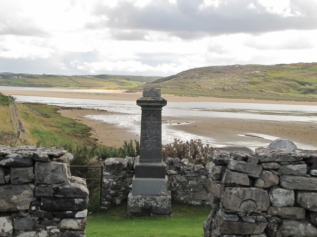
War Memorial, Bettyhill This memorial has been moved from a hillside location outside of the village to this more accessible  position in the village.
War Memorial, Bettyhill
This memorial has been moved from a hillside location outside of the village to this more accessible position in the village.
Bettyhill Hotel Dating from 1819; it has been much extended since .
Bettyhill Hotel
Dating from 1819; it has been much extended since .
Coastal view, Bettyhill Looking across the estuary of the River Naver to Torrisdale Bay. For other takes on this view see <a title="https://www.geograph.org.uk/photo/596772" href="https://www.geograph.org.uk/photo/596772">Link</a> <a title="https://www.geograph.org.uk/photo/1146320" href="https://www.geograph.org.uk/photo/1146320">Link</a> <a title="https://www.geograph.org.uk/photo/1486917" href="https://www.geograph.org.uk/photo/1486917">Link</a> .
Coastal view, Bettyhill
Looking across the estuary of the River Naver to Torrisdale Bay. For other takes on this view see Link Link Link .
Torrisdale Bay - 1978 River Naver estuary and Torrisdale Bay seen from A836 near Bettyhill.
Torrisdale Bay - 1978
River Naver estuary and Torrisdale Bay seen from A836 near Bettyhill.
River Naver - 1978 River Naver seen from the A836 near Invernaver.
River Naver - 1978
River Naver seen from the A836 near Invernaver.
Croft land above Bettyhill The high ground gives an expansive view over Farr Bay
Croft land above Bettyhill
The high ground gives an expansive view over Farr Bay
The footpath to Invernaver After crossing the ridge the path peters out on the flat, sand-smothered plain beside the Naver estuary.
The footpath to Invernaver
After crossing the ridge the path peters out on the flat, sand-smothered plain beside the Naver estuary.
Bettyhill war memorial
Bridge carrying the A836 over the River Naver
Bridge across River Naver South of Bettyhill, where A 836 crosses over River Naver
Bridge across River Naver
South of Bettyhill, where A 836 crosses over River Naver
Fields by the Naver estuary
Torrisdale Bay Seen from near the top of the hill on the A836, close to the Bettyhill Hotel. Àird Torrisdale is across the bay.
Torrisdale Bay
Seen from near the top of the hill on the A836, close to the Bettyhill Hotel. Àird Torrisdale is across the bay.
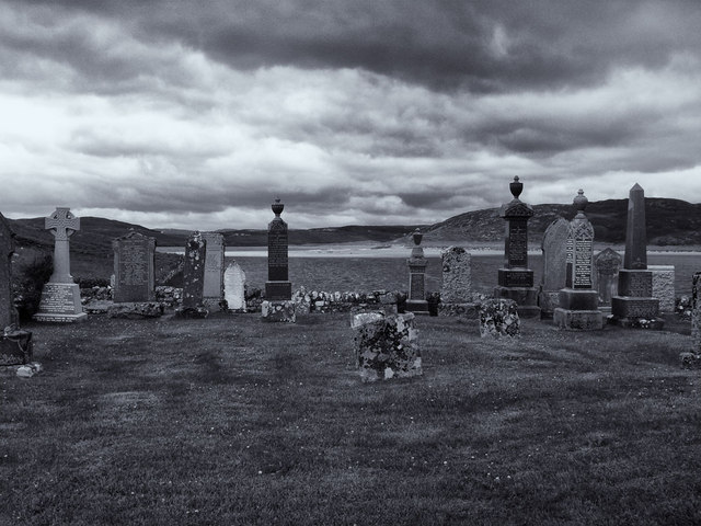
Graveyard at Skerray
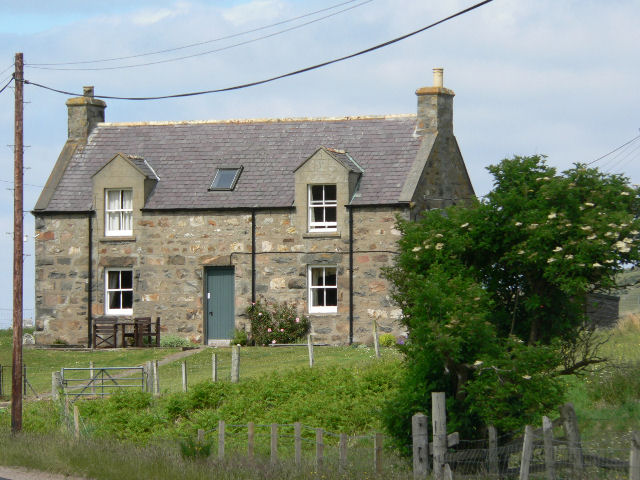
Cottage under reconstruction
River Borgie Estuary Viewed from the cemetery, the River Borgie flows out into the Torrisdale Bay.
River Borgie Estuary
Viewed from the cemetery, the River Borgie flows out into the Torrisdale Bay.
A novel use for a redundant bus shelter, Torrisdale Some local residents are using the old Highland Council shelter as a greenhouse. Should be a good crop of tomatoes with the recent hot weather!
A novel use for a redundant bus shelter, Torrisdale
Some local residents are using the old Highland Council shelter as a greenhouse. Should be a good crop of tomatoes with the recent hot weather!
Show me another place!

Lochan Druim an Dùin is located at Grid Ref: NC6961 (Lat: 58.518055, Lng: -4.2446513)

Unitary Authority: Highland

Police Authority: Highlands and Islands

What 3 Words

///blackmail.sits.cracks. Near Forsinard, Highland

Nearby Locations

Lochan Druim an Dùin

Related Wikis

Baile Mhargaite (Sandy Dun)

Baile Mhargaite (also known as Lochan Druim An Duin, the Sandy Dun, or Invernaver Broch) is an Iron Age broch in Strathnaver, Sutherland. It is a scheduled...

Invernaver

Invernaver (Gaelic: Inbhir Nabhair) is a small, remote hamlet, situated on the west bank of the River Naver as it flows into Torrisdale Bay, in Sutherland...

Torrisdale, Sutherland

Torrisdale is a remote hamlet on the western shore of Torrisdale Bay in Sutherland, Highland, on the north coast of Scotland. It is 3 kilometres (2 mi...

Bettyhill

Bettyhill (Scottish Gaelic: Am Blàran Odhar) is a village in the parish of Farr, on the north coast of Scotland.Bettyhill lies on the A836 road 32 miles...

Achina, Highland

Achina is a village in Highland, Scotland. == References ==

Leckfurin

Leckfurin is a small remote village, which lies on the left bank of the River Naver, in northern Sutherland in Scottish Highlands and is in the Scottish...

Strathnaver Museum

Strathnaver Museum is located in Bettyhill, Sutherland, Scotland. It is a fully accredited volunteer-run independent museum which first opened in 1976...

Achtoty

Achtoty (Scottish Gaelic: Achadh Toitidh) is a remote hamlet in the Scottish Highland Council area. Achtoty is about 26 miles (42 km) west of Thurso....

Nearby Amenities

Located within 500m of 58.518055,-4.2446513
Power: pole
Lat/Long: 58.5172752/-4.2458232
Power: pole
Lat/Long: 58.5167316/-4.2374504
Power: pole
Lat/Long: 58.5169845/-4.2412902
Power: pole
Lat/Long: 58.5171392/-4.2438796
Power: pole
Lat/Long: 58.5170892/-4.252722
Power: pole
Lat/Long: 58.5170608/-4.2508659
Power: pole
Lat/Long: 58.5171544/-4.2487775
Power: pole
Lat/Long: 58.51712/-4.2496181
Baile Mhargaite
Alt Name En: Sandy Dun;Invernaver Broch
Alt Name Gd: Lochan Druim an Dùin
Archaeological Site: fortification
Historic: archaeological_site
Historic Civilization: celtic
Wikidata: Q17985712
Wikipedia: en:Baile Mhargaite (Sandy Dun)
Lat/Long: 58.5173276/-4.2378454
The data included in this document is from www.openstreetmap.org. The data is made available under ODbL.

Have you been to Lochan Druim an Dùin?

Leave your review of Lochan Druim an Dùin below (or comments, questions and feedback).