Llyn Iwerddon

Lake, Pool, Pond, Freshwater Marsh in Merionethshire

Wales

Llyn Iwerddon

A470 towards Blaenau Ffestiniog
A470 towards Blaenau Ffestiniog Credit: Steven Brown

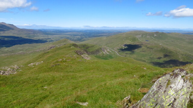
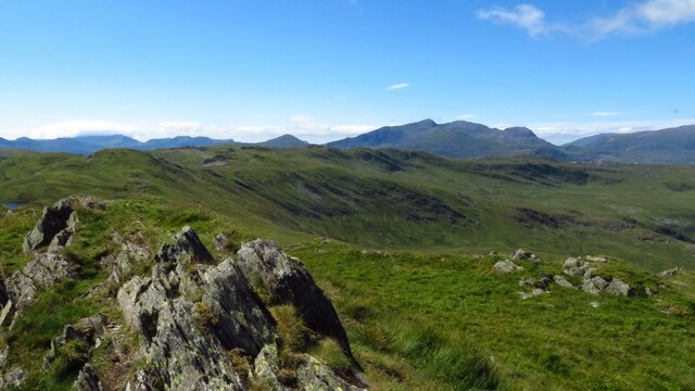
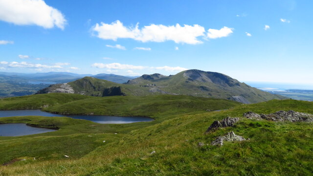
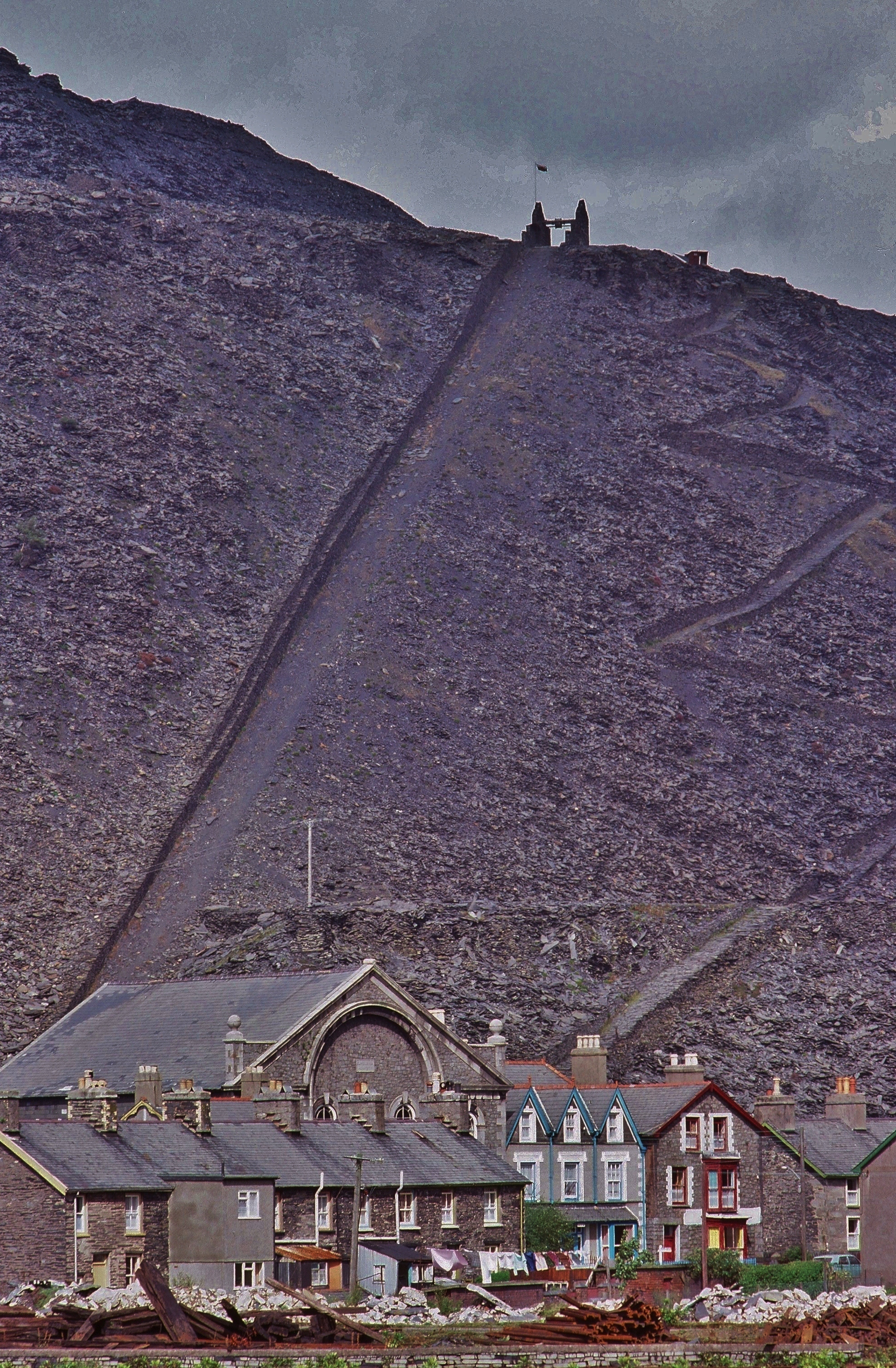
Llyn Iwerddon, located in the county of Merionethshire, Wales, is a captivating freshwater lake nestled amidst the stunning scenery of Snowdonia National Park. This natural wonder covers an area of approximately 30 acres and sits at an elevation of around 500 feet above sea level.

The lake is surrounded by rolling hills, lush greenery, and an abundance of wildlife, making it a popular destination for nature enthusiasts and photographers alike. Its tranquil waters reflect the beauty of the surrounding landscape, creating a picturesque setting that attracts visitors throughout the year.

Llyn Iwerddon is home to various species of fish, including brown trout and perch, making it a favorable spot for anglers seeking a peaceful fishing experience. The lake also supports a diverse range of birdlife, such as swans, ducks, and herons, providing a haven for birdwatchers to observe and appreciate.

Adjacent to the lake is a freshwater marsh, offering a unique ecosystem characterized by waterlogged soils and vegetation adapted to wet conditions. This marshland provides a habitat for numerous plant species, including reeds, rushes, and water lilies, which thrive in the damp environment.

Visitors to Llyn Iwerddon can enjoy a leisurely stroll along its shores, taking in the tranquility and natural beauty that surrounds them. The lake is easily accessible, with nearby parking facilities and footpaths leading to various viewpoints. It is also a popular spot for picnics and relaxation, providing an idyllic setting for visitors to unwind and embrace the serenity of the Welsh countryside.

In conclusion, Llyn Iwerddon in Merionethshire is a captivating freshwater lake, complemented by its freshwater marsh and breathtaking landscape. It offers a haven for nature enthusiasts, anglers, and those seeking a peaceful retreat amidst the stunning surroundings of Snowdonia National Park.

If you have any feedback on the listing, please let us know in the comments section below.

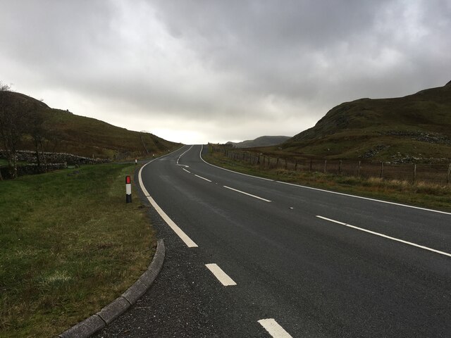
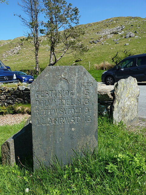
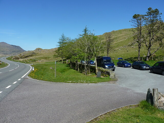
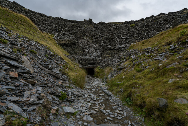
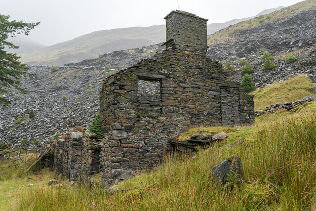
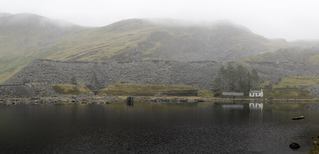
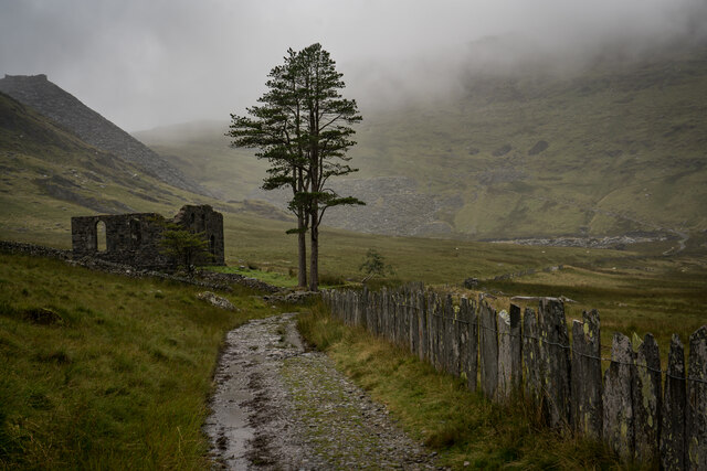
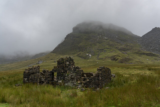
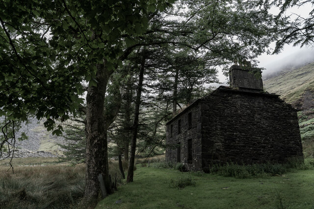
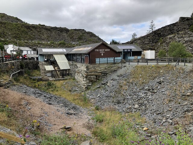
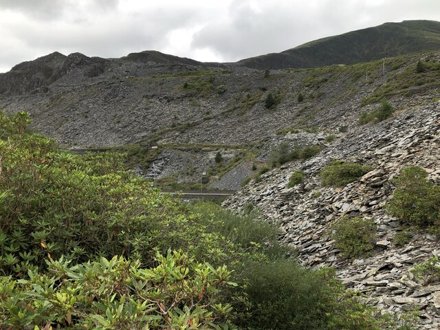
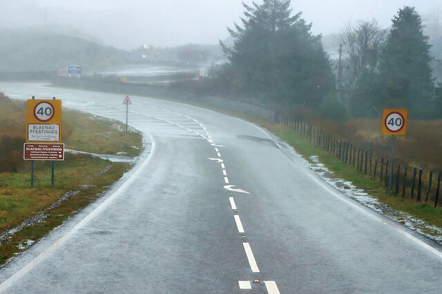
Llyn Iwerddon Images

Images are sourced within 2km of 53.011697/-3.9607698 or Grid Reference SH6847. Thanks to Geograph Open Source API. All images are credited.

A470 towards Blaenau Ffestiniog
Relocated milestone, Crimea Pass The same stone as <a href="https://www.geograph.org.uk/photo/6293052">SH7048 : Old Milestone by the A470, Dolwyddelan</a>, which was originally located a little way further down the hill towards Blaenau until being smartened up and relocated sometime in the last 20 years or so.
Relocated milestone, Crimea Pass
The same stone as SH7048 : Old Milestone by the A470, Dolwyddelan, which was originally located a little way further down the hill towards Blaenau until being smartened up and relocated sometime in the last 20 years or so.
Parking area at the top of Crimea Pass A short stretch of old road, sectioned off as parking for hillwalkers and passers-by
Parking area at the top of Crimea Pass
A short stretch of old road, sectioned off as parking for hillwalkers and passers-by
Cwmorthin Quarry Mine Adit There is a gate inside the entrance with a chilly breeze blowing through it.

Cwmorthin quarry was a slate quarry west of the village of Tanygrisiau, north Wales. Quarrying on the site started in 1810. In 1860 it was connected to the Ffestiniog Railway. In 1900 it was acquired by the nearby Oakeley quarry and the two were connected underground. In 1970 it closed along with Oakeley. There was small-scale working in the 1980s and 1990s, and the mine finally closed in 1997.

<span class="nowrap"><a title="https://en.wikipedia.org/wiki/Cwmorthin_quarry" rel="nofollow ugc noopener" href="https://en.wikipedia.org/wiki/Cwmorthin_quarry">Link</a><img style="margin-left:2px;" alt="External link" title="External link - shift click to open in new window" src="https://s1.geograph.org.uk/img/external.png" width="10" height="10"/></span>
Cwmorthin Quarry Mine Adit
There is a gate inside the entrance with a chilly breeze blowing through it. Cwmorthin quarry was a slate quarry west of the village of Tanygrisiau, north Wales. Quarrying on the site started in 1810. In 1860 it was connected to the Ffestiniog Railway. In 1900 it was acquired by the nearby Oakeley quarry and the two were connected underground. In 1970 it closed along with Oakeley. There was small-scale working in the 1980s and 1990s, and the mine finally closed in 1997. LinkExternal link
Ruined Buildings, Cwmorthin Quarry <span class="nowrap"><a title="https://en.wikipedia.org/wiki/Cwmorthin_quarry" rel="nofollow ugc noopener" href="https://en.wikipedia.org/wiki/Cwmorthin_quarry">Link</a><img style="margin-left:2px;" alt="External link" title="External link - shift click to open in new window" src="https://s1.geograph.org.uk/img/external.png" width="10" height="10"/></span>
Ruined Buildings, Cwmorthin Quarry
Llyn Cwmorthin & Old Quarry Buildings <span class="nowrap"><a title="https://en.wikipedia.org/wiki/Cwmorthin_quarry" rel="nofollow ugc noopener" href="https://en.wikipedia.org/wiki/Cwmorthin_quarry">Link</a><img style="margin-left:2px;" alt="External link" title="External link - shift click to open in new window" src="https://s1.geograph.org.uk/img/external.png" width="10" height="10"/></span>
Llyn Cwmorthin & Old Quarry Buildings
Capel y Gorlan & Tree's, Cwmorthin Quarry Was a former Methodist Chapel built around the 1860's. The pair of trees and the location make it an imposing focal point.

<span class="nowrap"><a title="http://www.cwmorthin.com/4._capel_y_gorlan.html" rel="nofollow ugc noopener" href="http://www.cwmorthin.com/4._capel_y_gorlan.html">Link</a><img style="margin-left:2px;" alt="External link" title="External link - shift click to open in new window" src="https://s1.geograph.org.uk/img/external.png" width="10" height="10"/></span>

<span class="nowrap"><a title="https://en.wikipedia.org/wiki/Cwmorthin_quarry" rel="nofollow ugc noopener" href="https://en.wikipedia.org/wiki/Cwmorthin_quarry">Link</a><img style="margin-left:2px;" alt="External link" title="External link - shift click to open in new window" src="https://s1.geograph.org.uk/img/external.png" width="10" height="10"/></span>
Capel y Gorlan & Tree's, Cwmorthin Quarry
Was a former Methodist Chapel built around the 1860's. The pair of trees and the location make it an imposing focal point. LinkExternal link LinkExternal link
Rhosydd Stables, Cwmorthin Quarry Built in the late 1850’s by Rhosydd Quarry to home the ponies used to carry its slates through the valley.

<span class="nowrap"><a title="http://www.cwmorthin.com/rhosydd_stables.html" rel="nofollow ugc noopener" href="http://www.cwmorthin.com/rhosydd_stables.html">Link</a><img style="margin-left:2px;" alt="External link" title="External link - shift click to open in new window" src="https://s1.geograph.org.uk/img/external.png" width="10" height="10"/></span>
Rhosydd Stables, Cwmorthin Quarry
Built in the late 1850’s by Rhosydd Quarry to home the ponies used to carry its slates through the valley. LinkExternal link
Plas Cwmorthin Quarry Plas Cwmorthin, the Rhosydd Quarry manager’s house, was built in 1860.

<span class="nowrap"><a title="http://www.cwmorthin.com/7._plas_cwmorthin.html" rel="nofollow ugc noopener" href="http://www.cwmorthin.com/7._plas_cwmorthin.html">Link</a><img style="margin-left:2px;" alt="External link" title="External link - shift click to open in new window" src="https://s1.geograph.org.uk/img/external.png" width="10" height="10"/></span>
Plas Cwmorthin Quarry
Plas Cwmorthin, the Rhosydd Quarry manager’s house, was built in 1860. LinkExternal link
Llechwedd Slate Caverns Former slate quarry and deep mines, now operating as a visitor attraction detailing the history of slate quarrying around Blaenau Ffestiniog. A deep mine tour is available via a steep funicular railway.
Llechwedd Slate Caverns
Former slate quarry and deep mines, now operating as a visitor attraction detailing the history of slate quarrying around Blaenau Ffestiniog. A deep mine tour is available via a steep funicular railway.
Slate Waste, Blaenau Ffestiniog Slate waste around the slopes of former Llechwedd and Gloddfa Ganol slate mines.
Slate Waste, Blaenau Ffestiniog
Slate waste around the slopes of former Llechwedd and Gloddfa Ganol slate mines.
A470, Blaenau Ffestiniog The A470, also known as the Cardiff to Glan Conwy Trunk Road, is the major long-distance road in Wales, from Cardiff on the south coast to Llandudno on the north coast. It is 185 miles long, and has undergone considerable road improvement in the last two decades. While previously one had to navigate the narrow roads of Llanidloes and Dolgellau, both these market towns are now bypassed due to extensive road modernisation.

The road travels through two of Wales's national parks, the Brecon Beacons in the South and Snowdonia National Park, starting just south of Dinas Mawddwy in the North. It is a primary trunk route throughout its length, and the southernmost 26 miles, from Cardiff Bay to Merthyr Tydfil, is mainly direct and good quality dual carriageway, but most of the route from north of Merthyr to Llandudno is single carriageway.
<span class="nowrap"><a title="http://www.sabre-roads.org.uk/wiki/index.php?title=A470" rel="nofollow ugc noopener" href="http://www.sabre-roads.org.uk/wiki/index.php?title=A470">Link</a><img style="margin-left:2px;" alt="External link" title="External link - shift click to open in new window" src="https://s1.geograph.org.uk/img/external.png" width="10" height="10"/></span>  SABRE
A470, Blaenau Ffestiniog
The A470, also known as the Cardiff to Glan Conwy Trunk Road, is the major long-distance road in Wales, from Cardiff on the south coast to Llandudno on the north coast. It is 185 miles long, and has undergone considerable road improvement in the last two decades. While previously one had to navigate the narrow roads of Llanidloes and Dolgellau, both these market towns are now bypassed due to extensive road modernisation. The road travels through two of Wales's national parks, the Brecon Beacons in the South and Snowdonia National Park, starting just south of Dinas Mawddwy in the North. It is a primary trunk route throughout its length, and the southernmost 26 miles, from Cardiff Bay to Merthyr Tydfil, is mainly direct and good quality dual carriageway, but most of the route from north of Merthyr to Llandudno is single carriageway. LinkExternal link SABRE
Bus Leaving Blaenau Ffestiniog on the A470 VDL Setra coach HRZ 1849, heading northwards on the A470 (Crimea Pass) from Blaenau Ffestiniog.
Bus Leaving Blaenau Ffestiniog on the A470
VDL Setra coach HRZ 1849, heading northwards on the A470 (Crimea Pass) from Blaenau Ffestiniog.
Llwyn-y-Gell Road, Blaenau Ffestiniog The A470, also known as the Cardiff to Glan Conwy Trunk Road, is the major long-distance road in Wales, from Cardiff on the south coast to Llandudno on the north coast. It is 185 miles long, and has undergone considerable road improvement in the last two decades. While previously one had to navigate the narrow roads of Llanidloes and Dolgellau, both these market towns are now bypassed due to extensive road modernisation.

The road travels through two of Wales's national parks, the Brecon Beacons in the South and Snowdonia National Park, starting just south of Dinas Mawddwy in the North. It is a primary trunk route throughout its length, and the southernmost 26 miles, from Cardiff Bay to Merthyr Tydfil, is mainly direct and good quality dual carriageway, but most of the route from north of Merthyr to Llandudno is single carriageway.
<span class="nowrap"><a title="http://www.sabre-roads.org.uk/wiki/index.php?title=A470" rel="nofollow ugc noopener" href="http://www.sabre-roads.org.uk/wiki/index.php?title=A470">Link</a><img style="margin-left:2px;" alt="External link" title="External link - shift click to open in new window" src="https://s1.geograph.org.uk/img/external.png" width="10" height="10"/></span>  SABRE
Llwyn-y-Gell Road, Blaenau Ffestiniog
The A470, also known as the Cardiff to Glan Conwy Trunk Road, is the major long-distance road in Wales, from Cardiff on the south coast to Llandudno on the north coast. It is 185 miles long, and has undergone considerable road improvement in the last two decades. While previously one had to navigate the narrow roads of Llanidloes and Dolgellau, both these market towns are now bypassed due to extensive road modernisation. The road travels through two of Wales's national parks, the Brecon Beacons in the South and Snowdonia National Park, starting just south of Dinas Mawddwy in the North. It is a primary trunk route throughout its length, and the southernmost 26 miles, from Cardiff Bay to Merthyr Tydfil, is mainly direct and good quality dual carriageway, but most of the route from north of Merthyr to Llandudno is single carriageway. LinkExternal link SABRE
On Allt-fawr, - view NE along ridge towards Crimea Pass
On Allt-fawr, - view towards Moel Druman
On Moel Druman, - view across Llyn Conglog to Moelwyn Mawr
Foxgloves by track, Llyn Cwmorthin
Show me another place!

Llyn Iwerddon is located at Grid Ref: SH6847 (Lat: 53.011697, Lng: -3.9607698)

Unitary Authority: Gwynedd

Police Authority: North Wales

What 3 Words

///amplified.butterfly.bound. Near Blaenau-Ffestiniog, Gwynedd

Nearby Locations

Llyn Iwerddon Allt-Fawr

Related Wikis

Allt-fawr

Allt-fawr is a mountain in Snowdonia, North Wales and forms part of the Moelwynion group. It is on the internal border of Snowdonia National Park, and...

Oakeley quarry

Oakeley quarry is a slate quarry in the town of Blaenau Ffestiniog, north Wales. It was the largest underground slate mine in the world, and had 26 floors...

Moel Druman

Moel Druman is a mountain in Snowdonia, North Wales and forms part of the Moelwynion. It is a subsidiary summit of Allt-fawr. == References == == External... ==

Blaenau Ffestiniog (Pantyrafon) railway station

Blaenau Ffestiniog (Pantyrafon) was the London and North Western Railway's (LNWR) first passenger station in Blaenau Ffestiniog, then in Merionethshire...

Nearby Amenities

Located within 500m of 53.011697,-3.9607698
Iwerddon
Notes: on historic OS maps from the 1830s this area is shown as Iwerddon but the true peak is 387 meters to the north
Lat/Long: 53.0116422/-3.9574442
Iwerddon
Ele: 583
Natural: peak
Lat/Long: 53.0151091/-3.957006
The data included in this document is from www.openstreetmap.org. The data is made available under ODbL.

Have you been to Llyn Iwerddon?

Leave your review of Llyn Iwerddon below (or comments, questions and feedback).