Loch Beag

Lake, Pool, Pond, Freshwater Marsh in Ross-shire

Scotland

Loch Beag

Under Struie
Under Struie Credit: Peter Moore

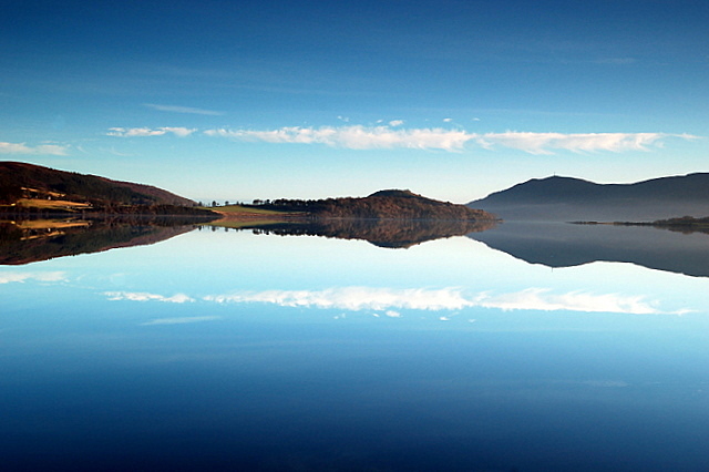
Loch Beag, located in Ross-shire, Scotland, is a picturesque freshwater loch that spans an area of approximately 2 hectares. Nestled amidst the stunning Scottish Highlands, this tranquil water body is often referred to as a lochan, which is a term used for small lakes or ponds in Scotland.

Surrounded by rolling hills and dense forests, Loch Beag is a haven for nature enthusiasts and offers a serene escape from the hustle and bustle of daily life. The loch is fed by small streams and springs, ensuring a constant supply of freshwater.

The water in Loch Beag is crystal clear and home to a diverse range of aquatic life, including various species of fish, such as trout and perch. The surrounding vegetation, including reeds and water lilies, creates a vibrant and lush ecosystem that supports a plethora of bird species, including ducks, swans, and herons.

The area surrounding the loch is rich in flora and fauna, with heather-covered moorlands and ancient Caledonian pine forests. Visitors can explore the nearby walking trails and enjoy breathtaking views of the loch and its surroundings.

For those seeking tranquility and a chance to connect with nature, Loch Beag is an ideal destination. Whether it's fishing, birdwatching, or simply immersing oneself in the peaceful ambiance, this small freshwater loch offers a captivating experience for all who visit.

If you have any feedback on the listing, please let us know in the comments section below.
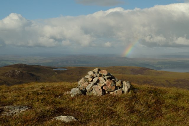
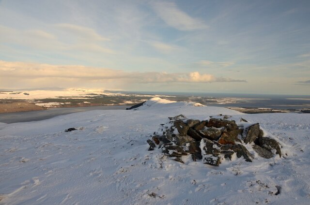
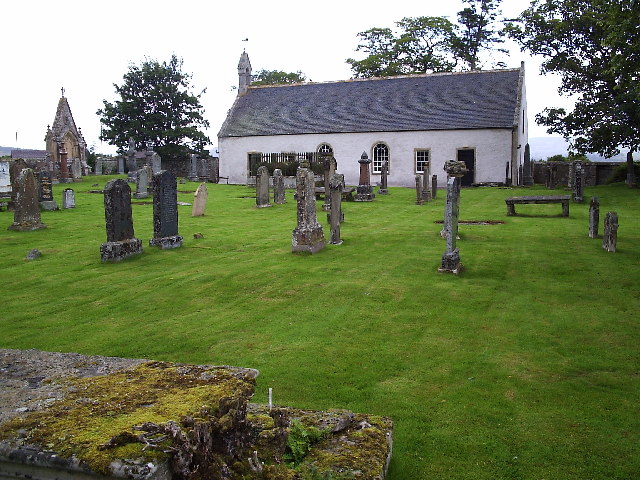
Loch Beag Images

Images are sourced within 2km of 57.824099/-4.2930255 or Grid Reference NH6383. Thanks to Geograph Open Source API. All images are credited.

Under Struie
Under Struie
Trees from west ridge of Struie Struie is a 'Marilyn' lying east of the highest point on the B9176. The view is to the north over heather moorland.
Trees from west ridge of Struie
Struie is a 'Marilyn' lying east of the highest point on the B9176. The view is to the north over heather moorland.
Loch Muigh-bhlaraidh Loch Muigh-bhlaraidh from over the hills
Loch Muigh-bhlaraidh
Loch Muigh-bhlaraidh from over the hills
Moorland, Corriefearn View towards Carn Salachaidh.
Moorland, Corriefearn
View towards Carn Salachaidh.
Allt Fearna / Easter Fearn Burn This is the Easter Fearn Burn just upstream of the hydropower intake. Taken on 10th June 2015.
Allt Fearna / Easter Fearn Burn
This is the Easter Fearn Burn just upstream of the hydropower intake. Taken on 10th June 2015.
Farm road to Corriefearn This road has a locked gate on the Struie road and follows the Easter Fearn Burn to give access to Corriefearn croft.
Farm road to Corriefearn
This road has a locked gate on the Struie road and follows the Easter Fearn Burn to give access to Corriefearn croft.
Moorland above Corriefearn The view extends over a river that feeds the Easter Fearn Burn.  The distant hill is Cnoc Mugh-bhlaraidh.
Moorland above Corriefearn
The view extends over a river that feeds the Easter Fearn Burn. The distant hill is Cnoc Mugh-bhlaraidh.
Distant view from above Corriefearn The croft of Corriefearn is visible beside the fields with Struie Wood beyond.
Distant view from above Corriefearn
The croft of Corriefearn is visible beside the fields with Struie Wood beyond.
Heather and grass above Corriefearn An easy slope for walking on towards the end of a wilderness walk.
Heather and grass above Corriefearn
An easy slope for walking on towards the end of a wilderness walk.
Corriefearn croft house The croft has been occupied for ten years - the crofter informed us.  It had been in poor repair, and he negotiated a rent-free deal to upgrade it.  He was and is a "happy chappie".

Geograph shows images of the croft house from 2003 and 2005 during which time no improvements seem to have been made.  This is the croft house in 2003 <a href="https://www.geograph.org.uk/photo/101280">NH6285 : Corriefearn Bothy</a>.
Corriefearn croft house
The croft has been occupied for ten years - the crofter informed us. It had been in poor repair, and he negotiated a rent-free deal to upgrade it. He was and is a "happy chappie". Geograph shows images of the croft house from 2003 and 2005 during which time no improvements seem to have been made. This is the croft house in 2003 NH6285 : Corriefearn Bothy.
Corriefearn Crofthouse The crofter had travelled the world, but this was the perfect place to stay.  The access from the Struie road was excellent.
Corriefearn Crofthouse
The crofter had travelled the world, but this was the perfect place to stay. The access from the Struie road was excellent.
Rainbow over the Struie, Ross-shire Viewed east from the east slopes of Cnoc Muigh-bhlaraidh.  The Dornoch Firth estuary, the east coast of Scotland, is just visible in the distance.
Rainbow over the Struie, Ross-shire
Viewed east from the east slopes of Cnoc Muigh-bhlaraidh. The Dornoch Firth estuary, the east coast of Scotland, is just visible in the distance.
Summit Cairn on Cnoc Muigh-Blaraidh, Ross-shire View to the north on the summit of Cnoc Muidh-blaraidh, a 546 m (1791 ft) high hill in the county of Ross-shire, Scotland.  There are no established paths to the summit, but the Beinn Tharsuinn windfarm access road passes within half a mile to the south. 

Cnoc Muigh-blaraidh has a topographic prominence of 119 m over a bealach (saddle point) which is 427 m high, half a mile to the south west.  The parent peak of Cnoc Muigh-blaraidh is Beinn Tharsuinn, 692 m.
Summit Cairn on Cnoc Muigh-Blaraidh, Ross-shire
View to the north on the summit of Cnoc Muidh-blaraidh, a 546 m (1791 ft) high hill in the county of Ross-shire, Scotland. There are no established paths to the summit, but the Beinn Tharsuinn windfarm access road passes within half a mile to the south. Cnoc Muigh-blaraidh has a topographic prominence of 119 m over a bealach (saddle point) which is 427 m high, half a mile to the south west. The parent peak of Cnoc Muigh-blaraidh is Beinn Tharsuinn, 692 m.
Down from the Struie Looking down from below the top of the Struie towards the road
Down from the Struie
Looking down from below the top of the Struie towards the road
Frozen Mountain Pool near Struie, Easter Ross A winter scene at Loch Beag, on Beinn Clach an Fheadain, Ross and Cromarty.
Frozen Mountain Pool near Struie, Easter Ross
A winter scene at Loch Beag, on Beinn Clach an Fheadain, Ross and Cromarty.
The Summit of Beinn Clach an Fheadain, Easter Ross The summit of the hill Beinn Clach an Fheadain (478 m, 1568 ft) in Easter Ross.  The sea in the background is the Moray Firth, north of Inverness.
The Summit of Beinn Clach an Fheadain, Easter Ross
The summit of the hill Beinn Clach an Fheadain (478 m, 1568 ft) in Easter Ross. The sea in the background is the Moray Firth, north of Inverness.
Boulder on the Moors above Struie, Easter Ross
Hydro Scheme Inlet Weir on the Allt Fearn Watercourse, Easter Ross The inlet structure for the Easter Fearn Burn micro-hydro electric scheme.  This is the upstream end of a 'run-of-the-river' type hydro scheme, so described because water is taken directly from the river via a weir without means of a dam or other impoundment.
Hydro Scheme Inlet Weir on the Allt Fearn Watercourse, Easter Ross
The inlet structure for the Easter Fearn Burn micro-hydro electric scheme. This is the upstream end of a 'run-of-the-river' type hydro scheme, so described because water is taken directly from the river via a weir without means of a dam or other impoundment.
Show me another place!

Loch Beag is located at Grid Ref: NH6383 (Lat: 57.824099, Lng: -4.2930255)

Unitary Authority: Highland

Police Authority: Highlands and Islands

What 3 Words

///mastering.acid.scavenger. Near Tain, Highland

Related Wikis

Easter Fearn

Easter Fearn is a small settlement in the Ross-shire area of the Highland council area in Scotland, on the A836 and B9176 roads it is 3 miles from Ardgay...

Creich

Creich (Scottish Gaelic: Craoich, pronounced [kʰɾɯːç]) is a substantial parish on the north side of the Dornoch Firth the largest settlement being Bonar...

Ardchronie

Ardchronie (Scottish Gaelic: Àird Chrònaidh) is a hamlet in the Highland Council area of Scotland. It lies on the south side of the Dornoch Firth, about...

Kincardine, Sutherland

Kincardine (Scottish Gaelic: Cinn Chàrdainn) is a small hamlet in Sutherland, situated on the west end of the south shore of the Dornoch Firth. The village...

Nearby Amenities

Located within 500m of 57.824099,-4.2930255
Beinn Clach an Fheadain
Corbett: no
Ele: 478
Munro: no
Natural: peak
Lat/Long: 57.8238677/-4.2966042
The data included in this document is from www.openstreetmap.org. The data is made available under ODbL.

Have you been to Loch Beag?

Leave your review of Loch Beag below (or comments, questions and feedback).