Lochan Ruadh

Lake, Pool, Pond, Freshwater Marsh in Sutherland

Scotland

Lochan Ruadh

Loch Modsarie
Loch Modsarie Credit: David Bremner

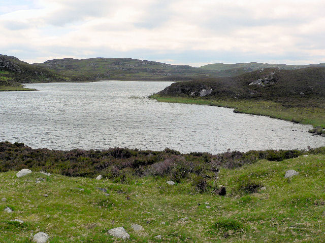
Lochan Ruadh is a small freshwater loch located in the remote and rugged countryside of Sutherland, Scotland. The loch is surrounded by rolling hills and moorland, giving it a secluded and peaceful atmosphere. The name Lochan Ruadh translates to "red loch" in Gaelic, likely referring to the red hues that can be seen in the water during certain times of the day.

The loch is relatively shallow and has a surface area of approximately 10 acres. It is fed by small streams and springs that flow down from the surrounding hills, keeping the water fresh and clear. The loch is home to a variety of freshwater fish species, such as brown trout and perch, making it a popular spot for anglers.

Lochan Ruadh is also a haven for birdwatchers, with a diverse range of bird species frequenting the area. Visitors may spot ducks, geese, swans, and other waterfowl either swimming in the loch or nesting along the shore.

Overall, Lochan Ruadh is a tranquil and picturesque spot, perfect for those seeking a peaceful escape in the unspoiled wilderness of the Scottish Highlands.

If you have any feedback on the listing, please let us know in the comments section below.
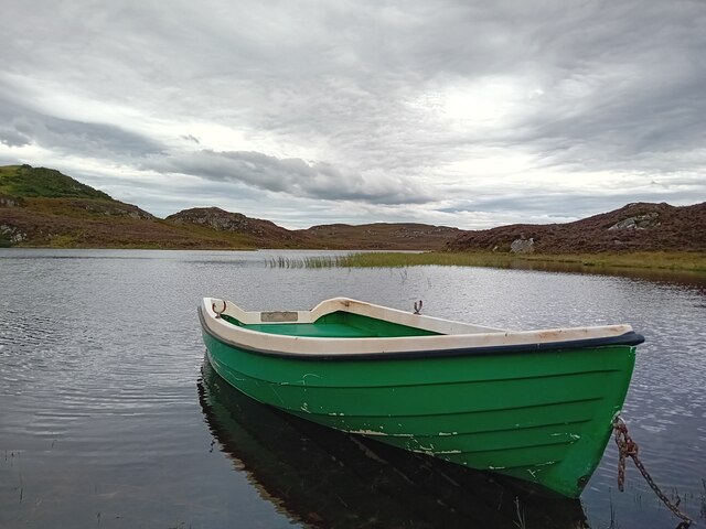
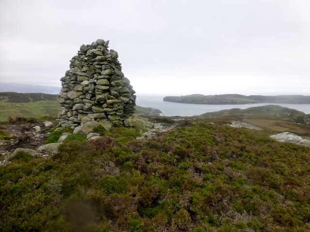
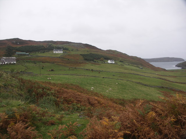
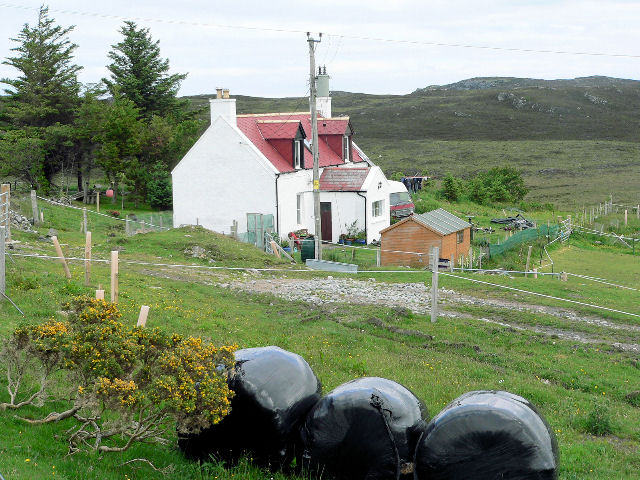
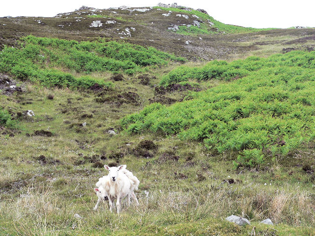
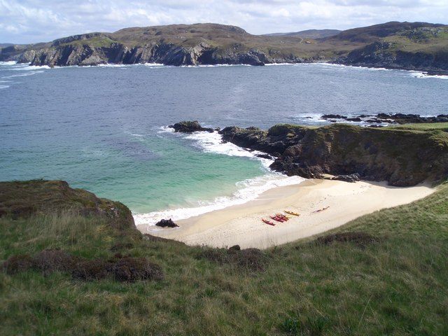
Lochan Ruadh Images

Images are sourced within 2km of 58.523936/-4.3438355 or Grid Reference NC6361. Thanks to Geograph Open Source API. All images are credited.

Loch Modsarie
Loch Modsarie
Wee bridge near Skerray
Skullomie from Talmine View East from Talmine Campsite using  telephoto
Skullomie from Talmine
View East from Talmine Campsite using telephoto
Carn Lamigo A quick bag after the 6 island TuMP boat trip with Jim Bloomer on a cool grey afternoon.
Name:Carn Lamigo
Hill number:9924
Height:113m / 371ft
Parent (Ma/M):1164  Meall nan Clach Ruadha
Area:16C: Tongue to Wick and Helmsdale
Class:1
Grid ref:NC648629 (est)
Drop:45m
Col:68m
Carn Lamigo
A quick bag after the 6 island TuMP boat trip with Jim Bloomer on a cool grey afternoon. Name:Carn Lamigo Hill number:9924 Height:113m / 371ft Parent (Ma/M):1164 Meall nan Clach Ruadha Area:16C: Tongue to Wick and Helmsdale Class:1 Grid ref:NC648629 (est) Drop:45m Col:68m
The Cottage and The Croft at Strathan Skerray The cottage is a new house, completed in 2001 on the site of an old crofter's cottage, which was last occupied in about 1950.

The Croft is a holiday cottage where I spent some most enjoyable summers as a child in late sixties.
The Cottage and The Croft at Strathan Skerray
The cottage is a new house, completed in 2001 on the site of an old crofter's cottage, which was last occupied in about 1950. The Croft is a holiday cottage where I spent some most enjoyable summers as a child in late sixties.
Old peat diggings
Old peat diggings
Sheep handling pens
Sheep handling pens
Loch Modsarie
Loch Modsarie
Farm house
Farm house
Rough grazing for sheep on Carn na h-Uamhaig
Approaching Loch Modsarie from the north
Minor road to Modsary
Scullomie Harbour Scullomie Pier, approximately three miles east of Tongue, is one of the points where crofters were put on boats during the Clearances. A lonely pile of rocks forming a desolate harbour is all that remains.
Scullomie Harbour
Scullomie Pier, approximately three miles east of Tongue, is one of the points where crofters were put on boats during the Clearances. A lonely pile of rocks forming a desolate harbour is all that remains.
Ruin by Skullomie
Ruin by Skullomie
Moorland below Carn an Fheidh  On the ground there is distinct path not on the map, I wondered whether it went to the ruined village further along the coast.
Moorland below Carn an Fheidh
On the ground there is distinct path not on the map, I wondered whether it went to the ruined village further along the coast.
Sleiteil Rocks Looking out towards Rabbit Islands.
Sleiteil Rocks
Looking out towards Rabbit Islands.
Sletell  Just in front of the house is the stone slab for crossing the burn.
Sletell
Just in front of the house is the stone slab for crossing the burn.
Show me another place!

Lochan Ruadh is located at Grid Ref: NC6361 (Lat: 58.523936, Lng: -4.3438355)

Unitary Authority: Highland

Police Authority: Highlands and Islands

What 3 Words

///punctuate.adults.reassured. Near Altnaharra, Highland

Related Wikis

Skullomie

Scullomie is a small fishing and crofting township at the head of Tongue Bay in Sutherland in the Scottish Highlands. It is located around 3 miles (4...

Skerray

Skerray (Scottish Gaelic: Sgeirea) is a remote small crofting hamlet and fishing port on the north coast of Sutherland, Scotland. It is located 7+3⁄4 miles...

Coldbackie

Coldbackie (Scottish Gaelic: Callbacaidh) is a crofting township in Sutherland and is in the Scottish council area of Highland Scotland. == Geography... ==

Skerray Bay

Skerray Bay is an arm of the Atlantic Ocean, located on the north coast of Sutherland, Highland, Scotland. Small and rocky, it is situated to the north...

Have you been to Lochan Ruadh?

Leave your review of Lochan Ruadh below (or comments, questions and feedback).