Llyn Cwm-bach

Lake, Pool, Pond, Freshwater Marsh in Caernarfonshire

Wales

Llyn Cwm-bach

Llyn Du
Llyn Du Credit: Chris Andrews

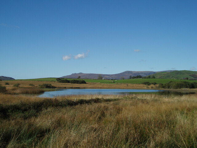
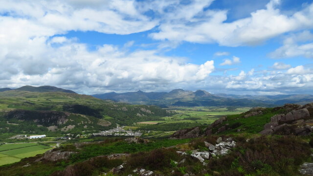
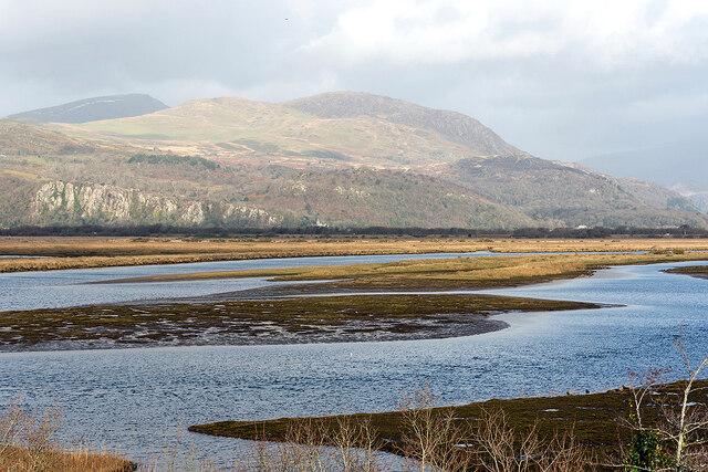
Llyn Cwm-bach is a small freshwater lake located in the county of Caernarfonshire, Wales. Situated within the stunning Snowdonia National Park, this picturesque body of water is nestled amidst the rugged mountains and lush greenery of the region. It lies approximately 4 miles south of the town of Beddgelert.

Covering an area of around 8 acres, Llyn Cwm-bach is a relatively small lake. However, its size does not diminish its beauty, as it is surrounded by breathtaking scenery and offers a tranquil retreat for visitors. The lake is situated at an elevation of around 650 feet above sea level, providing stunning panoramic views of the surrounding landscape.

The water in Llyn Cwm-bach is crystal clear and supports a diverse range of aquatic life, including various species of fish and invertebrates. It is also a haven for birdwatchers, with a variety of waterfowl and wading birds frequenting the lake's shores.

The surrounding area of Llyn Cwm-bach is covered in dense vegetation, including heather, mosses, and grasses. This creates a vibrant and colorful landscape, particularly during the summer months when wildflowers bloom in abundance.

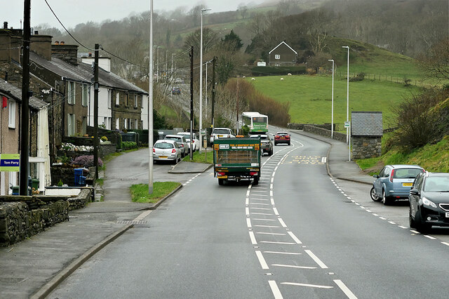
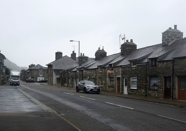
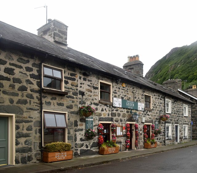
Access to Llyn Cwm-bach is relatively easy, with a footpath leading from nearby Beddgelert. The lake is a popular destination for hikers and nature enthusiasts, who come to enjoy its natural beauty and peaceful atmosphere. The surrounding area also offers a range of outdoor activities, including walking, cycling, and fishing.

Overall, Llyn Cwm-bach is a hidden gem within the stunning landscape of Snowdonia National Park, offering visitors a unique opportunity to immerse themselves in nature and enjoy the tranquility of this beautiful freshwater lake.

If you have any feedback on the listing, please let us know in the comments section below.

Llyn Cwm-bach Images

Images are sourced within 2km of 52.946698/-4.1397485 or Grid Reference SH5640. Thanks to Geograph Open Source API. All images are credited.

Tremadog Market Square, Tremadog.
Tremadog
Market Square, Tremadog.
A487, Tremadog Roundabout The A487 is one of the most important roads in Wales. It covers the majority of the west coast from St Davids to Menai Bridge, and is a primary route for most of its length, including a section where it multiplexes with the A470, another important north-south road. Along the way, it runs through two national parks: Snowdonia and Pembrokeshire Coast. Despite its length and importance, it is predominantly single carriageway, although the road has been upgraded in numerous places. It is 174 miles long.
<span class="nowrap"><a title="http://www.sabre-roads.org.uk/wiki/index.php?title=A487" rel="nofollow ugc noopener" href="http://www.sabre-roads.org.uk/wiki/index.php?title=A487">Link</a><img style="margin-left:2px;" alt="External link" title="External link - shift click to open in new window" src="https://s1.geograph.org.uk/img/external.png" width="10" height="10"/></span>
A487, Tremadog Roundabout
The A487 is one of the most important roads in Wales. It covers the majority of the west coast from St Davids to Menai Bridge, and is a primary route for most of its length, including a section where it multiplexes with the A470, another important north-south road. Along the way, it runs through two national parks: Snowdonia and Pembrokeshire Coast. Despite its length and importance, it is predominantly single carriageway, although the road has been upgraded in numerous places. It is 174 miles long. LinkExternal link
A487, Pwllgoleulas The A487 is one of the most important roads in Wales. It covers the majority of the west coast from St Davids to Menai Bridge, and is a primary route for most of its length, including a section where it multiplexes with the A470, another important north-south road. Along the way, it runs through two national parks: Snowdonia and Pembrokeshire Coast. Despite its length and importance, it is predominantly single carriageway, although the road has been upgraded in numerous places. It is 174 miles long.
<span class="nowrap"><a title="http://www.sabre-roads.org.uk/wiki/index.php?title=A487" rel="nofollow ugc noopener" href="http://www.sabre-roads.org.uk/wiki/index.php?title=A487">Link</a><img style="margin-left:2px;" alt="External link" title="External link - shift click to open in new window" src="https://s1.geograph.org.uk/img/external.png" width="10" height="10"/></span>
A487, Pwllgoleulas
The A487 is one of the most important roads in Wales. It covers the majority of the west coast from St Davids to Menai Bridge, and is a primary route for most of its length, including a section where it multiplexes with the A470, another important north-south road. Along the way, it runs through two national parks: Snowdonia and Pembrokeshire Coast. Despite its length and importance, it is predominantly single carriageway, although the road has been upgraded in numerous places. It is 174 miles long. LinkExternal link
Pwllgoleulas The A487 is one of the most important roads in Wales. It covers the majority of the west coast from St Davids to Menai Bridge, and is a primary route for most of its length, including a section where it multiplexes with the A470, another important north-south road. Along the way, it runs through two national parks: Snowdonia and Pembrokeshire Coast. Despite its length and importance, it is predominantly single carriageway, although the road has been upgraded in numerous places. It is 174 miles long.
<span class="nowrap"><a title="http://www.sabre-roads.org.uk/wiki/index.php?title=A487" rel="nofollow ugc noopener" href="http://www.sabre-roads.org.uk/wiki/index.php?title=A487">Link</a><img style="margin-left:2px;" alt="External link" title="External link - shift click to open in new window" src="https://s1.geograph.org.uk/img/external.png" width="10" height="10"/></span>
Pwllgoleulas
The A487 is one of the most important roads in Wales. It covers the majority of the west coast from St Davids to Menai Bridge, and is a primary route for most of its length, including a section where it multiplexes with the A470, another important north-south road. Along the way, it runs through two national parks: Snowdonia and Pembrokeshire Coast. Despite its length and importance, it is predominantly single carriageway, although the road has been upgraded in numerous places. It is 174 miles long. LinkExternal link
A487, Penmorfa The A487 is one of the most important roads in Wales. It covers the majority of the west coast from St Davids to Menai Bridge, and is a primary route for most of its length, including a section where it multiplexes with the A470, another important north-south road. Along the way, it runs through two national parks: Snowdonia and Pembrokeshire Coast. Despite its length and importance, it is predominantly single carriageway, although the road has been upgraded in numerous places. It is 174 miles long.
<span class="nowrap"><a title="http://www.sabre-roads.org.uk/wiki/index.php?title=A487" rel="nofollow ugc noopener" href="http://www.sabre-roads.org.uk/wiki/index.php?title=A487">Link</a><img style="margin-left:2px;" alt="External link" title="External link - shift click to open in new window" src="https://s1.geograph.org.uk/img/external.png" width="10" height="10"/></span>
A487, Penmorfa
The A487 is one of the most important roads in Wales. It covers the majority of the west coast from St Davids to Menai Bridge, and is a primary route for most of its length, including a section where it multiplexes with the A470, another important north-south road. Along the way, it runs through two national parks: Snowdonia and Pembrokeshire Coast. Despite its length and importance, it is predominantly single carriageway, although the road has been upgraded in numerous places. It is 174 miles long. LinkExternal link
Study in grey (Dublin Street, Tremadog) An exceptionally grey day even for the vicinity and I have lightened the photo as much as I dare. Each house in the terrace has a separate Cadw grade-II listing, with No. 15 as an example (85316 <span class="nowrap"><a title="https://cadwpublic-api.azurewebsites.net/reports/listedbuilding/FullReport?lang=&id=85316" rel="nofollow ugc noopener" href="https://cadwpublic-api.azurewebsites.net/reports/listedbuilding/FullReport?lang=&id=85316">Link</a><img style="margin-left:2px;" alt="External link" title="External link - shift click to open in new window" src="https://s1.geograph.org.uk/img/external.png" width="10" height="10"/></span> ), which notes that the terrace is probably the earliest surviving structure in Tremadog. Note the 'raked half dormer' roofs and huge chimney breasts.  The name Dublin Street refers to the hope in the early 19th Century that this would be on the route to Dublin (via Porth Dinllaen) although Holyhead eventually took that prize.
Study in grey (Dublin Street, Tremadog)
An exceptionally grey day even for the vicinity and I have lightened the photo as much as I dare. Each house in the terrace has a separate Cadw grade-II listing, with No. 15 as an example (85316 LinkExternal link ), which notes that the terrace is probably the earliest surviving structure in Tremadog. Note the 'raked half dormer' roofs and huge chimney breasts. The name Dublin Street refers to the hope in the early 19th Century that this would be on the route to Dublin (via Porth Dinllaen) although Holyhead eventually took that prize.
The Golden Fleece Inn, Tremadog Compare the same building taken in bright sunshine... <a title="https://www.geograph.org.uk/photo/5627105" href="https://www.geograph.org.uk/photo/5627105">Link</a> .   The inn was built ca. 1810 and is grade-II listed by Cadw: 85353 <span class="nowrap"><a title="https://cadwpublic-api.azurewebsites.net/reports/listedbuilding/FullReport?lang=&id=85353" rel="nofollow ugc noopener" href="https://cadwpublic-api.azurewebsites.net/reports/listedbuilding/FullReport?lang=&id=85353">Link</a><img style="margin-left:2px;" alt="External link" title="External link - shift click to open in new window" src="https://s1.geograph.org.uk/img/external.png" width="10" height="10"/></span> .
The Golden Fleece Inn, Tremadog
Compare the same building taken in bright sunshine... Link . The inn was built ca. 1810 and is grade-II listed by Cadw: 85353 LinkExternal link .
On Moel-y-Gest - view to Tremadog, Cnicht & Moelwyn Mawr
Mynydd Gorllwyn Viewed across Traeth Mawr from the Cob.
Mynydd Gorllwyn
Viewed across Traeth Mawr from the Cob.
A487 at Pwllgoleulas village boundary
Lane descending to Penmorfa A minor road running between Golan and Penmorfa. The lane forms part of National Cycle Network route 8.
Lane descending to Penmorfa
A minor road running between Golan and Penmorfa. The lane forms part of National Cycle Network route 8.
Lane in Penmorfa A bridleway runs along here, following the course of the Gorseddau Tramway into Tremadog and forming part of National Cycle Network route 8.
Lane in Penmorfa
A bridleway runs along here, following the course of the Gorseddau Tramway into Tremadog and forming part of National Cycle Network route 8.
NCN8 in Penmorfa This bridleway runs into Tremadog, following the course of the Gorseddau Tramway, forming part of National Cycle Network route 8.
NCN8 in Penmorfa
This bridleway runs into Tremadog, following the course of the Gorseddau Tramway, forming part of National Cycle Network route 8.
Fields below the former tramway Looking down from the bridleway running into Tremadog, following the course of the Gorseddau Tramway and forming part of National Cycle Network route 8.
Fields below the former tramway
Looking down from the bridleway running into Tremadog, following the course of the Gorseddau Tramway and forming part of National Cycle Network route 8.
NCN 8 between Penmorfa and Tremadog This bridleway runs into Tremadog, following the course of the Gorseddau Tramway and forming part of National Cycle Network route 8. For details on the tramway see: <span class="nowrap"><a title="https://en.wikipedia.org/wiki/Gorseddau_Tramway" rel="nofollow ugc noopener" href="https://en.wikipedia.org/wiki/Gorseddau_Tramway">Link</a><img style="margin-left:2px;" alt="External link" title="External link - shift click to open in new window" src="https://s1.geograph.org.uk/img/external.png" width="10" height="10"/></span>
NCN 8 between Penmorfa and Tremadog
This bridleway runs into Tremadog, following the course of the Gorseddau Tramway and forming part of National Cycle Network route 8. For details on the tramway see: LinkExternal link
Building ruins beside NCN8 Looking down from a bridleway leading into Tremadog which followa the course of the Gorseddau Tramway and forming part of National Cycle Network route 8. For details on the tramway see: <span class="nowrap"><a title="https://en.wikipedia.org/wiki/Gorseddau_Tramway" rel="nofollow ugc noopener" href="https://en.wikipedia.org/wiki/Gorseddau_Tramway">Link</a><img style="margin-left:2px;" alt="External link" title="External link - shift click to open in new window" src="https://s1.geograph.org.uk/img/external.png" width="10" height="10"/></span>
Building ruins beside NCN8
Looking down from a bridleway leading into Tremadog which followa the course of the Gorseddau Tramway and forming part of National Cycle Network route 8. For details on the tramway see: LinkExternal link
Path towards Penmorfa This bridleway runs between Penmorfa and Tremadog, following the course of the Gorseddau Tramway The path forms part of National Cycle Network route 8. For details on the tramway see: <span class="nowrap"><a title="https://en.wikipedia.org/wiki/Gorseddau_Tramway" rel="nofollow ugc noopener" href="https://en.wikipedia.org/wiki/Gorseddau_Tramway">Link</a><img style="margin-left:2px;" alt="External link" title="External link - shift click to open in new window" src="https://s1.geograph.org.uk/img/external.png" width="10" height="10"/></span>
Path towards Penmorfa
This bridleway runs between Penmorfa and Tremadog, following the course of the Gorseddau Tramway The path forms part of National Cycle Network route 8. For details on the tramway see: LinkExternal link
Show me another place!

Llyn Cwm-bach is located at Grid Ref: SH5640 (Lat: 52.946698, Lng: -4.1397485)

Unitary Authority: Gwynedd

Police Authority: North Wales

What 3 Words

///restores.bookmark.spending. Near Porthmadog, Gwynedd

Related Wikis

Coed Tremadog National Nature Reserve

Coed Tremadog National Nature Reserve is located near Porthmadog, Gwynedd, Wales. Its most striking features are huge volcanic cliffs which drop down to...

Tremadog Town Hall

Tremadog Town Hall (Welsh: Neuadd y Dref Tremadog) is a municipal building on Stryd Fawr, in Tremadog, Gwynedd, Wales. The structure, which was most recently...

Ysbyty Alltwen

Ysbyty Alltwen (English: Alltwen Hospital) is a health facility in Tremadog, Gwynedd, Wales. It is managed by the Betsi Cadwaladr University Health Board...

Tremadog

Tremadog (formerly Tremadoc) is a village in the community of Porthmadog, in Gwynedd, north west Wales; about one mile (1.6 km) north of Porthmadog town...

Ysgol Eifionydd

Ysgol Eifionydd is a bilingual co-educational comprehensive school for 11-16 year-old pupils. It is situated in the town of Porthmadog, Gwynedd, Wales...

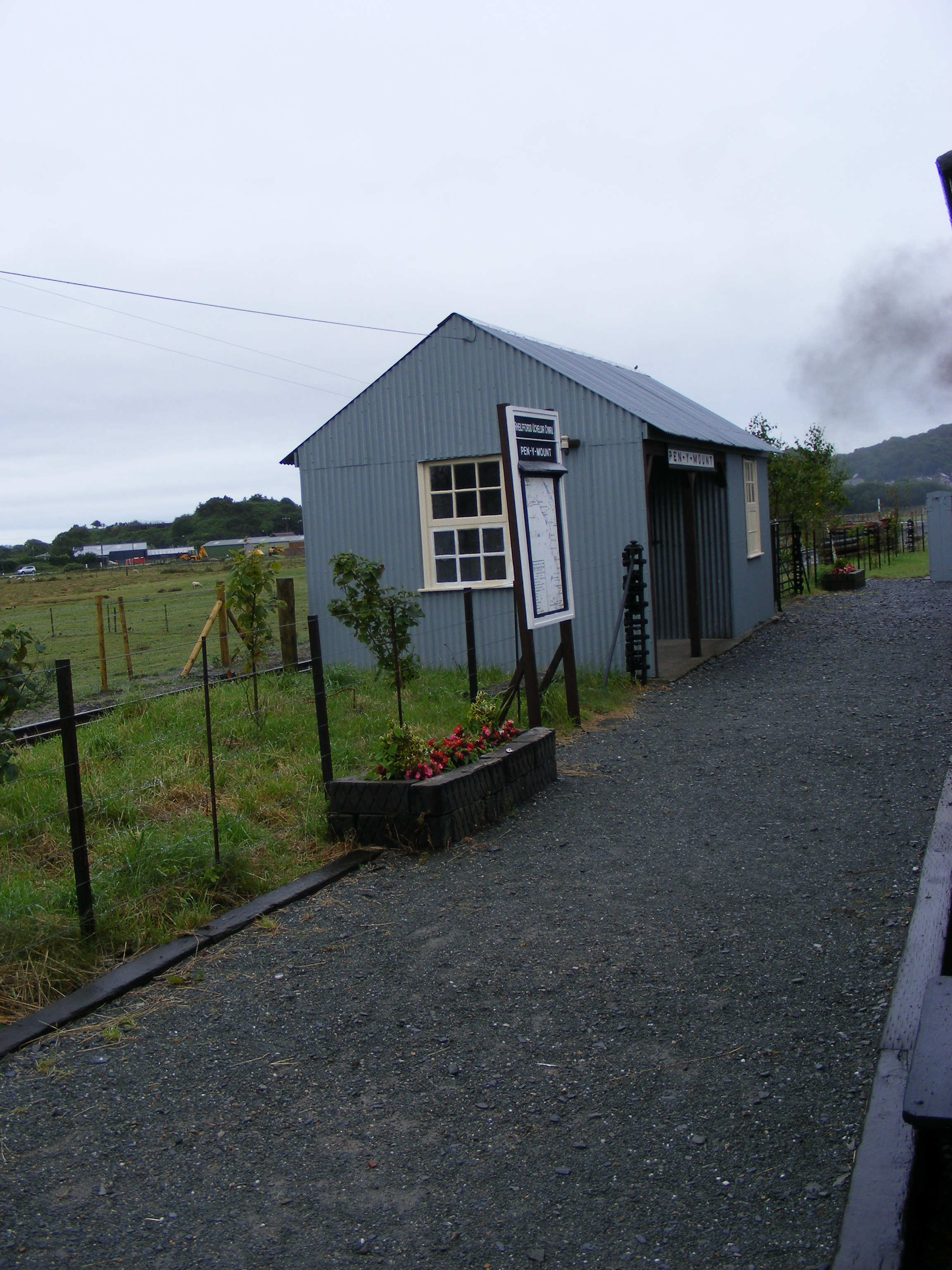
Pen-y-Mount Junction railway station

Pen-y-Mount Junction station is the northern terminus of the Welsh Highland Heritage Railway (WHHR) in Porthmadog, Wales. With the opening of all three...

Porthmadog railway station

Porthmadog railway station serves the town of Porthmadog on the Llŷn Peninsula in Gwynedd, Wales. The station is on the Cambrian Coast Railway with passenger...

Portmadoc, Beddgelert and South Snowdon Railway

The Porthmadog, Beddgelert and South Snowdon Railway (PB&SSR) was a 1 ft 11+1⁄2 in (597 mm) narrow gauge railway intended to connect Porthmadog with the...

Nearby Amenities

Located within 500m of 52.946698,-4.1397485
Pant-Ifan
Ele: 170
Natural: peak
Lat/Long: 52.9447573/-4.1330166
Y Glog
Ele: 198
Natural: peak
Lat/Long: 52.945286/-4.1406039
Building: yes
Lat/Long: 52.9458965/-4.1436447
Power: pole
Lat/Long: 52.9459797/-4.1438723
Power: pole
Lat/Long: 52.9460233/-4.1449478
Power: pole
Lat/Long: 52.9460831/-4.1457525
Power: pole
Lat/Long: 52.9461284/-4.1466081
Fach-goch
Ele: 204
Natural: peak
Lat/Long: 52.949734/-4.137308
Sychnant
Ele: 182
Natural: peak
Lat/Long: 52.949101/-4.141511
The data included in this document is from www.openstreetmap.org. The data is made available under ODbL.

Have you been to Llyn Cwm-bach?

Leave your review of Llyn Cwm-bach below (or comments, questions and feedback).