Loch Humphrey

Lake, Pool, Pond, Freshwater Marsh in Dunbartonshire

Scotland

Loch Humphrey

Road up Kilpatrick Braes
Road up Kilpatrick Braes Credit: Steven Brown

Loch Humphrey is a freshwater lake located in Dunbartonshire, Scotland. It is situated in a picturesque setting surrounded by rolling hills and lush greenery. The lake covers an area of approximately 10 acres, making it an ideal spot for various recreational activities.

The water in Loch Humphrey is crystal clear and teeming with a diverse range of aquatic life. Anglers are often drawn to the lake due to its abundance of fish, including trout and perch. Fishing enthusiasts can be seen casting their lines from the shores or from small boats that can be rented nearby.

The lake is also a popular destination for nature lovers and birdwatchers. The surrounding area is home to a variety of bird species, such as swans, ducks, and herons. Visitors can observe these beautiful creatures in their natural habitat and enjoy the peaceful ambiance created by the tranquil waters.

Additionally, Loch Humphrey offers opportunities for boating and kayaking. With its calm and serene atmosphere, it is the perfect place to spend a sunny afternoon on the water. The lake is easily accessible, with a car park located nearby for visitors' convenience.

Overall, Loch Humphrey is a hidden gem in Dunbartonshire, offering a serene and natural setting for outdoor enthusiasts. Whether it's fishing, birdwatching, or simply enjoying the peaceful surroundings, Loch Humphrey provides a delightful experience for all who visit.

If you have any feedback on the listing, please let us know in the comments section below.

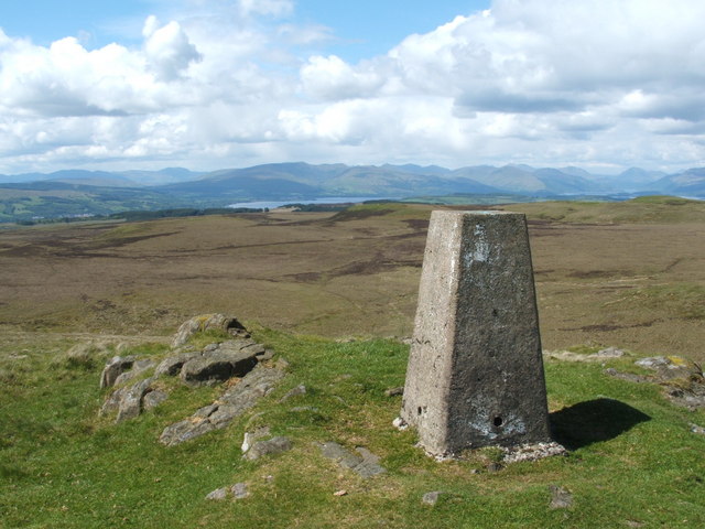
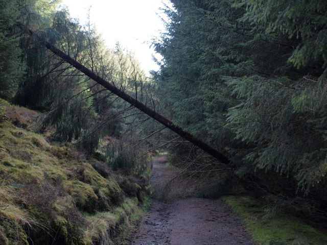
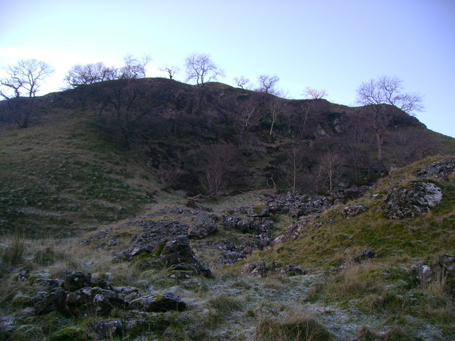
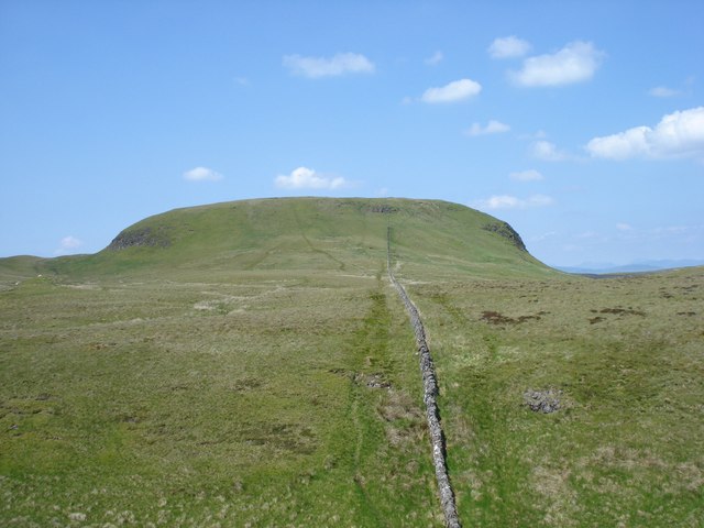
Loch Humphrey Images

Images are sourced within 2km of 55.952143/-4.4707989 or Grid Reference NS4575. Thanks to Geograph Open Source API. All images are credited.

Road up Kilpatrick Braes
View from Doughnot Hill The trig point sits a metre below the actual summit of 375 metres.
The hill's name amuses most people as it sounds a lot like 'doughnut'! The earliest record of it I have found is from a mid-1600s map on which it is recorded as 'Dounnet' Hill. All this is fanciful guesswork of course, but it is possible that it once had a small fort on it at some stage, 'dun' being an old word for fort in Scotland - there is, though, no mention of this anywhere.
It is the fifth highest hill in the Kilpatrick range, but having a prominence of just 20 metres or so, doesn't make it onto even the most obscure hill lists.
View from Doughnot Hill
The trig point sits a metre below the actual summit of 375 metres. The hill's name amuses most people as it sounds a lot like 'doughnut'! The earliest record of it I have found is from a mid-1600s map on which it is recorded as 'Dounnet' Hill. All this is fanciful guesswork of course, but it is possible that it once had a small fort on it at some stage, 'dun' being an old word for fort in Scotland - there is, though, no mention of this anywhere. It is the fifth highest hill in the Kilpatrick range, but having a prominence of just 20 metres or so, doesn't make it onto even the most obscure hill lists.
Track North of Kilpatrick Braes This is a very busy track - probably more so when I visited,  due to it having been a warm Saturday in June -  populated by dog-walkers in their trainers, hill-walkers in their boots, cyclists and quite a few sweaty runners (not to be confused with joggers, of which I saw none).
The OS mapping around here is a bit of a mess. On both scales of their paper maps a track is meant to be marked as a dotted line if unfenced and a solid line if fenced. Obviously this leads to some tracks having a solid line on one side and a dotted one on the other. At this point on the map the track is not only solid on both sides, but there is a line across the track too. Due to the size of the track it seems highly unlikely that anything other than a gate would ever have been here. I was thinking this might be the OS's famous 'one mistake on a map' policy to catch out illegal copycat mapmakers, but it's actually two mistakes, not one, as the right side of the track is clearly unfenced. Plus, the 1:50k scale map depicts the crags on the right whereas, bizarrely, the 1:25k map doesn't mark them at all.
Track North of Kilpatrick Braes
This is a very busy track - probably more so when I visited, due to it having been a warm Saturday in June - populated by dog-walkers in their trainers, hill-walkers in their boots, cyclists and quite a few sweaty runners (not to be confused with joggers, of which I saw none). The OS mapping around here is a bit of a mess. On both scales of their paper maps a track is meant to be marked as a dotted line if unfenced and a solid line if fenced. Obviously this leads to some tracks having a solid line on one side and a dotted one on the other. At this point on the map the track is not only solid on both sides, but there is a line across the track too. Due to the size of the track it seems highly unlikely that anything other than a gate would ever have been here. I was thinking this might be the OS's famous 'one mistake on a map' policy to catch out illegal copycat mapmakers, but it's actually two mistakes, not one, as the right side of the track is clearly unfenced. Plus, the 1:50k scale map depicts the crags on the right whereas, bizarrely, the 1:25k map doesn't mark them at all.
Spillway channel outlet, Greenside Reservoir, Dunbartonshire When the reservoir is at capacity, excess water flows down the spillway channel from the top right of the photo and through the outlet into the Loch Humphrey Burn.
Spillway channel outlet, Greenside Reservoir, Dunbartonshire
When the reservoir is at capacity, excess water flows down the spillway channel from the top right of the photo and through the outlet into the Loch Humphrey Burn.
The summit of the Doughnot Hill <a href="https://www.geograph.org.uk/photo/2836727">NS4477 : Doughnot Hill</a> is shown as "Douennet Hil" on the Pont/Blaeu map (which was based on surveys in the 1580s-90s). The "Dough-" of the modern spelling probably indicates the sound of "ch" in "loch" (the entirely accidental similarity to the much later word "doughnut" is misleading).

Likewise, in his booklet "Off the Main Road" (1976), I.M.M.MacPhail says that "beyond the Black Linn is the oddly-named Doughnot, a name pronounced formerly as 'Deochnay'. It is 1228 feet high and worth the short ascent for the fine view it offers". The "Black Linn" mentioned there is a waterfall: <a href="https://www.geograph.org.uk/photo/1734378">NS4477 : The Black Linn (detail)</a>. It gave its name to a reservoir built nearby: <a href="https://www.geograph.org.uk/photo/1654859">NS4477 : The Black Linn Reservoir</a>.

In the background of the present photograph, the areas of water are all part of Loch Lomond; the hills on the far side of the loch are more prominent in this view. The point from which this photograph was taken gives a fine view directly up the length of Glen Finlas (centred on <a href="https://www.geograph.org.uk/gridref/NS3388">NS3388</a>), just left of centre. Above the right-hand edge of the top of the trig point is the entrance of Glen Luss, viewed obliquely.

For other views of this summit area, see <a href="https://www.geograph.org.uk/photo/30697">NS4477 : Doughnot Hill</a>, <a href="https://www.geograph.org.uk/photo/284408">NS4477 : Doughnot Hill trig point S5142</a>, and <a href="https://www.geograph.org.uk/photo/830905">NS4477 : Trig point on Doughnot Hill</a>. For views of the hill from a distance, see, among others, <a href="https://www.geograph.org.uk/photo/830896">NS4477 : Doughnot Hill</a>, <a href="https://www.geograph.org.uk/photo/1937090">NS4377 : Weather station</a>, <a href="https://www.geograph.org.uk/photo/1595358">NS4477 : Doughnot Hill and Black Linn Reservoir</a>, and <a href="https://www.geograph.org.uk/photo/1796929">NS4377 : View along top of escarpment</a>.

Although its name is not now shown on maps, the little burn that arises on the eastern side of the hill, and which winds around the hill's northern side before meeting the Overtoun Burn, is called the Doughnot Burn (according to the OS Object Name Books).
The summit of the Doughnot Hill
NS4477 : Doughnot Hill is shown as "Douennet Hil" on the Pont/Blaeu map (which was based on surveys in the 1580s-90s). The "Dough-" of the modern spelling probably indicates the sound of "ch" in "loch" (the entirely accidental similarity to the much later word "doughnut" is misleading). Likewise, in his booklet "Off the Main Road" (1976), I.M.M.MacPhail says that "beyond the Black Linn is the oddly-named Doughnot, a name pronounced formerly as 'Deochnay'. It is 1228 feet high and worth the short ascent for the fine view it offers". The "Black Linn" mentioned there is a waterfall: NS4477 : The Black Linn (detail). It gave its name to a reservoir built nearby: NS4477 : The Black Linn Reservoir. In the background of the present photograph, the areas of water are all part of Loch Lomond; the hills on the far side of the loch are more prominent in this view. The point from which this photograph was taken gives a fine view directly up the length of Glen Finlas (centred on NS3388), just left of centre. Above the right-hand edge of the top of the trig point is the entrance of Glen Luss, viewed obliquely. For other views of this summit area, see NS4477 : Doughnot Hill, NS4477 : Doughnot Hill trig point S5142, and NS4477 : Trig point on Doughnot Hill. For views of the hill from a distance, see, among others, NS4477 : Doughnot Hill, NS4377 : Weather station, NS4477 : Doughnot Hill and Black Linn Reservoir, and NS4377 : View along top of escarpment. Although its name is not now shown on maps, the little burn that arises on the eastern side of the hill, and which winds around the hill's northern side before meeting the Overtoun Burn, is called the Doughnot Burn (according to the OS Object Name Books).
Waterfall below reservoir The overflow of Greenland Reservoir No 2 is the source of the water, which is cascading over limestone. In the background, on the right, a walkway crosses above the overflow; compare <a href="https://www.geograph.org.uk/photo/1812158">NS4375 : The dam of Greenland Reservoir № 2</a>, where the same feature is shown in the foreground. As noted there, the overflow feeds <a href="https://www.geograph.org.uk/photo/1812091">NS4375 : Greenland Reservoir № 3</a> (see also <a href="https://www.geograph.org.uk/photo/2836866">NS4375 : Greenland Reservoir No. 3</a>); on the way there, it passes along the valleys that are shown in <a href="https://www.geograph.org.uk/photo/2836820">NS4375 : Sharp bend in the Crags Circular Path</a>, and is piped below the footpath.
Waterfall below reservoir
The overflow of Greenland Reservoir No 2 is the source of the water, which is cascading over limestone. In the background, on the right, a walkway crosses above the overflow; compare NS4375 : The dam of Greenland Reservoir № 2, where the same feature is shown in the foreground. As noted there, the overflow feeds NS4375 : Greenland Reservoir № 3 (see also NS4375 : Greenland Reservoir No. 3); on the way there, it passes along the valleys that are shown in NS4375 : Sharp bend in the Crags Circular Path, and is piped below the footpath.
Black Linn Reservoir and Doughnot Hill The photo looks along the wee dam on the northwest side of the Black Linn reservoir. Doughnot Hill's top lies just to the right of the trees.
Black Linn Reservoir and Doughnot Hill
The photo looks along the wee dam on the northwest side of the Black Linn reservoir. Doughnot Hill's top lies just to the right of the trees.
Sharp bend in the Crags Circular Path Greenland Reservoir No. 3 and the burn that feeds it (see <a href="https://www.geograph.org.uk/photo/1812091">NS4375 : Greenland Reservoir № 3</a>) oblige the Crags Circular Path to make a detour and a sharp turn.
Sharp bend in the Crags Circular Path
Greenland Reservoir No. 3 and the burn that feeds it (see NS4375 : Greenland Reservoir № 3) oblige the Crags Circular Path to make a detour and a sharp turn.
Greenland Reservoir No. 3 The photo looks south over Greenland Reservoir No. 3 from above, from the edge of the trees. As discussed in <a href="https://www.geograph.org.uk/photo/1812109">NS4375 : Footbridge over reservoir overflow</a>, one of the streams that feeds the reservoir flows in from lower left (East). The country on the horizon is across the Clyde, above Paisley and Johnstone: Gleniffer Braes etc.
Greenland Reservoir No. 3
The photo looks south over Greenland Reservoir No. 3 from above, from the edge of the trees. As discussed in NS4375 : Footbridge over reservoir overflow, one of the streams that feeds the reservoir flows in from lower left (East). The country on the horizon is across the Clyde, above Paisley and Johnstone: Gleniffer Braes etc.
Gap in the forest on the Crags Circular Path The photo was taken at the point where the track to Humphrey Loch meets the Crags Circular Path. The Humphrey Loch track is at the photographer's back and the sign in the foreground indicates the way northeast along the Crags Circular path. The monoculture forest is a little bit unremitting but there is a slight gap at this point.
Gap in the forest on the Crags Circular Path
The photo was taken at the point where the track to Humphrey Loch meets the Crags Circular Path. The Humphrey Loch track is at the photographer's back and the sign in the foreground indicates the way northeast along the Crags Circular path. The monoculture forest is a little bit unremitting but there is a slight gap at this point.
Fallen tree across the path The Crags Circular Path is not quite blocked here by a fallen tree. These sights are almost routine in the forests since the big storm of 3 January 2012.
Fallen tree across the path
The Crags Circular Path is not quite blocked here by a fallen tree. These sights are almost routine in the forests since the big storm of 3 January 2012.
New moorland fence The green area on the right is the south-western slopes of Meikle Saughen Brae. Near the fence, there were a few sticks with pink labels on them; they were mostly set on rather slight mounds that were a little greener than their surroundings; they are perhaps related to surveying that was carried out in preparation for building the fence. Compare <a href="https://www.geograph.org.uk/photo/1759026">NS4775 : The first of a group of three shielings</a>, where the same sort of marker (from an archaeological survey) is visible.
New moorland fence
The green area on the right is the south-western slopes of Meikle Saughen Brae. Near the fence, there were a few sticks with pink labels on them; they were mostly set on rather slight mounds that were a little greener than their surroundings; they are perhaps related to surveying that was carried out in preparation for building the fence. Compare NS4775 : The first of a group of three shielings, where the same sort of marker (from an archaeological survey) is visible.
The Black Linn The map shows the falls, which are on the Overtoun Burn, as being near the corner of a wall; that corner is directly behind the top of the waterfall.

When I visited this location in February 2010, the waterfall was entirely frozen. Click on the end-note title for other pictures, including some taken on that occasion.
The Black Linn
The map shows the falls, which are on the Overtoun Burn, as being near the corner of a wall; that corner is directly behind the top of the waterfall. When I visited this location in February 2010, the waterfall was entirely frozen. Click on the end-note title for other pictures, including some taken on that occasion.
The Black Linn Click on the end-note title for other views. In the present picture, the falls are flowing, though fringed by ice; on a previous visit, the falls had been entirely frozen.
The Black Linn
Click on the end-note title for other views. In the present picture, the falls are flowing, though fringed by ice; on a previous visit, the falls had been entirely frozen.
Hill of Dun The eastern slopes of Hill of Dun viewed from a frosty hollow.
Hill of Dun
The eastern slopes of Hill of Dun viewed from a frosty hollow.
Track towards Loch Humphrey dam Icy access track to Loch Humphrey dam with Fynloch Hill (in the top left) and Duncolm (top right) visible beyond the reservoir.
Track towards Loch Humphrey dam
Icy access track to Loch Humphrey dam with Fynloch Hill (in the top left) and Duncolm (top right) visible beyond the reservoir.
Greenside Reservoir Dam Wall Looking along Greenside Reservoir Dam to the East side of The Slacks
Greenside Reservoir Dam Wall
Looking along Greenside Reservoir Dam to the East side of The Slacks
Duncolm View to Duncolm my destination by bike.
Duncolm
View to Duncolm my destination by bike.
Show me another place!

Loch Humphrey is located at Grid Ref: NS4575 (Lat: 55.952143, Lng: -4.4707989)

Unitary Authority: West Dunbartonshire

Police Authority: Argyll and West Dunbartonshire

What 3 Words

///testy.glue.loudness. Near Old Kilpatrick, West Dunbartonshire

Nearby Locations

Loch Humphrey

Related Wikis

Loch Humphrey

Loch Humphrey is a loch in West Dunbartonshire, Scotland. It is fished for mainly perch and occasional trout by members of the Bearsden Angling Club, who...

Duncolm

Duncolm (Scottish Gaelic: Dùn Choluim) is a hill in Scotland. It is the highest point in both West Dunbartonshire and the Kilpatrick Hills, at an elevation...

Bowling railway station (Lanarkshire and Dunbartonshire Railway)

Bowling railway station was a railway station located in the village of Bowling, Scotland, on the Lanarkshire and Dunbartonshire Railway. Bowling station...

Forth and Clyde Canal

The Forth and Clyde Canal is a canal opened in 1790, crossing central Scotland; it provided a route for the seagoing vessels of the day between the Firth...

Nearby Amenities

Located within 500m of 55.952143,-4.4707989
Power: tower
Lat/Long: 55.948235/-4.4723356
Power: tower
Lat/Long: 55.9479714/-4.4684322
Power: tower
Lat/Long: 55.9484844/-4.4691029
The data included in this document is from www.openstreetmap.org. The data is made available under ODbL.

Have you been to Loch Humphrey?

Leave your review of Loch Humphrey below (or comments, questions and feedback).