Loch Knockie

Lake, Pool, Pond, Freshwater Marsh in Inverness-shire

Scotland

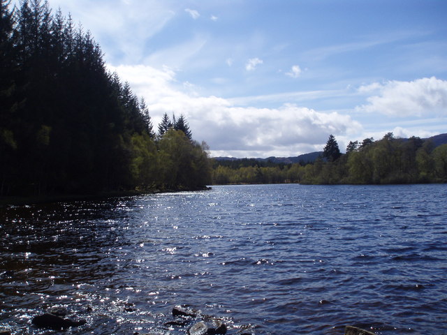
Loch Knockie

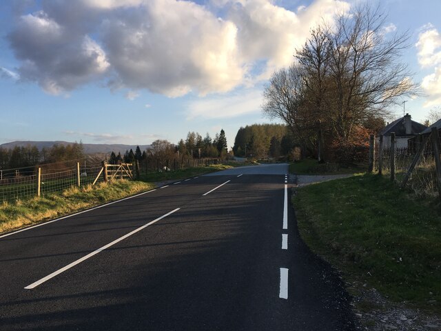
B862, Knockcarrach A long steady descent through clearfelled plantations.
B862, Knockcarrach Credit: Richard Webb

The requested URL returned error: 429 Too Many Requests

If you have any feedback on the listing, please let us know in the comments section below.

Loch Knockie Images

Images are sourced within 2km of 57.187334/-4.5560163 or Grid Reference NH4513. Thanks to Geograph Open Source API. All images are credited.

B862, Knockcarrach A long steady descent through clearfelled plantations.
B862, Knockcarrach
A long steady descent through clearfelled plantations.
Clearfell, Cnoc Carrach
General Wade's Military Road General George Wade (1673-1748) has given his name to military roads all over Scotland. During a distinguished Army career, the Hanoverian government appointed him Commander in Chief of His Majesty's forces, castles, forts and barracks in North Britain in 1725, part of his remit being to maintain peace in the Highlands following the Jacobite Rising of 1715. Until his promotion in 1739 to General of Horse, he masterminded the construction of some 240 miles of roads and bridges where there had previously been only rough tracks. The military purpose was to facilitate the movement of troops, but the military roads brought great benefits to the economy and the population in general. His legacy includes what is now the A9 from Perth to Inverness; the present A82 from Fort William to Inverness; the Corrieyairack road from Kingussie to Spean Bridge; the Devil's Elbow and Lecht roads; and the minor road from Aberfeldy to Dalnacardoch. 
He is commemorated by an often-quoted couplet, said to have been carved on a stone by one of his roads.
"If you had seen this road before it was made,
You would lift up your hands and bless General Wade."
General Wade's Military Road
General George Wade (1673-1748) has given his name to military roads all over Scotland. During a distinguished Army career, the Hanoverian government appointed him Commander in Chief of His Majesty's forces, castles, forts and barracks in North Britain in 1725, part of his remit being to maintain peace in the Highlands following the Jacobite Rising of 1715. Until his promotion in 1739 to General of Horse, he masterminded the construction of some 240 miles of roads and bridges where there had previously been only rough tracks. The military purpose was to facilitate the movement of troops, but the military roads brought great benefits to the economy and the population in general. His legacy includes what is now the A9 from Perth to Inverness; the present A82 from Fort William to Inverness; the Corrieyairack road from Kingussie to Spean Bridge; the Devil's Elbow and Lecht roads; and the minor road from Aberfeldy to Dalnacardoch. He is commemorated by an often-quoted couplet, said to have been carved on a stone by one of his roads. "If you had seen this road before it was made, You would lift up your hands and bless General Wade."
B862 south of Whitebridge
Road (B862) at Cnoc Carrach Looking south-westward.
Road (B862) at Cnoc Carrach
Looking south-westward.
Forest track giving access to Loch nan Lann Looking south-westward.
Forest track giving access to Loch nan Lann
Looking south-westward.
Tree-lined minor road beside Loch Knockie Looking south-westward.
Tree-lined minor road beside Loch Knockie
Looking south-westward.
Road (B862) between Knockcarrach and Wester Drummond Looking north-eastward.
Road (B862) between Knockcarrach and Wester Drummond
Looking north-eastward.
Ordnance Survey Flush Bracket G4027 This Bracket can be found on the wall of Knockcarrach - a private dwelling.
The recorded details give a height of 253.404 metres above sea level.
For more detail see : <span class="nowrap"><a title="https://www.bench-marks.org.uk/bm18614" rel="nofollow ugc noopener" href="https://www.bench-marks.org.uk/bm18614">Link</a><img style="margin-left:2px;" alt="External link" title="External link - shift click to open in new window" src="https://s1.geograph.org.uk/img/external.png" width="10" height="10"/></span>
Ordnance Survey Flush Bracket G4027
This Bracket can be found on the wall of Knockcarrach - a private dwelling. The recorded details give a height of 253.404 metres above sea level. For more detail see : LinkExternal link
Loch nan Lann Meall an Tarsaid & Beinn Mheadhoin lie distantly beyond Loch nan Lann as seen from a forestry road at the south-west side of the loch.
Loch nan Lann
Meall an Tarsaid & Beinn Mheadhoin lie distantly beyond Loch nan Lann as seen from a forestry road at the south-west side of the loch.
Knockcarrach Knockcarrach is a house beside a minor road just off the B862 close to Loch Knockie.
Knockcarrach
Knockcarrach is a house beside a minor road just off the B862 close to Loch Knockie.
Fishermen on Loch Knockie
Dell-Knockie boundary wall by Loch Knockie
Forest Clearing near Knockcarrach
Clear felling on Knockie estate
Cranog on Loch Knockie from Dell side
Loch Knockie East Shore (Dell estate)
Show me another place!

Loch Knockie is located at Grid Ref: NH4513 (Lat: 57.187334, Lng: -4.5560163)

Unitary Authority: Highland

Police Authority: Highlands and Islands

What 3 Words

///mascots.marbles.evoke. Near Drumnadrochit, Highland

Nearby Locations

Loch Knockie

Related Wikis

Whitebridge, Scotland

Whitebridge (Scottish Gaelic: An Drochaid Bhàn) is a small village on the southwest side of Loch Ness in northern Scotland. == Geography == It is roughly...

River Moriston

The River Moriston (Scottish Gaelic: Abhainn Mhoireastain) is a river in Inverness-shire, Scotland. It flows broadly east-north-east from the outfall of...

Loch Tarff

Loch Tarff is a small freshwater loch approximately 1.25 km (0.78 mi) from the southeastern shore of Loch Ness in the Scottish Highlands. == Geography... ==

Invermoriston

Invermoriston (Inbhir Mhoireastain in Gaelic) (grid reference NH420167) is a small village 11 kilometres (7 miles) north of Fort Augustus, Highland, Scotland...

Have you been to Loch Knockie?

Leave your review of Loch Knockie below (or comments, questions and feedback).