Loch Bowie

Lake, Pool, Pond, Freshwater Marsh in Dunbartonshire

Scotland

Loch Bowie

St Patrick's Primary School, Dumbarton Located adjacent to Dumbarton Academy in Crosslet Road, St Patrick's is a West Dunbartonshire Council Roman Catholic primary school with a current roll of approximately 360 pupils.
St Patrick's Primary School, Dumbarton Credit: Richard Dorrell

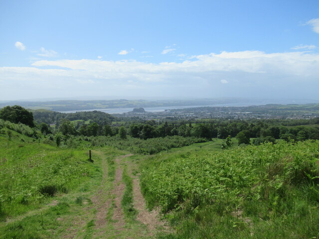
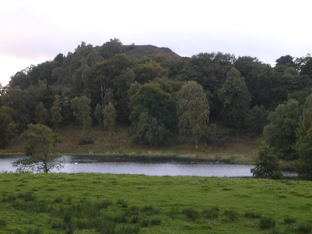
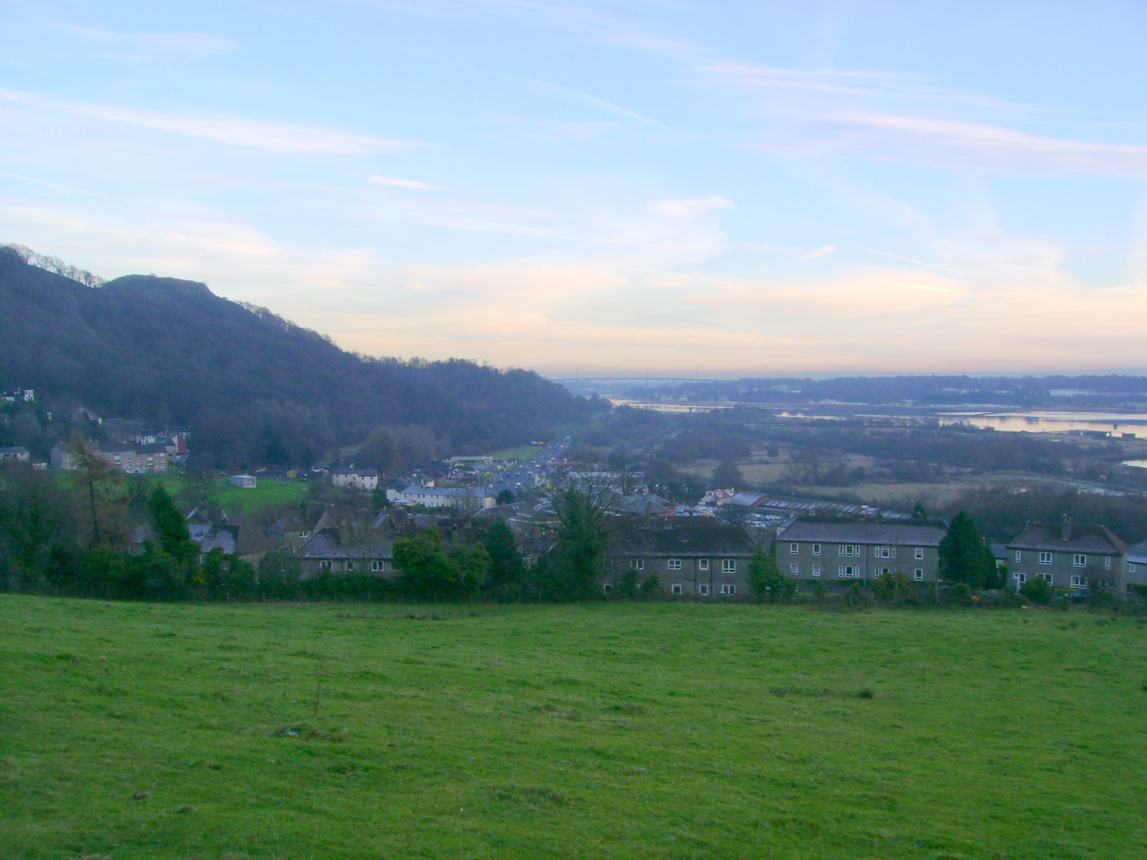
Loch Bowie is a picturesque freshwater loch located in Dunbartonshire, Scotland. Nestled amidst the stunning landscape of the Scottish Highlands, it is a popular destination for nature enthusiasts and those seeking tranquility.

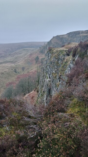
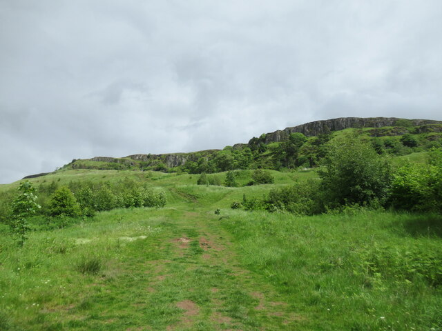
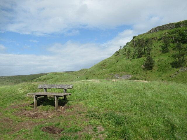
Covering an area of approximately 50 acres, Loch Bowie is a relatively small body of water. It is surrounded by rolling hills and dense woodlands, which add to its charm and provide a habitat for a diverse range of flora and fauna. The loch is fed by several small streams that flow down from the surrounding hills, ensuring a constant supply of fresh water.

The water of Loch Bowie is known for its clarity and purity. It is home to various species of fish, including brown trout and pike, making it a popular spot for anglers. The loch also attracts a wide variety of birdlife, such as herons, ducks, and swans, making it a perfect location for birdwatching.

In addition to the water itself, Loch Bowie is surrounded by a freshwater marsh, which serves as a vital habitat for many plant and animal species. The marsh is characterized by its wet, low-lying areas and is home to reeds, rushes, and other aquatic vegetation. It provides a sanctuary for numerous waterfowl and amphibians, contributing to the overall ecological diversity of the area.

Visitors to Loch Bowie can enjoy activities such as fishing, boating, and hiking. The tranquil atmosphere and breathtaking scenery make it an ideal destination for those seeking a peaceful retreat in the heart of nature.

If you have any feedback on the listing, please let us know in the comments section below.

Loch Bowie Images

Images are sourced within 2km of 55.944387/-4.5235263 or Grid Reference NS4275. Thanks to Geograph Open Source API. All images are credited.

St Patrick's Primary School, Dumbarton Located adjacent to Dumbarton Academy in Crosslet Road, St Patrick's is a West Dunbartonshire Council Roman Catholic primary school with a current roll of approximately 360 pupils.
St Patrick's Primary School, Dumbarton
Located adjacent to Dumbarton Academy in Crosslet Road, St Patrick's is a West Dunbartonshire Council Roman Catholic primary school with a current roll of approximately 360 pupils.
Crosslet Road, Dumbarton Housing towards the eastern end of the road.
Crosslet Road, Dumbarton
Housing towards the eastern end of the road.
Millburn Road, Dumbarton Looking east. Junction with Boghead Avenue on the left.
Millburn Road, Dumbarton
Looking east. Junction with Boghead Avenue on the left.
Eastern end of Boghead Road Looking north-west from the cul-de-sac end of this residential road in suburban Dumbarton.
Eastern end of Boghead Road
Looking north-west from the cul-de-sac end of this residential road in suburban Dumbarton.
Lang Craigs, Kilpatrick Hills There is a footpath running alongside a fence (for the most part) close to the edge of this steep impressive escarpment.
The Kilpatrick Hills, though only reaching around 400 metres at their highest, have the feel of something a bit bigger. The hills take their name from a village on the Western outskirts of Glasgow called Old Kilpatrick, which translates as 'old church of Patrick'. It is said by some that St Patrick - the patron saint of Ireland and credited with founding Christianity there - grew up near the village before being kidnapped (for whatever reason!) by Irish pirates.
Lang Craigs, Kilpatrick Hills
There is a footpath running alongside a fence (for the most part) close to the edge of this steep impressive escarpment. The Kilpatrick Hills, though only reaching around 400 metres at their highest, have the feel of something a bit bigger. The hills take their name from a village on the Western outskirts of Glasgow called Old Kilpatrick, which translates as 'old church of Patrick'. It is said by some that St Patrick - the patron saint of Ireland and credited with founding Christianity there - grew up near the village before being kidnapped (for whatever reason!) by Irish pirates.
View towards Dumbarton from path by Lang Craigs The area of woodland and grassland beneath Lang Craigs is managed by Forestry and Land Scotland, an agency of the Scottish Government.

Dumbarton Rock is visible beside the Firth of Clyde in the distance.
View towards Dumbarton from path by Lang Craigs
The area of woodland and grassland beneath Lang Craigs is managed by Forestry and Land Scotland, an agency of the Scottish Government. Dumbarton Rock is visible beside the Firth of Clyde in the distance.
Path below Lang Craigs Extensive tree plantings have been made by Forestry and Land Scotland (who manage the site) in this area beneath the basalt lava escarpment of the Lang Craigs.
Path below Lang Craigs
Extensive tree plantings have been made by Forestry and Land Scotland (who manage the site) in this area beneath the basalt lava escarpment of the Lang Craigs.
Bench below the Lang Craigs The basalt lava escarpment of the Lang Craigs looms over the network of paths below, managed by Forestry and Land Scotland, an agency of the Scottish Government.
Bench below the Lang Craigs
The basalt lava escarpment of the Lang Craigs looms over the network of paths below, managed by Forestry and Land Scotland, an agency of the Scottish Government.
Path below the Lang Craigs The path passes through a collapsed section of drystane dyke here, and can be followed on to Doughnot Hill.
Path below the Lang Craigs
The path passes through a collapsed section of drystane dyke here, and can be followed on to Doughnot Hill.
Entrance to Dumbarton East railway station Beneath the bridge that carries the railway across Glasgow Road. An uninviting entrance to a somewhat desolate station.
Entrance to Dumbarton East railway station
Beneath the bridge that carries the railway across Glasgow Road. An uninviting entrance to a somewhat desolate station.
Footpath into East End Park, Dumbarton Off Glasgow Road.
Footpath into East End Park, Dumbarton
Off Glasgow Road.
Glasgow Road, Dumbarton Looking towards Glasgow from Gruggies Bridge.
Glasgow Road, Dumbarton
Looking towards Glasgow from Gruggies Bridge.
A82 in Dumbarton
A82 in Dumbarton
A82 in Dumbarton
A82 in Dumbarton
A82 towards Milton
A82 towards Milton
A82 towards Milton
A82 towards Milton
Old milepost Not much change since 2015 when this flat milepost on the A814 in its own little wall was first recorded by the Milestone Society.   It is just west of the A82 junction opposite a 'Traffic Lights 400yds' sign and in front of some industrial buildings.  GLASGOW/ROYAL EXCHANGE/13 MILES.   DUMBARTON/CROSS/1 MILE with hands pointing the direction.
Old milepost
Not much change since 2015 when this flat milepost on the A814 in its own little wall was first recorded by the Milestone Society. It is just west of the A82 junction opposite a 'Traffic Lights 400yds' sign and in front of some industrial buildings. GLASGOW/ROYAL EXCHANGE/13 MILES. DUMBARTON/CROSS/1 MILE with hands pointing the direction.
Old milepost Looking towards Dumbarton along the A814   The width and depth of the stone wall with the milepost can be appreciated.   But the milepost does need painting to show it to its best advantage.
Old milepost
Looking towards Dumbarton along the A814 The width and depth of the stone wall with the milepost can be appreciated. But the milepost does need painting to show it to its best advantage.
Show me another place!

Loch Bowie is located at Grid Ref: NS4275 (Lat: 55.944387, Lng: -4.5235263)

Unitary Authority: West Dunbartonshire

Police Authority: Argyll and West Dunbartonshire

What 3 Words

///digested.cashier.playing. Near Dumbarton, West Dunbartonshire

Nearby Locations

Barwood Hill Loch Bowie

Related Wikis

Loch Bowie

Loch Bowie is a small freshwater loch located in West Dunbartonshire, Scotland. == Geography == To the west of the Loch is the former Iron Age Hillfort...

Overtoun House

Overtoun House is a 19th-century country house and estate in West Dunbartonshire, Scotland. Situated on a hill overlooking the River Clyde, it is two kilometres...

Overtoun Bridge

Overtoun Bridge is a category B-listed structure over the Overtoun Burn on the approach road from the west to Overtoun House, near Dumbarton in West Dunbartonshire...

Milton, West Dunbartonshire

Milton (historically Milton of Colquhoun) is a village in West Dunbartonshire, Scotland. It lies about one mile (two kilometres) east of Dumbarton, on...

Nearby Amenities

Located within 500m of 55.944387,-4.5235263
Dumbowie
Munro: no
Natural: peak
Lat/Long: 55.9440131/-4.5288604
Middleton
Place: isolated_dwelling
Lat/Long: 55.9441566/-4.5186832
Barnhill
Place: isolated_dwelling
Lat/Long: 55.9481122/-4.5253808
Power: pole
Lat/Long: 55.9462293/-4.5290006
Power: pole
Lat/Long: 55.9479236/-4.524793
Power: pole
Lat/Long: 55.9443847/-4.5194979
Power: pole
Lat/Long: 55.9439459/-4.5196467
Power: pole
Lat/Long: 55.94346/-4.5198122
Power: pole
Lat/Long: 55.9428628/-4.5200238
Power: pole
Lat/Long: 55.9424544/-4.5200008
Power: pole
Lat/Long: 55.9417503/-4.5199065
Power: pole
Lat/Long: 55.9409852/-4.5198185
Power: pole
Lat/Long: 55.9435586/-4.5213712
Power: pole
Lat/Long: 55.9433122/-4.5186828
Power: pole
Lat/Long: 55.9431643/-4.5176309
Power: pole
Lat/Long: 55.9430235/-4.5166083
Power: pole
Lat/Long: 55.9414863/-4.5205603
Power: pole
Lat/Long: 55.9413666/-4.5209353
The data included in this document is from www.openstreetmap.org. The data is made available under ODbL.

Have you been to Loch Bowie?

Leave your review of Loch Bowie below (or comments, questions and feedback).