Gogar

Settlement in Midlothian

Scotland

Gogar

New control tower and runway Edinburgh Airport
New control tower and runway Edinburgh Airport Credit: paul birrell

Gogar is a small village located in the county of Midlothian, Scotland. Situated approximately 7 miles west of Edinburgh city center, Gogar is nestled between the towns of Corstorphine and Newbridge. The village is primarily residential, with a population of around 500 residents.

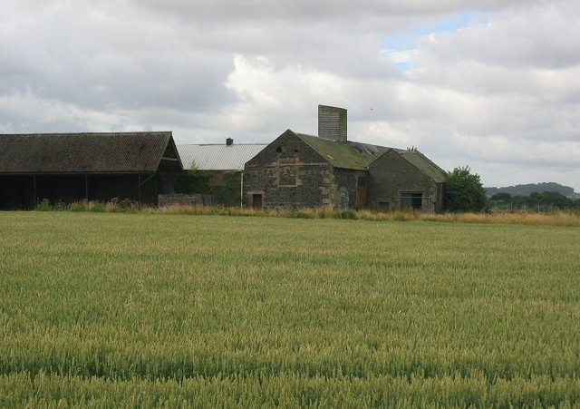
Gogar is renowned for its picturesque countryside setting, surrounded by rolling hills and lush green fields. The village offers a tranquil and peaceful atmosphere, making it an ideal place for those seeking a quieter lifestyle while still being in close proximity to the city.

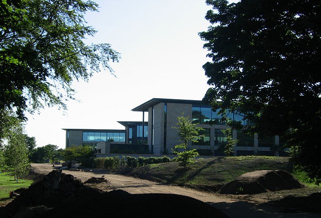
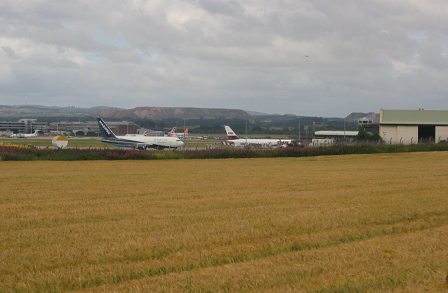
The village is well-connected to the rest of Midlothian and Edinburgh through excellent transportation links. The nearby Edinburgh Airport is just a short drive away, making it convenient for frequent travelers. Additionally, the M8 motorway and main bus routes pass through Gogar, providing easy access to other parts of Scotland.

For those seeking recreational activities, Gogar is located near several natural attractions. The Gogar Burn, a small river, flows through the village, offering pleasant walks and opportunities for fishing. The nearby Gogarbank Wood is a popular spot for nature lovers, with its diverse flora and fauna.

Gogar is also home to the Gogar Parish Church, a historic building that dates back to the 12th century. The church serves as a focal point for the community, hosting regular services and social events.

In summary, Gogar is a charming village in Midlothian, offering a peaceful countryside lifestyle with easy access to urban amenities. Its natural beauty, convenient location, and close-knit community make it an attractive place to live for both families and individuals alike.

If you have any feedback on the listing, please let us know in the comments section below.
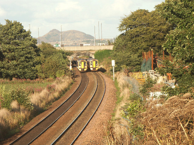
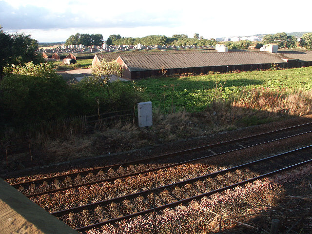
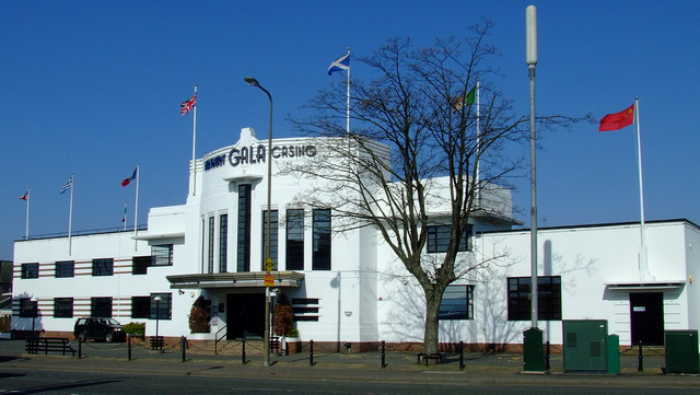
Gogar Images

Images are sourced within 2km of 55.936811/-3.331462 or Grid Reference NT1672. Thanks to Geograph Open Source API. All images are credited.

New control tower and runway Edinburgh Airport
Union Canal, Hermiston Taken from Hermiston bridge (no 12), looking E towards bridge no 11.  A popular route for walkers and cyclists.
Union Canal, Hermiston
Taken from Hermiston bridge (no 12), looking E towards bridge no 11. A popular route for walkers and cyclists.
Gyle Industrial Estate A big lurch westward in the 1980s, this is a tin shed estate with some more prestigious buildings like the Royal Bank offices here. The Royal Bank of Scotland are currently building a new head office at NT1672, I don't know if they will be staying here as well.
Gyle Industrial Estate
A big lurch westward in the 1980s, this is a tin shed estate with some more prestigious buildings like the Royal Bank offices here. The Royal Bank of Scotland are currently building a new head office at NT1672, I don't know if they will be staying here as well.
"knowledge is wonderful" Paolozzi statue outside the Royal Bank of Scotland offices in the Gyle Estate. With bus.
"knowledge is wonderful"
Paolozzi statue outside the Royal Bank of Scotland offices in the Gyle Estate. With bus.
Edinburgh Park Business Park by the city bypass  - a 1990's version of the industrial estate. A cut above the usual tin shed estate.

I got a home visit from the Police for taking this.  The first decade of the 21st century was not too comfortable for photography. The paranoia ended once cameras in mobile 'phones became commonplace.
Edinburgh Park
Business Park by the city bypass - a 1990's version of the industrial estate. A cut above the usual tin shed estate. I got a home visit from the Police for taking this. The first decade of the 21st century was not too comfortable for photography. The paranoia ended once cameras in mobile 'phones became commonplace.
South Gyle Shopping Centre. 1980's mall.
South Gyle Shopping Centre.
1980's mall.
Royal Bank of Scotland. On the site of the old Gogar Burn hospital, the new head office is nearing completion.
Royal Bank of Scotland.
On the site of the old Gogar Burn hospital, the new head office is nearing completion.
Suntrap The Suntrap Garden, Gogar.
Suntrap
The Suntrap Garden, Gogar.
M8 The most recently built section of the Edinburgh Glasgow road, doubles as a car park in the mornings. View towards the Pentlands.
M8
The most recently built section of the Edinburgh Glasgow road, doubles as a car park in the mornings. View towards the Pentlands.
Meadowfield Old farm buildings in a field of spring sown wheat. A thin strip of farmland, Edinburgh is expanding westward and there is pressure to expand the airport. If the city bypass is ever completed, it will run through this area.
Meadowfield
Old farm buildings in a field of spring sown wheat. A thin strip of farmland, Edinburgh is expanding westward and there is pressure to expand the airport. If the city bypass is ever completed, it will run through this area.
EDI Cargo terminal, Turnhouse. Air cargo terminal near the old RAF base at Edinburgh Airport.
EDI Cargo terminal, Turnhouse.
Air cargo terminal near the old RAF base at Edinburgh Airport.
The Maybury Once a dance hall, often empty, now a casino. A landmark building by a very busy road junction.

This is a well known landmark in the city, once an edge of town roadhouse.
The Maybury
Once a dance hall, often empty, now a casino. A landmark building by a very busy road junction. This is a well known landmark in the city, once an edge of town roadhouse.
Royal Bank of Scotland Bridge. Simple arch bridge over the A8.
Royal Bank of Scotland Bridge.
Simple arch bridge over the A8.
Park and ride, Ingliston. Amongst all the airport car parks, a new addition. Just before opening, an attempt to free up traffic in the city.
Park and ride, Ingliston.
Amongst all the airport car parks, a new addition. Just before opening, an attempt to free up traffic in the city.
Western approaches to Edinburgh Busy junction on the A8 entering Edinburgh from the west. There has been a lot of recent development here; it's a mass of tin shed shopping as well as hotels and some residential areas.
Western approaches to Edinburgh
Busy junction on the A8 entering Edinburgh from the west. There has been a lot of recent development here; it's a mass of tin shed shopping as well as hotels and some residential areas.
And they're neck and neck... DMU's. One to Edinburgh. One from Edinburgh. Taken from the bridge near Gogarbank House.
Mr Dalton's scrap metal fabrications, far right, gaze longingly at the hard working hardened-steel rails carrying passenger and freight trains to destinations far away.
And they're neck and neck...
DMU's. One to Edinburgh. One from Edinburgh. Taken from the bridge near Gogarbank House. Mr Dalton's scrap metal fabrications, far right, gaze longingly at the hard working hardened-steel rails carrying passenger and freight trains to destinations far away.
Gogarburn Broiler Farm Just stay upwind on a hot day...

A broiler is term used for chickens reared for meat. For more information see <span class="nowrap"><a title="http://en.wikipedia.org/wiki/Broiler" rel="nofollow ugc noopener" href="http://en.wikipedia.org/wiki/Broiler">Link</a><img style="margin-left:2px;" alt="External link" title="External link - shift click to open in new window" src="https://s1.geograph.org.uk/img/external.png" width="10" height="10"/></span>.

Beyond the trees you can just see Edinburgh Business Park on the other
side of the A720.  In the far distance Corstorphine Hill.
Gogarburn Broiler Farm
Just stay upwind on a hot day... A broiler is term used for chickens reared for meat. For more information see LinkExternal link. Beyond the trees you can just see Edinburgh Business Park on the other side of the A720. In the far distance Corstorphine Hill.
Sunflowers, Gogar. Sunflowers lining a field, perhaps as a game crop? Can live my Tour de France fantasies riding past the sunflowers here.
Sunflowers, Gogar.
Sunflowers lining a field, perhaps as a game crop? Can live my Tour de France fantasies riding past the sunflowers here.
Show me another place!

Gogar is located at Grid Ref: NT1672 (Lat: 55.936811, Lng: -3.331462)

Unitary Authority: City of Edinburgh

Police Authority: Edinburgh

What 3 Words

///cars.frames.grit. Near Ratho Station, Edinburgh

Nearby Locations

Castle Gogar Gogar

Related Wikis

Gogar

Gogar is a predominantly rural area of Edinburgh, Scotland, located to the west of the city. It is not far from Gogarloch, Edinburgh Park and Maybury....

Edinburgh Gateway station

Edinburgh Gateway station is a railway station and interchange at Gogar in Edinburgh, Scotland, which opened on 11 December 2016. It is served by ScotRail...

The Gyle Shopping Centre

Gyle Shopping Centre is a shopping center located in the South Gyle area of Edinburgh, Scotland. The main centre has two anchor tenants, Marks & Spencer...

Maybury

Maybury is an area on the western edge of Edinburgh, Scotland, near South Gyle and Ingliston, named after the road, which is itself named after the civil...

Related Videos

Nearby Amenities

Located within 500m of 55.936811,-3.331462
Traffic Signals
Crossing: no
Source: survey
Lat/Long: 55.9367396/-3.3362955
Motorway Junction
Lat/Long: 55.9367713/-3.336961
Motorway Junction
Gogar Roundabout
Lat/Long: 55.9388044/-3.3270112
Crossing
Button Operated: yes
Crossing: traffic_signals
Crossing Island: no
Crossing Markings: dots
Crossing Ref: toucan
Tactile Paving: yes
Lat/Long: 55.9365385/-3.3360396
Crossing
Crossing: zebra
Crossing Island: yes
Tactile Paving: yes
Lat/Long: 55.9357396/-3.3342126
Crossing
Button Operated: yes
Crossing: traffic_signals
Crossing Island: yes
Tactile Paving: yes
Lat/Long: 55.9359418/-3.3329775
Bus Stop
Gogarburn A8
Bench: yes
Bus: yes
Naptan AdministrativeAreaCode: 124
Naptan Area Name: Edinburgh
Naptan AtcoAreaCode: 620
Naptan AtcoCode: 6200202320
Naptan Bearing: NE
Naptan CommonName: Gogarburn A8
Naptan Indicator: NE-bound
Naptan Landmark: Gogarburn
Naptan LocalityName: Gogar
Naptan NaptanCode: 36232429
Naptan NptgLocalityCode: N0067298
Naptan PlusbusZoneRef: EDINBUR
Naptan SourceLocalityType: Add
Naptan StopAreaCode: 620G202320
Naptan StopAreaType: GPBS
Naptan StopArea Name: GOGAR Gogarburn RBS
Naptan Street: Glasgow Road
Naptan Verified: yes
Public Transport: platform
Shelter: yes
Source: NaPTAN + Survey
Lat/Long: 55.9383028/-3.3297082
Bus Stop
Gogar Roundabout
Bench: yes
Bin: yes
Bus: yes
Naptan AdministrativeAreaCode: 124
Naptan Area Name: Edinburgh
Naptan AtcoAreaCode: 620
Naptan AtcoCode: 6200202330
Naptan Bearing: E
Naptan CommonName: Gogar Roundabout
Naptan Indicator: E-bound
Naptan Landmark: City Bypass
Naptan LocalityName: Gogar
Naptan NaptanCode: 36238935
Naptan NptgLocalityCode: N0067298
Naptan PlusbusZoneRef: EDINBUR
Naptan SourceLocalityType: Add
Naptan StopAreaCode: 620G202330
Naptan StopAreaType: GPBS
Naptan StopArea Name: GOGAR Roundabout
Naptan Street: Glasgow Road
Naptan Verified: yes
Public Transport: platform
Shelter: yes
Source: NaPTAN + Survey
Lat/Long: 55.9391007/-3.3261448
Bus Stop
Gogar Roundabout
Bench: yes
Bin: yes
Bus: yes
Naptan AdministrativeAreaCode: 124
Naptan Area Name: Edinburgh
Naptan AtcoAreaCode: 620
Naptan AtcoCode: 6200247560
Naptan Bearing: W
Naptan CommonName: Gogar Roundabout
Naptan Indicator: W-bound
Naptan Landmark: Gogar Roundabout
Naptan LocalityName: Gogar
Naptan NaptanCode: 36237985
Naptan NptgLocalityCode: N0067298
Naptan PlusbusZoneRef: EDINBUR
Naptan SourceLocalityType: Add
Naptan StopAreaCode: 620G202330
Naptan StopAreaType: GPBS
Naptan StopArea Name: GOGAR Roundabout
Naptan Street: Glasgow Road
Naptan Verified: yes
Public Transport: platform
Shelter: yes
Source: NaPTAN + Survey
Lat/Long: 55.9387318/-3.3256121
Bus Stop
Gogarburn A8
Bench: yes
Bin: yes
Bus: yes
Naptan AdministrativeAreaCode: 124
Naptan Area Name: Edinburgh
Naptan AtcoAreaCode: 620
Naptan AtcoCode: 6200247570
Naptan Bearing: W
Naptan CommonName: Gogarburn A8
Naptan Indicator: W-bound
Naptan Landmark: Gogarburn
Naptan LocalityName: Gogar
Naptan NaptanCode: 36232428
Naptan NptgLocalityCode: N0067298
Naptan PlusbusZoneRef: EDINBUR
Naptan SourceLocalityType: Add
Naptan StopAreaCode: 620G202320
Naptan StopAreaType: GPBS
Naptan StopArea Name: GOGAR Gogarburn RBS
Naptan Street: Glasgow Road
Naptan Verified: yes
Passenger Information Display: yes
Public Transport: platform
Shelter: yes
Source: NaPTAN + Survey
Lat/Long: 55.9365574/-3.3383363
Bus Stop
Royal Bank HQ
Bench: yes
Covered: no
Naptan AtcoCode: 6200247575
Naptan Bearing: S
Naptan CommonName: Royal Bank HQ
Naptan Indicator: At Terminus
Naptan Landmark: Royal Bank of Scotland World HQ
Naptan NaptanCode: 36246582
Naptan PlusbusZoneRef: EDINBUR
Naptan Street: Royal Bank Link Road
Public Transport: platform
Shelter: yes
Source: naptan_import
Lat/Long: 55.9355034/-3.331932
Stop
Lat/Long: 55.9381901/-3.3318029
Stop
Lat/Long: 55.9381175/-3.3317448
Crossing
Crossing: zebra
Crossing Island: no
Tactile Paving: yes
Lat/Long: 55.9354975/-3.3361659
Railway: switch
Lat/Long: 55.9400344/-3.3284305
Railway: switch
Lat/Long: 55.9393363/-3.3279354
Railway: switch
Lat/Long: 55.9400965/-3.3284864
Railway: switch
Lat/Long: 55.9392702/-3.3282639
Railway: switch
Lat/Long: 55.9401016/-3.3281837
Railway: switch
Lat/Long: 55.9402517/-3.3279156
Railway: switch
Lat/Long: 55.9403177/-3.3279896
Railway: switch
Lat/Long: 55.9392755/-3.3288055
Railway: switch
Lat/Long: 55.9391627/-3.3282889
Railway: switch
Lat/Long: 55.939955/-3.3286592
Railway: switch
Lat/Long: 55.9394052/-3.3258776
Bicycle Parking
Bicycle Parking: stands
Capacity: 6
Covered: no
Lat/Long: 55.9378432/-3.3326289
Traffic Signals
Traffic Signals: crossing
Lat/Long: 55.9365727/-3.3360438
Motorway Junction
Lat/Long: 55.9369232/-3.3351254
Motorway Junction
Lat/Long: 55.9377806/-3.331156
Railway: level_crossing
Lat/Long: 55.9398223/-3.3288637
Stop
Lat/Long: 55.9387722/-3.32906
Crossing Barrier: no
Crossing Light: no
Railway: tram_level_crossing
Supervised: no
Lat/Long: 55.9387912/-3.3290712
Crossing Barrier: no
Crossing Light: no
Railway: tram_level_crossing
Supervised: no
Lat/Long: 55.9388239/-3.3290914
Stop
Lat/Long: 55.9388505/-3.3291106
Railway: switch
Lat/Long: 55.9392948/-3.3262198
Railway: switch
Lat/Long: 55.9394736/-3.3254884
Railway: switch
Lat/Long: 55.9401666/-3.3282386
Gogarburn
Network: Edinburgh Trams
Operator: Edinburgh Trams Ltd.
Public Transport: stop_position
Railway: tram_stop
Tram: yes
Lat/Long: 55.9380086/-3.3322732
Gogarburn
Network: Edinburgh Trams
Operator: Edinburgh Trams Ltd.
Public Transport: stop_position
Railway: tram_stop
Tram: yes
Lat/Long: 55.9380333/-3.3322942
Barrier: bollard
Foot: yes
Lat/Long: 55.9376266/-3.3338898
Crossing Barrier: no
Crossing Light: no
Railway: tram_level_crossing
Supervised: no
Lat/Long: 55.9381367/-3.3317585
Crossing Barrier: no
Crossing Light: no
Railway: tram_level_crossing
Supervised: no
Lat/Long: 55.9381614/-3.3317786
Traffic Signals
Lat/Long: 55.9348037/-3.3302763
Traffic Signals
Lat/Long: 55.9353284/-3.3305636
Gogar
Place: hamlet
Wikidata: Q5577328
Wikipedia: en:Gogar
Lat/Long: 55.9380228/-3.3332796
Waterway: weir
Lat/Long: 55.9344265/-3.3381559
Entrance: yes
Lat/Long: 55.934976/-3.3352767
Crossing
Crossing: zebra
Crossing Island: yes
Tactile Paving: yes
Lat/Long: 55.9356511/-3.3351896
Barrier: lift_gate
Lat/Long: 55.9355638/-3.3366919
Turning Circle
Lat/Long: 55.937341/-3.3268834
Railway: crossing
Lat/Long: 55.9398602/-3.3257537
Railway: crossing
Lat/Long: 55.9397919/-3.3257118
Railway: crossing
Lat/Long: 55.9397247/-3.3256701
Railway: crossing
Lat/Long: 55.93962/-3.3256048
Railway: crossing
Lat/Long: 55.9395487/-3.3255591
Railway: crossing
Lat/Long: 55.9394708/-3.3255888
Railway: crossing
Lat/Long: 55.9394383/-3.3255664
Gogarburn Hospital Memorial
Historic: memorial
Inscription: To the memory of those who lived and died in Gogarburn Hospital December 1924-May 1999 "We're a' Jock Tamson's Bairns"
Memorial: plaque_mounted_in_boulder
Lat/Long: 55.936912/-3.3317388
Bench
Lat/Long: 55.9368749/-3.3318528
Bench
Lat/Long: 55.9369451/-3.3317207
Crossing
Crossing: zebra
Crossing Island: no
Tactile Paving: yes
Lat/Long: 55.9361266/-3.3323162
Railway: crossing
Lat/Long: 55.9400263/-3.32856
Railway: crossing
Lat/Long: 55.9400078/-3.3285214
Crossing
Crossing: marked
Lat/Long: 55.9395858/-3.3282223
Grit Bin
Lat/Long: 55.9379564/-3.3317739
Door: revolving
Entrance: main
Lat/Long: 55.935299/-3.3324167
Artwork Type: sculpture
Tourism: artwork
Lat/Long: 55.9356905/-3.3323029
Barrier: lift_gate
Lat/Long: 55.9360073/-3.3390066
Fountain
Lat/Long: 55.9351374/-3.3356984
Barrier: lift_gate
Lat/Long: 55.9359694/-3.3390546
Barrier: lift_gate
Lat/Long: 55.9353217/-3.3311452
Crossing
Button Operated: yes
Crossing: traffic_signals
Crossing Island: no
Crossing Markings: dots
Crossing Ref: toucan
Tactile Paving: yes
Lat/Long: 55.9365243/-3.3361438
The data included in this document is from www.openstreetmap.org. The data is made available under ODbL.

Have you been to Gogar?

Leave your review of Gogar below (or comments, questions and feedback).