Goferydd
Settlement in Anglesey
Wales
Goferydd

Goferydd is a small village located on the island of Anglesey in Wales, United Kingdom. Situated in the northwestern part of the island, it lies approximately 3 miles southwest of the town of Holyhead. The village is nestled in a picturesque rural setting, surrounded by rolling hills and farmland.
Goferydd is a close-knit community with a population of around 200 residents. The village is known for its peaceful and tranquil atmosphere, making it an ideal place for those seeking a peaceful retreat away from the hustle and bustle of city life. The local residents are friendly and welcoming, creating a sense of community spirit.
The village itself is relatively small, with a few scattered houses, a church, and a village hall. The church, dedicated to St. Mary, is a prominent landmark in Goferydd and holds regular religious services. The village hall serves as a hub for community activities and events, hosting gatherings, meetings, and celebrations throughout the year.
The surrounding area offers plenty of opportunities for outdoor activities and exploration. The nearby coastline boasts stunning sandy beaches, rugged cliffs, and breathtaking views of the Irish Sea. Outdoor enthusiasts can enjoy coastal walks, fishing, and water sports in this beautiful area.
Goferydd's location also provides easy access to the amenities and services of Holyhead, which is a short drive away. Holyhead offers a range of shops, supermarkets, schools, and healthcare facilities, ensuring that residents have access to all necessary amenities.
In summary, Goferydd is a peaceful village in Anglesey, offering a tranquil lifestyle in a beautiful rural setting. With its strong sense of community and proximity to amenities, it is an attractive place to live or visit for those seeking a slower pace of life.
If you have any feedback on the listing, please let us know in the comments section below.
Goferydd Images
Images are sourced within 2km of 53.304277/-4.7028444 or Grid Reference SH2082. Thanks to Geograph Open Source API. All images are credited.


Goferydd is located at Grid Ref: SH2082 (Lat: 53.304277, Lng: -4.7028444)
Unitary Authority: Isle of Anglesey
Police Authority: North Wales
What 3 Words
///untruth.walnuts.stretch. Near Holyhead, Isle of Anglesey
Nearby Locations
Related Wikis

South Stack Lighthouse
The South Stack Lighthouse is built on the summit of a small island off the north-west coast of Holy Island, Anglesey, Wales. It was built in 1809 to warn...

South Stack
South Stack (Welsh: Ynys Lawd) is an island situated just off Holy Island on the northwest coast of Anglesey, Wales. == Geology == South Stack is an island...
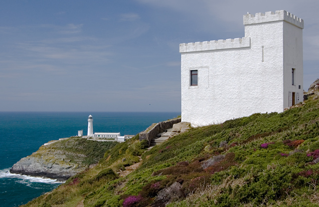
Elin's Tower
Elin's Tower (Welsh: Tŵr Elin) is a Victorian stone tower on Holy Island, located around 2+1⁄2 miles (4 km) west of Holyhead. The castellated folly, which...

Goferydd
Goferydd is an area in the community of Trearddur, Anglesey, Wales, which is 141.4 miles (227.5 km) from Cardiff and 228.9 miles (368.4 km) from London...

Holyhead Mountain Hut Circles
The Holyhead Mountain Hut Circles named in Welsh: Tŷ Mawr / Cytiau'r Gwyddelod, literally meaning Big house or "Irishmen's Huts". are the remains of a...
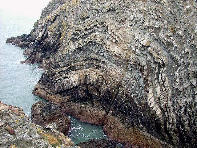
South Stack Formation
The South Stack Formation is a sequence of Cambro-Ordovician (Furongian to Tremadocian) metasedimentary rocks exposed in northwestern Anglesey, North Wales...

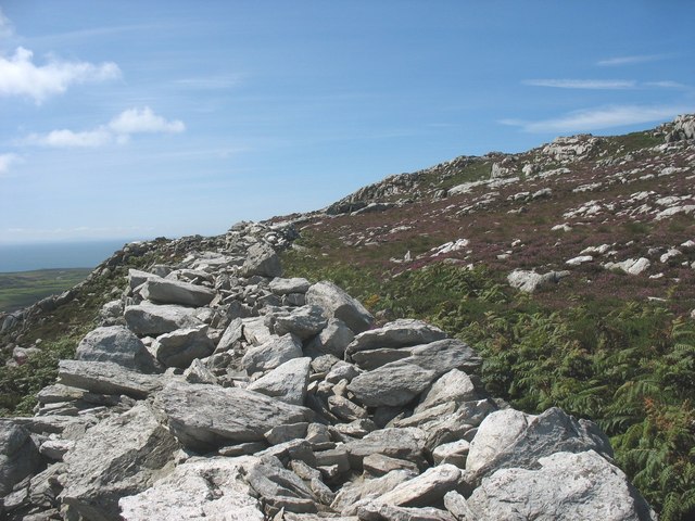
Holyhead Mountain
Holyhead Mountain (Welsh Mynydd Twr, from mynydd 'mountain, unenclosed land' and twr 'a heap, pile') is the highest point on Holy Island, Anglesey, and...
Caer y Twr
Caer y Twr (meaning 'fort of the pile/heap') is an Iron Age hillfort atop the summit of the Holyhead Mountain in Anglesey, Wales. The hillfort, which...
Nearby Amenities
Located within 500m of 53.304277,-4.7028444Have you been to Goferydd?
Leave your review of Goferydd below (or comments, questions and feedback).