Loch Ulbhach Coire

Lake, Pool, Pond, Freshwater Marsh in Sutherland

Scotland

Loch Ulbhach Coire

Summit of Beinn Direach Looking west to the ridge of Carn an Tionail
Summit of Beinn Direach Credit: Pete Drummond

The requested URL returned error: 429 Too Many Requests

If you have any feedback on the listing, please let us know in the comments section below.

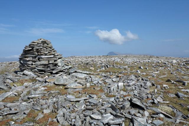
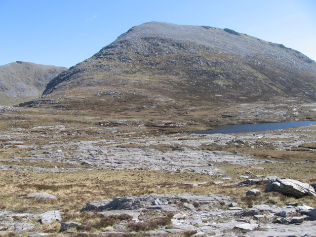
Loch Ulbhach Coire Images

Images are sourced within 2km of 58.297674/-4.7673106 or Grid Reference NC3737. Thanks to Geograph Open Source API. All images are credited.

Summit of Beinn Direach Looking west to the ridge of Carn an Tionail
Summit of Beinn Direach
Looking west to the ridge of Carn an Tionail
Grassy spur with peat bank The ridge running south from the Graham, Carn an Tionail broadens as it reaches a lesser top, A' Ghlaise; from that top a spur branches away south-west to end above the crags of Creag na h-Uidhe. The spur is the grassy ridge heading away beyond the peat bank. The distant mountains are in the district of Coigach - Cul Beag and Cul Mor.
Grassy spur with peat bank
The ridge running south from the Graham, Carn an Tionail broadens as it reaches a lesser top, A' Ghlaise; from that top a spur branches away south-west to end above the crags of Creag na h-Uidhe. The spur is the grassy ridge heading away beyond the peat bank. The distant mountains are in the district of Coigach - Cul Beag and Cul Mor.
Ridge rising northwards to A' Ghlaise A' Ghlaise is the long south ridge of the Graham, Carn an Tionail; at this location, around 575m, there's extensive scattered rock; higher, there's grass.
Ridge rising northwards to A' Ghlaise
A' Ghlaise is the long south ridge of the Graham, Carn an Tionail; at this location, around 575m, there's extensive scattered rock; higher, there's grass.
Ridge rising towards A' Ghlaise A' Ghlaise, at the left side of the image is a rise of the south ridge of the Graham, Carn an Tionail, which is the mountain dome seen in the distance.
Ridge rising towards A' Ghlaise
A' Ghlaise, at the left side of the image is a rise of the south ridge of the Graham, Carn an Tionail, which is the mountain dome seen in the distance.
Stone shelter south of Carn an Tionail The collection of stones is a small shelter between the peak Carn an Tionail and its lower southern top, A' Ghlaise. The mountain to the left side of the image is Càrn Dearg, an eastern top of the wonderfully named Corbett, Meallan Liath Coire Mhic Dhughaill!
Stone shelter south of Carn an Tionail
The collection of stones is a small shelter between the peak Carn an Tionail and its lower southern top, A' Ghlaise. The mountain to the left side of the image is Càrn Dearg, an eastern top of the wonderfully named Corbett, Meallan Liath Coire Mhic Dhughaill!
Summit plateau of Carn an Tionail Carn an Tionail has a flat summit scattered with rocks some of which have been assembled to form a 'beehive' cairn. The distant mountain below the cloud is Ben Hope - the most northerly of the Munros.
Summit plateau of Carn an Tionail
Carn an Tionail has a flat summit scattered with rocks some of which have been assembled to form a 'beehive' cairn. The distant mountain below the cloud is Ben Hope - the most northerly of the Munros.
A' Glaise The steep east face of A' Glaise.
A' Glaise
The steep east face of A' Glaise.
Gullies, A' Ghlaise The steep east face of A' Ghlaise.  It is a wet crag and probably has some winter potential, given a very cold spell - it is low altitude.
Gullies, A' Ghlaise
The steep east face of A' Ghlaise. It is a wet crag and probably has some winter potential, given a very cold spell - it is low altitude.
Waterfall on the Allt Beithe The grass by the stream was a pleasant oasis, compared to the heathery, peaty terrain round about. Creag na h-Uidhe in the background.
Waterfall on the Allt Beithe
The grass by the stream was a pleasant oasis, compared to the heathery, peaty terrain round about. Creag na h-Uidhe in the background.
Rocks on Slopes above the Allt Beithe Walking was difficult through this rough area. Deer can just be seen on the horizon.
Rocks on Slopes above the Allt Beithe
Walking was difficult through this rough area. Deer can just be seen on the horizon.
Boulder on Slopes above the Allt Beithe Lots of peat hags around, making this a difficult area to walk through. A lone deer can just be seen on the horizon.
Boulder on Slopes above the Allt Beithe
Lots of peat hags around, making this a difficult area to walk through. A lone deer can just be seen on the horizon.
Remains of Old Bridge This was right in the middle of a large area of peat hags, but strangely there was no track leading to or from it. Creag na h-Uidhe in the background.
Remains of Old Bridge
This was right in the middle of a large area of peat hags, but strangely there was no track leading to or from it. Creag na h-Uidhe in the background.
Remains of Bridge and Loch Ulbhach Coire There was high pressure and the cloud remained in the corrie all day.
Remains of Bridge and Loch Ulbhach Coire
There was high pressure and the cloud remained in the corrie all day.
Boulder by the Allt Beithe Although the stream was in peat hags by Loch Ulbhach Coire, there were pleasant grassy areas down here. The boulder provided welcome shelter from the wind.
Boulder by the Allt Beithe
Although the stream was in peat hags by Loch Ulbhach Coire, there were pleasant grassy areas down here. The boulder provided welcome shelter from the wind.
South End of Creag na h-Uidhe There was high pressure and a mist on the top of the Creag. Rough mixed heather and grass with some impressive boulders.
South End of Creag na h-Uidhe
There was high pressure and a mist on the top of the Creag. Rough mixed heather and grass with some impressive boulders.
Coire Mhic Faide Very remote corrie between Carn Dearg and Carn an Tionail.
Coire Mhic Faide
Very remote corrie between Carn Dearg and Carn an Tionail.
Thrifty Rock above Lochan a' Bhealaich On an upland plateau with mainly short grass. Ptarmigan were nesting around here. This rock had thrift growing on top. Behind the loch are W slopes of Carn an Tionail.
Thrifty Rock above Lochan a' Bhealaich
On an upland plateau with mainly short grass. Ptarmigan were nesting around here. This rock had thrift growing on top. Behind the loch are W slopes of Carn an Tionail.
Lochan Below Coire Loch Coire Loch is actually hidden but lies between here and the eastern ridges of Meallan Liath Coire Mhic Dhughaill. There are a few lochans in this boggy area, with bogbean growing in them.
Lochan Below Coire Loch
Coire Loch is actually hidden but lies between here and the eastern ridges of Meallan Liath Coire Mhic Dhughaill. There are a few lochans in this boggy area, with bogbean growing in them.
Show me another place!

Loch Ulbhach Coire is located at Grid Ref: NC3737 (Lat: 58.297674, Lng: -4.7673106)

Unitary Authority: Highland

Police Authority: Highlands and Islands

What 3 Words

///verifying.sweat.outfit. Near Altnaharra, Highland

Nearby Locations

Loch Ulbhach Coire

Related Wikis

Meallan Liath Coire Mhic Dhùghaill

Meallan Liath Coire Mhic Dhughaill (801 m) is a mountain in the Northwest Highlands, Scotland. It lies in the far north of Scotland between Lairg and Durness...

Ben Hee

Ben Hee is a mountain in Scotland that rises to the height of 865.7 metres (2,840 ft). == References == == External links == Foinaven-Ben Hee Wild Land...

Loch Merkland

Loch Merkland is a large long inland loch in Sutherland, Northern Scotland. It is located adjacent to the A838 main road which provides almost all access...

Eas Creag an Luchda

Eas Creag an Luchda is a waterfall of Scotland. == See also == Waterfalls of Scotland == References ==

Have you been to Loch Ulbhach Coire?

Leave your review of Loch Ulbhach Coire below (or comments, questions and feedback).