Lochan Cruachan

Lake, Pool, Pond, Freshwater Marsh in Stirlingshire

Scotland

Lochan Cruachan

Glen Arklet - Minor road climbing away from Inversnaid and Loch Lomond Looking north-eastward.
Glen Arklet - Minor road climbing away from Inversnaid and Loch Lomond Credit: Peter Wood

Lochan Cruachan is a picturesque freshwater loch located in Stirlingshire, Scotland. Nestled in the scenic surroundings of the Trossachs National Park, it is a popular destination for nature lovers and outdoor enthusiasts. The loch covers an area of approximately 20 hectares and sits at an elevation of 290 meters above sea level.

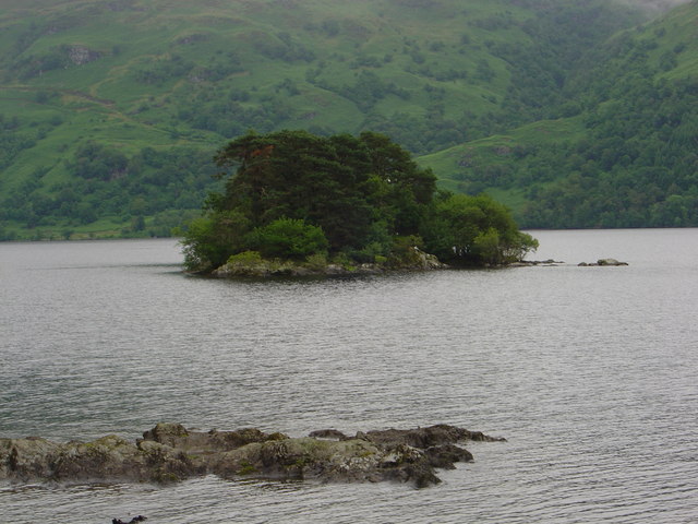
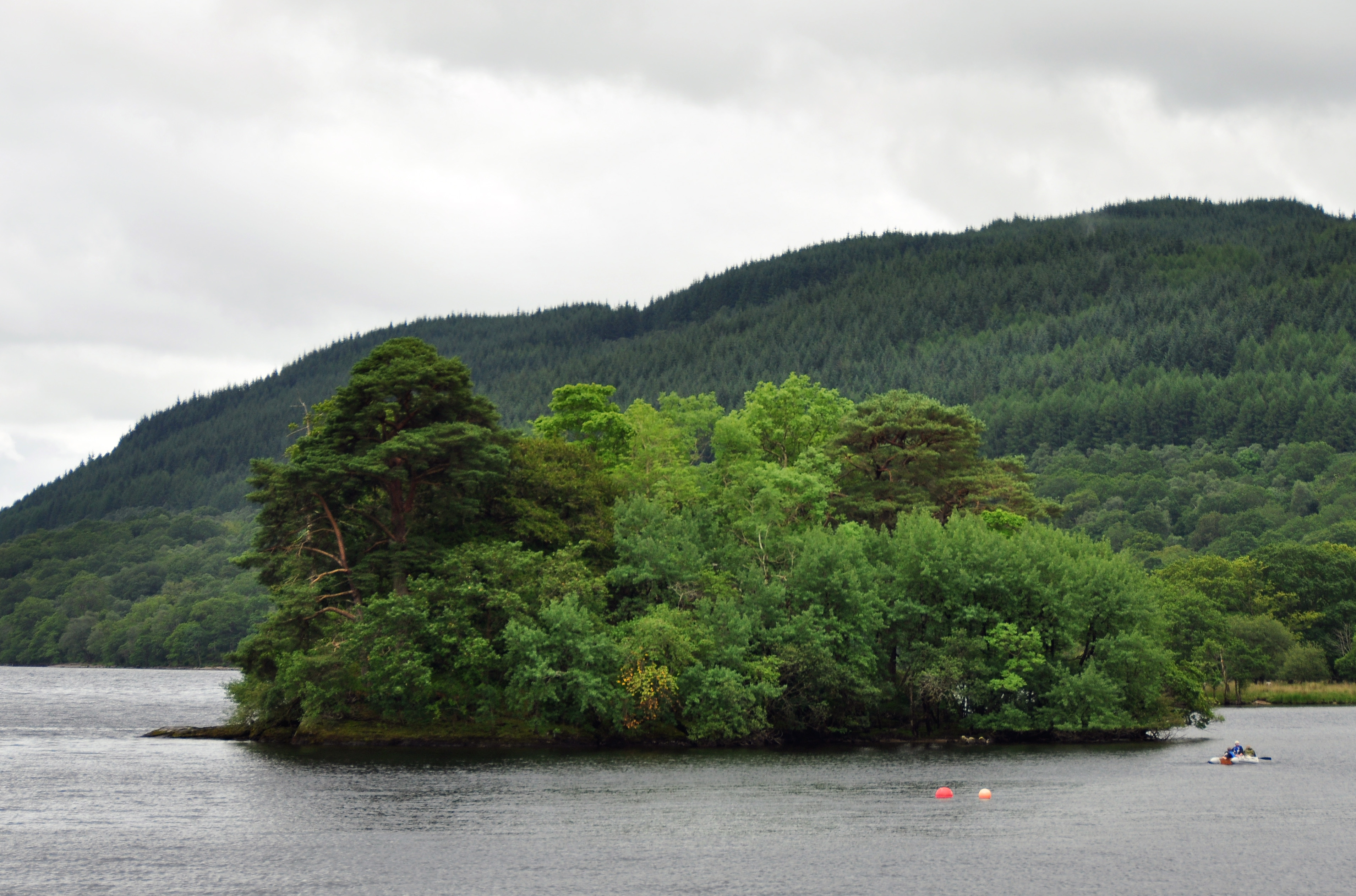
Surrounded by lush greenery and rolling hills, Lochan Cruachan offers a serene and tranquil atmosphere. Its crystal-clear waters are fed by numerous small streams and springs that flow from the surrounding hills. The loch is known for its exceptional water quality, making it an important habitat for various aquatic species.

The shores of Lochan Cruachan are adorned with a diverse range of vegetation, including reeds, grasses, and water lilies. These plants provide a habitat for numerous bird species, such as swans, ducks, and herons, which can often be seen gracefully gliding across the water.

The surrounding area of Lochan Cruachan is also home to a variety of other wildlife, including red deer, otters, and various small mammals. The loch is a popular spot for fishing, with brown trout being the most common catch.

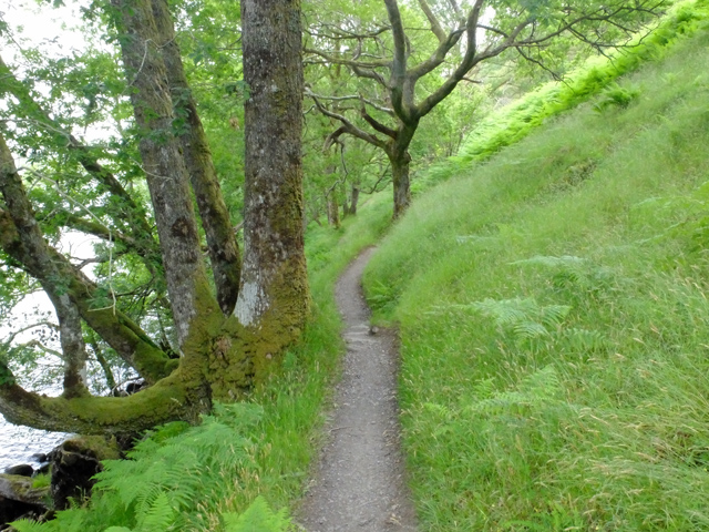
Visitors to Lochan Cruachan can enjoy a range of recreational activities, such as walking, picnicking, and birdwatching. There are also several walking trails that lead to nearby viewpoints, offering breathtaking vistas of the loch and its surroundings.

In conclusion, Lochan Cruachan is a stunning freshwater loch in Stirlingshire, Scotland, offering a peaceful retreat in the heart of nature. Its diverse ecosystem, beautiful scenery, and range of activities make it a must-visit destination for outdoor enthusiasts and nature lovers alike.

If you have any feedback on the listing, please let us know in the comments section below.

Lochan Cruachan Images

Images are sourced within 2km of 56.231024/-4.6604341 or Grid Reference NN3507. Thanks to Geograph Open Source API. All images are credited.

Glen Arklet - Minor road climbing away from Inversnaid and Loch Lomond Looking north-eastward.
Glen Arklet - Minor road climbing away from Inversnaid and Loch Lomond
Looking north-eastward.
Loch Lomond Looking southward from Inversnaid Harbour.
Loch Lomond
Looking southward from Inversnaid Harbour.
Memorial to Loch Lomond fatality Mid morning on Sunday 23 November 1975, a party of walkers got into trouble whilst trying to wade through an in-spate Cailness Burn. This burn is approximately 2 km south of Inversnaid on the West Highland Way long distance walk. At that time there was no foot-bridge across the burn; the previous one had been washed away in July of that year. Three of the walkers were swept out into Loch Lomond and their leader, 6ft 5in Bill Lobban, waded in to the water to try and rescue them.
All this was witnessed by 68 year old John Groome from nearby Caillnes Cottage. John launched his motorised ten foot open dinghy and managed to rescue three of those in trouble, but there was no sign of Bill Lobban, his body was never recovered.
The full story is available as part of John Groome’s Diaries. These are available via the Friends of Loch Lomond’s website. <span class="nowrap"><a title="https://www.lochlomondtrossachs.org.uk/john-groome-diaries" rel="nofollow ugc noopener" href="https://www.lochlomondtrossachs.org.uk/john-groome-diaries">Link</a><img style="margin-left:2px;" alt="External link" title="External link - shift click to open in new window" src="https://s1.geograph.org.uk/img/external.png" width="10" height="10"/></span>
Memorial to Loch Lomond fatality
Mid morning on Sunday 23 November 1975, a party of walkers got into trouble whilst trying to wade through an in-spate Cailness Burn. This burn is approximately 2 km south of Inversnaid on the West Highland Way long distance walk. At that time there was no foot-bridge across the burn; the previous one had been washed away in July of that year. Three of the walkers were swept out into Loch Lomond and their leader, 6ft 5in Bill Lobban, waded in to the water to try and rescue them. All this was witnessed by 68 year old John Groome from nearby Caillnes Cottage. John launched his motorised ten foot open dinghy and managed to rescue three of those in trouble, but there was no sign of Bill Lobban, his body was never recovered. The full story is available as part of John Groome’s Diaries. These are available via the Friends of Loch Lomond’s website. LinkExternal link
Loch Arklet Dam
Loch Arklet Dam
Boulder by the West Highland Way The West Highland Way is a long distance footpath, running for 154km (96miles) between Milngavie and Fort William. 
It passes through countryside north of Glasgow, follows the east shore of Loch Lomond to Glen Falloch and Strathfillan, crosses Rannoch Moor to the head of Glencoe, climbs the Devil’s Staircase and descends to Loch Leven, before crossing the Lairigmor and Glen Nevis to finish in Gordon Square, Fort William.
Boulder by the West Highland Way
The West Highland Way is a long distance footpath, running for 154km (96miles) between Milngavie and Fort William. It passes through countryside north of Glasgow, follows the east shore of Loch Lomond to Glen Falloch and Strathfillan, crosses Rannoch Moor to the head of Glencoe, climbs the Devil’s Staircase and descends to Loch Leven, before crossing the Lairigmor and Glen Nevis to finish in Gordon Square, Fort William.
The Cailness Burn Viewed from the West Highland Way footbridge.
The Cailness Burn
Viewed from the West Highland Way footbridge.
Cailness Truly remote living on the east side of Loch Lomond.
Cailness
Truly remote living on the east side of Loch Lomond.
East shore of Loch Lomond South of Inversnaid on the West Highland Way.
East shore of Loch Lomond
South of Inversnaid on the West Highland Way.
The West Highland Way below Ashlan Heading north towards Inversnaid.
The West Highland Way below Ashlan
Heading north towards Inversnaid.
Inversnaid upper falls Viewed from the footbridge that carries the West Highland Way.
Inversnaid upper falls
Viewed from the footbridge that carries the West Highland Way.
The Cailness road The zigzags down to Cailness, for so long a hideous eyesore are beginning to weather into something less obvious.
The Cailness road
The zigzags down to Cailness, for so long a hideous eyesore are beginning to weather into something less obvious.
View west from minor burn coming off Maol a' Chapuill near Inversnaid
View south from slopes of Maol a' Chapuill near Inversnaid The 'Cromer' road in Gleann Gaoithe then Cruinn a' Bheinn then hiding in weather and background' the home of the most southerly ptarmigan, Ben Lomond.
View south from slopes of Maol a' Chapuill near Inversnaid
The 'Cromer' road in Gleann Gaoithe then Cruinn a' Bheinn then hiding in weather and background' the home of the most southerly ptarmigan, Ben Lomond.
Bracken and rock outcrop east of minor burn coming off Maol a' Chapuill near Inversnaid
Minor burn coming off Maol a' Chapuill near Inversnaid
Big crag on Maol a' Chapuill near Inversnaid
Craggy hillside on Maol a' Chapuill near Inversnaid
South slopes of Maol a' Chapuill taken from Cromer road
Show me another place!

Lochan Cruachan is located at Grid Ref: NN3507 (Lat: 56.231024, Lng: -4.6604341)

Unitary Authority: Stirling

Police Authority: Forth Valley

What 3 Words

///renews.prickly.hopefully. Near Garelochhead, Argyll & Bute

Nearby Locations

Cruachan Lochan Cruachan

Related Wikis

Inversnaid Falls

Inversnaid Falls is a waterfall of Scotland. == See also == Waterfalls of Scotland == References == Media related to Inversnaid Falls at Wikimedia Commons

Inversnaid

Inversnaid (Scottish Gaelic: Inbhir Snàthaid) is a small rural community on the east bank of Loch Lomond in Scotland, near the north end of the loch....

Loch Arklet

Loch Arklet is a freshwater loch and reservoir in the Trossachs area of the Scottish Highlands. It is within the historic county and registration county...

Tarbet Isle

Tarbet Isle is an island in Loch Lomond, Scotland. It is off Tarbet on the mainland. It is 10 feet (3.0 m) at its highest point, and 80 metres (260 ft...

Loch Lomond and The Trossachs National Park

Loch Lomond and The Trossachs National Park (Scottish Gaelic: Pàirc Nàiseanta Loch Laomainn is nan Tròisichean) is a national park in Scotland centred...

Wallace's Isle

Wallace's Isle is an island in Loch Lomond, Scotland.Wallace's Isle is a low, flat island in the mouth of Inveruglas Water, just south of Inveruglas and...

Inveruglas Isle

Inveruglas Isle (Scottish Gaelic: "Innis Inbhir Dhughlais") is a small uninhabited island within Loch Lomond, and lies off the shore at Inveruglas opposite...

Inveruglas

Inveruglas (Scottish Gaelic: Inbhir Dhubhghlais) is a hamlet on the west shore of Loch Lomond, fairly near the north end of the loch and is within the...

Nearby Amenities

Located within 500m of 56.231024,-4.6604341
Cruachan
Ele: 537
Natural: peak
Note: This is the right spelling, some maps have the auch but its uach
Lat/Long: 56.2325336/-4.6620001
The data included in this document is from www.openstreetmap.org. The data is made available under ODbL.

Have you been to Lochan Cruachan?

Leave your review of Lochan Cruachan below (or comments, questions and feedback).