Loch Beannacharan

Lake, Pool, Pond, Freshwater Marsh in Inverness-shire

Scotland

Loch Beannacharan

Tom a' Mhein Named after a "lead" mine on its southern side, this distinctive wee hill with the pine is a fine viewpoint - once you get past the bog in the foreground. Conditions were very dry.

The "lead" on the Ordnance Survey map is graphite - pencil lead!
Tom a' Mhein Credit: Richard Webb

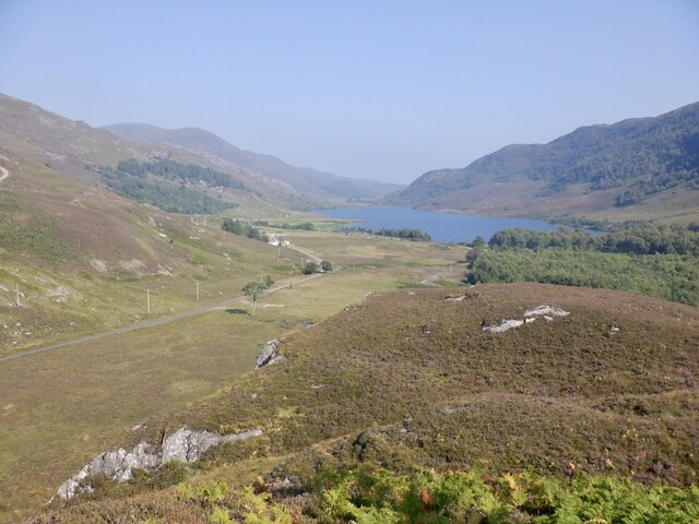
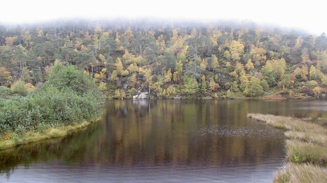
Loch Beannacharan is a picturesque freshwater lake located in Inverness-shire, Scotland. Covering an area of approximately 50 hectares, it is nestled amidst the stunning highland landscape, surrounded by rolling hills and dense forests. The loch is situated about 10 kilometers southeast of Inverness, making it easily accessible for both locals and visitors.

With crystal-clear waters and a tranquil ambiance, Loch Beannacharan is a popular destination for nature enthusiasts and outdoor lovers. It offers a range of recreational activities such as fishing, boating, and wildlife observation. The lake is home to a variety of fish species, including brown trout and pike, making it a favored spot for anglers.

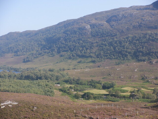
Surrounding the lake, there are several patches of freshwater marshes, which provide important habitats for a diverse range of plant and animal species. These marshes are characterized by their lush vegetation, including reeds, rushes, and water lilies. They serve as breeding grounds and sanctuaries for numerous bird species, including ducks, swans, and herons. During the spring and summer months, the marshes come alive with vibrant colors and the melodious sounds of birdsong.

The tranquility and natural beauty of Loch Beannacharan make it an ideal place for peaceful walks and picnics. Visitors can enjoy panoramic views of the surrounding hills and the shimmering waters of the loch. The area is also well-maintained, with designated pathways and seating areas, allowing visitors to fully immerse themselves in the beauty of the Scottish Highlands.

If you have any feedback on the listing, please let us know in the comments section below.

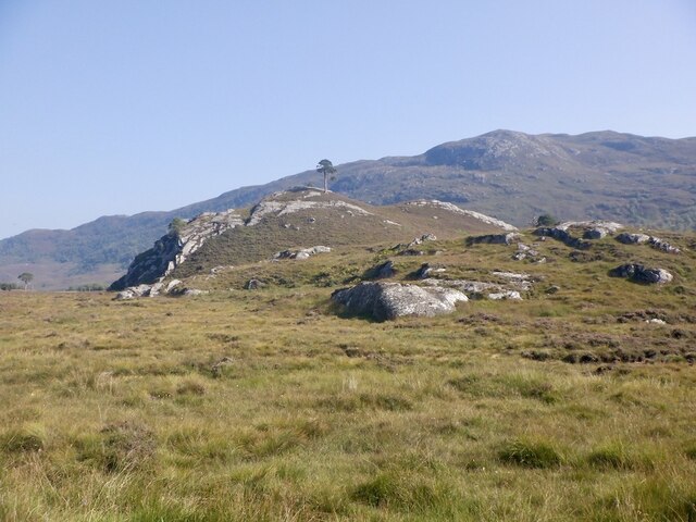
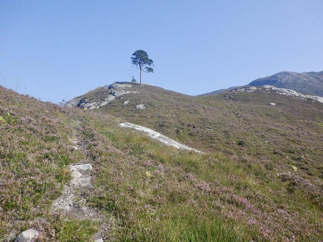
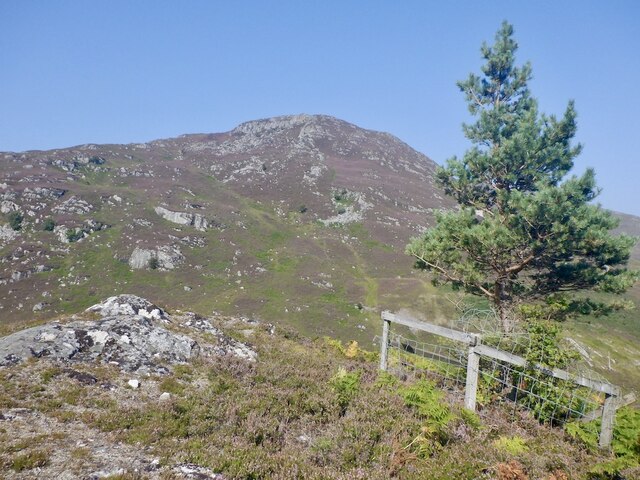
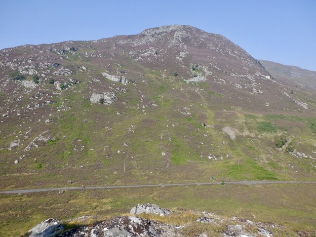
Loch Beannacharan Images

Images are sourced within 2km of 57.409126/-4.8237305 or Grid Reference NH3038. Thanks to Geograph Open Source API. All images are credited.

Tom a' Mhein Named after a "lead" mine on its southern side, this distinctive wee hill with the pine is a fine viewpoint - once you get past the bog in the foreground. Conditions were very dry.

The "lead" on the Ordnance Survey map is graphite - pencil lead!
Tom a' Mhein
Named after a "lead" mine on its southern side, this distinctive wee hill with the pine is a fine viewpoint - once you get past the bog in the foreground. Conditions were very dry. The "lead" on the Ordnance Survey map is graphite - pencil lead!
Tom a' Mhein The distinctive lone pine on the hill now has a companion growing almost at the summit. A fine viewpoint.

The hill is named after the graphite mine to the south - the Ordnance Survey's lead is pencil lead.
Tom a' Mhein
The distinctive lone pine on the hill now has a companion growing almost at the summit. A fine viewpoint. The hill is named after the graphite mine to the south - the Ordnance Survey's lead is pencil lead.
Summit, Tom a' Mhein The distinctive lone pine on the hill now has a companion growing almost at the summit. A fine viewpoint.
Summit, Tom a' Mhein
The distinctive lone pine on the hill now has a companion growing almost at the summit. A fine viewpoint.
Creag a Bhruic and the Glen Strathfarrar road View northwards from the summit of Tom a' Mhein.
Creag a Bhruic and the Glen Strathfarrar road
View northwards from the summit of Tom a' Mhein.
View from Tom a' Mhein Looking down Glen Strathfarrar towards Loch Beannacharan.
View from Tom a' Mhein
Looking down Glen Strathfarrar towards Loch Beannacharan.
Meanders in the Farrar Towards Loch Beannacharan from Tom a' Mhein. The lower glen is still well wooded.
Meanders in the Farrar
Towards Loch Beannacharan from Tom a' Mhein. The lower glen is still well wooded.
Loch Beannacharan One of the lochs in Glen Strathfarrar
Loch Beannacharan
One of the lochs in Glen Strathfarrar
The Glen Strathfarrar road Passing Loch Beannacharan.
The Glen Strathfarrar road
Passing Loch Beannacharan.
Road by Loch Beannacharan The road up Glen Strathfarrar on a misty day, the tops of the hills hidden in the clouds.
Road by Loch Beannacharan
The road up Glen Strathfarrar on a misty day, the tops of the hills hidden in the clouds.
Loch Beannacharan, Glen Strathfarrar
Tom a' Mhein, Glen Strathfarrar
Birches beside Loch Beannacharan, Glen Strathfarrar
Pines, Craig nan Suidheag, Glen Strathfarrar
Loch Beannacharan Under low cloud which was breaking up.
Loch Beannacharan
Under low cloud which was breaking up.
Loch Beannacharan Glen Strathfarrar rises gently towards the cloud deck beyond the loch. Warmer humid air was being blown in from the east and I took a chance on the west end of Glen Strathfarrar being clear. It was.
Loch Beannacharan
Glen Strathfarrar rises gently towards the cloud deck beyond the loch. Warmer humid air was being blown in from the east and I took a chance on the west end of Glen Strathfarrar being clear. It was.
Bog, Glen Strathfarrar
Loch Beannacharan, Strathfarrar Loch Beannacharan is enlarged by a hydroelectric scheme and there is a narrow part of the new loch just upstream of the dam.
Loch Beannacharan, Strathfarrar
Loch Beannacharan is enlarged by a hydroelectric scheme and there is a narrow part of the new loch just upstream of the dam.
Flooded bog, Loch Beannacharan The loch has been enlarged by the Hydro.
Flooded bog, Loch Beannacharan
The loch has been enlarged by the Hydro.
Show me another place!

Loch Beannacharan is located at Grid Ref: NH3038 (Lat: 57.409126, Lng: -4.8237305)

Unitary Authority: Highland

Police Authority: Highlands and Islands

What 3 Words

///expiring.longingly.snore. Near Cannich, Highland

Related Wikis

Loch Beannacharan

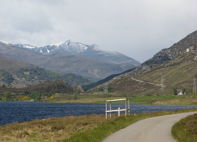
Loch Beannacharan is a freshwater loch in Glen Strathfarrar, situated roughly 9.5 kilometres (5.9 mi) west of the village of Struy. The loch sits on the...

Glen Strathfarrar

Glen Strathfarrar (Scottish Gaelic: Srath Farair) is a glen in the Highland region of Scotland, near Loch Ness. The Glen is part of the Affric-Beauly hydro...

Sgorr na Dìollaid

Sgorr na Dìollaid is a mountain in the Northwest Highlands of Scotland. It is situated between Glen Strathfarrar and Glen Cannich, 7 km north-west of the...

Càrn nan Gobhar (Strathfarrar)

Càrn nan Gobhar is a mountain rising to 992 metres (3,255 ft) in the Northwest Highlands of Scotland. It lies north of Glen Strathfarrar and south of Glen...

Related Videos

First Solo Wild Camp in the Remote Scottish Mountains

In today's video I will be doing my first EVER solo wildcamp, this includes a 35 mile "Bike & Hike" into a remote Scottish Glen, then ...

Glen Strathfarrar Munros Circuit | How to access and climb | Munro Bagging

Join Douglas as he heads into Glen Strathfarrar to bag the 4 Munros of Sgurr na Ruaidhe, Carn nan Gobhar, Sgurr a' Choire ...

Glen Strathfarrar

Glen Strathfarrar (Scottish Gaelic: Srath Farair) can be found in the Highland region of Scotland, near Loch Ness. Glen Strathfarrar ...

Ah Sithean a remote Corbett 9th July 2021

A video of a cycle up Glen Strathfarrer to Loch Monar and a walk and wild camp on way to An Sithdean. The first 4 minutes are ...

Nearby Amenities

Located within 500m of 57.409126,-4.8237305
Power: tower
Lat/Long: 57.4121864/-4.8249832
Power: tower
Lat/Long: 57.4114081/-4.8289591
Power: tower
Lat/Long: 57.4127121/-4.8215488
The data included in this document is from www.openstreetmap.org. The data is made available under ODbL.

Have you been to Loch Beannacharan?

Leave your review of Loch Beannacharan below (or comments, questions and feedback).