Loch nam Breac Buidhe

Lake, Pool, Pond, Freshwater Marsh in Sutherland

Scotland

Loch nam Breac Buidhe
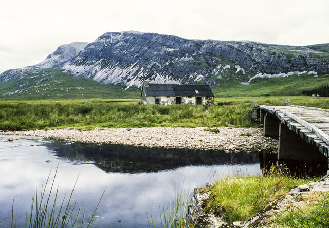
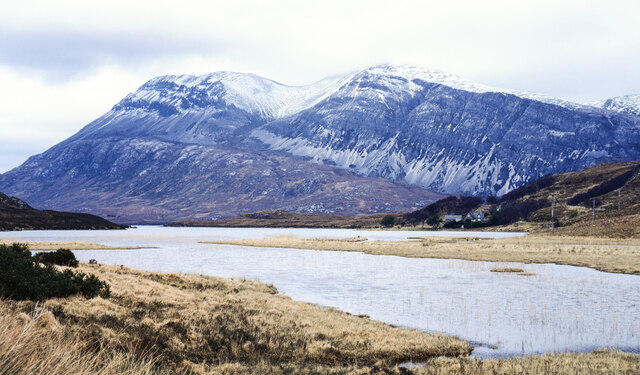
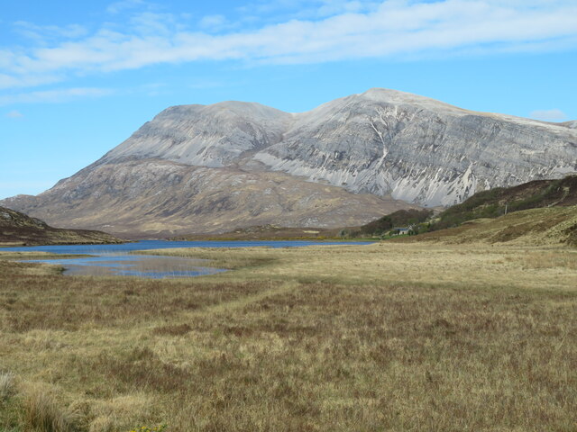
Lone in 1996 The bothy at Lone seen across the Abhainn an Loin with Arkle in the distance.
Jim Barton's image made in 2017 shows that there's been little obvious change over the intervening 21 years. <a title="https://www.geograph.org.uk/photo/5531727" href="https://www.geograph.org.uk/photo/5531727">Link</a>
Lone in 1996 Credit: Trevor Littlewood

The requested URL returned error: 429 Too Many Requests

If you have any feedback on the listing, please let us know in the comments section below.

Loch nam Breac Buidhe Images

Images are sourced within 2km of 58.320177/-4.8970453 or Grid Reference NC3040. Thanks to Geograph Open Source API. All images are credited.

Lone in 1996 The bothy at Lone seen across the Abhainn an Loin with Arkle in the distance.
Jim Barton's image made in 2017 shows that there's been little obvious change over the intervening 21 years. <a title="https://www.geograph.org.uk/photo/5531727" href="https://www.geograph.org.uk/photo/5531727">Link</a>
Lone in 1996
The bothy at Lone seen across the Abhainn an Loin with Arkle in the distance. Jim Barton's image made in 2017 shows that there's been little obvious change over the intervening 21 years. Link
Loch More, Achfary In high water the stepping stones <a href="https://www.geograph.org.uk/photo/1263564">NC3039 : Stepping stones and Bridge</a> had disappeared. At this water level, there is a very strong current running from Loch More through the narrows.There is a sign on the bridge warning against using it. While it might be unsafe, it does make a very picturesque feature between Loch More and Loch Ealachan, know locally as the Ghillies' Loch. This is the loch on which the estate workers are allowed to fish. This was very a productive occupation in the days when sea trout runs were several orders of magnitude greater that at present. Arkle is very impressive in the background.
Loch More, Achfary
In high water the stepping stones NC3039 : Stepping stones and Bridge had disappeared. At this water level, there is a very strong current running from Loch More through the narrows.There is a sign on the bridge warning against using it. While it might be unsafe, it does make a very picturesque feature between Loch More and Loch Ealachan, know locally as the Ghillies' Loch. This is the loch on which the estate workers are allowed to fish. This was very a productive occupation in the days when sea trout runs were several orders of magnitude greater that at present. Arkle is very impressive in the background.
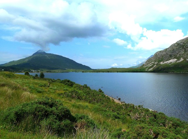
Loch More View Looking down Loch More towards Ben Stack. The cloud was already building into what turned out to be a huge downpour.
Loch More View
Looking down Loch More towards Ben Stack. The cloud was already building into what turned out to be a huge downpour.
Ben Stack and Loch More
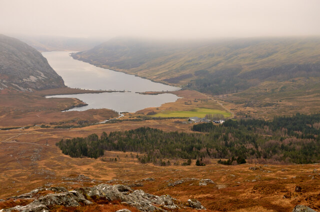
View over Achfary and Loch More, Sutherland Viewed from the eastern slope of Ben Stack.  Part of the Duke of Westminster's Estate in the Scottish Highlands.
View over Achfary and Loch More, Sutherland
Viewed from the eastern slope of Ben Stack. Part of the Duke of Westminster's Estate in the Scottish Highlands.
Southern end of Loch Stack The narrow, southern end of the loch seen from the A838 north of Achfary.
Arkle is the striking mountain.
Southern end of Loch Stack
The narrow, southern end of the loch seen from the A838 north of Achfary. Arkle is the striking mountain.
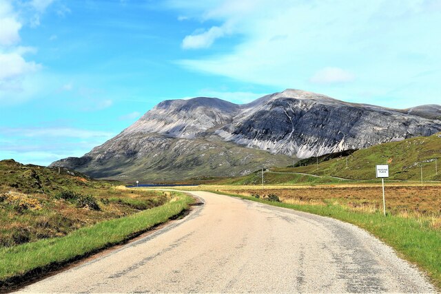
Arkle from An Earachd Arkle from the A838 at An Earachd.
Arkle from An Earachd
Arkle from the A838 at An Earachd.
Head of Loch Stack Near this point the superb mountain that is Arkle comes into view for travellers heading NW on A838.
Head of Loch Stack
Near this point the superb mountain that is Arkle comes into view for travellers heading NW on A838.
A838 towards Laxford Bridge
Boggy path on Ben Stack
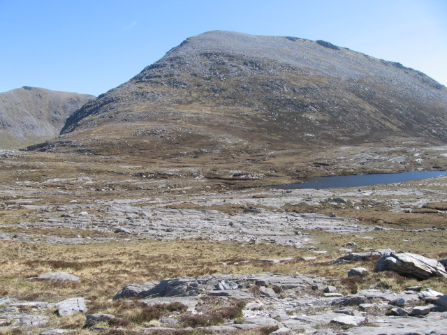
Ben Screavie North western slopes near Loch nam Breac Buidhe.
Ben Screavie
North western slopes near Loch nam Breac Buidhe.
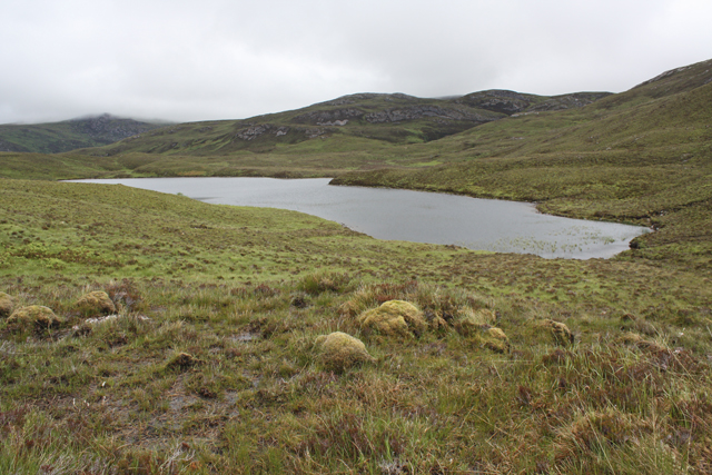
Loch nam Breac Buidhe Surrounded by boggy moorland north of Ben Screavie.
Loch nam Breac Buidhe
Surrounded by boggy moorland north of Ben Screavie.
Tree and Allt
Tree and Allt
Monarchs of the Glen Close to a feeding station on the Reay estate
Monarchs of the Glen
Close to a feeding station on the Reay estate
Arkle Approach Walking in towards Arkle which at this point seems a long way off.
Arkle Approach
Walking in towards Arkle which at this point seems a long way off.
An inlet of Loch Stack Arkle Rises behind
An inlet of Loch Stack
Arkle Rises behind
Track to Lone
Track to Lone
Show me another place!

Loch nam Breac Buidhe is located at Grid Ref: NC3040 (Lat: 58.320177, Lng: -4.8970453)

Unitary Authority: Highland

Police Authority: Highlands and Islands

What 3 Words

///habits.afflict.civil. Near Inchnadamph, Highland

Nearby Locations

Loch nam Breac Buidhe

Related Wikis

Achfary

Achfary (Scottish Gaelic: Achadh Taigh Phairidh) is a hamlet in the Scottish council area of Highland. To the east of the village lies Loch nan Ealachan...

A838 road

The A838 is a major road in Sutherland, in the Highland area of Scotland. It runs generally northwest from the A836 in the Lairg area to Laxford Bridge...

Ben Stack

Ben Stack (Scottish Gaelic: Beinn Stac) is a mountain in Sutherland, in the northwest of Scotland. It is 721 m (2,365 ft) high. It lies southeast of Laxford...

Meallan Liath Coire Mhic Dhùghaill

Meallan Liath Coire Mhic Dhughaill (801 m) is a mountain in the Northwest Highlands, Scotland. It lies in the far north of Scotland between Lairg and Durness...

Have you been to Loch nam Breac Buidhe?

Leave your review of Loch nam Breac Buidhe below (or comments, questions and feedback).