Gryfe Reservoir Number 2
Lake, Pool, Pond, Freshwater Marsh in Renfrewshire
Scotland
Gryfe Reservoir Number 2

Gryfe Reservoir Number 2 is a freshwater body located in Renfrewshire, Scotland. It is classified as a reservoir, serving as a water storage facility. The reservoir was built to meet the growing demand for water supply in the area.
Spread across an area of approximately [Insert Size], Gryfe Reservoir Number 2 is surrounded by lush greenery and offers a serene and picturesque landscape. The reservoir is fed by natural streams and rainfall, ensuring a constant supply of freshwater. It serves as a vital source of water for various purposes, including agriculture, drinking water, and industrial use.
The reservoir is home to a diverse range of aquatic flora and fauna. The calm waters provide a suitable habitat for numerous species of fish, including trout, pike, and perch. Additionally, water birds such as ducks, swans, and herons can be spotted along the shores of the reservoir.
Gryfe Reservoir Number 2 also plays a crucial role in flood prevention, as it helps regulate water levels during periods of heavy rainfall. It has a well-maintained dam and spillway system that ensures controlled water flow.
The reservoir is a popular spot for recreational activities such as fishing, boating, and birdwatching. Fishing enthusiasts can enjoy a peaceful day on the water, while nature lovers can explore the diverse wildlife that thrives in and around the reservoir.
Overall, Gryfe Reservoir Number 2 is a significant freshwater body in Renfrewshire, providing essential water resources for various purposes and offering a tranquil environment for both humans and wildlife to enjoy.
If you have any feedback on the listing, please let us know in the comments section below.
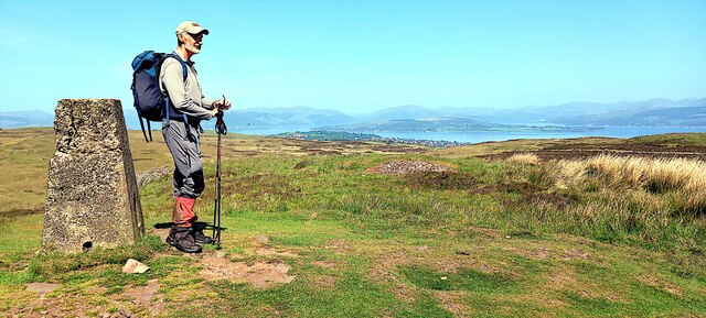
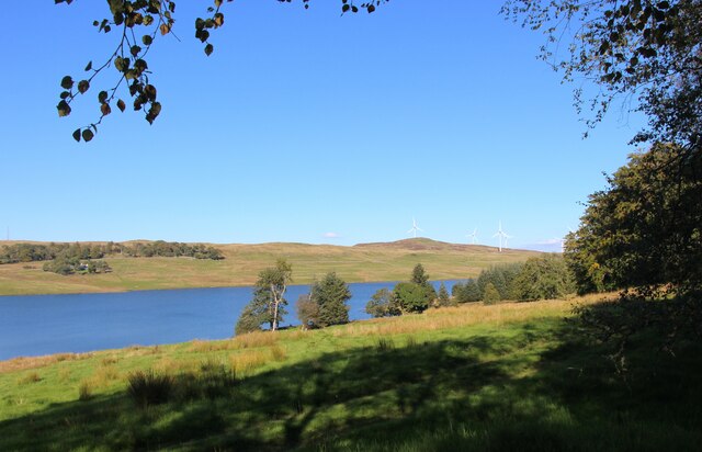
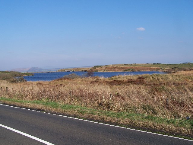
Gryfe Reservoir Number 2 Images
Images are sourced within 2km of 55.909006/-4.7333027 or Grid Reference NS2971. Thanks to Geograph Open Source API. All images are credited.


![Remains of enclosures See <a href="https://www.geograph.org.uk/photo/1853572">NS2973 : Lurg Moor Roman fortlet</a> for a discussion of various other antiquities located nearby on the moor, with links to photographs. Compared to some of those sites, the remains shown in the present photograph are less conspicuous, but they are shown on the 1:25000 OS map.
Several enclosures have been reported in the immediate vicinity of this one, but the remains shown in this photograph are the easiest to pick out visually. See <span class="nowrap"><a title="https://canmore.org.uk/site/41340/burnhead-moor" rel="nofollow ugc noopener" href="https://canmore.org.uk/site/41340/burnhead-moor">Link</a><img style="margin-left:2px;" alt="External link" title="External link - shift click to open in new window" src="https://s1.geograph.org.uk/img/external.png" width="10" height="10"/></span> (at Canmore) for further details; the subject of this photograph is structure &quot;A&quot; in that report, the D-shaped enclosure. Structures &quot;A&quot; and &quot;B&quot; together make up the enclosures that are depicted on the 1:25000 map.
[See <span class="nowrap"><a title="https://www.google.com/maps/d/viewer?mid=1Np6emNB53CxbNJmyJ_LicpxJvus&amp;ll=55.915499%2C-4.72162400000002&amp;z=19" rel="nofollow ugc noopener" href="https://www.google.com/maps/d/viewer?mid=1Np6emNB53CxbNJmyJ_LicpxJvus&amp;ll=55.915499%2C-4.72162400000002&amp;z=19">Link</a><img style="margin-left:2px;" alt="External link" title="External link - shift click to open in new window" src="https://s1.geograph.org.uk/img/external.png" width="10" height="10"/></span> for an annotated satellite image (zoom out for other antiquities located nearby). The satellite view shows some other interesting details nearby: for example, only 60 metres ESE is another feature, the form of two overlapping circles: I examined that area on a later visit: <a href="https://www.geograph.org.uk/photo/2089851">NS3072 : Possible hut circles on Burnhead Moor</a>.]
The present photograph shows two ridges, both greener than the surrounding moor, but with some dark tussocks along their course. The nearer one is straight, and the more distant one is curved into a C-shape, with the open side toward the photographer, so that they are arranged (very roughly) as &quot;C|&quot;.
In the foreground, just below the centre of the photograph, part of the nearer (straight) ridge runs across the width of the image, sloping upwards to the right. Behind it is the other (curved) ridge. Only one half of its C-shape is seen in this view; the near end of that arm of the ridge is to the left of and slightly above the centre of the photograph. From there, the ridge can be followed to the right-hand edge of the picture.
Providing confirmation of the view direction, Corlic Hill (called Corlick Hill on the OS map) appears centrally on the skyline.](https://s3.geograph.org.uk/geophotos/01/85/55/1855511_63674562.jpg)

![Sluice gate on the Devol Burn This photograph shows one of a pair of sluice gates located on the course of the Devol Burn. Just beyond the left-hand side of the sluice, another part of the burn can be seen joining this one from the right. The other sluice gate is located further up that part of the burn; compare <a href="https://www.geograph.org.uk/photo/2089519">NS3073 : Sluice gate on the Devol Burn</a>.
The foreground section of the burn had itself been diverted here by a wall that is located just 60m to the NNW, and which is shown in <a href="https://www.geograph.org.uk/photo/2089523">NS3073 : Old water valve beside the Devol Burn</a>.
See <a href="https://www.geograph.org.uk/photo/2089231">NS3073 : Auchmountain Road</a> for a view along the section of road that can be seen in the background.
[The first-edition OS map (c.1860) refers to the burn by its present name, Devol Burn, but earlier maps show some variation in the name. For example, John Ainslie&#039;s 1796 map shows the lower part of its course, the present-day <a href="https://www.geograph.org.uk/photo/1661703">NS3074 : Devol Glen</a>, as &quot;Divels Glen&quot;, while Roy&#039;s Military Survey of Scotland (1740s-50s) shows &quot;Devils Glen&quot;.]](https://s1.geograph.org.uk/geophotos/02/08/95/2089517_21f8d831.jpg)


![Possible hut circles on Burnhead Moor [Update: on the nature of what is shown here, the following comments refer to a field visit made by professional archaeologists in 2012: &quot;It is possible that both features ... are the remains of hut platforms, but they are equally likely to be the result of geology and natural vegetation cover&quot;. One of the main reasons for my submitting possible finds is so that they can be properly assessed, and I am glad that this has occurred.]
A number of hut circles and ancient enclosures have already been reported from these moors. The majority of these discoveries were made by the Renfrewshire archaeologist Frank Newall.
Three such sites are known from the immediate vicinity of the area shown in this photograph; for those reports, see (1) <span class="nowrap"><a title="https://canmore.org.uk/site/41340/burnhead-moor" rel="nofollow ugc noopener" href="https://canmore.org.uk/site/41340/burnhead-moor">Link</a><img style="margin-left:2px;" alt="External link" title="External link - shift click to open in new window" src="https://s1.geograph.org.uk/img/external.png" width="10" height="10"/></span> (2) <span class="nowrap"><a title="https://canmore.org.uk/site/41375/burnhead-moor" rel="nofollow ugc noopener" href="https://canmore.org.uk/site/41375/burnhead-moor">Link</a><img style="margin-left:2px;" alt="External link" title="External link - shift click to open in new window" src="https://s1.geograph.org.uk/img/external.png" width="10" height="10"/></span> (3) <span class="nowrap"><a title="https://canmore.org.uk/site/42449/burnhead-moor-hut-circle" rel="nofollow ugc noopener" href="https://canmore.org.uk/site/42449/burnhead-moor-hut-circle">Link</a><img style="margin-left:2px;" alt="External link" title="External link - shift click to open in new window" src="https://s1.geograph.org.uk/img/external.png" width="10" height="10"/></span> (all at Canmore). The first of those reports corresponds to <a href="https://www.geograph.org.uk/photo/1855511">NS3072 : Remains of enclosures</a>; the other two are about sites just to the north and west of those enclosures.
However, the rather faint feature that is shown in this photograph lies about 65 metres to the east of the enclosures; it seems, therefore, that this particular site had not been reported until now. It is noticeable on some satellite imagery (although to what extent very much depends on when those images were taken); see the link in the end-note for a satellite view centred on this feature.
The NW circle of the pair is shown here at the centre of the photograph, and it fills most of the width of the image. For a view from a different angle, see <a href="https://www.geograph.org.uk/photo/2089865">NS3072 : Possible hut circles on Burnhead Moor</a>. The area is flat, and falls away at its northern rocky edge. In both photographs, traces of a low circular ridge can be seen on the elevated upper surface (most notably at the link just cited).
These circular features might be hut circles (the conventional name given to the remains of roundhouses – circular dwellings of various kinds – dating from the late Bronze Age or early Iron Age); if this interpretation is correct, then the overlapping circles indicate that a later building was erected on almost the same spot as an earlier one (a good location was likely to be re-used). As mentioned above, several rather more visible hut circles have already been recorded from other parts of the moor (see <a href="https://www.geograph.org.uk/photo/1853572">NS2973 : Lurg Moor Roman fortlet</a> for the relevant links).
The area shown in the present photograph is flat, and is slightly elevated above the surrounding moorland; it would have provided an ideal platform for a dwelling. However, the traces visible on the ground here are slight, and it would take a more expert appraisal than mine to definitely identify them as genuine hut circles. Nevertheless, the feature shown in the present photograph may merit further examination; to that end, I have submitted a report to WoSAS (that report also includes the feature described below).
Similar circular features can be seen nearby; one of them is located just 55 metres to the east: <a href="https://www.geograph.org.uk/photo/2089891">NS3072 : Possible hut circle on Burnhead Moor</a>.](https://s3.geograph.org.uk/geophotos/02/08/98/2089851_3b668788.jpg)
Gryfe Reservoir Number 2 is located at Grid Ref: NS2971 (Lat: 55.909006, Lng: -4.7333027)
Unitary Authority: Inverclyde
Police Authority: Renfrewshire and Inverclyde
What 3 Words
///pelted.penny.earphones. Near Port Glasgow, Inverclyde
Nearby Locations
Related Wikis

Gryffe Reservoirs
The Gryffe Reservoirs, also spelled 'Gryfe', take their name from the River Gryffe, name deriving from the Gaelic garbh meaning "rough stream". are two...

Inverclyde (UK Parliament constituency)
Inverclyde is a parliamentary constituency of the House of Commons of the Parliament of the United Kingdom. It replaced Greenock and Inverclyde and the...

Inverclyde
Inverclyde (Scots: Inerclyde, Scottish Gaelic: Inbhir Chluaidh, pronounced [iɲiɾʲˈxl̪ˠuəj], "mouth of the Clyde") is one of 32 council areas used for local...

Easter Greenock Castle
Easter Greenock Castle was a castle of unknown design near the burgh of Greenock, Scotland. == History == === Construction and location === Built sometime...
Nearby Amenities
Located within 500m of 55.909006,-4.7333027Have you been to Gryfe Reservoir Number 2?
Leave your review of Gryfe Reservoir Number 2 below (or comments, questions and feedback).