Aylesbeare

Settlement in Devon East Devon

England

Aylesbeare

Barn at Froginwell Vineyard Vineyard and hospitality venue
Barn at Froginwell Vineyard Credit: David Smith

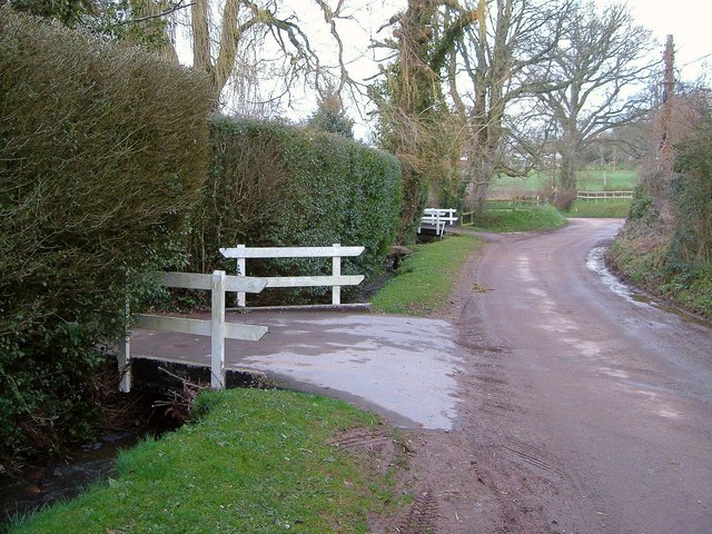
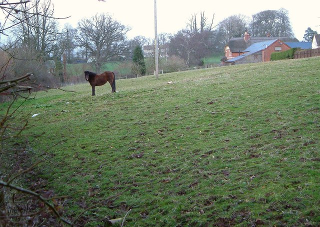
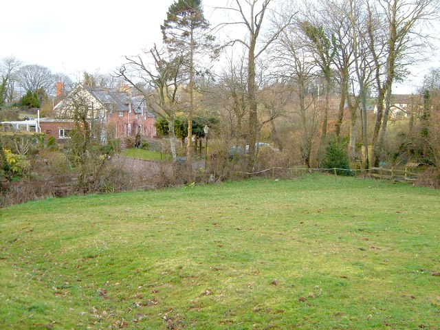
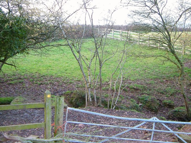
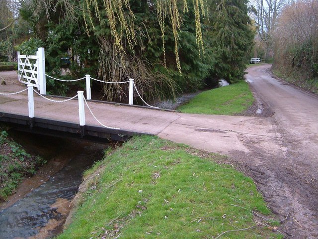
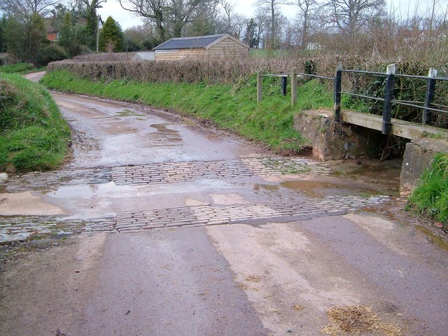
Aylesbeare is a small village located in the county of Devon, England. Situated approximately 10 miles east of the city of Exeter, Aylesbeare is nestled within the East Devon Area of Outstanding Natural Beauty. The village is surrounded by picturesque countryside, with rolling hills and lush green fields, providing a serene and idyllic setting.

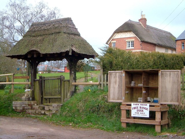
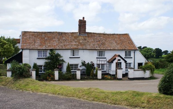
The history of Aylesbeare dates back centuries, with evidence of human habitation in the area since the Neolithic period. The village itself is known for its charming thatched-roof cottages, which add to its traditional English village ambiance.

Despite its small size, Aylesbeare boasts a strong sense of community, with a local pub, village hall, and a primary school at its heart. The village is also home to the renowned Aylesbeare Common, a nature reserve managed by the Royal Society for the Protection of Birds (RSPB). This reserve is a haven for wildlife, including rare bird species such as the nightjar and the Dartford warbler.

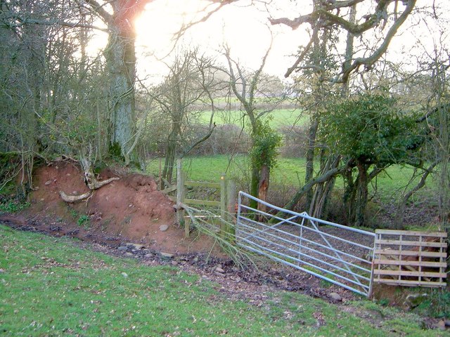
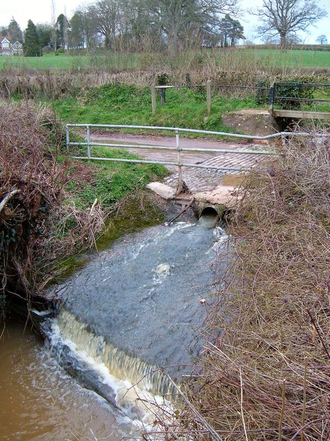
For outdoor enthusiasts, Aylesbeare offers numerous walking trails and paths, allowing visitors to explore the stunning countryside and enjoy breathtaking views. The nearby East Devon coast is also easily accessible, providing opportunities for scenic walks along the South West Coast Path and visits to sandy beaches.

Overall, Aylesbeare is a tranquil and picturesque village, perfect for those seeking a peaceful retreat amidst the natural beauty of Devon.

If you have any feedback on the listing, please let us know in the comments section below.

Aylesbeare Images

Images are sourced within 2km of 50.717305/-3.362853 or Grid Reference SY0391. Thanks to Geograph Open Source API. All images are credited.

Barn at Froginwell Vineyard Vineyard and hospitality venue
Barn at Froginwell Vineyard
Vineyard and hospitality venue
Vines at Froginwell Vineyard  Besides the vines, this is a hospitality venue
Vines at Froginwell Vineyard
Besides the vines, this is a hospitality venue
A pond in a field Podgers pit junction.
Close to the B3180 and Harp Lane.
A pond in a field
Podgers pit junction. Close to the B3180 and Harp Lane.
Harp Lane junction Linked to the B3180 at the strangely named Podgers Pit.
Harp Lane junction
Linked to the B3180 at the strangely named Podgers Pit.
Bridges at Perkin's Village Giving access to properties over a tiny roadside stream.
Bridges at Perkin's Village
Giving access to properties over a tiny roadside stream.
Pasture at Perkin's Village I doubt if this creature still grazes this meadow. The listed farmhouse of  Rosamondford <span class="nowrap"><a title="http://www.historicengland.org.uk/listing/the-list/list-entry/1328733" rel="nofollow ugc noopener" href="http://www.historicengland.org.uk/listing/the-list/list-entry/1328733">Link</a><img style="margin-left:2px;" alt="External link" title="External link - shift click to open in new window" src="https://s1.geograph.org.uk/img/external.png" width="10" height="10"/></span> is on the hillside beyond.
Pasture at Perkin's Village
I doubt if this creature still grazes this meadow. The listed farmhouse of Rosamondford LinkExternal link is on the hillside beyond.
Meadow, Perkin's Village Crossed by Farringdon Footpath 11 which meets the lane through the village just across a stream among the trees on the right.
Meadow, Perkin's Village
Crossed by Farringdon Footpath 11 which meets the lane through the village just across a stream among the trees on the right.
Footpath, Perkin's Village Someone's seems anxious to stop the stile being used. I wonder how things look now? This is Farringdon Footpath 11, crossing its second stream in less than 100 metres.
Footpath, Perkin's Village
Someone's seems anxious to stop the stile being used. I wonder how things look now? This is Farringdon Footpath 11, crossing its second stream in less than 100 metres.
Footpath, Perkin's Village See <a href="https://www.geograph.org.uk/photo/4824537">SY0291 : Footpath, Perkin's Village</a>. Farringdon Footpath 11 doesn't cross the further stream here (that would be three streams in less than 100 metres) but, as the waymark suggests, turns left if you've made it over stile or through gate.
Footpath, Perkin's Village
See SY0291 : Footpath, Perkin's Village. Farringdon Footpath 11 doesn't cross the further stream here (that would be three streams in less than 100 metres) but, as the waymark suggests, turns left if you've made it over stile or through gate.
Bridge at Perkin's Village Another, rather graceful, bridge just along the lane from those in <a href="https://www.geograph.org.uk/photo/4824454">SY0291 : Bridges at Perkin's Village</a>, one of which can be seen in the background. Willow leaves are just coming out.
Bridge at Perkin's Village
Another, rather graceful, bridge just along the lane from those in SY0291 : Bridges at Perkin's Village, one of which can be seen in the background. Willow leaves are just coming out.
Eggs for sale, Perkin's Village Beef too, according to the notice. Beside the stall is a thatched gateway to the listed Rosamondford Farm <span class="nowrap"><a title="http://www.historicengland.org.uk/listing/the-list/list-entry/1328733" rel="nofollow ugc noopener" href="http://www.historicengland.org.uk/listing/the-list/list-entry/1328733">Link</a><img style="margin-left:2px;" alt="External link" title="External link - shift click to open in new window" src="https://s1.geograph.org.uk/img/external.png" width="10" height="10"/></span>.
Eggs for sale, Perkin's Village
Beef too, according to the notice. Beside the stall is a thatched gateway to the listed Rosamondford Farm LinkExternal link.
Ford, Perkin's Village A winter version of the late summer scene in <a href="https://www.geograph.org.uk/photo/3692283">SY0291 : Ford at Perkin's Village and Rosamondford</a>; the ford also appears in <a title="https://www.geograph.org.uk/search.php?i=60964649" href="https://www.geograph.org.uk/search.php?i=60964649">Link</a> .
Ford, Perkin's Village
A winter version of the late summer scene in SY0291 : Ford at Perkin's Village and Rosamondford; the ford also appears in Link .
Stream, Perkin's Village The stream emerges from a culvert beneath the ford shown in <a href="https://www.geograph.org.uk/photo/143290">SY0291 : Ford at Perkins Village</a> and drops over a small weir.
Stream, Perkin's Village
The stream emerges from a culvert beneath the ford shown in SY0291 : Ford at Perkins Village and drops over a small weir.
Ford, Perkin's Village A reverse view of <a href="https://www.geograph.org.uk/photo/4824625">SY0291 : Ford, Perkin's Village</a>, with Rosamondford Farm behind on the left and Ford Cottage on the right.
Ford, Perkin's Village
A reverse view of SY0291 : Ford, Perkin's Village, with Rosamondford Farm behind on the left and Ford Cottage on the right.
Rill Farm A fine seven-bay façade for this farmhouse by the lane north of Perkin's Village.
Rill Farm
A fine seven-bay façade for this farmhouse by the lane north of Perkin's Village.
Lych gate and church, Aylesbeare And the path between them. The lych gate is described at <span class="nowrap"><a title="http://www.historicengland.org.uk/listing/the-list/list-entry/1141430" rel="nofollow ugc noopener" href="http://www.historicengland.org.uk/listing/the-list/list-entry/1141430">Link</a><img style="margin-left:2px;" alt="External link" title="External link - shift click to open in new window" src="https://s1.geograph.org.uk/img/external.png" width="10" height="10"/></span> , the grade II* listed church at <span class="nowrap"><a title="http://www.historicengland.org.uk/listing/the-list/list-entry/1328734" rel="nofollow ugc noopener" href="http://www.historicengland.org.uk/listing/the-list/list-entry/1328734">Link</a><img style="margin-left:2px;" alt="External link" title="External link - shift click to open in new window" src="https://s1.geograph.org.uk/img/external.png" width="10" height="10"/></span> .
Lych gate and church, Aylesbeare
And the path between them. The lych gate is described at LinkExternal link , the grade II* listed church at LinkExternal link .
Rag Lane, Westcott Another view along the charming row of buildings shown in <a href="https://www.geograph.org.uk/photo/3088185">SY0393 : Rag Lane, Westcott</a>.
Rag Lane, Westcott
Another view along the charming row of buildings shown in SY0393 : Rag Lane, Westcott.
Lion, Rockbeare Manor One of the lions shown in <a href="https://www.geograph.org.uk/photo/143954">SY0394 : Entrance to Rockbeare Manor</a>, sejant atop its gate pier <span class="nowrap"><a title="http://www.historicengland.org.uk/listing/the-list/list-entry/1141387" rel="nofollow ugc noopener" href="http://www.historicengland.org.uk/listing/the-list/list-entry/1141387">Link</a><img style="margin-left:2px;" alt="External link" title="External link - shift click to open in new window" src="https://s1.geograph.org.uk/img/external.png" width="10" height="10"/></span> .
Lion, Rockbeare Manor
One of the lions shown in SY0394 : Entrance to Rockbeare Manor, sejant atop its gate pier LinkExternal link .
Show me another place!

Aylesbeare is located at Grid Ref: SY0391 (Lat: 50.717305, Lng: -3.362853)

Administrative County: Devon

District: East Devon

Police Authority: Devon and Cornwall

What 3 Words

///flagpole.honeybees.overruns. Near Newton Poppleford, Devon

Nearby Locations

Aylesbeare

Related Wikis

Aylesbeare

Aylesbeare is a village and civil parish in the East Devon district of Devon, England, 8 miles (13 km) east of Exeter. According to the 2001 census the...

Nutwalls

Nutwalls is a hamlet in Devon, England. It is located 9 miles (14 km) south-east of Exeter, close to Aylesbeare. Two cottages built in the 18th century...

Allercombe

Allercombe is a hamlet in east Devon, England. It lies just south of the A30 road between the villages of Whimple and Aylesbeare.

Marsh Green, Devon

Marsh Green is a small village about 8 miles east of Exeter and 4 miles west of Ottery St Mary in East Devon, England, at OS grid reference SY042936....

Farringdon, Devon

Farringdon is a village, civil parish and former manor in the district of East Devon in the county of Devon, England. The parish is surrounded clockwise...
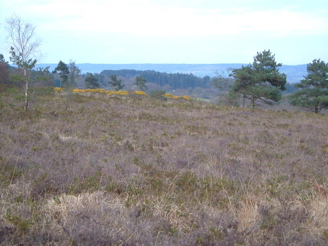
Aylesbeare Common

Aylesbeare Common is a protected area in Devon, England. It is composed largely of heathland and woodland, interspersed with a few streams and ponds....

Fire Beacon Hill

Fire Beacon Hill is a Local Nature Reserve in East Devon, England. It is registered as Common land and known as Harpford Common. Sidmouth Town Council...

West Hill, Devon

West Hill is a village in the East Devon district of Devon, England. The village lies approximately 2 miles south west of Ottery St Mary, its nearest town...

Nearby Amenities

Located within 500m of 50.717305,-3.362853
Barrier: stile
Lat/Long: 50.7145271/-3.3614745
Barrier: stile
Lat/Long: 50.719927/-3.3662159
Barrier: kissing_gate
Lat/Long: 50.7195153/-3.3647337
Pub
The NightJar
Addr City: Exeter
Addr Housename: The Nightjar
Addr Postcode: EX5 2BX
Addr Street: Village Way
Outdoor Seating: yes
Wikidata: Q70628188
Lat/Long: 50.7174135/-3.3629726
Telephone
Lat/Long: 50.7185846/-3.36361
Bus Stop
Bus: yes
Public Transport: platform
Lat/Long: 50.7206224/-3.3627688
Post Box
Lat/Long: 50.7204974/-3.3627345
Post Box
Lat/Long: 50.7171826/-3.3625113
Design: barrel
Location Transition: yes
Power: tower
Lat/Long: 50.7181928/-3.3681089
Aylesbeare
Place: village
Wikidata: Q11687118
Wikipedia: en:Aylesbeare
Lat/Long: 50.720377/-3.3628433
Power: pole
Lat/Long: 50.7153984/-3.3689404
Power: pole
Lat/Long: 50.7143785/-3.3667892
Power: pole
Lat/Long: 50.7137841/-3.3655031
Power: pole
Lat/Long: 50.7130589/-3.3639957
The data included in this document is from www.openstreetmap.org. The data is made available under ODbL.

Have you been to Aylesbeare?

Leave your review of Aylesbeare below (or comments, questions and feedback).