Am Fiar-Loch

Lake, Pool, Pond, Freshwater Marsh in Ross-shire

Scotland

Am Fiar-Loch

Summit, Beinn Mheadhoin The summit of Beinn Mheadhoin is a short narrow ridge of rock on a plateau.
Summit, Beinn Mheadhoin Credit: Richard Webb

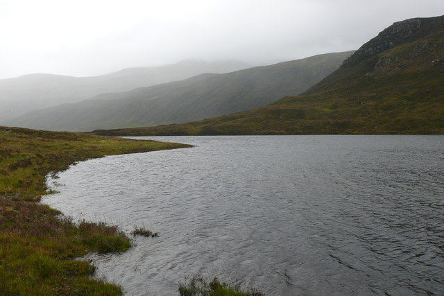
Am Fiar-Loch, located in Ross-shire, Scotland, is a picturesque freshwater loch nestled in a serene and natural setting. Spanning an area of approximately 10 hectares, it is a popular destination for nature enthusiasts and offers a tranquil retreat from the hustle and bustle of urban life.

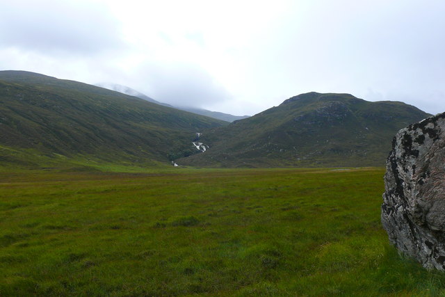
Surrounded by rolling hills and dense woodlands, Am Fiar-Loch boasts crystal-clear waters that reflect the stunning landscape around it. The loch is fed by several small streams, which contribute to its pristine condition and provide a habitat for a diverse range of aquatic flora and fauna.

The shoreline of Am Fiar-Loch is predominantly rocky, adorned with vibrant green moss and lichen-covered stones. This rocky terrain creates an ideal habitat for various species of waterfowl, including ducks, geese, and swans, which can often be spotted gracefully gliding across the water's surface.

In addition to its natural beauty, Am Fiar-Loch is also home to a rich ecosystem of freshwater plants. Water lilies, reeds, and rushes thrive in the shallower areas, creating a lush and vibrant environment. These plants not only provide shelter and food for the resident wildlife but also add to the loch's aesthetic appeal.

Visitors to Am Fiar-Loch can enjoy a range of activities, including fishing, birdwatching, and walking along the well-maintained trails that surround the loch. There are also designated picnic areas, allowing visitors to relax and soak in the peaceful ambiance while enjoying a meal or snack.

Am Fiar-Loch truly offers a haven of tranquility and natural beauty, making it a must-visit destination for those seeking a peaceful escape in the heart of Ross-shire.

If you have any feedback on the listing, please let us know in the comments section below.
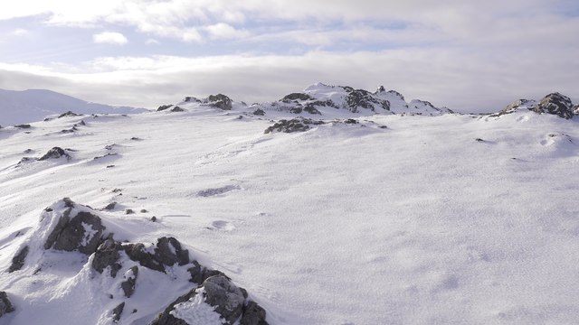
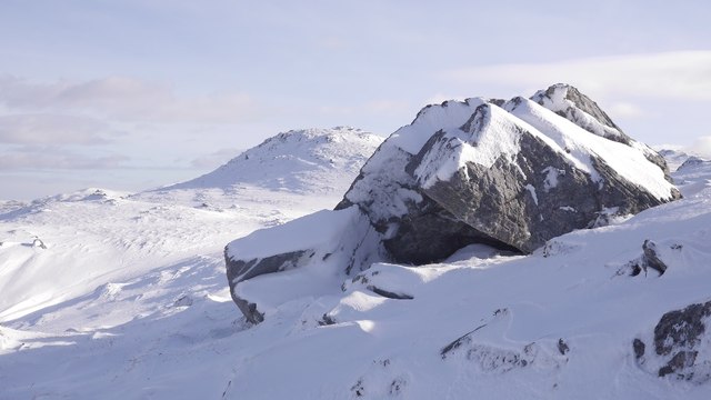
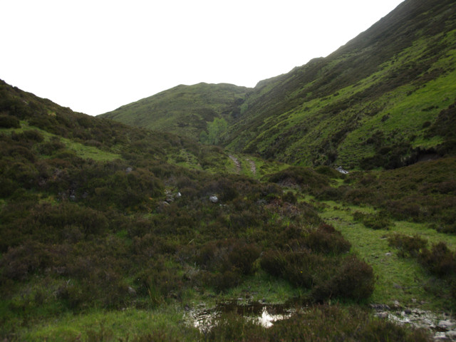
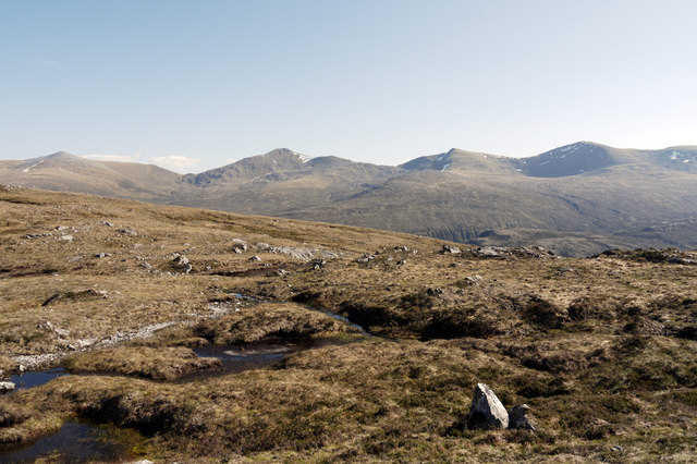
Am Fiar-Loch Images

Images are sourced within 2km of 57.475207/-4.9219713 or Grid Reference NH2446. Thanks to Geograph Open Source API. All images are credited.

Summit, Beinn Mheadhoin The summit of Beinn Mheadhoin is a short narrow ridge of rock on a plateau.
Summit, Beinn Mheadhoin
The summit of Beinn Mheadhoin is a short narrow ridge of rock on a plateau.
The summit, Beinn Mheadhoin The 665m summit of Beinn Mheadhoin, between Glen Orrin and Strathconon.
The summit, Beinn Mheadhoin
The 665m summit of Beinn Mheadhoin, between Glen Orrin and Strathconon.
Plateau, Beinn Mheadhoin The high ground of Beinn Mheadhoin seen from by the summit rock with Carn nan Gobhar and  Sgùrr a' Choire Ghlais in the background.
Plateau, Beinn Mheadhoin
The high ground of Beinn Mheadhoin seen from by the summit rock with Carn nan Gobhar and Sgùrr a' Choire Ghlais in the background.
View south from Beinn Mheadhoin Several Glen Orrin and Strathfarrar tops along a high ridge  (left to right: Sgùrr a' Choire Ghlais  Creag Ghorm a' Bhealaich, Sgùrr Fhuar-thuill and Sgùrr na Fearstaig.)
View south from Beinn Mheadhoin
Several Glen Orrin and Strathfarrar tops along a high ridge (left to right: Sgùrr a' Choire Ghlais Creag Ghorm a' Bhealaich, Sgùrr Fhuar-thuill and Sgùrr na Fearstaig.)
Beinn Mheadhoin summit plateau East of the summit with some rocky terrain and presumably under the snow and ice, wet ground.
Beinn Mheadhoin summit plateau
East of the summit with some rocky terrain and presumably under the snow and ice, wet ground.
Rocky ground on Beinn Mheadhoin The summit plateau of Beinn Mheadhoin is scattered with rocky outcrops and boulders.
Rocky ground on Beinn Mheadhoin
The summit plateau of Beinn Mheadhoin is scattered with rocky outcrops and boulders.
Summit plateau, Beinn Mheadhoin Hummocky ground, often rocky, beneath a coating of high quality and easy to walk on snow.  The skyline is much higher, the ridge on the other side of Glen Orrin.
Summit plateau, Beinn Mheadhoin
Hummocky ground, often rocky, beneath a coating of high quality and easy to walk on snow. The skyline is much higher, the ridge on the other side of Glen Orrin.
River Orrin
River Orrin
Track in Gleann Chorainn Track in Gleann Chorainn.
Track in Gleann Chorainn
Track in Gleann Chorainn.
Track in Gleann Chorainn Track in Gleann Chorainn.
Track in Gleann Chorainn
Track in Gleann Chorainn.
Pool on subsidiary top of Beinn Mheadhoin The western top of Beinn Mheadhoin may be lower than the main summit but it's a splendid location with a number of pools and rock outcrops. Three of the four Strathfarrar Munros are seen distantly to the south.
Pool on subsidiary top of Beinn Mheadhoin
The western top of Beinn Mheadhoin may be lower than the main summit but it's a splendid location with a number of pools and rock outcrops. Three of the four Strathfarrar Munros are seen distantly to the south.
Western slopes of Beinn Mheadhoin The western slopes of Beinn Mheadhoin rise gently towards the mountain's summit. Beyond, unseen, is Glen Orrin with the four Strathfarrar Munros on the skyline.
Western slopes of Beinn Mheadhoin
The western slopes of Beinn Mheadhoin rise gently towards the mountain's summit. Beyond, unseen, is Glen Orrin with the four Strathfarrar Munros on the skyline.
Ground east of summit of Beinn Mheadhoin Beinn Mheadhoin, east of its summit has numerous minor rock outcrops and grassy ribs before the steepness of the east face which lies to the left in the photograph. The distant mountains are three of the four known as the 'Strathfarrar' Munros, though they belong equally to Glen Orrin.
Ground east of summit of Beinn Mheadhoin
Beinn Mheadhoin, east of its summit has numerous minor rock outcrops and grassy ribs before the steepness of the east face which lies to the left in the photograph. The distant mountains are three of the four known as the 'Strathfarrar' Munros, though they belong equally to Glen Orrin.
Am Fiar Loch and Bac an Eich Bad weather climbing Carn nan Gobhar
Am Fiar Loch and Bac an Eich
Bad weather climbing Carn nan Gobhar
Glen Orrin Looking across the floodplain of the River Orrin to a waterfall on a large tributary called Allt Loch a' Ghormlaich.
Glen Orrin
Looking across the floodplain of the River Orrin to a waterfall on a large tributary called Allt Loch a' Ghormlaich.
Glen Orrin Huge rock beside the side of the path in the upper reaches of Glen Orrin.
Glen Orrin
Huge rock beside the side of the path in the upper reaches of Glen Orrin.
Am Fiar Loch A grey showery day in the upper reaches of Glen Orrin.
Am Fiar Loch
A grey showery day in the upper reaches of Glen Orrin.
Loch na Caoidhe A view of Loch na Caoidhe from the footpath in the upper reaches of Glen Orrin.
Loch na Caoidhe
A view of Loch na Caoidhe from the footpath in the upper reaches of Glen Orrin.
Show me another place!

Am Fiar-Loch is located at Grid Ref: NH2446 (Lat: 57.475207, Lng: -4.9219713)

Unitary Authority: Highland

Police Authority: Highlands and Islands

What 3 Words

///priced.topped.including. Near Achnasheen, Highland

Related Wikis

Bac an Eich

Bac an Eich (849 m) is a mountain in Ross and Cromarty in the Northwest Highlands of Scotland. A very remote mountain, it lies at the head of Strathconan...

Càrn nan Gobhar (Strathfarrar)

Càrn nan Gobhar is a mountain rising to 992 metres (3,255 ft) in the Northwest Highlands of Scotland. It lies north of Glen Strathfarrar and south of Glen...

Sgùrr a' Choire Ghlais

Sgurr a' Choire Ghlais is a mountain in the North-west Highlands of Scotland. It lies between Glen Strathfarrar and Glen Orrin and it is an excellent viewpoint...

Inverchoran

Inverchoran (Scottish Gaelic: Inbhir Chòmhrainn) is a small remote hamlet, situated in the upper reaches of Strathconon, in Ross-shire, in the Highland...

Have you been to Am Fiar-Loch?

Leave your review of Am Fiar-Loch below (or comments, questions and feedback).