Glentress

Settlement in Peeblesshire

Scotland

Glentress

Horsburgh Castle ruin with sheep pasture
Horsburgh Castle ruin with sheep pasture Credit: Astrid H

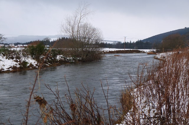
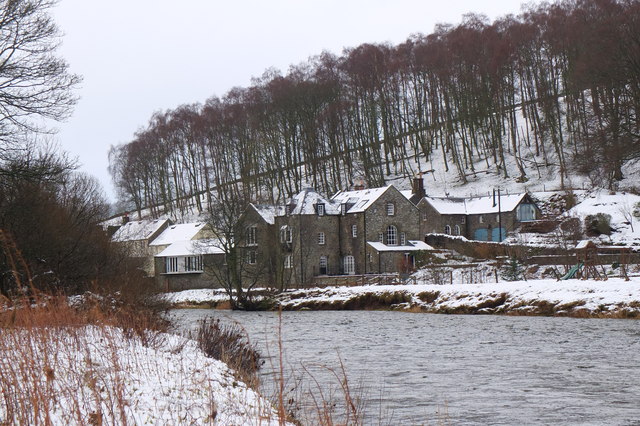
Glentress is a picturesque village located in the county of Peeblesshire, Scotland. Situated in the scenic Tweed Valley, it is nestled within the rolling hills of the Scottish Borders region. With a population of around 2,000 residents, Glentress offers a tranquil and charming atmosphere, making it an ideal destination for nature lovers and outdoor enthusiasts.

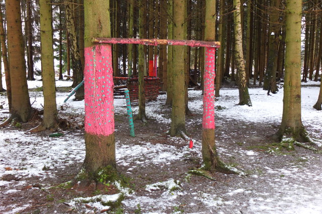
One of the main attractions of Glentress is its stunning natural surroundings. The village is surrounded by vast forests, including the renowned Glentress Forest, which is part of the larger Tweed Valley Forest Park. This forest is a haven for outdoor activities, particularly mountain biking and hiking, with a network of well-maintained trails catering to all skill levels.

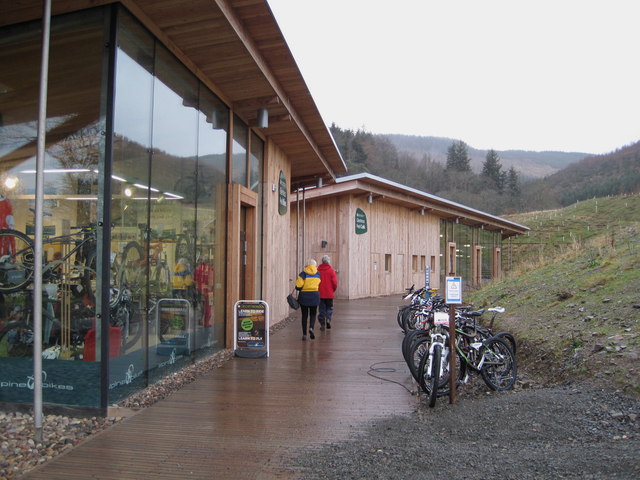
Glentress also boasts a world-class mountain biking center, attracting visitors from far and wide. The Glentress Mountain Bike Centre offers a range of trails, from gentle routes for beginners to exhilarating downhill tracks for adrenaline seekers. The center provides facilities such as bike rental, coaching, and a café, ensuring a seamless experience for visitors.

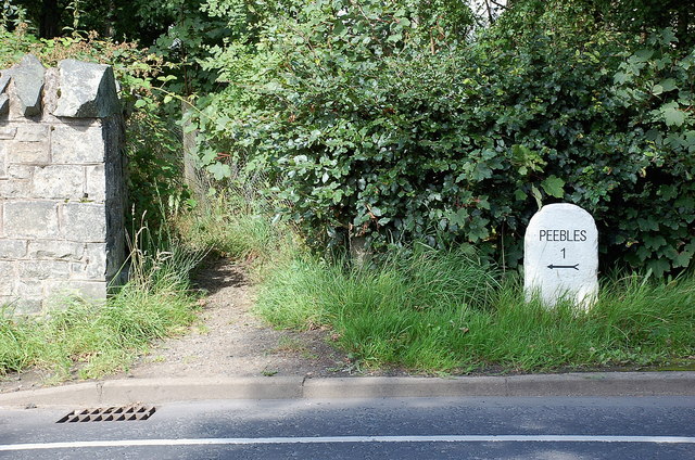
In addition to its outdoor pursuits, Glentress offers a small but vibrant community. There are local amenities such as shops, cafes, and a visitor center, providing essentials and information to both residents and tourists. The village's proximity to the charming market town of Peebles is an added advantage, offering a wider range of services and entertainment options.

Overall, Glentress, Peeblesshire, is a haven of natural beauty and outdoor activities, making it a must-visit destination for those seeking a tranquil escape in the heart of Scotland's stunning countryside.

If you have any feedback on the listing, please let us know in the comments section below.
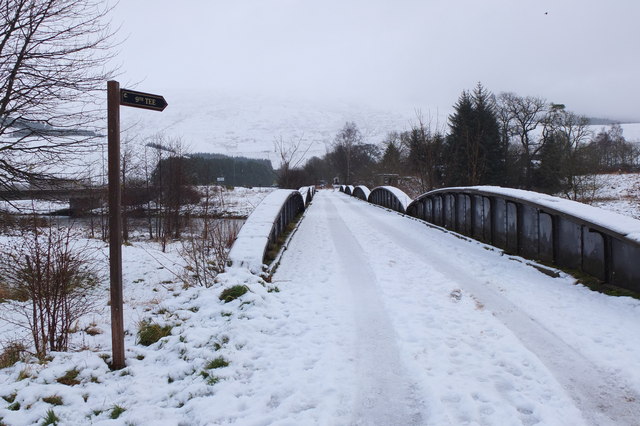
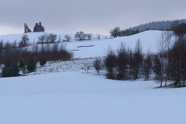
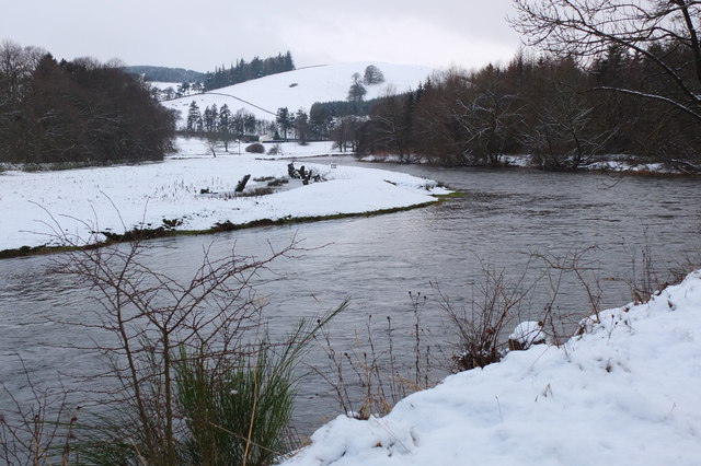
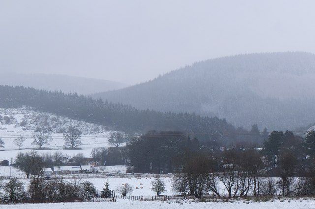
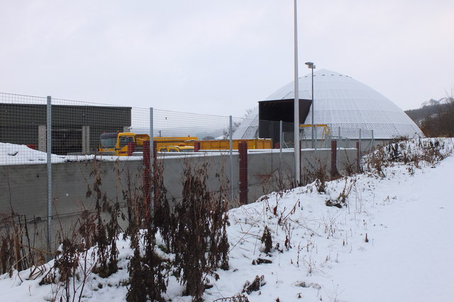
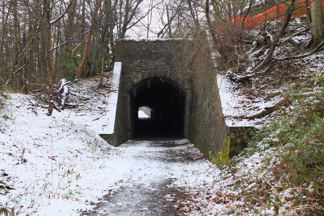
Glentress Images

Images are sourced within 2km of 55.639199/-3.1453642 or Grid Reference NT2839. Thanks to Geograph Open Source API. All images are credited.

Horsburgh Castle ruin with sheep pasture
Horsburgh Castle Horsburgh Castle seen from the visitors centre on the opposite hillside.  Sheep and hills a plenty.
Horsburgh Castle
Horsburgh Castle seen from the visitors centre on the opposite hillside. Sheep and hills a plenty.
MacDonalds Cardrona Hotel This exclusive hotel, golf and country club has an idyllic location  on the north bank of the river Tweed. A glimpse of the river can be seen to the left of the picture. Between the hotel and the river is the golf course and a row of golf buggies are parked adjacent to a large bunker in front of the hotel.
MacDonalds Cardrona Hotel
This exclusive hotel, golf and country club has an idyllic location on the north bank of the river Tweed. A glimpse of the river can be seen to the left of the picture. Between the hotel and the river is the golf course and a row of golf buggies are parked adjacent to a large bunker in front of the hotel.
Milestone at Kingsmeadows, Peebles The One Mile marker on Kingsmeadows Road. An overgrown footpath just to the left leads to the riverside.
Milestone at Kingsmeadows, Peebles
The One Mile marker on Kingsmeadows Road. An overgrown footpath just to the left leads to the riverside.
Remnant of the Wire Bridge, Peebles The post in the foreground appears to be the only surviving part of a former suspension footbridge across the Tweed here. It was a private bridge for the Kingsmeadows estate, connecting with Wire Bridge Cottage, just in view across the river. Further historical background and a photograph of the bridge are given in 'Peebles Remembered' published by The Tweeddale Society in 2005.
Remnant of the Wire Bridge, Peebles
The post in the foreground appears to be the only surviving part of a former suspension footbridge across the Tweed here. It was a private bridge for the Kingsmeadows estate, connecting with Wire Bridge Cottage, just in view across the river. Further historical background and a photograph of the bridge are given in 'Peebles Remembered' published by The Tweeddale Society in 2005.
The Hub Cafe, Glentress Packed out as usual and sadly such a good, fair priced cafe as this just had to go. They were denied the chance to bid for the lease for the shiny new facility over the road and closed down by the Forestry Commission.  Apparently this is normal practice once one of their facilities becomes popular, and I have seen a similar enterprise in the Forest of Dean go the same way.  

The bike shop closed today, so no more good value, and quick services for my bikes.
The Hub Cafe, Glentress
Packed out as usual and sadly such a good, fair priced cafe as this just had to go. They were denied the chance to bid for the lease for the shiny new facility over the road and closed down by the Forestry Commission. Apparently this is normal practice once one of their facilities becomes popular, and I have seen a similar enterprise in the Forest of Dean go the same way. The bike shop closed today, so no more good value, and quick services for my bikes.
The Hub - the last day Having done so much for the success of the bike trails in Glentress Forest, today the shop was closed down by the Forestry Commission. They were not allowed to bid for the lease in the new all singing and all dancing centre across the road which we are expected to pay for (not a penny from me! - I'm parking elsewhere and riding in) and they are to be replaced by one of the big Edinburgh shops.

A legend!
The Hub - the last day
Having done so much for the success of the bike trails in Glentress Forest, today the shop was closed down by the Forestry Commission. They were not allowed to bid for the lease in the new all singing and all dancing centre across the road which we are expected to pay for (not a penny from me! - I'm parking elsewhere and riding in) and they are to be replaced by one of the big Edinburgh shops. A legend!
Old railway bridge, Cardrona The bridge over the Tweed, looking back to Cardrona and the site of the former station. The line is now a path and cycleway to Peebles. The golf course surrounds the nearby hotel and extends E along the riverside.
Old railway bridge, Cardrona
The bridge over the Tweed, looking back to Cardrona and the site of the former station. The line is now a path and cycleway to Peebles. The golf course surrounds the nearby hotel and extends E along the riverside.
Horsbrugh Castle A 16th century castle, now a roofless ruin, on a hillock just S of the A72 near Cardrona - see <span class="nowrap"><a title="http://www.scotlandsplaces.gov.uk/search_item/index.php?service=RCAHMS&id=51274" rel="nofollow ugc noopener" href="http://www.scotlandsplaces.gov.uk/search_item/index.php?service=RCAHMS&id=51274">Link</a><img style="margin-left:2px;" alt="External link" title="External link - shift click to open in new window" src="https://s1.geograph.org.uk/img/external.png" width="10" height="10"/></span> for more detail. Horsburgh is an alternative spelling for the name. There is also a ruined tower at Nether Horsburgh in NT3039 to the east.
Horsbrugh Castle
A 16th century castle, now a roofless ruin, on a hillock just S of the A72 near Cardrona - see LinkExternal link for more detail. Horsburgh is an alternative spelling for the name. There is also a ruined tower at Nether Horsburgh in NT3039 to the east.
The Tweed near Kailzie Compare with <a href="https://www.geograph.org.uk/photo/1850309">NT2838 : A bend on the River Tweed near Kailzie</a> which shows the same scene in May 2010.
The Tweed near Kailzie
Compare with NT2838 : A bend on the River Tweed near Kailzie which shows the same scene in May 2010.
Eshiels and Glentress A view from the old railway route between Cardrona and Peebles on a morning with light snow showers.
Eshiels and Glentress
A view from the old railway route between Cardrona and Peebles on a morning with light snow showers.
Decorated trees, Eshiels Community Woodland Trees with a brighter look at the site of the Eshiels Youth Sculpture Project in this part of the woodland by the Tweed - see also <a href="https://www.geograph.org.uk/photo/1306105">NT2739 : Eshiels Youth Sculpture project</a>.
Decorated trees, Eshiels Community Woodland
Trees with a brighter look at the site of the Eshiels Youth Sculpture Project in this part of the woodland by the Tweed - see also NT2739 : Eshiels Youth Sculpture project.
The Tweed near Scotsmill Looking upstream with some of the new houses at Whitehaugh on the edge of Peebles in view.
The Tweed near Scotsmill
Looking upstream with some of the new houses at Whitehaugh on the edge of Peebles in view.
Scotsmill by the Tweed Houses on the S bank upstream of the Kailzie Estate.
Scotsmill by the Tweed
Houses on the S bank upstream of the Kailzie Estate.
Peebles sewage works Filter beds at Eshiels; the path and cycleway from Cardrona passes to the right, following the former Peebles - Galashiels railway line.
Peebles sewage works
Filter beds at Eshiels; the path and cycleway from Cardrona passes to the right, following the former Peebles - Galashiels railway line.
Ready for winter, Eshiels Depot A silo of road salt and several gritting lorries at the Scottish Borders Council road depot at Eshiels, on the site of a former railway yard and sheds.
Ready for winter, Eshiels Depot
A silo of road salt and several gritting lorries at the Scottish Borders Council road depot at Eshiels, on the site of a former railway yard and sheds.
Eshiels Tunnel The former railway tunnel under the A72 road has been opened up for use in the footpath and cycleway from Peebles to Cardrona. <a href="https://www.geograph.org.uk/photo/1306143">NT2739 : Eastern portal of Eshiels Tunnel</a> and <a href="https://www.geograph.org.uk/photo/1306165">NT2739 : Inside Eshiels Tunnel</a> show the tunnel in 2009 before it was opened up.
Eshiels Tunnel
The former railway tunnel under the A72 road has been opened up for use in the footpath and cycleway from Peebles to Cardrona. NT2739 : Eastern portal of Eshiels Tunnel and NT2739 : Inside Eshiels Tunnel show the tunnel in 2009 before it was opened up.
Peel bike shop and cafe, Glentress The shiny new shop and cafe referred to in <a href="https://www.geograph.org.uk/photo/2685512">NT2839 : The Hub Cafe, Glentress</a>, part of a new development at Glentress with car park, visitor centre and offices.
Peel bike shop and cafe, Glentress
The shiny new shop and cafe referred to in NT2839 : The Hub Cafe, Glentress, part of a new development at Glentress with car park, visitor centre and offices.
Show me another place!

Glentress is located at Grid Ref: NT2839 (Lat: 55.639199, Lng: -3.1453642)

Unitary Authority: The Scottish Borders

Police Authority: The Lothians and Scottish Borders

What 3 Words

///plenty.rating.scorched. Near Peebles, Scottish Borders

Nearby Locations

Glentress

Related Wikis

Kailzie Gardens

Kailzie Gardens is a walled garden near Kirkburn in the Scottish Borders area of Scotland, in the Tweed valley, four km east of Peebles, off the B7062...
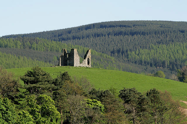
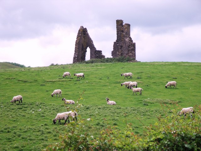
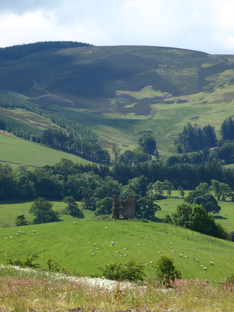
Horsburgh Castle

Horsburgh Castle, also known as Horsbrugh Castle or Horsbrugh Tower, is a ruined tower house castle by the River Tweed, on the A72 road from Peebles to...

Kirkburn, Scottish Borders

Kirkburn is a village on the B7062, close to Peebles and the River Tweed, in the Scottish Borders area of Scotland, at the edge of the Cardrona Forest...

Cardrona railway station

Cardrona railway station served the village of Cardrona, Scottish Borders, Scotland from 1864 to 1962 on the Peebles Railway. == History == The station...

Nearby Amenities

Located within 500m of 55.639199,-3.1453642
Bench
Backrest: yes
Lat/Long: 55.640225/-3.1475908
Check Date: 2022-02-23
Information: map
Tourism: information
Lat/Long: 55.6395119/-3.1378132
Information: guidepost
Tourism: information
Lat/Long: 55.6395117/-3.1376961
Power: pole
Lat/Long: 55.6423125/-3.1510327
Power: pole
Lat/Long: 55.6420759/-3.1499546
Power: pole
Lat/Long: 55.6418205/-3.1488764
Power: pole
Lat/Long: 55.641572/-3.1478012
Power: pole
Lat/Long: 55.6412481/-3.146796
Power: pole
Lat/Long: 55.6408418/-3.1455629
Power: pole
Lat/Long: 55.640463/-3.1443936
Power: pole
Lat/Long: 55.640307/-3.1439472
Power: pole
Lat/Long: 55.6401442/-3.1429328
Power: pole
Lat/Long: 55.6399899/-3.1419214
Power: pole
Lat/Long: 55.6398339/-3.1409343
Power: pole
Lat/Long: 55.6396437/-3.1397073
Restaurant
Courtyard Cafe
Addr City: Peebles
Addr Postcode: EH45 9HT
Addr Street: Kailzie Gardens
Check Date: 2022-11-19
Contact Facebook: courtyardcafeklz
Contact Instagram: courtyardcafeklz
Cuisine: regional;coffee_shop;cake
Diet Vegan: yes
Diet Vegetarian: yes
Drink Beer: served
Drink Coffee: served
Drink Tea: served
Drink Wine: served
Highchair: yes
Internet Access: wlan
Opening Hours: We-Fr 10:00-16:00; Sa,Su 10:00-16:30
Outdoor Seating: yes
Payment Mastercard: yes
Payment Visa: yes
Phone: +44 1721 724 111
Real Fire: yes
Website: https://www.courtyardcafeklz.com/
Lat/Long: 55.6353709/-3.1433626
Power: pole
Lat/Long: 55.6378599/-3.1456201
Power: pole
Lat/Long: 55.6375996/-3.1460516
Power: pole
Lat/Long: 55.6373644/-3.1464028
Power: pole
Lat/Long: 55.6382025/-3.146847
Power: pole
Lat/Long: 55.6380223/-3.1462589
Power: pole
Lat/Long: 55.637676/-3.1450426
Power: pole
Lat/Long: 55.637368/-3.1441923
Power: pole
Lat/Long: 55.6367985/-3.1423837
Power: pole
Lat/Long: 55.63634/-3.1423773
Material: wood
Power: pole
Lat/Long: 55.6361071/-3.1428131
Material: wood
Power: pole
Lat/Long: 55.63562/-3.1436973
Material: wood
Power: pole
Lat/Long: 55.6353967/-3.1441203
Power: pole
Lat/Long: 55.636857/-3.1390584
Power: pole
Lat/Long: 55.6380437/-3.1417871
Power: pole
Lat/Long: 55.6434972/-3.1444059
Power: pole
Lat/Long: 55.6421948/-3.1443827
Power: pole
Lat/Long: 55.6410977/-3.14437
Kailzie Fishery
Shop: fishing
Lat/Long: 55.636493/-3.1422937
Traffic Calming: bump
Lat/Long: 55.6373545/-3.1464904
Traffic Calming: bump
Lat/Long: 55.6367989/-3.1459279
Shop: ticket
Lat/Long: 55.6352115/-3.1432773
Toilets
Fee: no
Lat/Long: 55.6352771/-3.1431349
Entrance: main
Lat/Long: 55.6352987/-3.1432854
Entrance: main
Lat/Long: 55.6352289/-3.143304
Clock
Architect: A. Adie of Edinburgh
Display: sundial
Support: pedestal
Wikidata: Q17848812
Lat/Long: 55.6348647/-3.1450996
Passing Place
Lat/Long: 55.6377008/-3.1467502
Barrier: bollard
Bollard: fixed
Colour: white
Material: wood
Motor Vehicle: no
Lat/Long: 55.6357922/-3.1430039
Board Type: map
Covered: yes
Direction: 55
Hiking: yes
Information: map
Map Size: site
Map Type: yes
Tourism: information
Lat/Long: 55.6357823/-3.1431033
The data included in this document is from www.openstreetmap.org. The data is made available under ODbL.

Have you been to Glentress?

Leave your review of Glentress below (or comments, questions and feedback).