Am Feur-loch

Lake, Pool, Pond, Freshwater Marsh in Ross-shire

Scotland

Am Feur-loch

Loch Bad an Sgalaig
Loch Bad an Sgalaig Credit: Peter Moore

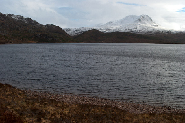
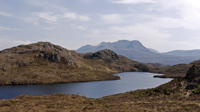
Am Feur-loch is a picturesque freshwater feature located in Ross-shire, Scotland. Also known as a loch, it is a small body of water that is often referred to as a lake, pool, pond, or freshwater marsh due to its unique characteristics.

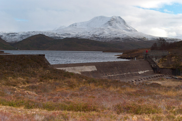
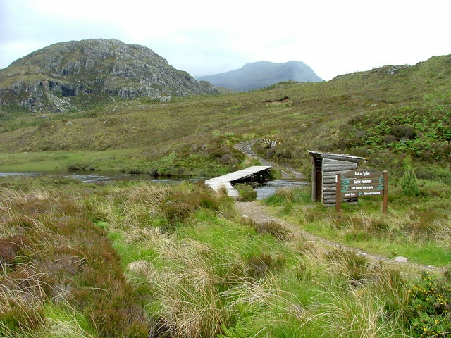
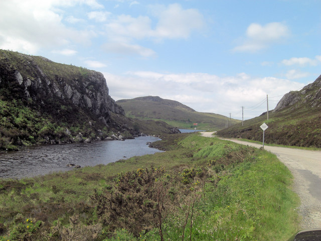
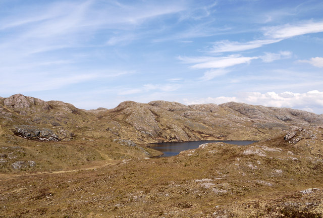
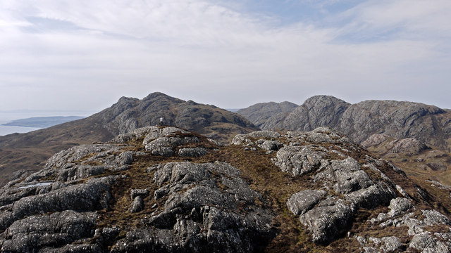
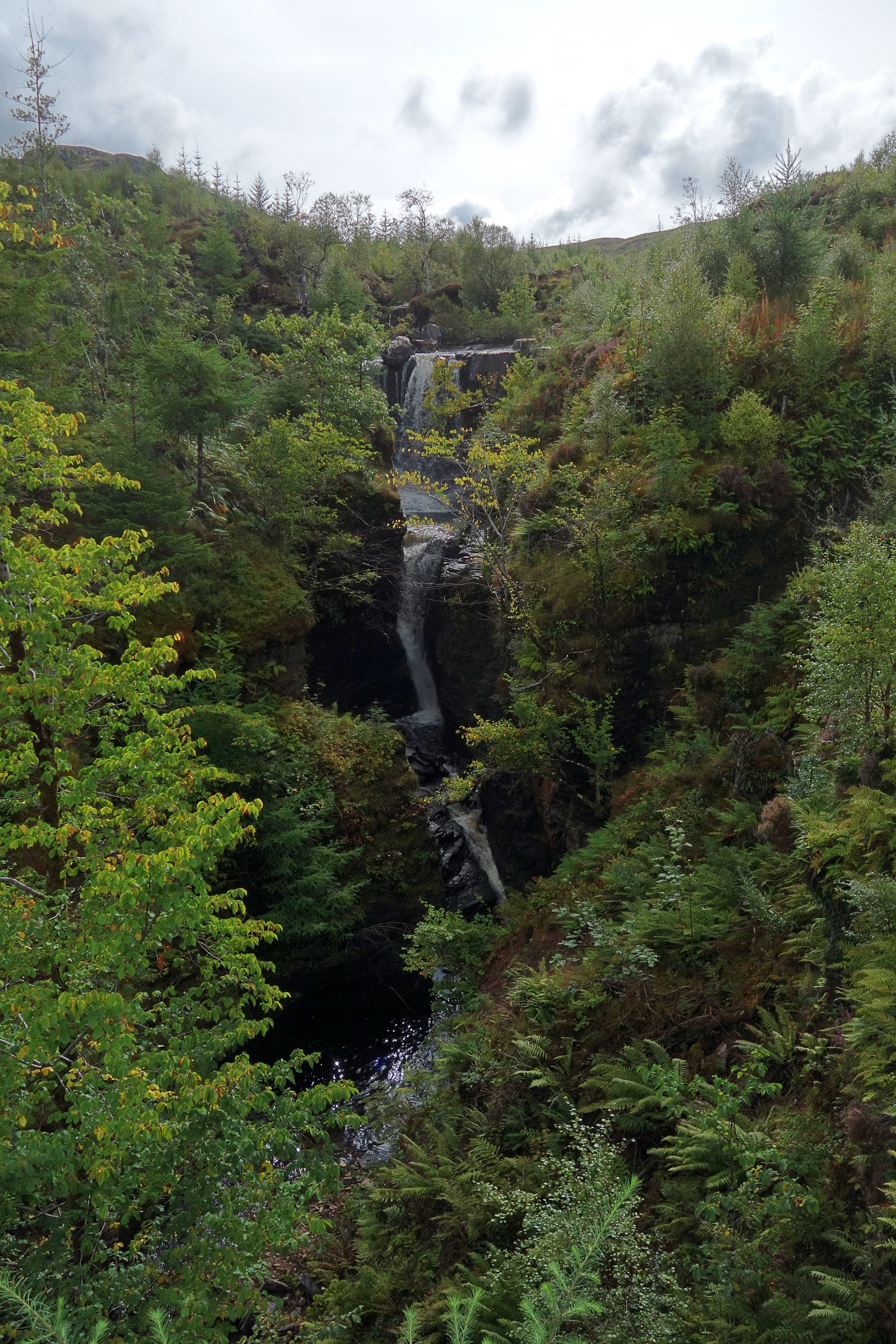
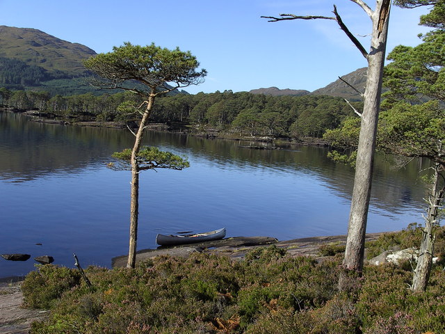
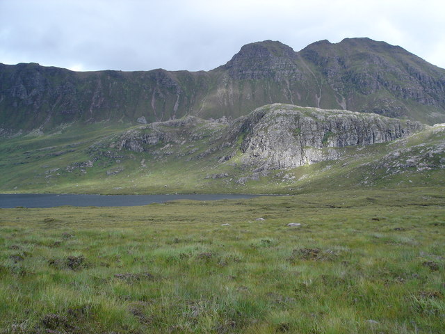
The loch is nestled within a scenic landscape, surrounded by rolling hills and lush green vegetation, making it a popular destination for nature enthusiasts and photographers. Its tranquil ambiance and untouched natural beauty attract visitors from far and wide.

Am Feur-loch covers an area of approximately 2 hectares and has a relatively shallow depth, ranging from 1 to 5 meters. The water in the loch is primarily sourced from rainfall and runoff from the surrounding land, ensuring its freshness and purity.

The loch supports a diverse range of flora and fauna, with numerous species of water plants and aquatic wildlife. Visitors can spot various waterfowl such as ducks, geese, and swans gracefully gliding across the water's surface. The surrounding marshes provide a habitat for amphibians like frogs and newts, as well as insects and reptiles.

The loch is a haven for fishing enthusiasts, who can try their luck at catching brown trout, which is abundant in these waters. It is also a popular spot for kayaking and canoeing due to its calm and peaceful nature.

Am Feur-loch is a hidden gem in Ross-shire, offering a serene and captivating experience for those seeking to connect with nature and enjoy the tranquility of a freshwater marsh.

If you have any feedback on the listing, please let us know in the comments section below.

Am Feur-loch Images

Images are sourced within 2km of 57.686305/-5.5934117 or Grid Reference NG8571. Thanks to Geograph Open Source API. All images are credited.

Loch Bad an Sgalaig
Loch Bad an Sgalaig
Wee Hydro Dam
Wee Hydro Dam
Heading for Am Feur-Loch On the track from Loch na h-Oidhche, as it heads downhill before levelling out by the loch. Taken before the regeneration project for this spot was started.
Heading for Am Feur-Loch
On the track from Loch na h-Oidhche, as it heads downhill before levelling out by the loch. Taken before the regeneration project for this spot was started.
Lone derelict cottage Taken from a layby on the A832.
Looking across Loch Bad an Sgalaig.
Lone derelict cottage
Taken from a layby on the A832. Looking across Loch Bad an Sgalaig.
Road beside Loch Bad an Sgalaig The A832 which has passing places on this stretch.
Road beside Loch Bad an Sgalaig
The A832 which has passing places on this stretch.
Loch Bad an Sgalaig Dam This loch was dammed in 1949 to power the Kerry Falls power station.
Loch Bad an Sgalaig Dam
This loch was dammed in 1949 to power the Kerry Falls power station.
Footbridge and path to Bad na Sgalag native pinewood The water is the outflow from Am Feur-Loch.
Footbridge and path to Bad na Sgalag native pinewood
The water is the outflow from Am Feur-Loch.
Am Feur-Loch
Am Feur-Loch
Outflow from Am Feur-Loch The water in the far distance is Loch Bad an Sgalaig.
Outflow from Am Feur-Loch
The water in the far distance is Loch Bad an Sgalaig.
A832 runs beside Am Feur-Loch Feur-Loch is grassy loch?
A832 runs beside Am Feur-Loch
Feur-Loch is grassy loch?
Dam across Loch Bad an Sgalaig outfall The loch of the clump of the farm worker is the rather convoluted name of this body of water. The outflow becomes the River Kerry but damming the loch has inundated much of the original waterfall and made it one with Dubh Loch to the south.
Dam across Loch Bad an Sgalaig outfall
The loch of the clump of the farm worker is the rather convoluted name of this body of water. The outflow becomes the River Kerry but damming the loch has inundated much of the original waterfall and made it one with Dubh Loch to the south.
A832 climbs towards Airigh-fraoch
A832 descends towards Loch Maree
Loch Bad an Sgalaig Near Gairloch, a derelict lochside cottage.
Loch Bad an Sgalaig
Near Gairloch, a derelict lochside cottage.
Loch Bad an Sgalaig Looking across the loch. There are marked footpaths leading into the hills.
Loch Bad an Sgalaig
Looking across the loch. There are marked footpaths leading into the hills.
Loch nam Buainichean Meall an Triubhais Dhuibh is the minor hill beyond the loch; Baosbheinn is the mountain more distant.
Loch nam Buainichean
Meall an Triubhais Dhuibh is the minor hill beyond the loch; Baosbheinn is the mountain more distant.
Moorland west of Loch nam Buainichean Loch nam Buainichean and the moorland west of it sit in a hollow enclosed by a number of low but very rocky hills; Meall Aundrary, from which the image was recorded, is one of them.
Moorland west of Loch nam Buainichean
Loch nam Buainichean and the moorland west of it sit in a hollow enclosed by a number of low but very rocky hills; Meall Aundrary, from which the image was recorded, is one of them.
Meall Aundrary Meall Aundrary is a prominent if low hill to the north of the A832 near to Loch Bad an Sgalaig; it has two tops of a similar height, the image being recorded from the higher of them. The hills beyond are Sithean Mor and An Groban the rocky nature of which is typical of the low hills between Loch Gairloch and the head of Loch Maree.
Meall Aundrary
Meall Aundrary is a prominent if low hill to the north of the A832 near to Loch Bad an Sgalaig; it has two tops of a similar height, the image being recorded from the higher of them. The hills beyond are Sithean Mor and An Groban the rocky nature of which is typical of the low hills between Loch Gairloch and the head of Loch Maree.
Show me another place!

Am Feur-loch is located at Grid Ref: NG8571 (Lat: 57.686305, Lng: -5.5934117)

Unitary Authority: Highland

Police Authority: Highlands and Islands

What 3 Words

///subway.commuting.plankton. Near Gairloch, Highland

Related Wikis

Victoria Falls, Wester Ross

Victoria Falls is a waterfall on the southern side of Loch Maree in Wester Ross in the north-west of Scotland. It is on the Abhainn Garbhaig, a short river...

Eilean Ruairidh Mòr

Eilean Ruairidh Mòr is a forested island in Loch Maree, Wester Ross, Scotland. Its name was formerly anglicised as "Ellan-Rorymore".The island is owned...

Fairy Lochs

The Fairy Lochs is a recent English name for Na Lochan Sgeireach and are a small group of freshwater lochans approximately 2 mi (3.2 km) south-east of...

Garbh Eilean, Loch Maree

Garbh Eilean is a forested island in Loch Maree, Wester Ross, Scotland. Garbh Eilean lies between Eilean Sùbhainn and Eilean Ruairidh Mòr. The islands...

Charlestown, Wester Ross

Charlestown is a small hamlet, making up one of the settlements which are collectively called Gairloch, and located directly south of the main village...

Loch Maree Hotel botulism poisoning

The Loch Maree Hotel botulism poisoning of 1922 was the first recorded outbreak of botulism in the United Kingdom. Eight people died, with the resulting...

An Ard

An Ard (Scottish Gaelic: ) is a collection of small settlements on the A832 road, close to Charlestown, in Gairloch, Ross-shire, on the east shore of Gair...

Loch a' Ghobhainn

Loch a' Ghobhainn is an upland freshwater loch lying inland and south west of the village of Shieldaig in the Scottish Highlands. The loch has an irregular...

Nearby Amenities

Located within 500m of 57.686305,-5.5934117
Information: board
Tourism: information
Lat/Long: 57.6870134/-5.5971331
Power: pole
Lat/Long: 57.689858/-5.5884549
Power: pole
Lat/Long: 57.6892745/-5.5899248
Power: pole
Lat/Long: 57.6890064/-5.5917352
Power: pole
Lat/Long: 57.6887713/-5.5933017
Power: pole
Lat/Long: 57.6884831/-5.5951792
Power: pole
Lat/Long: 57.6882165/-5.5967778
Power: pole
Lat/Long: 57.6879713/-5.5985212
Power: pole
Lat/Long: 57.6876874/-5.60038
The data included in this document is from www.openstreetmap.org. The data is made available under ODbL.

Have you been to Am Feur-loch?

Leave your review of Am Feur-loch below (or comments, questions and feedback).