Awsworth

Settlement in Nottinghamshire Broxtowe

England

Awsworth

Nottingham Canal near Cossall Common
Nottingham Canal near Cossall Common Credit: David Martin

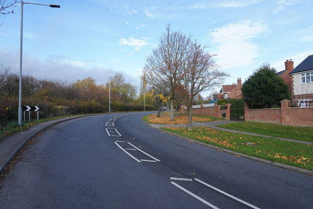
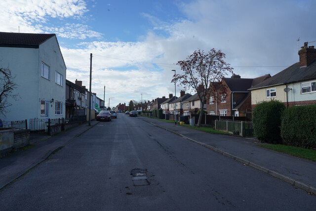
Awsworth is a small village located in the county of Nottinghamshire, in the East Midlands region of England. Situated approximately 10 miles northwest of Nottingham city center, Awsworth is a rural community with a population of around 2,000 residents.

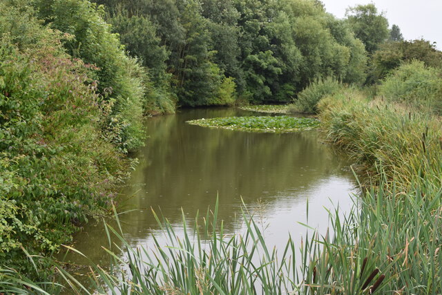
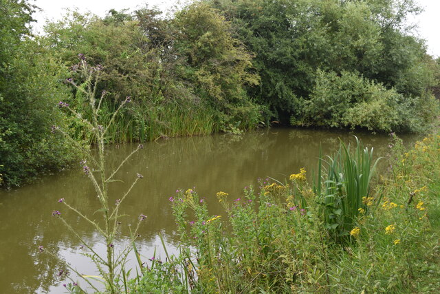
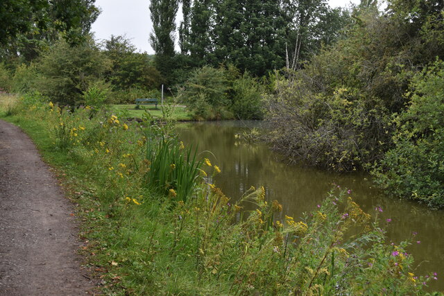
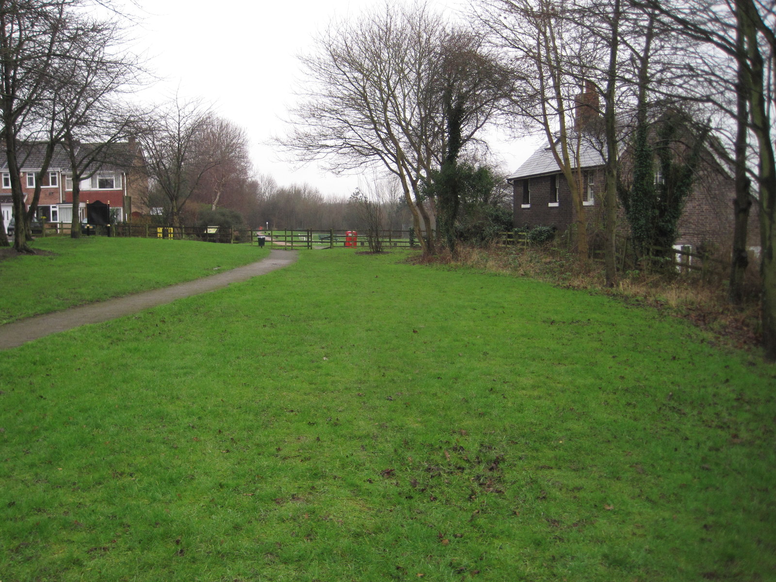
The village is known for its picturesque countryside and is surrounded by fields and farmland, offering a peaceful and tranquil environment. The River Erewash runs along the village's southern border, adding to its scenic beauty.

Awsworth has a rich history, with evidence of human settlement dating back to the Roman times. The village played a significant role during the Industrial Revolution, with the mining industry being a major source of employment. However, like many mining communities in the region, the industry declined in the 20th century, and today, Awsworth is primarily a residential area.

Despite its small size, Awsworth has a strong sense of community, with various local amenities and organizations. These include a primary school, village hall, several pubs, and a cricket club. The village also hosts annual events such as fairs and festivals, bringing the community together.

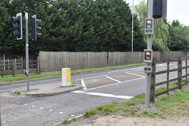
Transportation in Awsworth is facilitated by regular bus services connecting the village to nearby towns and cities. The village is also conveniently located near the M1 motorway, providing easy access to other parts of the country.

Overall, Awsworth offers a peaceful and close-knit community, surrounded by beautiful countryside, making it an attractive place to live for those seeking a rural lifestyle within close proximity to urban amenities.

If you have any feedback on the listing, please let us know in the comments section below.
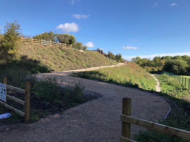
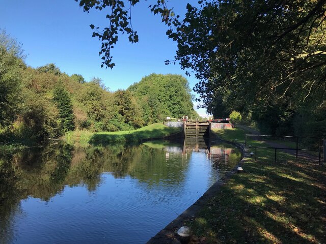
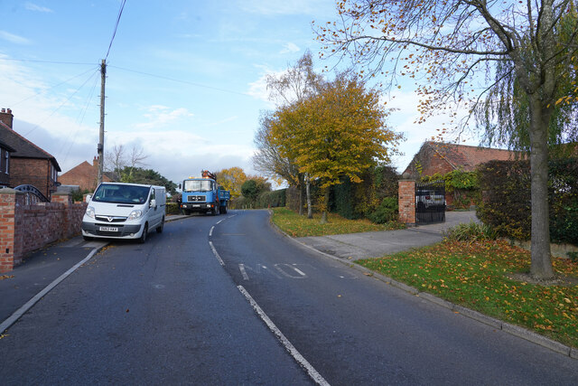
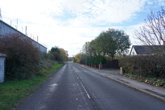
Awsworth Images

Images are sourced within 2km of 52.993574/-1.282675 or Grid Reference SK4844. Thanks to Geograph Open Source API. All images are credited.

Nottingham Canal near Cossall Common
Nottingham Canal near Cossall Marsh
Pegasus Crossing on Shilo Way A dedicated road crossing for horse riders, complete with high-level push buttons to avoid the need to dismount.
Pegasus Crossing on Shilo Way
A dedicated road crossing for horse riders, complete with high-level push buttons to avoid the need to dismount.
Nottingham Canal near Cossall Marsh Here, looking towards a small side branch. There is a low-level wooden footbridge just out of sight to the left.
Nottingham Canal near Cossall Marsh
Here, looking towards a small side branch. There is a low-level wooden footbridge just out of sight to the left.
New ramps to Bennerley Viaduct Park of a major refurbishment of the viaduct as a walking and cycling route.
New ramps to Bennerley Viaduct
Park of a major refurbishment of the viaduct as a walking and cycling route.
Stenson's Lock
Stenson's Lock
Postbox on Maws Lane
Church Lane Church Lane as it goes through Cossall is a very twisty road and the road works on it do not help traffic flow.
Church Lane
Church Lane as it goes through Cossall is a very twisty road and the road works on it do not help traffic flow.
Coronation Road To the left are industrial buildings, to the right are some houses and fields.
Coronation Road
To the left are industrial buildings, to the right are some houses and fields.
Awsworth Lane Awsworth Lane at this point is just on the edge of the village of the same name.
Awsworth Lane
Awsworth Lane at this point is just on the edge of the village of the same name.
Station Road Though it is called Station Road there does not appear to be any station nearby.
Station Road
Though it is called Station Road there does not appear to be any station nearby.
On the Robin Hood Way northwest of Kimberley
Bennerley Viaduct One of only two remaining wrought iron viaducts in England, Bennerley Viaduct was built in 1877 for the Great Northern Railway Company to carry the railway between Derby and Asworth Junction across the Erewash Valley. It closed in 1968 as part of the Beeching cuts. It has survived several attempts to demolish it and is now a grade II* listed structure and is on the Heritage at risk register. Restoration work to create a public walk and cycleway started in 2020.
Bennerley Viaduct
One of only two remaining wrought iron viaducts in England, Bennerley Viaduct was built in 1877 for the Great Northern Railway Company to carry the railway between Derby and Asworth Junction across the Erewash Valley. It closed in 1968 as part of the Beeching cuts. It has survived several attempts to demolish it and is now a grade II* listed structure and is on the Heritage at risk register. Restoration work to create a public walk and cycleway started in 2020.
Underneath Bennerley Viaduct One of only two remaining wrought iron viaducts in England, Bennerley Viaduct was built in 1877 for the Great Northern Railway Company. For more details see <a href="https://www.geograph.org.uk/photo/7043154">SK4743 : Bennerley Viaduct</a>.
Underneath Bennerley Viaduct
One of only two remaining wrought iron viaducts in England, Bennerley Viaduct was built in 1877 for the Great Northern Railway Company. For more details see SK4743 : Bennerley Viaduct.
Bennerley Viaduct One of only two remaining wrought iron viaducts in England, Bennerley Viaduct was built in 1877 for the Great Northern Railway Company. 
The scrubland in front of the viaduct was most recently a British Coal distribution depot and prior to that the site of Bennerley Ironworks.
Bennerley Viaduct
One of only two remaining wrought iron viaducts in England, Bennerley Viaduct was built in 1877 for the Great Northern Railway Company. The scrubland in front of the viaduct was most recently a British Coal distribution depot and prior to that the site of Bennerley Ironworks.
Bennerley Viaduct One of only two remaining wrought iron viaducts in England, Bennerley Viaduct was built in 1877 for the Great Northern Railway Company to carry the railway between Derby and Asworth Junction across the Erewash Valley. It closed in 1968 as part of the Beeching cuts. It has survived several attempts to demolish it and is now a grade II* listed structure and is on the Heritage at risk register. Restoration work to create a public walk and cycleway started in 2020.
Bennerley Viaduct
One of only two remaining wrought iron viaducts in England, Bennerley Viaduct was built in 1877 for the Great Northern Railway Company to carry the railway between Derby and Asworth Junction across the Erewash Valley. It closed in 1968 as part of the Beeching cuts. It has survived several attempts to demolish it and is now a grade II* listed structure and is on the Heritage at risk register. Restoration work to create a public walk and cycleway started in 2020.
Bennerley Viaduct Information Board With the viaduct beyond. For detail of the board see <a href="https://www.geograph.org.uk/photo/7043440">SK4743 : Bennerley Viaduct Information Board</a> and for more on the viaduct see <a href="https://www.geograph.org.uk/photo/7043437">SK4743 : Bennerley Viaduct</a>.
Bennerley Viaduct Information Board
With the viaduct beyond. For detail of the board see SK4743 : Bennerley Viaduct Information Board and for more on the viaduct see SK4743 : Bennerley Viaduct.
Bennerley Viaduct Information Board See also <a href="https://www.geograph.org.uk/photo/7043439">SK4743 : Bennerley Viaduct Information Board</a>
Bennerley Viaduct Information Board
Show me another place!

Awsworth is located at Grid Ref: SK4844 (Lat: 52.993574, Lng: -1.282675)

Administrative County: Nottinghamshire

District: Broxtowe

Police Authority: Nottinghamshire

What 3 Words

///lake.remove.fairly. Near Awsworth, Nottinghamshire

Nearby Locations

Awsworth

Related Wikis

Awsworth

Awsworth is a village and civil parish in the Borough of Broxtowe, Nottinghamshire, England. Its population of 2,577 in the 2001 Census and 2,517 in that...

Awsworth railway station

Awsworth railway station was a former railway station in Awsworth, Nottinghamshire. It was opened by the Great Northern Railway on its Derbyshire and Staffordshire...

Giltbrook Viaduct

Giltbrook Viaduct was a railway viaduct built in the Erewash Valley between Awsworth and Giltbrook in Nottinghamshire. It was demolished in 1973 to make...
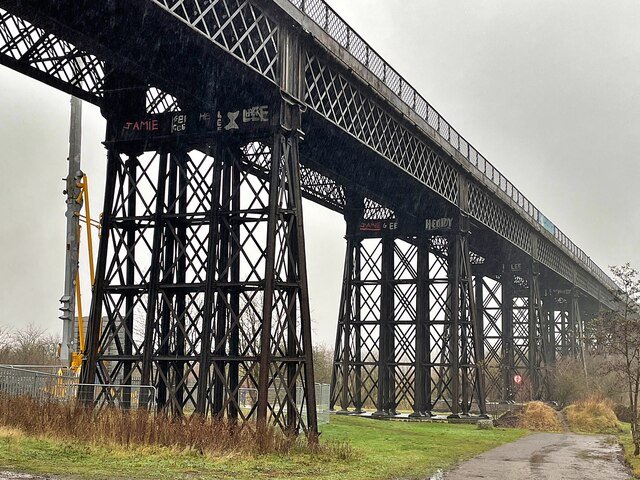
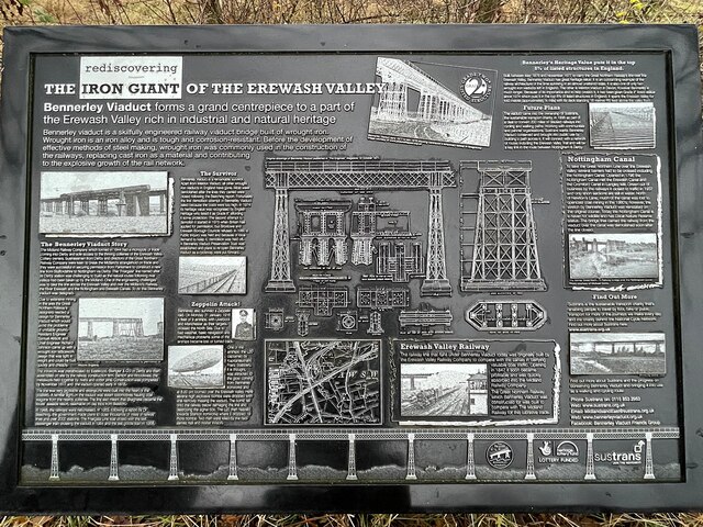
Bennerley Viaduct

Bennerley Viaduct (originally Ilkeston Viaduct and known informally as the Iron Giant) is a former railway bridge, now a foot and cycle bridge, between...

Giltbrook

Giltbrook is a village in England situated approximately 6 miles (9.7 km) northwest of Nottingham and within close reach of junction 26 of the M1 motorway...

Ilkeston F.C.

Ilkeston Football Club was an English semi-professional football club based at the New Manor Ground in Ilkeston, Derbyshire, England. == History == The...

Ilkeston Town F.C.

Ilkeston Town Football Club is a football club based in Ilkeston, Derbyshire, England. They currently play in the Northern Premier League Premier Division...

Erewash Sound

Erewash Sound is a community radio station broadcasting to the borough of Erewash in Derbyshire, including Ilkeston, West Hallam, Long Eaton, Borrowash...

Nearby Amenities

Located within 500m of 52.993574,-1.282675
Bus Stop
Nursery
Bus: yes
Naptan AtcoCode: 3300BR0346
Naptan Bearing: SW
Naptan CommonName: Junior School
Naptan Indicator: o/s
Naptan Landmark: Junior School
Naptan NaptanCode: ntsdpdwg
Naptan Notes: BW--3300BR0554
Naptan Street: The Lane
Naptan Verified: yes
Public Transport: platform
Shelter: no
Source: naptan_import
Lat/Long: 52.9913064/-1.2824267
Bus Stop
Main Street
Bus: yes
Naptan AtcoCode: 3300BR0355
Naptan Bearing: S
Naptan CommonName: Main Street
Naptan Crossing: Gin Close Way
Naptan Indicator: adj
Naptan NaptanCode: ntsawtga
Naptan Notes: none
Naptan Street: Main Street
Public Transport: platform
Shelter: yes
Source: naptan_import
Lat/Long: 52.9939679/-1.2825316
Bus Stop
Main Street
Bus: yes
Naptan AtcoCode: 3300BR0356
Naptan Bearing: N
Naptan CommonName: Main Street
Naptan Crossing: Main Street
Naptan Indicator: opp
Naptan Landmark: Hunts Corner
Naptan NaptanCode: ntsawtgd
Naptan Notes: none
Naptan Street: Gin Close Way
Naptan Verified: no
Public Transport: platform
Source: naptan_import
Lat/Long: 52.9943748/-1.2829122
Bus Stop
Gin Close Way
Bus: yes
Naptan AtcoCode: 3300BR0357
Naptan Bearing: NE
Naptan CommonName: Gin Close Way
Naptan Indicator: NE-bound
Naptan Landmark: Total Garage
Naptan NaptanCode: ntsawtgj
Naptan Notes: none
Naptan Street: Gin Close Way
Naptan Verified: yes
Public Transport: platform
Shelter: no
Source: naptan_import
Lat/Long: 52.9975643/-1.2811309
Bus Stop
Gin Close Way
Bus: yes
Naptan AtcoCode: 3300BR0358
Naptan Bearing: SW
Naptan CommonName: Gin Close Way
Naptan Indicator: SW-bound
Naptan Landmark: Total Garage
Naptan NaptanCode: ntsawtgm
Naptan Notes: none
Naptan Street: Gin Close Way
Naptan Verified: no
Public Transport: platform
Source: naptan_import
Lat/Long: 52.9975093/-1.280953
Bus Stop
Middleton Street
Bus: yes
Naptan AtcoCode: 3300BR0398
Naptan Bearing: N
Naptan CommonName: Middleton Street
Naptan Crossing: Middleton Street
Naptan Indicator: adj
Naptan NaptanCode: ntsdtdpm
Naptan Notes: none
Naptan Street: The Lane
Naptan Verified: yes
Public Transport: platform
Shelter: yes
Source: naptan_import
Lat/Long: 52.9892547/-1.283578
Bus Stop
Nursery
Bus: yes
Naptan AtcoCode: 3300BR0554
Naptan Bearing: N
Naptan BusStopType: CUS
Naptan CommonName: Junior School
Naptan Indicator: opp
Naptan Landmark: Junior School
Naptan NaptanCode: ntsgpdam
Naptan Notes: CUS--3300BR0346
Naptan Street: The Lane
Naptan Verified: yes
Public Transport: platform
Shelter: no
Source: naptan_import
Lat/Long: 52.9911186/-1.2827847
Barrier: cycle_barrier
Lat/Long: 52.9896288/-1.2854137
Barrier: cycle_barrier
Lat/Long: 52.9894133/-1.2844232
Barrier: bollard
Lat/Long: 52.989686/-1.2862153
Barrier: cycle_barrier
Lat/Long: 52.9895369/-1.2854228
Pub
The Gate Inn
Addr Postcode: NG16 2RN
Addr Street: Awsworth Lane
Fhrs Id: 566318
Source: survey
Source Addr: Food Hygiene Open Data
Lat/Long: 52.9954989/-1.2787903
Turning Circle
Lat/Long: 52.9939539/-1.2817208
Crossing
Crossing: unmarked
Lat/Long: 52.9955677/-1.2830822
Crossing
Crossing: unmarked
Lat/Long: 52.9957582/-1.2825543
Entrance: main
Lat/Long: 52.9904761/-1.2851277
Entrance: main
Lat/Long: 52.9906571/-1.2851025
Crossing
Crossing: unmarked
Lat/Long: 52.995826/-1.2825416
Crossing
Crossing: unmarked
Lat/Long: 52.9955729/-1.2828769
Telephone
Booth: KX100
Source: survey
Lat/Long: 52.9907325/-1.2853546
Post Box
Collection Times: Mo-Fr 09:00; Sa 07:00
Operator: Royal Mail
Operator Wikidata: Q638098
Post Box Type: pillar
Ref: NG16 38
Royal Cypher: EIIR
Royal Cypher Wikidata: Q33102113
Source: survey
Lat/Long: 52.9914072/-1.2868515
Awsworth
Place: village
Wikidata: Q2446068
Wikipedia: en:Awsworth
Lat/Long: 52.992029/-1.2842695
Recycling
Source: survey
Lat/Long: 52.9904145/-1.2821737
Leisure: pitch
Sport: cricket
Lat/Long: 52.9898152/-1.2808425
Crossing
Crossing: unmarked
Lat/Long: 52.9957586/-1.2836333
Fixme: needs survey beyond here
Lat/Long: 52.9932455/-1.2823659
Access: yes
Leisure: playground
Lat/Long: 52.9933466/-1.2890465
Post Box
Collection Times: Mo-Fr 17:00; Sa 12:00
Note: seems to have moved from former PO site, new box?
Operator: Royal Mail
Operator Wikidata: Q638098
Post Box Type: lamp
Ref: NG16 40
Royal Cypher: EIIR
Royal Cypher Wikidata: Q33102113
Source: survey
Lat/Long: 52.991337/-1.2824174
Post Office
Nisa Local
Addr Housenumber: 51-52
Addr Postcode: NG16 2QQ
Addr Street: The Lane
Brand: Nisa Local
Brand Wikidata: Q16999069
Brand Wikipedia: en:Nisa (retailer)
Fhrs Id: 566442
Shop: convenience
Source: survey
Source Addr: Food Hygiene Open Data
Lat/Long: 52.9913261/-1.2823447
Barrier: stile
Source: survey
Step Count: 1
Stile: stepover
Lat/Long: 52.9908287/-1.2819472
Crossing
Crossing: unmarked
Lat/Long: 52.9958516/-1.2836883
HE Ref: 1443591
Historic: memorial
Listed Status: Grade II
Memorial: war_memorial
Source: survey
Source Listed Status: Historic England
Lat/Long: 52.9919724/-1.2828743
Entrance: main
Lat/Long: 52.9920588/-1.2830818
Addr Flats: 1-3
Addr Housenumber: 51
Addr Street: The Lane
Source: survey
Use: residential
Lat/Long: 52.991352/-1.2822554
Barrier: bollard
Lat/Long: 52.9902964/-1.2832767
Bonners Lane Awsworth
Operator: National Grid Electricity Distribution
Operator Wikidata: Q7988183
Power: substation
Ref: 870613
Source: survey
Voltage: 11000
Lat/Long: 52.9894642/-1.2838017
Crossing
Bicycle: yes
Crossing: unmarked
Kerb: lowered
Tactile Paving: yes
Lat/Long: 52.9969877/-1.2817423
Childrens Centre
Awsworth Children's Centre (SureStart)
Addr Place: Awsworth Primary School
Addr Postcode: NG16 2QS
Addr Street: The Lane
Old Fhrs Id: 566321
Source: survey
Source Addr: Food Hygiene Open Data
Lat/Long: 52.9899792/-1.2838969
Bench
Source: survey
Lat/Long: 52.9902966/-1.2832523
Entrance: main
Lat/Long: 52.9904314/-1.2851339
Entrance: main
Lat/Long: 52.9905209/-1.2851215
Defibrillator
Emergency: defibrillator
Ref: CHT-9163
Ref GB The Circuit: 131AA3F4-B6F6-4493-9853-AFFD00D1F189
Source: survey
Lat/Long: 52.9905585/-1.2851162
Entrance: main
Lat/Long: 52.9905809/-1.2851131
Entrance: main
Lat/Long: 52.9906114/-1.2851089
Bicycle Parking
Bicycle Parking: stands
Capacity: 4
Covered: no
Source: survey
Lat/Long: 52.9906805/-1.2851597
Barrier: kissing_gate
Source: survey
Lat/Long: 52.991983/-1.2770962
Barrier: stile
Material: metal
Source: survey
Stile: ramblers_gate
Lat/Long: 52.991911/-1.2772266
Addr Housenumber: 4
Addr Postcode: NG16 2WX
Addr Street: Old School Lane
Source: survey
Lat/Long: 52.9923339/-1.281378
Addr Housenumber: 8
Addr Postcode: NG16 2WX
Addr Street: Old School Lane
Source: survey
Lat/Long: 52.9923889/-1.2811771
Barrier: stile
Note: n apparent purpose solved
Source: survey
Lat/Long: 52.9918941/-1.2805562
Barrier: stile
Material: wood
Note: missing step
Source: survey
Step Count: 1
Stile: stepover
Lat/Long: 52.9929348/-1.281388
Barrier: stile
Material: wood
Source: survey
Step Count: 1
Stile: stepover
Lat/Long: 52.994289/-1.2790371
Addr Housenumber: 12
Addr Postcode: NG16 2WX
Addr Street: Old School Lane
Source: survey
Lat/Long: 52.9924527/-1.2809854
Addr Housenumber: 6
Addr Postcode: NG16 2WX
Addr Street: Old School Lane
Source: survey
Lat/Long: 52.9923695/-1.281271
Addr Housenumber: 10
Addr Postcode: NG16 2WX
Addr Street: Old School Lane
Source: survey
Lat/Long: 52.992426/-1.2810832
Addr Housenumber: 28
Addr Postcode: NG16 2WX
Addr Street: Old School Lane
Source: extrapolation
Lat/Long: 52.9929386/-1.2816882
Addr Housenumber: 14
Addr Postcode: NG16 2WX
Addr Street: Old School Lane
Source: extrapolation
Lat/Long: 52.9925285/-1.2813181
Addr Housenumber: 17
Addr Postcode: NG16 2WX
Addr Street: Old School Lane
Source: survey
Lat/Long: 52.9928804/-1.2819766
Addr Housenumber: 5
Addr Postcode: NG16 2WX
Addr Street: Old School Lane
Source: extrapolation
Lat/Long: 52.9925705/-1.2818329
Barrier: stile
Material: wood
Source: survey
Step Count: 1
Stile: stepover
Lat/Long: 52.9947969/-1.2793387
Addr Housenumber: 25
Addr Postcode: NG16 2RJ
Addr Street: Douglas Avenue
Source: survey
Source Postcode: ONS Open Data
Lat/Long: 52.9941699/-1.281501
Addr Housenumber: 68
Addr Postcode: NG16 2RL
Addr Street: Main Street
Source: survey
Source Postcode: ONS Open Data
Lat/Long: 52.9942936/-1.2808676
Addr Housenumber: 79
Addr Postcode: NG16 2RN
Addr Street: Main Street
Source: survey
Source Postcode: ONS Open Data
Lat/Long: 52.9945628/-1.2810714
Addr Housenumber: 106
Addr Postcode: NG16 2RL
Addr Street: Main Street
Source: survey
Source Postcode: ONS Open Data
Lat/Long: 52.994673/-1.2794536
Addr Housenumber: 54
Addr Postcode: NG16 2QT
Addr Street: Main Street
Source: survey
Source Postcode: ONS Open Data
Lat/Long: 52.9937311/-1.2824449
Addr Housenumber: 33
Addr Postcode: NG16 2RH
Addr Street: Main Street
Source: survey
Source Postcode: ONS Open Data
Lat/Long: 52.9932135/-1.2828386
Addr Housenumber: 36
Addr Postcode: NG16 2QT
Addr Street: Main Street
Source Postcode: ONS Open Data
Lat/Long: 52.9932996/-1.2825343
Addr Housenumber: 24
Addr Postcode: NG16 2WX
Addr Street: Old School Lane
Lat/Long: 52.9928099/-1.2815458
Mortib lifts
Addr Housenumber: 28
Addr Postcode: NG16 2QT
Addr Street: Main Street
Source Addr Postcode: OS Open Data Codepoint
Lat/Long: 52.9929985/-1.2823837
Addr Housenumber: 29
Addr Postcode: NG16 2RH
Addr Street: Main Street
Source: survey
Lat/Long: 52.9931338/-1.2828642
Addr Housenumber: 22
Addr Postcode: NG16 2WX
Addr Street: Old School Lane
Lat/Long: 52.9927578/-1.2815294
Addr Housenumber: 6
Addr Postcode: NG16 2RF
Addr Street: Station Road
Source: survey
Source Postcode: ONS Postcode Open Data
Lat/Long: 52.9937172/-1.2831015
Addr Housenumber: 47
Addr Postcode: NG16 2RH
Addr Street: Main Street
Source: survey
Source Postcode: ONS Postcodes Open Data
Lat/Long: 52.9935009/-1.2828438
Genus: Acer
Natural: tree_stump
Species: Axer pseudiolatanus
Lat/Long: 52.994192/-1.2817847
Addr Housenumber: 26
Addr Postcode: NG16 2WX
Addr Street: Old School Lane
Lat/Long: 52.9928714/-1.2816741
Addr Housenumber: 61-67
Addr Interpolation: odd
Addr Postcode: NG16 2RN
Addr Street: Main Street
Lat/Long: 52.9943847/-1.2820927
Addr Housenumber: 2
Addr Postcode: NG16 2RF
Addr Street: Station Road
Source: survey
Source Postcode: ONS Postcode Open Data
Lat/Long: 52.9937608/-1.2828976
Addr Housenumber: 8
Addr Postcode: NG16 2RF
Addr Street: Station Road
Source: survey
Source Postcode: ONS Postcode Open Data
Lat/Long: 52.993706/-1.2831711
Addr Housename: The Chapel House
Addr Housenumber: 1
Addr Postcode: NG16 2QZ
Addr Street: Station Road
Source: survey
Source Postcode: ONS Postcodes Open Data
Lat/Long: 52.9933798/-1.2834341
Addr Housenumber: 69-75
Addr Interpolation: odd
Addr Postcode: NG16 2RN
Addr Street: Main Street
Lat/Long: 52.9945047/-1.2814535
Addr Housenumber: 61-67
Addr Interpolation: odd
Addr Postcode: NG16 2RN
Addr Street: Main Street
Lat/Long: 52.9944207/-1.2817864
Addr Housenumber: 32
Addr Postcode: NG16 2QT
Addr Street: Main Street
Source Addr Postcode: OS Open Data Codepoint
Lat/Long: 52.993155/-1.2824419
Addr Housenumber: 4
Addr Postcode: NG16 2RF
Addr Street: Station Road
Source: survey
Source Postcode: ONS Postcode Open Data
Lat/Long: 52.9937468/-1.2829961
Addr Housenumber: 48
Addr Postcode: NG16 2QT
Addr Street: Main Street
Source: interpolation
Source Postcode: ONS Open Data
Lat/Long: 52.9936106/-1.2824843
Addr Housenumber: 16
Addr Postcode: NG16 2RF
Addr Street: Station Road
Source: survey
Source Postcode: ONS Postcode Open Data
Lat/Long: 52.99363/-1.2835948
Addr Housenumber: 35
Addr Postcode: NG16 2RH
Addr Street: Main Street
Source: interpolation
Source Postcode: ONS Postcodes Open Data
Lat/Long: 52.993249/-1.2828387
Addr Housenumber: 40
Addr Postcode: NG16 2RF
Addr Street: Station Road
Source: extrapolation
Source Postcode: ONS Postcode Open Data
Lat/Long: 52.9934024/-1.2848259
Addr Housenumber: 40
Addr Postcode: NG16 2QT
Addr Street: Main Street
Source: interpolation
Source Postcode: ONS Open Data
Lat/Long: 52.9933362/-1.2825246
Addr Housenumber: 50
Addr Postcode: NG16 2QT
Addr Street: Main Street
Source: interpolation
Source Postcode: ONS Open Data
Lat/Long: 52.9936575/-1.2824682
Addr Housenumber: 14
Addr Postcode: NG16 2RF
Addr Street: Station Road
Source: survey
Source Postcode: ONS Postcode Open Data
Lat/Long: 52.9936349/-1.2835063
Addr Housenumber: 50
Addr Postcode: NG16 2RF
Addr Street: Station Road
Source: extrapolation
Source Postcode: ONS Postcode Open Data
Lat/Long: 52.9933038/-1.2853275
Addr Housenumber: 54
Addr Postcode: NG16 2RF
Addr Street: Station Road
Source: extrapolation
Source Postcode: ONS Postcode Open Data
Lat/Long: 52.9932602/-1.285526
Addr Housenumber: 28
Addr Postcode: NG16 2RF
Addr Street: Station Road
Source: extrapolation
Source Postcode: ONS Postcode Open Data
Lat/Long: 52.9935169/-1.2842063
Addr Housenumber: 96
Addr Postcode: NG16 2RL
Addr Street: Main Street
Source: interpolation
Source Postcode: ONS Open Data
Lat/Long: 52.9944824/-1.2798504
Addr Housenumber: 98
Addr Postcode: NG16 2RL
Addr Street: Main Street
Source: interpolation
Source Postcode: ONS Open Data
Lat/Long: 52.9945906/-1.2797029
Addr Housenumber: 84
Addr Postcode: NG16 2RL
Addr Street: Main Street
Source: interpolation
Source Postcode: ONS Open Data
Lat/Long: 52.9943952/-1.2803091
Addr Housenumber: 52
Addr Postcode: NG16 2RF
Addr Street: Station Road
Source: extrapolation
Source Postcode: ONS Postcode Open Data
Lat/Long: 52.9932861/-1.285416
Addr Housenumber: 82
Addr Postcode: NG16 2RL
Addr Street: Main Street
Source: interpolation
Source Postcode: ONS Open Data
Lat/Long: 52.9943839/-1.2803734
Addr Housenumber: 30
Addr Postcode: NG16 2RF
Addr Street: Station Road
Source: extrapolation
Source Postcode: ONS Postcode Open Data
Lat/Long: 52.9934911/-1.2843217
Addr Housenumber: 7
Addr Postcode: NG16 2QZ
Addr Street: Station Road
Source: extrapolation
Source Postcode: ONS Postcodes Open Data
Lat/Long: 52.9933393/-1.2836833
Addr Housenumber: 80
Addr Postcode: NG16 2RL
Addr Street: Main Street
Source: interpolation
Source Postcode: ONS Open Data
Lat/Long: 52.9943677/-1.2804298
Addr Housenumber: 64
Addr Postcode: NG16 2RF
Addr Street: Station Road
Source: extrapolation
Source Postcode: ONS Postcode Open Data
Lat/Long: 52.993157/-1.2860034
Addr Housenumber: 3
Addr Postcode: NG16 2QZ
Addr Street: Station Road
Source: survey
Source Postcode: ONS Postcodes Open Data
Lat/Long: 52.9933587/-1.2835277
Addr Housenumber: 66
Addr Postcode: NG16 2RL
Addr Street: Main Street
Source: survey
Source Postcode: ONS Open Data
Lat/Long: 52.994208/-1.2810091
Addr Housenumber: 9
Addr Postcode: NG16 2QZ
Addr Street: Station Road
Source: extrapolation
Source Postcode: ONS Postcodes Open Data
Lat/Long: 52.99332/-1.2837664
Addr Housenumber: 36
Addr Postcode: NG16 2RF
Addr Street: Station Road
Source: extrapolation
Source Postcode: ONS Postcode Open Data
Lat/Long: 52.9934475/-1.2846167
Addr Housenumber: 22
Addr Postcode: NG16 2RF
Addr Street: Station Road
Source: extrapolation
Source Postcode: ONS Postcode Open Data
Lat/Long: 52.993567/-1.2839166
Addr Housenumber: 60
Addr Postcode: NG16 2RF
Addr Street: Station Road
Source: extrapolation
Source Postcode: ONS Postcode Open Data
Lat/Long: 52.9931924/-1.2858049
Addr Housenumber: 45
Addr Postcode: NG16 2RH
Addr Street: Main Street
Source: interpolation
Source Postcode: ONS Postcodes Open Data
Lat/Long: 52.9934509/-1.2828387
Addr Housenumber: 77
Addr Postcode: NG16 2RN
Addr Street: Main Street
Source: survey
Source Postcode: ONS Open Data
Lat/Long: 52.994547/-1.2811996
Addr Housenumber: 31
Addr Postcode: NG16 2RH
Addr Street: Main Street
Source: survey
Source Postcode: ONS Postcodes Open Data
Lat/Long: 52.9931682/-1.2828625
Addr Housenumber: 32
Addr Postcode: NG16 2RF
Addr Street: Station Road
Source: extrapolation
Source Postcode: ONS Postcode Open Data
Lat/Long: 52.9934799/-1.2844021
Addr Housenumber: 48
Addr Postcode: NG16 2RF
Addr Street: Station Road
Source: extrapolation
Source Postcode: ONS Postcode Open Data
Lat/Long: 52.9933346/-1.2852121
Addr Housenumber: 76
Addr Postcode: NG16 2RL
Addr Street: Main Street
Source: interpolation
Source Postcode: ONS Open Data
Lat/Long: 52.9943435/-1.2805612
Addr Housenumber: 86
Addr Postcode: NG16 2RL
Addr Street: Main Street
Source: interpolation
Source Postcode: ONS Open Data
Lat/Long: 52.9944323/-1.2801401
Addr Housenumber: 46
Addr Postcode: NG16 2QT
Addr Street: Main Street
Source: interpolation
Source Postcode: ONS Open Data
Lat/Long: 52.9935493/-1.2825004
Addr Housenumber: 41
Addr Postcode: NG16 2RH
Addr Street: Main Street
Source: interpolation
Source Postcode: ONS Postcodes Open Data
Lat/Long: 52.9933669/-1.282844
Addr Housenumber: 74
Addr Postcode: NG16 2RL
Addr Street: Main Street
Source: interpolation
Source Postcode: ONS Open Data
Lat/Long: 52.9943257/-1.2806604
Addr Housenumber: 58
Addr Postcode: NG16 2RF
Addr Street: Station Road
Source: extrapolation
Source Postcode: ONS Postcode Open Data
Lat/Long: 52.9932102/-1.2857298
Addr Housenumber: 12
Addr Postcode: NG16 2RF
Addr Street: Station Road
Source: survey
Source Postcode: ONS Postcode Open Data
Lat/Long: 52.9936638/-1.2833802
Addr Housenumber: 38
Addr Postcode: NG16 2RF
Addr Street: Station Road
Source: extrapolation
Source Postcode: ONS Postcode Open Data
Lat/Long: 52.9934185/-1.2847428
Addr Housenumber: 90
Addr Postcode: NG16 2RL
Addr Street: Main Street
Source: interpolation
Source Postcode: ONS Open Data
Lat/Long: 52.9944662/-1.2800113
Addr Housenumber: 34
Addr Postcode: NG16 2RF
Addr Street: Station Road
Source: extrapolation
Source Postcode: ONS Postcode Open Data
Lat/Long: 52.9934636/-1.2845148
Addr Housenumber: 52
Addr Postcode: NG16 2QT
Addr Street: Main Street
Source: interpolation
Source Postcode: ONS Open Data
Lat/Long: 52.9936962/-1.2824575
Addr Housenumber: 44
Addr Postcode: NG16 2RF
Addr Street: Station Road
Source: extrapolation
Source Postcode: ONS Postcode Open Data
Lat/Long: 52.9933668/-1.285019
Addr Housenumber: 88
Addr Postcode: NG16 2RL
Addr Street: Main Street
Source: interpolation
Source Postcode: ONS Open Data
Lat/Long: 52.9944275/-1.2801857
Addr Housenumber: 43
Addr Postcode: NG16 2RH
Addr Street: Main Street
Source: interpolation
Source Postcode: ONS Postcodes Open Data
Lat/Long: 52.9934072/-1.2828413
Addr Housenumber: 5
Addr Postcode: NG16 2QZ
Addr Street: Station Road
Source: survey
Source Postcode: ONS Postcodes Open Data
Lat/Long: 52.9933556/-1.2836082
Addr Housenumber: 20
Addr Postcode: NG16 2RF
Addr Street: Station Road
Source: extrapolation
Source Postcode: ONS Postcode Open Data
Lat/Long: 52.9935945/-1.2838067
Addr Housenumber: 37
Addr Postcode: NG16 2RH
Addr Street: Main Street
Source: interpolation
Source Postcode: ONS Postcodes Open Data
Lat/Long: 52.9932878/-1.2828387
Addr Housenumber: 100
Addr Postcode: NG16 2RL
Addr Street: Main Street
Source: interpolation
Source Postcode: ONS Open Data
Lat/Long: 52.9946115/-1.2796358
Addr Housenumber: 92
Addr Postcode: NG16 2RL
Addr Street: Main Street
Source: interpolation
Source Postcode: ONS Open Data
Lat/Long: 52.9944581/-1.280073
Addr Housenumber: 42
Addr Postcode: NG16 2QT
Addr Street: Main Street
Source: interpolation
Source Postcode: ONS Open Data
Lat/Long: 52.9934379/-1.2825192
Addr Housenumber: 56
Addr Postcode: NG16 2RF
Addr Street: Station Road
Source: extrapolation
Source Postcode: ONS Postcode Open Data
Lat/Long: 52.9932457/-1.2856037
Addr Housenumber: 24
Addr Postcode: NG16 2RF
Addr Street: Station Road
Source: extrapolation
Source Postcode: ONS Postcode Open Data
Lat/Long: 52.9935589/-1.2839917
Addr Housenumber: 42
Addr Postcode: NG16 2RF
Addr Street: Station Road
Source: extrapolation
Source Postcode: ONS Postcode Open Data
Lat/Long: 52.9933862/-1.2849412
Addr Housenumber: 10
Addr Postcode: NG16 2RF
Addr Street: Station Road
Source: survey
Source Postcode: ONS Postcode Open Data
Lat/Long: 52.9936768/-1.2833078
Addr Housenumber: 62
Addr Postcode: NG16 2RF
Addr Street: Station Road
Source: extrapolation
Source Postcode: ONS Postcode Open Data
Lat/Long: 52.9931667/-1.2859176
Addr Housenumber: 102
Addr Postcode: NG16 2RL
Addr Street: Main Street
Source: interpolation
Source Postcode: ONS Open Data
Lat/Long: 52.9946229/-1.2795768
Addr Housenumber: 72
Addr Postcode: NG16 2RL
Addr Street: Main Street
Source: interpolation
Source Postcode: ONS Open Data
Lat/Long: 52.9943161/-1.2807141
Addr Housenumber: 39
Addr Postcode: NG16 2RH
Addr Street: Main Street
Source: interpolation
Source Postcode: ONS Postcodes Open Data
Lat/Long: 52.99332/-1.282836
Addr Housenumber: 26
Addr Postcode: NG16 2RF
Addr Street: Station Road
Source: extrapolation
Source Postcode: ONS Postcode Open Data
Lat/Long: 52.9935315/-1.2841232
Addr Housenumber: 70
Addr Postcode: NG16 2RL
Addr Street: Main Street
Source: interpolation
Source Postcode: ONS Open Data
Lat/Long: 52.9943/-1.2808106
Addr Housenumber: 18
Addr Postcode: NG16 2RF
Addr Street: Station Road
Source: extrapolation
Source Postcode: ONS Postcode Open Data
Lat/Long: 52.9936122/-1.2837182
Addr Housenumber: 46
Addr Postcode: NG16 2RF
Addr Street: Station Road
Source: extrapolation
Source Postcode: ONS Postcode Open Data
Lat/Long: 52.9933459/-1.285129
Addr Housenumber: 82
Addr Postcode: NG16 2RL
Addr Street: Main Street
Source: interpolation
Source Postcode: ONS Open Data
Lat/Long: 52.9944097/-1.2802527
Addr Housenumber: 78
Addr Postcode: NG16 2RL
Addr Street: Main Street
Source: interpolation
Source Postcode: ONS Open Data
Lat/Long: 52.99435/-1.2805075
Addr Housenumber: 104
Addr Postcode: NG16 2RL
Addr Street: Main Street
Source: interpolation
Source Postcode: ONS Open Data
Lat/Long: 52.9946583/-1.279491
Addr Housenumber: 44
Addr Postcode: NG16 2QT
Addr Street: Main Street
Source: interpolation
Source Postcode: ONS Open Data
Lat/Long: 52.9934992/-1.2825058
Hunt's Corner Awsworth
Operator: National Grid Electricity Distribution
Operator Wikidata: Q7988183
Power: substation
Ref: 880586
Source: survey
Voltage: 11000
Lat/Long: 52.9937525/-1.2823716
Waste Basket
Lat/Long: 52.9904443/-1.2851697
Waste Basket
Lat/Long: 52.9905541/-1.2851483
Waste Basket
Lat/Long: 52.9906655/-1.2851342
Generator Method: photovoltaic
Generator Output Electricity: yes
Generator Source: solar
Generator Type: solar_photovoltaic_panel
Location: roof
Power: generator
Lat/Long: 52.9897377/-1.2844407
Generator Method: photovoltaic
Generator Output Electricity: yes
Generator Source: solar
Generator Type: solar_photovoltaic_panel
Location: roof
Power: generator
Lat/Long: 52.9900493/-1.2845158
Generator Method: photovoltaic
Generator Output Electricity: yes
Generator Source: solar
Generator Type: solar_photovoltaic_panel
Location: roof
Power: generator
Lat/Long: 52.9901167/-1.2859588
Generator Method: photovoltaic
Generator Output Electricity: yes
Generator Source: solar
Generator Type: solar_photovoltaic_panel
Location: roof
Power: generator
Lat/Long: 52.9915973/-1.289148
Generator Method: photovoltaic
Generator Output Electricity: yes
Generator Source: solar
Generator Type: solar_photovoltaic_panel
Location: roof
Power: generator
Lat/Long: 52.9902588/-1.2874502
Generator Method: photovoltaic
Generator Output Electricity: yes
Generator Source: solar
Generator Type: solar_photovoltaic_panel
Location: roof
Power: generator
Lat/Long: 52.9904267/-1.2864363
Generator Method: photovoltaic
Generator Output Electricity: yes
Generator Source: solar
Generator Type: solar_photovoltaic_panel
Location: roof
Power: generator
Lat/Long: 52.9908982/-1.2864068
Generator Method: photovoltaic
Generator Output Electricity: yes
Generator Source: solar
Generator Type: solar_photovoltaic_panel
Location: roof
Power: generator
Lat/Long: 52.9913325/-1.2856209
Generator Method: photovoltaic
Generator Output Electricity: yes
Generator Source: solar
Generator Type: solar_photovoltaic_panel
Location: roof
Power: generator
Lat/Long: 52.9927064/-1.2865248
Generator Method: photovoltaic
Generator Output Electricity: yes
Generator Source: solar
Generator Type: solar_photovoltaic_panel
Location: roof
Power: generator
Lat/Long: 52.9930099/-1.2872624
Generator Method: photovoltaic
Generator Output Electricity: yes
Generator Source: solar
Generator Type: solar_photovoltaic_panel
Location: roof
Power: generator
Lat/Long: 52.9932699/-1.2840786
Generator Method: photovoltaic
Generator Output Electricity: yes
Generator Source: solar
Generator Type: solar_photovoltaic_panel
Location: roof
Power: generator
Lat/Long: 52.9939334/-1.282987
Direction: SSW
Generator Method: photovoltaic
Generator Output Electricity: yes
Generator Solar Modules: 16
Generator Source: solar
Generator Type: solar_photovoltaic_panel
Location: roof
Power: generator
Lat/Long: 52.9936315/-1.28097
Direction: SSE
Generator Method: photovoltaic
Generator Output Electricity: yes
Generator Source: solar
Generator Type: solar_photovoltaic_panel
Location: roof
Power: generator
Lat/Long: 52.9941976/-1.2845418
Generator Method: photovoltaic
Generator Output Electricity: yes
Generator Source: solar
Generator Type: solar_photovoltaic_panel
Location: roof
Power: generator
Lat/Long: 52.990961/-1.2885115
Generator Method: photovoltaic
Generator Output Electricity: yes
Generator Source: solar
Generator Type: solar_photovoltaic_panel
Location: roof
Power: generator
Lat/Long: 52.9898437/-1.2829204
Direction: SSE
Generator Method: photovoltaic
Generator Output Electricity: yes
Generator Solar Modules: 10
Generator Source: solar
Generator Type: solar_photovoltaic_panel
Location: roof
Power: generator
Lat/Long: 52.9919656/-1.2821627
Direction: 80
Generator Method: photovoltaic
Generator Output Electricity: yes
Generator Solar Modules: 14
Generator Source: solar
Generator Type: solar_photovoltaic_panel
Location: roof
Power: generator
Lat/Long: 52.9924273/-1.2823451
Awsworth
Abandoned Railway: station
Railway: site
Wikidata: Q4830134
Wikipedia: en:Awsworth railway station
Lat/Long: 52.9934395/-1.287606
Direction: 210
Man Made: surveillance
Surveillance: public
Surveillance Type: ALPR
Surveillance Zone: traffic
Lat/Long: 52.9975547/-1.2811347
Cafe
The Cabin Cafe
Addr City: Nottingham
Addr Housename: Buildbase
Addr Postcode: NG16 2TA
Addr Street: Gin Close Way
Addr Suburb: Awsworth
Contact Facebook: https://www.facebook.com/Thecabinawsworth/
Fhrs Id: 1569552
Fixme: Location only estimated, next to Buildbase. Awsworth address on Gin Close Way
Old Fhrs Id: 1224867
Lat/Long: 52.9965394/-1.2813073
Parking Space
Parking Space: disabled
Lat/Long: 52.9929241/-1.2829488
Waste Basket
Lat/Long: 52.9940188/-1.2825586
Bench
Lat/Long: 52.9940071/-1.2825291
Waste Basket
Lat/Long: 52.991296/-1.2824245
Addr Housename: The Vicarage
Lat/Long: 52.9908762/-1.2834209
Defibrillator
Emergency: defibrillator
Ref GB The Circuit: 81A0864A-D4E0-463D-A80F-AFFD00D01D83
Lat/Long: 52.9903587/-1.2828175
Bench
Lat/Long: 52.99041/-1.2828717
Bench
Lat/Long: 52.9904023/-1.2829515
Fast Food
Just Joe's
Addr City: Nottingham
Addr Housenumber: 51
Addr Postcode: NG16 2QY
Addr Street: Croft Crescent
Addr Suburb: Awsworth
Fhrs Id: 1635913
Lat/Long: 52.9928127/-1.2849617
The data included in this document is from www.openstreetmap.org. The data is made available under ODbL.

Have you been to Awsworth?

Leave your review of Awsworth below (or comments, questions and feedback).