Loch a' Bhealaich

Lake, Pool, Pond, Freshwater Marsh in Ross-shire

Scotland

Loch a' Bhealaich

Lichens on Old Oak In amongst the small pocket of Atlantic Oakwoods above Reraig and this old dead oak has an array of lichens - probably Beard or Horsehair Lichen - growing on it.
A lovely walk to do on a wet summer's day. Some information here:-
<span class="nowrap"><a title="https://forestryandland.gov.scot/visit/balmacara-woods" rel="nofollow ugc noopener" href="https://forestryandland.gov.scot/visit/balmacara-woods">Link</a><img style="margin-left:2px;" alt="External link" title="External link - shift click to open in new window" src="https://s1.geograph.org.uk/img/external.png" width="10" height="10"/></span>
Lichens on Old Oak Credit: Adam Ward

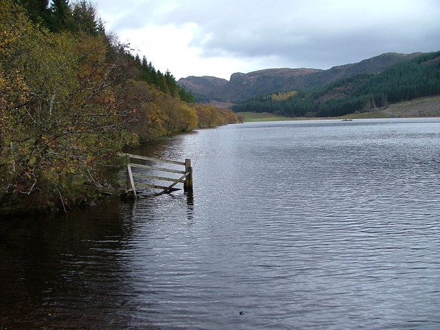
Loch a' Bhealaich is a freshwater loch located in Ross-shire, Scotland. It is situated in a remote and picturesque area, surrounded by rolling hills and lush vegetation. The loch is relatively small in size, with a surface area of approximately 20 acres.

The water in Loch a' Bhealaich is clear and clean, making it an ideal habitat for a variety of aquatic plants and animals. The loch supports a diverse range of wildlife, including fish such as brown trout and perch, as well as waterfowl like ducks and swans.

The surrounding area of Loch a' Bhealaich is a popular destination for outdoor enthusiasts, offering opportunities for fishing, birdwatching, and hiking. The tranquil and peaceful setting of the loch makes it a perfect spot for relaxation and reflection.

Overall, Loch a' Bhealaich is a beautiful and serene location, providing a natural haven for both wildlife and visitors alike. Its tranquil waters and stunning surroundings make it a must-visit destination for those seeking a peaceful escape in the Scottish Highlands.

If you have any feedback on the listing, please let us know in the comments section below.

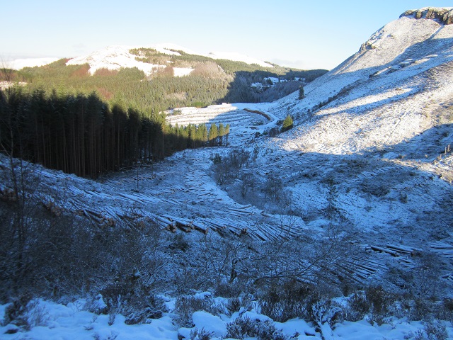
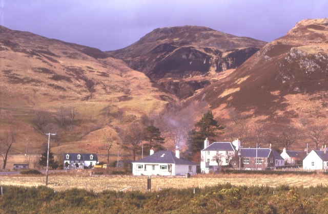
Loch a' Bhealaich Images

Images are sourced within 2km of 57.303856/-5.6033407 or Grid Reference NG8329. Thanks to Geograph Open Source API. All images are credited.

Lichens on Old Oak In amongst the small pocket of Atlantic Oakwoods above Reraig and this old dead oak has an array of lichens - probably Beard or Horsehair Lichen - growing on it.
A lovely walk to do on a wet summer's day. Some information here:-
<span class="nowrap"><a title="https://forestryandland.gov.scot/visit/balmacara-woods" rel="nofollow ugc noopener" href="https://forestryandland.gov.scot/visit/balmacara-woods">Link</a><img style="margin-left:2px;" alt="External link" title="External link - shift click to open in new window" src="https://s1.geograph.org.uk/img/external.png" width="10" height="10"/></span>
Lichens on Old Oak
In amongst the small pocket of Atlantic Oakwoods above Reraig and this old dead oak has an array of lichens - probably Beard or Horsehair Lichen - growing on it. A lovely walk to do on a wet summer's day. Some information here:- LinkExternal link
No Hill Too Steep 'No Hill Too Steep' appears to be the motto of Munro Plant Hire of Kyle and it is quite a steep track to get to this point. The track is not marked on 1:50,000 maps which has this point as being forested so obviously has recently been felled.
The rocky peak is Auchtertyre Hill.
No Hill Too Steep
'No Hill Too Steep' appears to be the motto of Munro Plant Hire of Kyle and it is quite a steep track to get to this point. The track is not marked on 1:50,000 maps which has this point as being forested so obviously has recently been felled. The rocky peak is Auchtertyre Hill.
General view of square Looking SW.
Loch na Smeoraich in centre of photo.
General view of square
Looking SW. Loch na Smeoraich in centre of photo.
General view NG 8230 Looking NW.  Loch Kishorn & the Applecross hills beyond.
In 2013 this area was swept by fire, but did not set fire to the forestry plantation just beyond the loch.  Up till then the vegetation was mainly heather and blueberries, not the rough grass as in the photo.
General view NG 8230
Looking NW. Loch Kishorn & the Applecross hills beyond. In 2013 this area was swept by fire, but did not set fire to the forestry plantation just beyond the loch. Up till then the vegetation was mainly heather and blueberries, not the rough grass as in the photo.
General view of NG 8330 Looking east over Lochan Dubha.
In 2013 this area was swept by fire.  Up till then the vegetation was mainly heather and blueberries, not the rough grass as in the photo.  When the photo was taken shoots of heather were starting to regrow midst the grass – much to the delight of the local grouse.
General view of NG 8330
Looking east over Lochan Dubha. In 2013 this area was swept by fire. Up till then the vegetation was mainly heather and blueberries, not the rough grass as in the photo. When the photo was taken shoots of heather were starting to regrow midst the grass – much to the delight of the local grouse.
General view of NG 8330 Looking south east over Loch nam Breac Mora. 
In 2013 this area was swept by fire.  Up till then the vegetation was mainly heather and blueberries, not the rough grass as in the photo.  When the photo was taken shoots of heather were starting to regrow midst the grass – much to the delight of the local grouse.
General view of NG 8330
Looking south east over Loch nam Breac Mora. In 2013 this area was swept by fire. Up till then the vegetation was mainly heather and blueberries, not the rough grass as in the photo. When the photo was taken shoots of heather were starting to regrow midst the grass – much to the delight of the local grouse.
Reservoir (disused) Believed to be the reservoir that supplied the WWII gun emplacement/camp above Reraig in the area of the view point shown on the OS map (NG810276).
When the "Red Trail" was constructed it was filled in by the Forestry Commission.
Reservoir (disused)
Believed to be the reservoir that supplied the WWII gun emplacement/camp above Reraig in the area of the view point shown on the OS map (NG810276). When the "Red Trail" was constructed it was filled in by the Forestry Commission.
Dun NW of Kirkton, Lochalsh "A kind of hill fort and also a kind of Atlantic roundhouse."
In this case all that remains are a moss covered circle of stones.
See also <span class="nowrap"><a title="http://canmore.org.uk/site/11859/kirkton" rel="nofollow ugc noopener" href="http://canmore.org.uk/site/11859/kirkton">Link</a><img style="margin-left:2px;" alt="External link" title="External link - shift click to open in new window" src="https://s1.geograph.org.uk/img/external.png" width="10" height="10"/></span>
Dun NW of Kirkton, Lochalsh
"A kind of hill fort and also a kind of Atlantic roundhouse." In this case all that remains are a moss covered circle of stones. See also LinkExternal link
NG 8428 & 29 general view General view of NG8428 & 29 taken from the flank of Maol Beag.
Traces of the old track from Auchtertyre north, shown on the estate map of 1805, can be found in the valley.
NG 8428 & 29 general view
General view of NG8428 & 29 taken from the flank of Maol Beag. Traces of the old track from Auchtertyre north, shown on the estate map of 1805, can be found in the valley.
Old track Remnant of the original track northwards from Auchtertyre.
This appears on the estate map of 1805.
Old track
Remnant of the original track northwards from Auchtertyre. This appears on the estate map of 1805.
General view NG 8229 Looking south,towards Kylerhea narrows.
In 2013 this area was swept by fire.  Until then the vegetation was mainly heather and blueberries, not the rough grass as in the photo.  When the photo was taken shoots of heather were starting to regrow amidst the grass – much to the delight of the local grouse.
General view NG 8229
Looking south,towards Kylerhea narrows. In 2013 this area was swept by fire. Until then the vegetation was mainly heather and blueberries, not the rough grass as in the photo. When the photo was taken shoots of heather were starting to regrow amidst the grass – much to the delight of the local grouse.
New forest road below Sgurr Mor A recently built forest road to the west of Sgurr Mor. The path from Balmacara keeps left then is signposted right to contour through the plantation ahead.
New forest road below Sgurr Mor
A recently built forest road to the west of Sgurr Mor. The path from Balmacara keeps left then is signposted right to contour through the plantation ahead.
New forest road below Sgurr Mor (2) Looking SE along the new road from the path contouring above.
New forest road below Sgurr Mor (2)
Looking SE along the new road from the path contouring above.
Path junction, Skye View Trail The path ahead is to Kirkton, with the Skye View Trail (right) to the viewpoint, then returning to Balmacara Square.
Path junction, Skye View Trail
The path ahead is to Kirkton, with the Skye View Trail (right) to the viewpoint, then returning to Balmacara Square.
Skye View Trail crosses new forest road The path takes the first exit to the right to emerge from the plantation in about half a kilometre.
Skye View Trail crosses new forest road
The path takes the first exit to the right to emerge from the plantation in about half a kilometre.
Tree harvesting Tree harvesting on NE flank of Sgurr Mor (behind skyline).
The road in the photo was constructed in 2020 to enable the timber extraction.
Tree harvesting
Tree harvesting on NE flank of Sgurr Mor (behind skyline). The road in the photo was constructed in 2020 to enable the timber extraction.
Tree harvesting The spur road above the centre of the photo and another, just below the skyline above it (not visible, <a href="https://www.geograph.org.uk/gridref/NG8229">NG8229</a>), were built in 2020 to enable the harvesting of the timber.
Tree harvesting
The spur road above the centre of the photo and another, just below the skyline above it (not visible, NG8229), were built in 2020 to enable the harvesting of the timber.
Angel's Hill, Kirkton An indistinct path climbs the hill, which is steeper than it looks in the photograph. At the top is a small burial ground which contains some 20th century graves. (See <a href="https://www.geograph.org.uk/photo/2769531">NG8327 : Angel's Hill burial ground</a>). In the past, the hill was topped by an iron age Dùn.

Footnote: Geograph Moderator James Yardley has pointed out that the Gaelic name for this hill is Cnoc nan Aingeal, which translates as 'Hill of the Angels', so the singular Angel in the popular English spelling of the name of the hill should strictly be a plural (Angels').
Angel's Hill, Kirkton
An indistinct path climbs the hill, which is steeper than it looks in the photograph. At the top is a small burial ground which contains some 20th century graves. (See NG8327 : Angel's Hill burial ground). In the past, the hill was topped by an iron age Dùn. Footnote: Geograph Moderator James Yardley has pointed out that the Gaelic name for this hill is Cnoc nan Aingeal, which translates as 'Hill of the Angels', so the singular Angel in the popular English spelling of the name of the hill should strictly be a plural (Angels').
Show me another place!

Loch a' Bhealaich is located at Grid Ref: NG8329 (Lat: 57.303856, Lng: -5.6033407)

Unitary Authority: Highland

Police Authority: Highlands and Islands

What 3 Words

///fells.ballpoint.formally. Near Kyleakin, Highland

Nearby Locations

Loch a' Bhealaich

Related Wikis

Auchtertyre

Auchtertyre (Scottish Gaelic: Uachdar Thìre, "Upper Land") is a village, lying half a mile from the north shore of Loch Alsh near Kyle of Lochalsh, in...

Loch Achaidh na h-Inich

Loch Achaidh na h-Inich is a freshwater loch in Scotland, located around 3 kilometres (1.9 mi) south-south-east of Plockton, 2 kilometres (1.2 mi) east...

Balmacara Square

Balmacara Square (Scottish Gaelic: Ceàrnag Bhaile Mac Carra) is a small village, close to Balmacara, in Lochlash, Scottish Highlands and is in the council...

Balmacara

Balmacara (Scottish Gaelic: Baile Mac Ara) is a scattered village on the north shore of Loch Alsh near Kyle of Lochalsh, Ross-shire, Highland and is in...

Related Videos

Arriving at Auchtertyre Farm Aire

Auchtertyre Farm is a CAMPrA authorised aire. it costs £10 a night to stay, including water, rubbish disposal and black waste ...

MLG 1VS1 + SERVER RELEASE 🔥 🔥 mit ImmerNochNoah

Zu ImmerNochNoah (Und zum Livestream) https://www.youtube.com/channel/UCEpeeFggbxR4Slku7ulE9BQ Server IP: ...

NOVO SERVIDOR DE MINECRAFT PE 0.15.10 ÉPICO COM VARIOS KITS E MAPAS SEM LAG!

Contato: ➡Twitter: https://twitter.com/100tedioDsn MeninoL: https://youtu.be/jhcD-KC2b2M Servidor: ➡IP: ...

Have you been to Loch a' Bhealaich?

Leave your review of Loch a' Bhealaich below (or comments, questions and feedback).