Awliscombe

Settlement in Devon East Devon

England

Awliscombe

At Weston Cross, looking south
At Weston Cross, looking south Credit: Rob Purvis

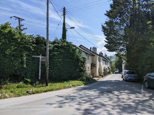
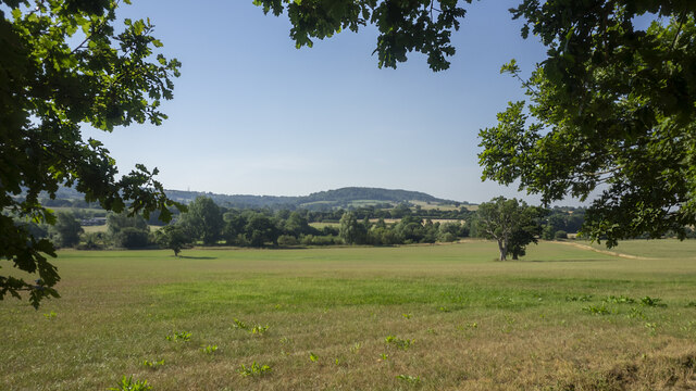
Awliscombe is a small village located in the county of Devon, England. It lies approximately 3 miles northeast of the market town of Honiton. The village is nestled in the beautiful countryside of the Otter Valley, surrounded by rolling hills and farmland.

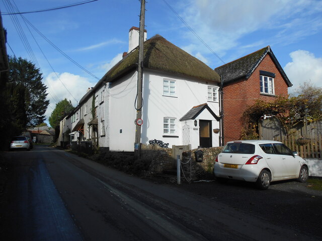
With a population of around 400 people, Awliscombe is a close-knit community that exudes a traditional English village charm. The village is characterized by its picturesque thatched cottages, historic buildings, and a quaint church that dates back to the 14th century.

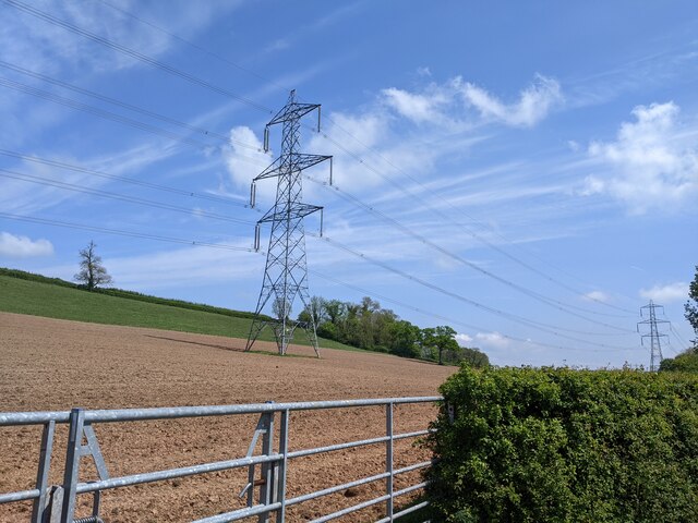
The village boasts stunning natural beauty, offering a range of outdoor activities for nature enthusiasts. The nearby Blackdown Hills, an Area of Outstanding Natural Beauty, provides ample opportunities for hiking, cycling, and enjoying the peaceful surroundings. The River Otter also runs through the village, providing a tranquil setting for fishing and leisurely walks.

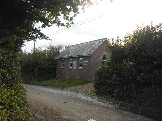
Awliscombe is well-served by local amenities, including a primary school, a village hall, and a local pub that acts as a hub for social gatherings. While the village itself is relatively quiet, it benefits from its proximity to Honiton, where residents can access a wider range of shops, supermarkets, and services.

Overall, Awliscombe is an idyllic village that offers a serene and peaceful way of life. Its natural beauty, friendly community, and convenient location make it an attractive place to live for those seeking a tranquil rural lifestyle in the heart of Devon.

If you have any feedback on the listing, please let us know in the comments section below.

Awliscombe Images

Images are sourced within 2km of 50.807842/-3.228308 or Grid Reference ST1301. Thanks to Geograph Open Source API. All images are credited.

At Weston Cross, looking south
Field and power lines near Deer Park Farm
Buildings at Deer Park Farm
Down hill heading south out of Buckerell
The Deer Park Hotel A specialist wedding venue - very good it is too!
The Deer Park Hotel
A specialist wedding venue - very good it is too!
View across the Otter valley Westgate Hill in the distance, viewed from the grounds of The Deer Park Hotel.
View across the Otter valley
Westgate Hill in the distance, viewed from the grounds of The Deer Park Hotel.
Water Lily pond One of the features of the walled garden at The Deer Park Hotel.
Water Lily pond
One of the features of the walled garden at The Deer Park Hotel.
Sunflower and Bumble Bee Within the sun-trap that is the walled garden at The Deer Park Hotel.
Sunflower and Bumble Bee
Within the sun-trap that is the walled garden at The Deer Park Hotel.
Weston Manor Cottage An OS Benchmark can be found close to the base of the telegraph pole.
Weston Manor Cottage
An OS Benchmark can be found close to the base of the telegraph pole.
Weston chapel Apart from the posters there is no indication of the denomination or that the chapel is still in use.
Weston chapel
Apart from the posters there is no indication of the denomination or that the chapel is still in use.
Winnieford ford The farm a short distance up the road is spelt Wynford on a map of a different scale. The River is called the Wolf.
For a reverse view see <a href="https://www.geograph.org.uk/photo/4195144">ST1400 : Ford at Winneford</a>.
Winnieford ford
The farm a short distance up the road is spelt Wynford on a map of a different scale. The River is called the Wolf. For a reverse view see ST1400 : Ford at Winneford.
Power for the people  Looking West from under the electricity pylons as they cross a footpath.
Power for the people
Looking West from under the electricity pylons as they cross a footpath.
A stream from Pulshaynes hill A small stream runs past Iveden Copse and emerges into a culvert running parallel to the road.
A stream from Pulshaynes hill
A small stream runs past Iveden Copse and emerges into a culvert running parallel to the road.
Gates to Awliscombe Lodge
Footbridge over the river Wolf The River Wolf feeds into the River Otter.
Footbridge over the river Wolf
The River Wolf feeds into the River Otter.
Awliscombe from Bushy Knap looking towards St Cyres hill in the distance.
Awliscombe from Bushy Knap
looking towards St Cyres hill in the distance.
Otter Inn in Weston A view of the front of the Otter Inn in Weston, near Honiton, Devon. The Inn is next to the River Otter and close to the A30.
Otter Inn in Weston
A view of the front of the Otter Inn in Weston, near Honiton, Devon. The Inn is next to the River Otter and close to the A30.
Otter Inn Sign in Weston A view of the Otter Inn Sign in Weston, near Honiton, Devon. The Inn is next to the River Otter and close to the A30.
Otter Inn Sign in Weston
A view of the Otter Inn Sign in Weston, near Honiton, Devon. The Inn is next to the River Otter and close to the A30.
Show me another place!

Awliscombe is located at Grid Ref: ST1301 (Lat: 50.807842, Lng: -3.228308)

Administrative County: Devon

District: East Devon

Police Authority: Devon and Cornwall

What 3 Words

///handrail.error.towel. Near Honiton, Devon

Related Wikis

Awliscombe

Awliscombe is a village and civil parish in the East Devon district of Devon, England. The village is about two miles west of Honiton. The 2011 census...

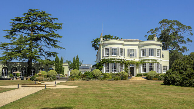
Deer Park Country House, Buckerell

Deer Park Country House near Honiton, Devon is a house of historical significance and is Grade II listed on the English Heritage Register. It was built...

Buckerell

Buckerell is a small village and civil parish in the East Devon district of Devon, England. The village is about 2.5 miles west of the nearest town, Honiton...

Honiton Town F.C.

Honiton Town Football Club is a football club based in Honiton, Devon, England. They are currently members of the South West Peninsula League Premier Division...

Pomeroy Wood

Pomeroy Wood is the site near Honiton in Devon of a Roman military site of unknown type, probably either a fort or marching camp, though archaeological...

Combe Raleigh

Combe Raleigh () is a village and civil parish in the county of Devon, England. The village lies about 1.5 miles north of the town of Honiton, and the...

Hembury

Hembury is a Neolithic causewayed enclosure and Iron Age hillfort near Honiton in Devon. Its history stretches from the late fifth and early fourth millennia...

Honiton Community College

Honiton Community College is a comprehensive academy school located in Honiton, Devon, England. It was originally established as Honiton Secondary School...

Nearby Amenities

Located within 500m of 50.807842,-3.228308
Laurel Bank
Junction: yes
Lat/Long: 50.806341/-3.2256864
Awliscombe
Place: village
Lat/Long: 50.8082274/-3.2293995
Give Way
Direction: forward
Lat/Long: 50.8077366/-3.2287099
Barrier: kissing_gate
Lat/Long: 50.805666/-3.2308892
Tourism: caravan_site
Lat/Long: 50.8035853/-3.2292648
Addr City: Honiton
Addr Housename: Heathfield
Addr Suburb: Awliscombe
Lat/Long: 50.8077849/-3.229653
Addr City: Honiton
Addr Housenumber: 1
Addr Street: Chinston Close
Addr Suburb: Awliscombe
Lat/Long: 50.8083742/-3.2298316
Addr City: Honiton
Addr Housenumber: 6
Addr Street: Chinston Close
Addr Suburb: Awliscombe
Lat/Long: 50.8085511/-3.2288025
Addr City: Honiton
Addr Housenumber: 7
Addr Street: Chinston Close
Addr Suburb: Awliscombe
Lat/Long: 50.8083373/-3.2291285
Addr City: Honiton
Addr Housenumber: 8
Addr Street: Chinston Close
Addr Suburb: Awliscombe
Lat/Long: 50.8081299/-3.2294626
Addr City: Honiton
Addr Housename: The Grannary
Addr Suburb: Awliscombe
Lat/Long: 50.8077219/-3.2288577
Addr City: Honiton
Addr Housename: Thistle Cottage
Addr Suburb: Awliscombe
Lat/Long: 50.8076564/-3.2286856
Addr City: Honiton
Addr Housename: Redwoods
Addr Suburb: Awliscombe
Lat/Long: 50.8075789/-3.2285354
Addr City: Honiton
Addr Housenumber: 1
Addr Suburb: Awliscombe
Lat/Long: 50.8076252/-3.2286224
Post Box
Awliscombe Village
Collection Times: Mo-Fr 17:15; Sa 08:30
Drive Through: no
Operator: Royal Mail
Post Box Type: lamp
Postal Code: EX14 3PJ
Ref: EX14 15
Lat/Long: 50.8083395/-3.2305473
Addr City: Honiton
Addr Housename: The Old Rectory
Addr Place: Awliscombe
Addr Postcode: EX14 3PJ
Lat/Long: 50.8084106/-3.2303255
Addr City: Honiton
Addr Housename: The Vicarage
Addr Place: Awliscombe
Addr Postcode: EX14 3PJ
Lat/Long: 50.8086831/-3.2308103
Addr City: Honiton
Addr Housenumber: 2
Addr Street: Church Hill
Addr Suburb: Awliscombe
Lat/Long: 50.80906/-3.231542
Operator: BT
Removed Amenity: telephone
Lat/Long: 50.8087714/-3.2315265
Addr City: Honiton
Addr Housename: Greenways
Addr Street: Greenway Lane
Addr Suburb: Awliscombe
Lat/Long: 50.8084054/-3.2278902
Addr City: Honiton
Addr Housename: Whitelands
Addr Street: Greenway Lane
Addr Suburb: Awliscombe
Lat/Long: 50.8082181/-3.2282517
Addr City: Honiton
Addr Housename: Spring Grove
Addr Street: Greenway Lane
Addr Suburb: Awliscombe
Lat/Long: 50.8080167/-3.2276689
Historic: memorial
Memorial: war_memorial
Website: https://www.warmemorialsonline.org.uk/memorial/144080
Lat/Long: 50.8077098/-3.2283818
Awliscombe
Direction: backward
Traffic Sign: city_limit
Lat/Long: 50.8058186/-3.222183
Give Way
Direction: backward
Lat/Long: 50.8068233/-3.2269276
Give Way
Direction: backward
Lat/Long: 50.8089622/-3.2315619
Give Way
Direction: backward
Lat/Long: 50.8080856/-3.2297748
Give Way
Direction: backward
Lat/Long: 50.8077296/-3.2285057
Give Way
Direction: backward
Lat/Long: 50.8043338/-3.2259411
Ford: yes
Lat/Long: 50.8038826/-3.2292993
Give Way
Direction: forward
Lat/Long: 50.8063178/-3.225697
Give Way
Direction: backward
Lat/Long: 50.8079721/-3.2296801
Ford: yes
Lat/Long: 50.8072195/-3.2321021
Turning Circle
Lat/Long: 50.8056339/-3.2305223
Give Way
Direction: backward
Lat/Long: 50.8099941/-3.2329376
Power: pole
Source: bing
Lat/Long: 50.8091/-3.2344364
Generator Method: photovoltaic
Generator Output Electricity: yes
Generator Source: solar
Generator Type: solar_photovoltaic_panel
Location: roof
Power: generator
Lat/Long: 50.8085785/-3.2288128
Generator Method: photovoltaic
Generator Output Electricity: yes
Generator Source: solar
Generator Type: solar_photovoltaic_panel
Location: roof
Power: generator
Lat/Long: 50.8077551/-3.2291597
Generator Method: photovoltaic
Generator Output Electricity: yes
Generator Source: solar
Generator Type: solar_photovoltaic_panel
Location: roof
Power: generator
Lat/Long: 50.8077399/-3.2291114
Generator Method: photovoltaic
Generator Output Electricity: yes
Generator Source: solar
Generator Type: solar_photovoltaic_panel
Location: roof
Power: generator
Lat/Long: 50.8076992/-3.2289156
Power: pole
Source: bing
Lat/Long: 50.8036091/-3.2305652
Power: pole
Source: bing
Lat/Long: 50.8049558/-3.2317038
Power: pole
Source: bing
Lat/Long: 50.8065093/-3.2332313
Power: pole
Source: bing
Lat/Long: 50.80575/-3.2325017
Power: pole
Source: bing
Lat/Long: 50.807267/-3.2346489
Power: pole
Source: bing
Lat/Long: 50.8083077/-3.2216549
Power: pole
Source: bing
Lat/Long: 50.8054423/-3.2251163
Power: pole
Source: bing
Lat/Long: 50.8060763/-3.2243626
Power: pole
Source: bing
Lat/Long: 50.8063356/-3.2240367
Power: pole
Source: bing
Lat/Long: 50.8069788/-3.2232615
Power: pole
Source: bing
Lat/Long: 50.8076518/-3.2224475
Poles: bipole
Power: pole
Source: bing
Transformer: distribution
Lat/Long: 50.8071992/-3.2292482
Power: pole
Source: bing
Lat/Long: 50.806611/-3.2283872
Power: pole
Source: bing
Lat/Long: 50.8060508/-3.227533
Power: pole
Source: bing
Lat/Long: 50.8054254/-3.226613
Power: pole
Source: bing
Lat/Long: 50.8050669/-3.2260591
Power: pole
Source: bing
Lat/Long: 50.8048084/-3.2256755
Power: pole
Source: bing
Lat/Long: 50.8045516/-3.2252236
Power: pole
Source: bing
Lat/Long: 50.804277/-3.2247314
The data included in this document is from www.openstreetmap.org. The data is made available under ODbL.

Have you been to Awliscombe?

Leave your review of Awliscombe below (or comments, questions and feedback).