Loch Lagain Loisgte

Lake, Pool, Pond, Freshwater Marsh in Inverness-shire

Scotland

Loch Lagain Loisgte

Trees and deer near the Inverie River At a bend in the river named as Poll Ailein (Allan's Pool) on old OS maps, see <span class="nowrap"><a title="https://scotlandsplaces.gov.uk/digital-volumes/ordnance-survey-name-books/inverness-shire-os-name-books-1876-1878/inverness-shire-mainland-volume-29/115?display=transcription" rel="nofollow ugc noopener" href="https://scotlandsplaces.gov.uk/digital-volumes/ordnance-survey-name-books/inverness-shire-os-name-books-1876-1878/inverness-shire-mainland-volume-29/115?display=transcription">Link</a><img style="margin-left:2px;" alt="External link" title="External link - shift click to open in new window" src="https://s1.geograph.org.uk/img/external.png" width="10" height="10"/></span>
Trees and deer near the Inverie River Credit: wrobison

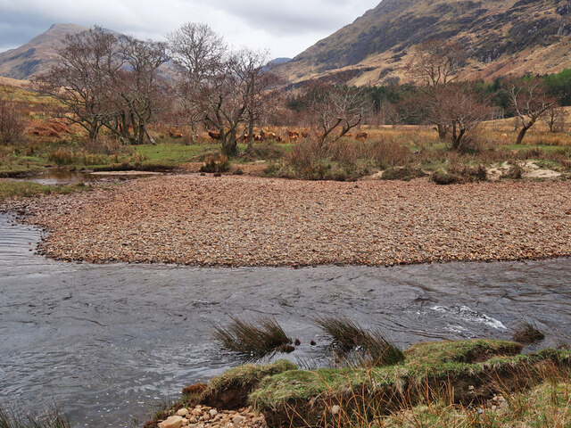
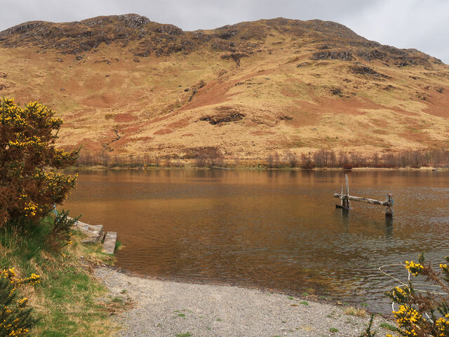
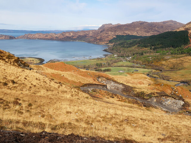
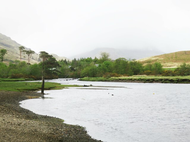
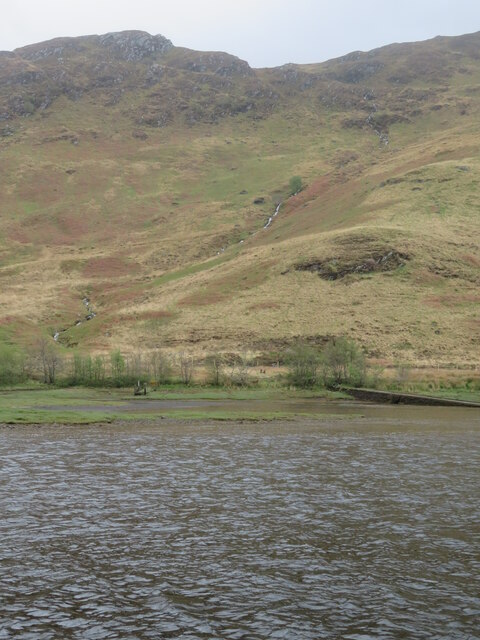
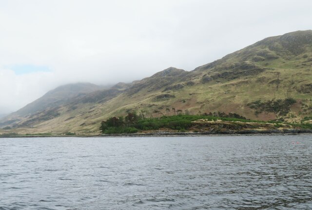
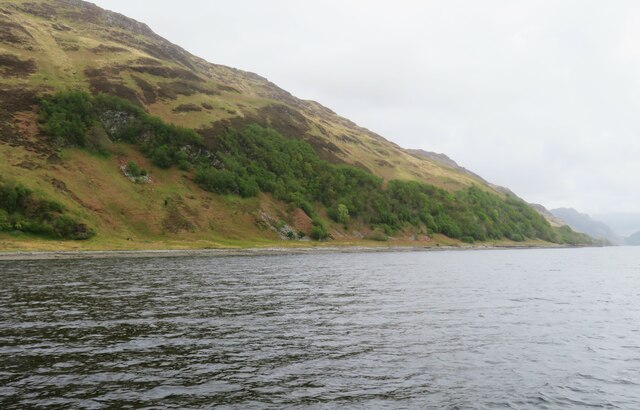
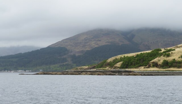
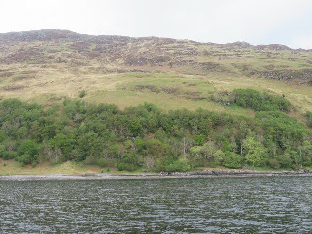
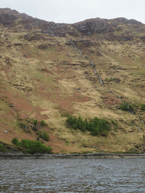
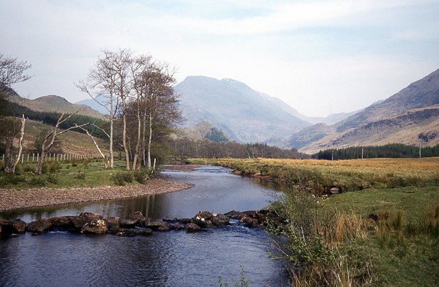
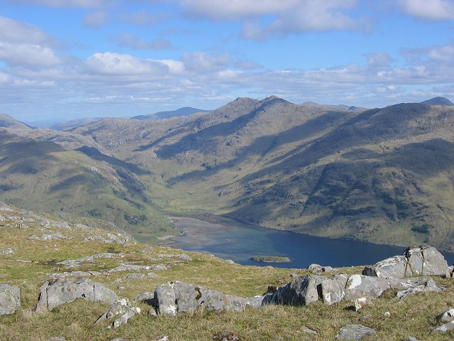
Loch Lagain Loisgte is a small freshwater loch located in Inverness-shire, Scotland. It is situated within a picturesque and tranquil setting, surrounded by rolling hills and lush greenery. The loch is relatively shallow, with a maximum depth of around 10 meters, and covers an area of approximately 1.5 hectares.

The water in Loch Lagain Loisgte is crystal clear and teeming with a variety of aquatic life, including fish, frogs, and waterfowl. The surrounding marshlands provide important habitat for a diverse range of plant and animal species, making it a popular destination for wildlife enthusiasts and birdwatchers.

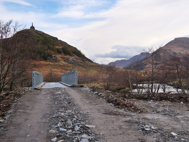
Visitors to Loch Lagain Loisgte can enjoy a range of outdoor activities, such as fishing, birdwatching, and hiking along the scenic trails that meander around the loch. The tranquil atmosphere and stunning natural beauty of the area make it a perfect spot for relaxation and contemplation.

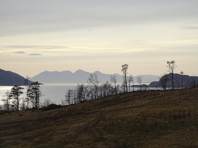
Overall, Loch Lagain Loisgte is a hidden gem in the Scottish Highlands, offering visitors a peaceful retreat in the midst of nature's beauty.

If you have any feedback on the listing, please let us know in the comments section below.

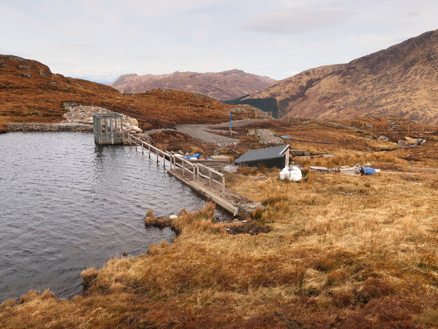
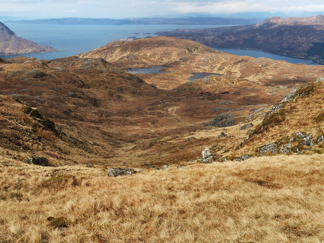
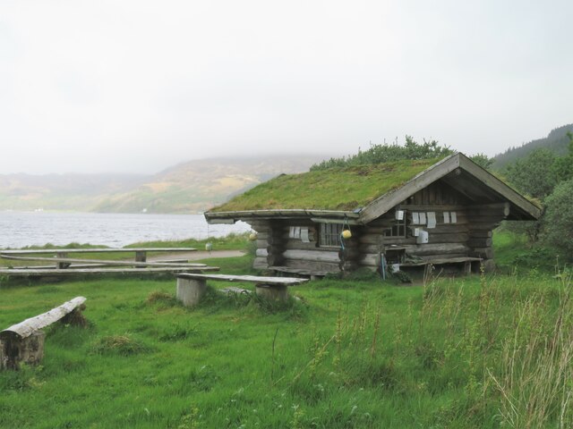
Loch Lagain Loisgte Images

Images are sourced within 2km of 57.013283/-5.6595525 or Grid Reference NM7797. Thanks to Geograph Open Source API. All images are credited.

Trees and deer near the Inverie River At a bend in the river named as Poll Ailein (Allan's Pool) on old OS maps, see <span class="nowrap"><a title="https://scotlandsplaces.gov.uk/digital-volumes/ordnance-survey-name-books/inverness-shire-os-name-books-1876-1878/inverness-shire-mainland-volume-29/115?display=transcription" rel="nofollow ugc noopener" href="https://scotlandsplaces.gov.uk/digital-volumes/ordnance-survey-name-books/inverness-shire-os-name-books-1876-1878/inverness-shire-mainland-volume-29/115?display=transcription">Link</a><img style="margin-left:2px;" alt="External link" title="External link - shift click to open in new window" src="https://s1.geograph.org.uk/img/external.png" width="10" height="10"/></span>
Trees and deer near the Inverie River
At a bend in the river named as Poll Ailein (Allan's Pool) on old OS maps, see LinkExternal link
Kilchoan Burial Ground, Inverie The rectangular Roman Catholic burial ground is enclosed by a 19th-century wall and is on the site of a medieval church dedicated to St Comgan. The nearby circular Protestant burial ground is on the left. For more info, see <span class="nowrap"><a title="https://canmore.org.uk/site/22719/knoydart-inverie-st-comgans-church" rel="nofollow ugc noopener" href="https://canmore.org.uk/site/22719/knoydart-inverie-st-comgans-church">Link</a><img style="margin-left:2px;" alt="External link" title="External link - shift click to open in new window" src="https://s1.geograph.org.uk/img/external.png" width="10" height="10"/></span>
Kilchoan Burial Ground, Inverie
The rectangular Roman Catholic burial ground is enclosed by a 19th-century wall and is on the site of a medieval church dedicated to St Comgan. The nearby circular Protestant burial ground is on the left. For more info, see LinkExternal link
Mouth of the Inverie River Looking across the river towards A' Chruach. Taken at high tide, compare with <a href="https://www.geograph.org.uk/photo/6239594">NM7798 : Boats near the mouth of the Inverie River, Knoydart</a>.
Mouth of the Inverie River
Looking across the river towards A' Chruach. Taken at high tide, compare with NM7798 : Boats near the mouth of the Inverie River, Knoydart.
Bridge over the Inverie River Providing access to the community owned Knoydart Hydro generating station.
Bridge over the Inverie River
Providing access to the community owned Knoydart Hydro generating station.
Steep slopes on Beinn Bhuidhe The new track on the left connects the hydro station near the Inverie River to the small dam at Loch Bhraomisaig and rises 300m in 1km.
Looking towards Inverie Bay.
Steep slopes on Beinn Bhuidhe
The new track on the left connects the hydro station near the Inverie River to the small dam at Loch Bhraomisaig and rises 300m in 1km. Looking towards Inverie Bay.
Dam at Loch Bhraomisaig The water source for the Knoydart Hydro generating station. The first hydro scheme was built in 1979 but it became unreliable and was switched off in 2001. After repairs and modernisations were made to the dam, pipeline and turbine, the scheme was switched on again on 5th November 2021,  see <span class="nowrap"><a title="https://knoydart.org/2021/11/05/the-historic-moment-after-years-of-work-we-switch-to-our-new-hydro-pipeline/" rel="nofollow ugc noopener" href="https://knoydart.org/2021/11/05/the-historic-moment-after-years-of-work-we-switch-to-our-new-hydro-pipeline/">Link</a><img style="margin-left:2px;" alt="External link" title="External link - shift click to open in new window" src="https://s1.geograph.org.uk/img/external.png" width="10" height="10"/></span>
Dam at Loch Bhraomisaig
The water source for the Knoydart Hydro generating station. The first hydro scheme was built in 1979 but it became unreliable and was switched off in 2001. After repairs and modernisations were made to the dam, pipeline and turbine, the scheme was switched on again on 5th November 2021, see LinkExternal link
Coire nan Gobhar Above Loch Bhraomisaig on Beinn Bhuidhe
Coire nan Gobhar
Above Loch Bhraomisaig on Beinn Bhuidhe
Moorland above Loch Bhraomisaig on Beinn Bhuidhe
Inverie camping ground A stretch of open and grassy shoreline, possibly breezy enough to deter midges, with this shelter as a focal point. There's a composting toilet nearby as well.
Inverie camping ground
A stretch of open and grassy shoreline, possibly breezy enough to deter midges, with this shelter as a focal point. There's a composting toilet nearby as well.
Upstream along the Inverie River On a clear day there would be a splendid view towards the mountains, but not on this occasion.
Upstream along the Inverie River
On a clear day there would be a splendid view towards the mountains, but not on this occasion.
Across the Inverie River Just a few metres upstream from where the river meets the sea. On the far side is part of the structure shown as a slipway on the OS map, whilst steep hill slopes beyond rise to 350m plus.
Across the Inverie River
Just a few metres upstream from where the river meets the sea. On the far side is part of the structure shown as a slipway on the OS map, whilst steep hill slopes beyond rise to 350m plus.
An Cnap Viewed from the ferry heading for Tarbet, An Cnap is a low headland part covered in scots pine.
An Cnap
Viewed from the ferry heading for Tarbet, An Cnap is a low headland part covered in scots pine.
Steep slopes above the Loch Nevis shore Part wooded and part rocky slopes that rise above the NE shoreline of Loch Nevis at this point.
Steep slopes above the Loch Nevis shore
Part wooded and part rocky slopes that rise above the NE shoreline of Loch Nevis at this point.
Creag an Eilein This rocky reef/islet is at the northern end of the grid square. Beyond, and shrouded in cloud, is the Corbett of Sgurr Coire Choinnichean.
Creag an Eilein
This rocky reef/islet is at the northern end of the grid square. Beyond, and shrouded in cloud, is the Corbett of Sgurr Coire Choinnichean.
A remote coastline A view from the Tarbet bound ferry, looking towards the eastern shoreline of Loch Nevis. No tracks or paths cross this area.
A remote coastline
A view from the Tarbet bound ferry, looking towards the eastern shoreline of Loch Nevis. No tracks or paths cross this area.
Allt Direach We were the only two passengers on the run from Inverie to Tarbet and the skipper was quite happy to hug the shore so that I could take photographs. This grid square has three small burns cascading down the hillside into the loch, and the most obvious one here is the burn that is the furthest south and is also named as Allt Direach.
Allt Direach
We were the only two passengers on the run from Inverie to Tarbet and the skipper was quite happy to hug the shore so that I could take photographs. This grid square has three small burns cascading down the hillside into the loch, and the most obvious one here is the burn that is the furthest south and is also named as Allt Direach.
Inverie Bay & Rum A sea mist is just beginning to form late in the day on the waters between Knoydart and the Isle of Rum.
Inverie Bay & Rum
A sea mist is just beginning to form late in the day on the waters between Knoydart and the Isle of Rum.
Inverie River
Inverie River
Show me another place!

Loch Lagain Loisgte is located at Grid Ref: NM7797 (Lat: 57.013283, Lng: -5.6595525)

Unitary Authority: Highland

Police Authority: Highlands and Islands

What 3 Words

///toolbar.foam.quaking. Near Armadale, Highland

Related Wikis

Loch Nevis

Loch Nevis (Scottish Gaelic: Loch Nibheis) is a sea loch in Lochaber on the west coast of Scotland. It runs inland from the Sound of Sleat, and is bounded...

Inverie Bay

Inverie Bay is a coastal embayment, on a chord of 2.12 miles, on a 207° orientation, on the northwestern coast of the sea loch in Loch Nevis, and is next...

Inverie

Inverie (; Scottish Gaelic: Inbhir Aoidh) is the main village on the Knoydart peninsula in the Scottish Highlands. It is located on the north side of Loch...

Beinn Bhuidhe (Knoydart)

Beinn Bhuidhe (855m) is a mountain in the Northwest Highlands of Scotland. It lies in a very remote area of Knoydart, Lochaber. Lying on the north side...

Have you been to Loch Lagain Loisgte?

Leave your review of Loch Lagain Loisgte below (or comments, questions and feedback).