Glackmore

Settlement in Ross-shire

Scotland

Glackmore

Croftland working croftland with Munlochy Bay in the distance
Croftland Credit: David Maclennan

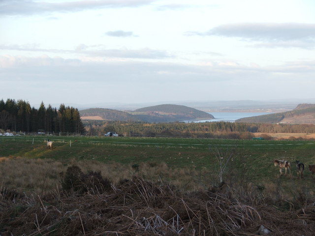
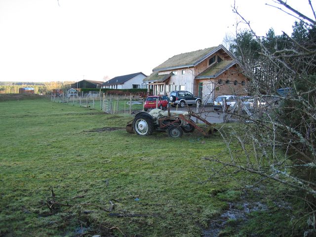
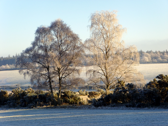
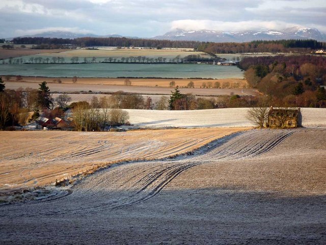
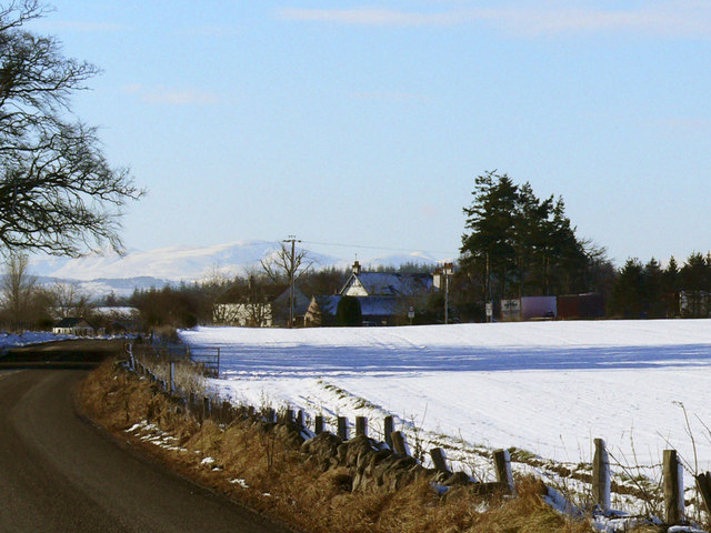
Glackmore is a small village located in the historic county of Ross-shire, in the Scottish Highlands. Nestled amidst picturesque landscapes, it is situated approximately 6 miles northwest of the town of Dingwall. The village is surrounded by rolling hills and verdant farmland, offering residents and visitors a tranquil and idyllic setting.

With a population of around 200 people, Glackmore is a close-knit community that prides itself on its friendly and welcoming atmosphere. The village is known for its strong sense of community spirit, with residents actively involved in various local initiatives and events.

Despite its small size, Glackmore boasts a few amenities to serve its residents. These include a village hall, which acts as a hub for community gatherings and events, and a small convenience store that caters to daily needs. For more extensive shopping and services, the nearby town of Dingwall provides a wider range of amenities.

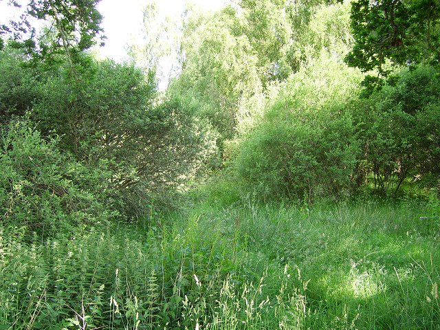
Nature enthusiasts and outdoor lovers are drawn to Glackmore for its stunning surroundings. The village is located within close proximity to several popular hiking trails, offering breathtaking views of the surrounding countryside and glimpses of local wildlife. The nearby Black Isle Peninsula is also a popular destination for birdwatching and nature walks.

Glackmore's location provides easy access to the wider Ross-shire area, making it an ideal base for exploring the Highlands. The village is well-connected by road, with the A862 passing nearby, offering convenient travel options to nearby towns and cities.

In summary, Glackmore is a charming and peaceful village in Ross-shire, Scotland. With its scenic beauty, strong community spirit, and convenient location, it offers residents and visitors a delightful place to call home or to experience the natural wonders of the Scottish Highlands.

If you have any feedback on the listing, please let us know in the comments section below.

Glackmore Images

Images are sourced within 2km of 57.530512/-4.327368 or Grid Reference NH6051. Thanks to Geograph Open Source API. All images are credited.

Croftland working croftland with Munlochy Bay in the distance
Croftland
working croftland with Munlochy Bay in the distance
Cattle Grazing Fields at Glackmore
Cattle Grazing
Fields at Glackmore
Glackmore Farm In the district of Glackmore
Glackmore Farm
In the district of Glackmore
Linnie Wood A lot of the Black Isle is wooded. This was moorland on the 1940's map now a very dense scrubby woodland.
Linnie Wood
A lot of the Black Isle is wooded. This was moorland on the 1940's map now a very dense scrubby woodland.
Looking Westward to the Tore roundabout.
Allangrange All that remains of a 13th century church.
Allangrange
All that remains of a 13th century church.
Forestry at Broomhill A small area of forest recovering from being cleared, probably a few years ago. A few tall trees have been left behind and the ground is returning to its natural state among the stumps of the felled trees.
Forestry at Broomhill
A small area of forest recovering from being cleared, probably a few years ago. A few tall trees have been left behind and the ground is returning to its natural state among the stumps of the felled trees.
Stubble A field of stubble next to the A9, which runs in the trees on the far side.
Stubble
A field of stubble next to the A9, which runs in the trees on the far side.
Barn at Cotterton Used today as a shelter for horses.
Barn at Cotterton
Used today as a shelter for horses.
Glachbeg Croft Glachbeg Croft is an education centre that is part of a six hectare croft on the Black Isle. It offers community events, training for adults with special needs and programmes around farming, the countryside and environmental education. Note the turf roof.
Glachbeg Croft
Glachbeg Croft is an education centre that is part of a six hectare croft on the Black Isle. It offers community events, training for adults with special needs and programmes around farming, the countryside and environmental education. Note the turf roof.
Easter Muchnich I am told that this farm is known locally as Easter Muckernich, the same as the neighbouring croft in NH5952. The name 'Muchnich' as on the OS map appears to be an error.
Easter Muchnich
I am told that this farm is known locally as Easter Muckernich, the same as the neighbouring croft in NH5952. The name 'Muchnich' as on the OS map appears to be an error.
Near Glachbeg, on a frosty morning.
On the track to Parkton Often muddy, progress along the track is made lots easier by the frozen surface.
On the track to Parkton
Often muddy, progress along the track is made lots easier by the frozen surface.
View from A9, Torepark looking south. Early morning mist clearing from Munlochy Bay.
View from A9, Torepark looking south.
Early morning mist clearing from Munlochy Bay.
Track to Gallow Hill Part of the network of tracks that gives a pleasant circular walk from Arpafeelie to Redcastle
Track to Gallow Hill
Part of the network of tracks that gives a pleasant circular walk from Arpafeelie to Redcastle
Fields around Parkton Farm A Black Isle scene with Beinn Wyvis dominating the skyline.  The view was taken from a circular walk between Arpafeelie and Redcastle that circumnavigates Gallowhill Wood.
Fields around Parkton Farm
A Black Isle scene with Beinn Wyvis dominating the skyline. The view was taken from a circular walk between Arpafeelie and Redcastle that circumnavigates Gallowhill Wood.
Track alongside Gallowhill Wood This is a section of the circular walk between Arpafeelie and Redcastle.
Track alongside Gallowhill Wood
This is a section of the circular walk between Arpafeelie and Redcastle.
Forestry track through Gallowhill Wood This track ends abruptly, but enterprising walkers have created a way to link up with another forestry track to create a circular walk from Arpafeelie to Redcastle.
Forestry track through Gallowhill Wood
This track ends abruptly, but enterprising walkers have created a way to link up with another forestry track to create a circular walk from Arpafeelie to Redcastle.
Show me another place!

Glackmore is located at Grid Ref: NH6051 (Lat: 57.530512, Lng: -4.327368)

Unitary Authority: Highland

Police Authority: Highlands and Islands

What 3 Words

///restores.plotter.portfolio. Near Conon Bridge, Highland

Nearby Locations

Glackmore

Related Wikis

Allangrange railway station

Allangrange railway station was a station on the single track branch of the Highland Railway, in north east Scotland. The line connected villages in The...

Arpafeelie

Arpafeelie (Scottish Gaelic: Arpa Phìlidh) is a hamlet on the Black Isle, in Ross and Cromarty, in the Highland council area of Scotland. It is situated...

Tore, Scotland

Tore (Scottish Gaelic: An Todhar) is a small village on the Black Isle, in Ross and Cromarty, Highland, Scotland. == Settlements == It is located 7 miles...

Redcastle railway station

Redcastle railway station served the parish of Killearnan, Ross and Cromarty, Scotland, from 1894 to 1951 on the Fortrose Branch. == History == The station...

Nearby Amenities

Located within 500m of 57.530512,-4.327368
Glackmore
Place: hamlet
Lat/Long: 57.5273898/-4.3311973
Bus Stop
Glackmore
Bench: no
Bin: no
Lit: no
Naptan AtcoCode: 670090024E
Naptan Bearing: NW
Naptan CommonName: Glackmore
Naptan Indicator: Glackmore Junction
Naptan Landmark: Glackmore Junction
Naptan NaptanCode: 45323234
Naptan Street: A9
Naptan Verified: no
Shelter: no
Source: naptan_import
Tactile Paving: no
Lat/Long: 57.5303494/-4.3268779
Parking
Layby 193
Access: yes
Fee: no
Parking: layby
Source: survey
Lat/Long: 57.5283378/-4.3251654
Parking
Layby 194
Access: yes
Fee: no
Parking: layby
Source Name: interpolation
Lat/Long: 57.5339901/-4.3286139
Drinking Water
Drinking Water: yes
Man Made: water_tap
Lat/Long: 57.5313671/-4.3206592
Power: pole
Lat/Long: 57.5285025/-4.3204516
Power: pole
Lat/Long: 57.5291343/-4.3208656
Power: pole
Lat/Long: 57.5297444/-4.3212105
Power: pole
Lat/Long: 57.5303697/-4.3216164
Power: pole
Lat/Long: 57.5310124/-4.3219897
Power: pole
Lat/Long: 57.5321432/-4.3226797
Power: pole
Lat/Long: 57.5326682/-4.3230043
Power: pole
Lat/Long: 57.533202/-4.323331
Power: pole
Lat/Long: 57.5312652/-4.329792
Power: pole
Lat/Long: 57.5315146/-4.3287937
Material: wood
Power: pole
Lat/Long: 57.5317325/-4.3278927
Power: pole
Lat/Long: 57.5320528/-4.3269065
Power: pole
Lat/Long: 57.5323327/-4.3260116
Power: pole
Lat/Long: 57.5326279/-4.3251086
Power: pole
Lat/Long: 57.532921/-4.3242158
Power: pole
Lat/Long: 57.5334776/-4.3224605
Power: pole
Lat/Long: 57.5276834/-4.3332361
Power: pole
Lat/Long: 57.5273875/-4.3322631
Power: pole
Lat/Long: 57.5272196/-4.3316637
Power: pole
Lat/Long: 57.5271387/-4.3314031
Power: pole
Lat/Long: 57.5269812/-4.330878
Power: pole
Lat/Long: 57.5274341/-4.3306888
Power: pole
Lat/Long: 57.5277534/-4.3299204
Power: pole
Lat/Long: 57.5281016/-4.3290768
Power: pole
Lat/Long: 57.5283981/-4.3283296
Power: pole
Lat/Long: 57.5266909/-4.331573
Power: pole
Lat/Long: 57.5310005/-4.3307274
Power: pole
Lat/Long: 57.530756/-4.331739
Power: pole
Lat/Long: 57.5305228/-4.3327178
Power: pole
Lat/Long: 57.5302668/-4.333712
Power: pole
Lat/Long: 57.5300253/-4.3347024
Power: pole
Lat/Long: 57.5278587/-4.3322175
Power: pole
Lat/Long: 57.5280779/-4.3324015
Power: pole
Lat/Long: 57.5284991/-4.333239
Power: pole
Lat/Long: 57.5289749/-4.3342162
Power: pole
Lat/Long: 57.5293814/-4.3350114
Power: pole
Lat/Long: 57.5313809/-4.3332348
Power: pole
Lat/Long: 57.5309824/-4.3329979
The data included in this document is from www.openstreetmap.org. The data is made available under ODbL.

Have you been to Glackmore?

Leave your review of Glackmore below (or comments, questions and feedback).