Gipsy Row

Settlement in Suffolk Babergh

England

Gipsy Row

The A12, Capel St Mary I've been here before. <a title="https://www.geograph.org.uk/photo/5377066" href="https://www.geograph.org.uk/photo/5377066">Link</a>
The A12, Capel St Mary Credit: David Howard

The requested URL returned error: 503 Service Temporarily Unavailable

If you have any feedback on the listing, please let us know in the comments section below.
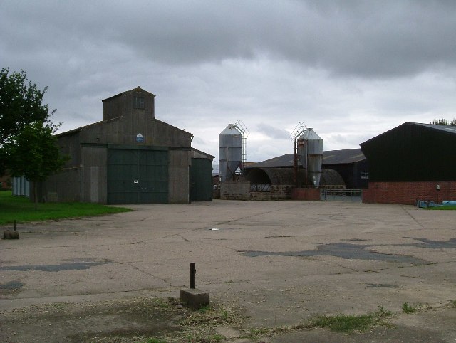
Gipsy Row Images

Images are sourced within 2km of 52.009197/1.01986 or Grid Reference TM0738. Thanks to Geograph Open Source API. All images are credited.

The A12, Capel St Mary I've been here before. <a title="https://www.geograph.org.uk/photo/5377066" href="https://www.geograph.org.uk/photo/5377066">Link</a>
The A12, Capel St Mary
I've been here before. Link
The A12, Capel St Mary
Hadleigh from the air Hadleigh is on the left of the photo. The distinctive shape of Wolves Wood can be seen to the left of centre.
Hadleigh from the air
Hadleigh is on the left of the photo. The distinctive shape of Wolves Wood can be seen to the left of centre.
Brook Lane & Bottle Bridge Cottages
Brook Lane & bridleway
Bridleway to The Street & Upper Birches Off Brook Lane
Bridleway to The Street & Upper Birches
Off Brook Lane
Raydon Hall Farm This workman like looking farm stands on the edge of the old Raydon Aerodrome it has the advantage that many of its farm tracks are concrete taxiways.  Clearly the yard was once an aircraft dispersal.
Raydon Hall Farm
This workman like looking farm stands on the edge of the old Raydon Aerodrome it has the advantage that many of its farm tracks are concrete taxiways. Clearly the yard was once an aircraft dispersal.
Runway The photograph was taken from the remains of an aircraft dispersal looking northeast(ish) along the minor road to Hintlesham. The road follows the course of one of the runways of Raydon airfield.
Runway
The photograph was taken from the remains of an aircraft dispersal looking northeast(ish) along the minor road to Hintlesham. The road follows the course of one of the runways of Raydon airfield.
"They Came in Our Hour of Need" Raydon Airfield Memorial, the monument remembers the members of the USAAF 833 & 862 Aviation Engineering Battalions and 353,357,358 Fighter Groups who served at Raydon Airfield in WW2. The plaque says "They Came in Our Hour of Need". It stands at the end of one of the main runways. The photo was taken looking southwest. The remains of the airscrews are from P51 Mustang on the Right and a P47 thunderbolt on the left. Both types operated from Raydon.
"They Came in Our Hour of Need"
Raydon Airfield Memorial, the monument remembers the members of the USAAF 833 & 862 Aviation Engineering Battalions and 353,357,358 Fighter Groups who served at Raydon Airfield in WW2. The plaque says "They Came in Our Hour of Need". It stands at the end of one of the main runways. The photo was taken looking southwest. The remains of the airscrews are from P51 Mustang on the Right and a P47 thunderbolt on the left. Both types operated from Raydon.
St. Mary's church, Capel St. Mary, Suffolk This is a mainly 15th century church.  At one time it had a spire. Inside, there is a fine hammerbeam roof.
St. Mary's church, Capel St. Mary, Suffolk
This is a mainly 15th century church. At one time it had a spire. Inside, there is a fine hammerbeam roof.
St. John's church, Great Wenham, Suffolk This mainly 14th century church has a fine tower with nice flushwork decoration.
St. John's church, Great Wenham, Suffolk
This mainly 14th century church has a fine tower with nice flushwork decoration.
All Saints church, Little Wenham, Suffolk This church, seen across a field, dates from 1300 and stands close to the 13th century Little Wenham Hall, which is private. The brick built upper stage of the tower is Tudor.
All Saints church, Little Wenham, Suffolk
This church, seen across a field, dates from 1300 and stands close to the 13th century Little Wenham Hall, which is private. The brick built upper stage of the tower is Tudor.
Footpath that runs alongside Acacia Farm
Raydon Hall Farm
Raydon Hall Farm
Wenham Place, Great Wenham, Suffolk
Public footpath at Great Wenham
Allotments along Pound Lane
Capel St. Mary, Suffolk This is the view at the end of Pound Lane by St. Mary's church.
Capel St. Mary, Suffolk
This is the view at the end of Pound Lane by St. Mary's church.
Show me another place!

Gipsy Row is located at Grid Ref: TM0738 (Lat: 52.009197, Lng: 1.01986)

Administrative County: Suffolk

District: Babergh

Police Authority: Suffolk

What 3 Words

///ghosts.sporting.finger. Near Capel St Mary, Suffolk

Related Wikis

Wenham Magna

Wenham Magna, also known as Great Wenham, is a village and a civil parish in the Babergh district of Suffolk in eastern England. The parish also contains...

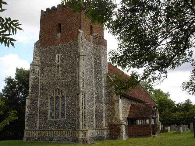
All Saints Church, Little Wenham

All Saints Church is a redundant Anglican church in the village of Little Wenham, Suffolk, England. It is recorded in the National Heritage List for England...

Little Wenham

Little Wenham is a small village in Suffolk, England. It is part of the civil parish of Wenham Parva – the ancient name for Little Wenham) within Babergh...

Wenham Parva

Wenham Parva is a civil parish in the Babergh district, in the county of Suffolk, England. It covers the village of Little Wenham (whose ancient name it...

Related Videos

East Bergholt, Suffolk, Bell Cage, July 2023

East Bergholt, Suffolk, Bell Cage, July 2023 #bellringing #churchhistory #constable.

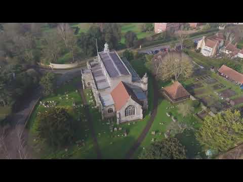
St Mary the Virgin Church East Bergholt Suffolk

The church stands in the old part of the village among narrow lanes and across from Old Hall, once a Catholic convent and today ...

The Blocky Adventurer visits St Mary’s East Bergholt and its curious bell cage.

Join the Blocky Adventurer as he looks at the wonderful church at East Bergholt. Why is the tower ruined? What is that barn in the ...

Modern Foreign Languages MFL Subject Showcase EBHS Virtual Open Evening 2020

Modern Foreign Languages MFL Subject Showcase EBHS Virtual Open Evening 2020.

Nearby Amenities

Located within 500m of 52.009197,1.01986
Bus Stop
Queens Head
Local Ref: adj
Naptan AtcoCode: 390010567
Naptan Bearing: E
Naptan BusStopType: CUS
Naptan CommonName: Queens Head
Naptan Landmark: Queens Head
Naptan NaptanCode: sufagpjw
Naptan Street: The Row
Naptan Verified: no
Source: naptan_import
Lat/Long: 52.007542/1.0188505
Bus Stop
Queens Head
Local Ref: opp
Naptan AtcoCode: 390010568
Naptan Bearing: W
Naptan BusStopType: CUS
Naptan CommonName: Queens Head
Naptan Landmark: Queens Head
Naptan NaptanCode: sufagpma
Naptan Street: The Row
Naptan Verified: no
Source: naptan_import
Lat/Long: 52.007558/1.0185747
Pub
Queens Head (AKA Queen)
Addr City: Wenham Magna
Addr Postcode: CO7 6PU
Addr Street: Capel St Mary Road
Lat/Long: 52.0076914/1.0188667
The data included in this document is from www.openstreetmap.org. The data is made available under ODbL.

Have you been to Gipsy Row?

Leave your review of Gipsy Row below (or comments, questions and feedback).