Giltbrook

Settlement in Nottinghamshire Broxtowe

England

Giltbrook

Postbox on Maws Lane
Postbox on Maws Lane Credit: David Lally

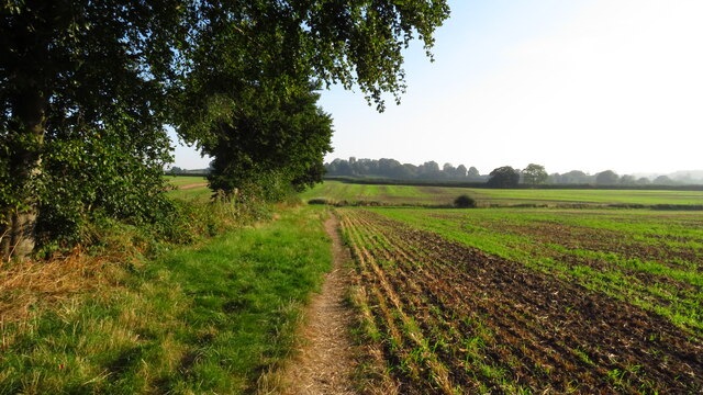
Giltbrook is a small village located in the borough of Broxtowe, Nottinghamshire, England. It is situated approximately 8 miles northwest of Nottingham city center and 3 miles southeast of Eastwood. Giltbrook is known for its historical significance and its proximity to the scenic countryside.

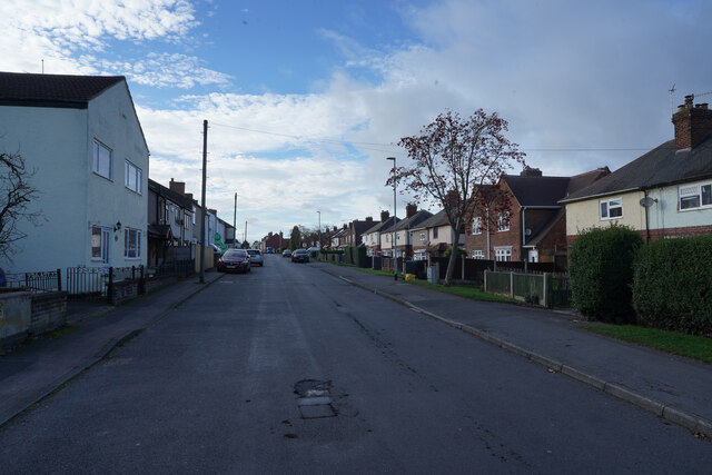
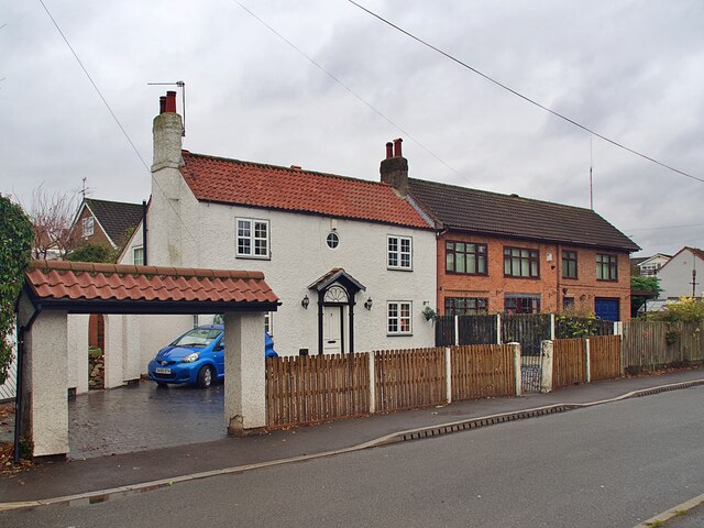
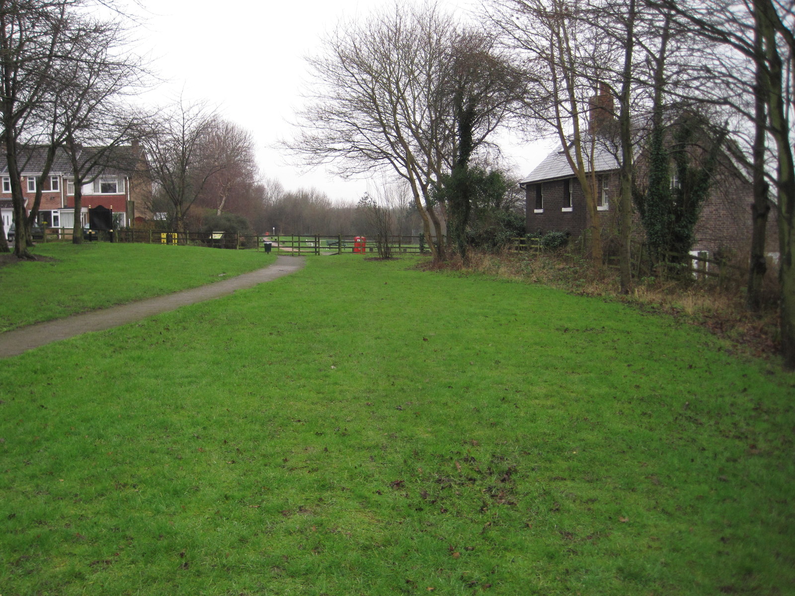
The village has a population of around 3,000 residents, offering a close-knit community atmosphere. Giltbrook is primarily a residential area, with a mix of traditional and modern housing developments. The village is characterized by its quaint cottages and tree-lined streets, providing a picturesque setting for residents and visitors alike.

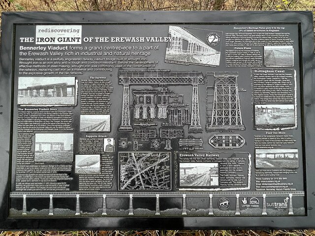
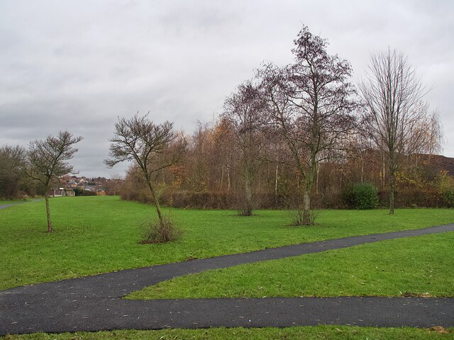
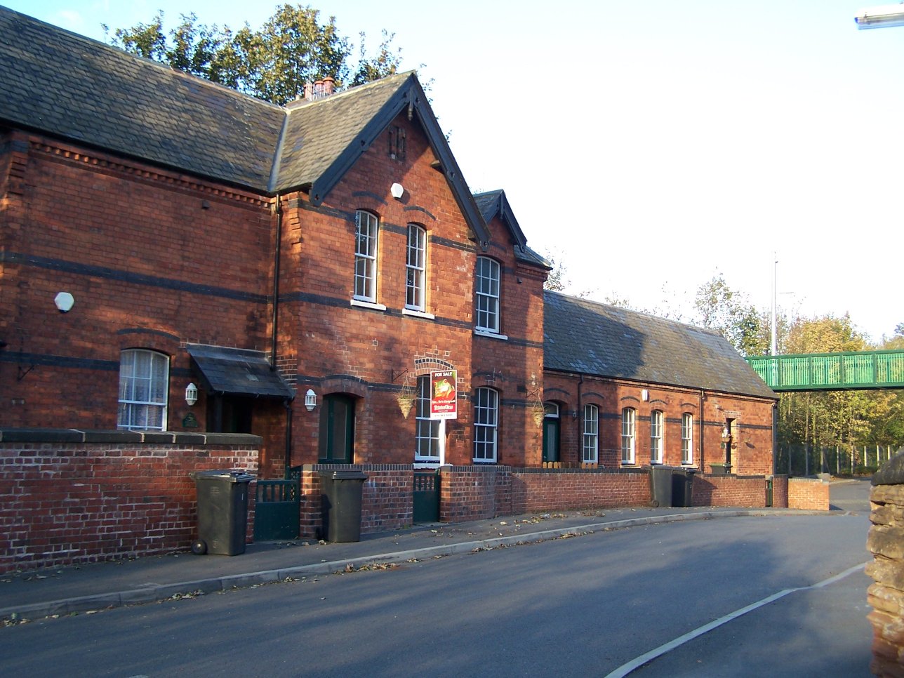
One of the notable landmarks in Giltbrook is the Giltbrook Viaduct, a historic railway bridge that dates back to the 19th century. It stands as a testament to the village's industrial past and is a popular spot for photography enthusiasts. The village also boasts several green spaces, including Giltbrook Park, which offers recreational facilities such as a children's playground and walking trails.

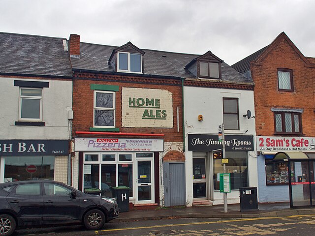
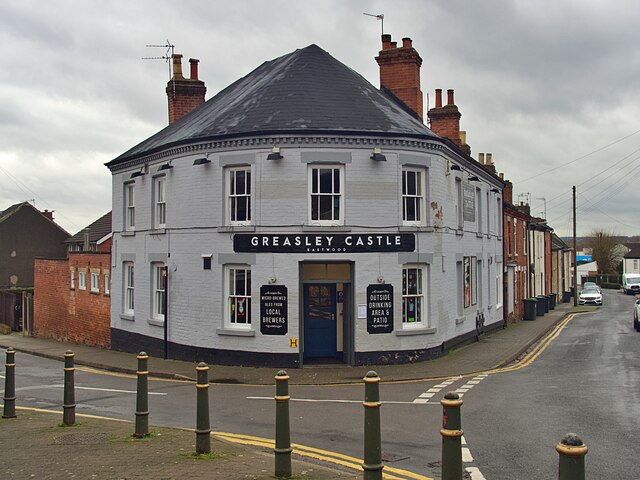
Despite its small size, Giltbrook offers convenient amenities for its residents. The village is home to a range of shops, including a supermarket and a variety of local businesses. Additionally, there are a few pubs and restaurants that cater to both locals and visitors.

Giltbrook benefits from excellent transportation links, with regular bus services connecting the village to nearby towns and Nottingham city center. The village is also conveniently located near the M1 motorway, providing easy access to other parts of Nottinghamshire and the wider Midlands region.

Overall, Giltbrook is a charming village with a rich history and a peaceful atmosphere, making it an attractive place to live or visit in Nottinghamshire.

If you have any feedback on the listing, please let us know in the comments section below.
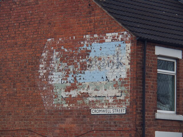
Giltbrook Images

Images are sourced within 2km of 53.005147/-1.278683 or Grid Reference SK4845. Thanks to Geograph Open Source API. All images are credited.

Postbox on Maws Lane
Station Road Though it is called Station Road there does not appear to be any station nearby.
Station Road
Though it is called Station Road there does not appear to be any station nearby.
On the Robin Hood Way northwest of Kimberley
Robin Hood Way leading northeast towards Greasley
St Mary's Church, Greasley
Bennerley Viaduct Information Board With the viaduct beyond. For detail of the board see <a href="https://www.geograph.org.uk/photo/7043440">SK4743 : Bennerley Viaduct Information Board</a> and for more on the viaduct see <a href="https://www.geograph.org.uk/photo/7043437">SK4743 : Bennerley Viaduct</a>.
Bennerley Viaduct Information Board
With the viaduct beyond. For detail of the board see SK4743 : Bennerley Viaduct Information Board and for more on the viaduct see SK4743 : Bennerley Viaduct.
Bennerley Viaduct Information Board See also <a href="https://www.geograph.org.uk/photo/7043439">SK4743 : Bennerley Viaduct Information Board</a>
Bennerley Viaduct Information Board
The Erewash Canal at bridge #23A The bridge carries the Nottingham - Mansfield railway over the canal
The Erewash Canal at bridge #23A
The bridge carries the Nottingham - Mansfield railway over the canal
Ghost sign on Nottingham Road For Home Ales, a brand which disappeared in the 1990s but I believe used to supply the Greasley Castle opposite <a href="https://www.geograph.org.uk/photo/7045094">SK4746 : The Greasley Castle</a>
Ghost sign on Nottingham Road
For Home Ales, a brand which disappeared in the 1990s but I believe used to supply the Greasley Castle opposite SK4746 : The Greasley Castle
The Greasley Castle Public House at the Castle Street/Raglan Street junction.  I believe the pub used to sell Home Ales, for which beer there remains a ghost sign opposite on Nottingham Road <a href="https://www.geograph.org.uk/photo/7045090">SK4746 : Ghost sign on Nottingham Road</a>
The Greasley Castle
Public House at the Castle Street/Raglan Street junction. I believe the pub used to sell Home Ales, for which beer there remains a ghost sign opposite on Nottingham Road SK4746 : Ghost sign on Nottingham Road
Houses on Pinfold Road, Giltbrook
Ghost sign  Pointing the way to 'Gilbrook Dyers and Cleaners' whose premises were to the left of the sign but have now moved to Ilkeston.
Ghost sign
Pointing the way to 'Gilbrook Dyers and Cleaners' whose premises were to the left of the sign but have now moved to Ilkeston.
Giltbrook Dyers and Cleaners Ghost sign on a gable end on Cromwell Street. The sign was pointing the way to their premises but the company has moved and is now located in Ilkeston. Local knowledge from a walking colleague assisted in deciphering the wording.
For context see <a href="https://www.geograph.org.uk/photo/7045107">SK4845 : Ghost sign </a>.
Giltbrook Dyers and Cleaners
Ghost sign on a gable end on Cromwell Street. The sign was pointing the way to their premises but the company has moved and is now located in Ilkeston. Local knowledge from a walking colleague assisted in deciphering the wording. For context see SK4845 : Ghost sign .
Smithurst Meadows A local nature reserve in Giltbrook
Smithurst Meadows
A local nature reserve in Giltbrook
The Nottingham Canal in Awsworth This section of the canal still in water but little remains of the canal north of here, it having been mostly destroyed by open cast mining.
The Nottingham Canal in Awsworth
This section of the canal still in water but little remains of the canal north of here, it having been mostly destroyed by open cast mining.
Near the Bennerley Viaduct The Bennerley Viaduct has just had a renovation and is now open for people to walk across. This is the path leading to the eastern end of the viaduct.
Near the Bennerley Viaduct
The Bennerley Viaduct has just had a renovation and is now open for people to walk across. This is the path leading to the eastern end of the viaduct.
Bennerley Viaduct There is now a new surface in the centre of the viaduct that allows walkers and cyclists to cross easily. The viaduct is 443 metres (1452 feet) long and is 18.5 metres (60.8 feet) above the land it crosses. It is a wrought iron structure which is Grade II* listed and has just had a 1.7 million pound restoration which includes the new decking for walkers and cyclists.
Bennerley Viaduct
There is now a new surface in the centre of the viaduct that allows walkers and cyclists to cross easily. The viaduct is 443 metres (1452 feet) long and is 18.5 metres (60.8 feet) above the land it crosses. It is a wrought iron structure which is Grade II* listed and has just had a 1.7 million pound restoration which includes the new decking for walkers and cyclists.
The end of the Nottingham Canal The Nottingham Canal is mostly filled in. In this area it is used for fishermen with many square platforms being provided for access to the water. Two of which can be seen in this view.
The end of the Nottingham Canal
The Nottingham Canal is mostly filled in. In this area it is used for fishermen with many square platforms being provided for access to the water. Two of which can be seen in this view.
Show me another place!

Giltbrook is located at Grid Ref: SK4845 (Lat: 53.005147, Lng: -1.278683)

Administrative County: Nottinghamshire

District: Broxtowe

Police Authority: Nottinghamshire

What 3 Words

///strike.audible.warned. Near Eastwood, Nottinghamshire

Nearby Locations

Giltbrook

Related Wikis

Giltbrook

Giltbrook is a village in England situated approximately 6 miles (9.7 km) northwest of Nottingham and within close reach of junction 26 of the M1 motorway...

Newthorpe, Nottinghamshire

Newthorpe is a village in the English county of Nottinghamshire. It is in the Broxtowe Borough Council ward of Greasley (Giltbrook and Newthorpe). It forms...

Kimberley Brewery

The Kimberley Brewery, also known as Hardy & Hanson's Brewery or Hardys & Hansons, was the oldest independent brewery in the English county of Nottinghamshire...

Kimberley West railway station

Kimberley West railway station was a station serving the town of Kimberley in Nottinghamshire, England. == History == It was built in 1882 for the Midland...

Awsworth

Awsworth is a village and civil parish in the Borough of Broxtowe, Nottinghamshire, England. Its population of 2,577 in the 2001 Census and 2,517 in that...

Awsworth railway station

Awsworth railway station was a former railway station in Awsworth, Nottinghamshire. It was opened by the Great Northern Railway on its Derbyshire and Staffordshire...

Kimberley East railway station

Kimberley East Railway Station was a station serving the town of Kimberley in Nottinghamshire, England. == History == It was opened by the Great Northern...

St Mary's Church, Greasley

St Mary's Church, Greasley is a parish church in the Church of England in Greasley, Nottinghamshire. The church is Grade II listed by the Department for...

Nearby Amenities

Located within 500m of 53.005147,-1.278683
Camera Mount: wall
Camera Type: dome
Man Made: surveillance
Surveillance: outdoor
Surveillance Type: camera
Surveillance Zone: parking
Lat/Long: 53.0018573/-1.2823957
Entrance: main
Lat/Long: 53.0030406/-1.281963
Fast Food
IKEA Restaurant
Addr City: Nottingham
Addr Place: Giltbrook Retail Park
Addr Postcode: NG16 2RP
Addr Street: IKEA Way
Brand: IKEA
Brand Wikidata: Q54078
Brand Wikipedia: en:IKEA
Cuisine: swedish
Name Ru: Ресторан ИКЕА
Opening Hours: Mo-Fr 09:30-20:30; Sa 09:00-19:30; Su 10:00-16:30; PH 09:30-18:30
Takeaway: yes
Website: https://www.ikea.com/gb/en/store/nottingham/restaurant
Wheelchair: yes
Lat/Long: 53.0024149/-1.2840238
Marketplace
IKEA Bistro
Addr City: Nottingham
Addr Place: Giltbrook Retail Park
Addr Postcode: NG16 2RP
Addr Street: IKEA Way
Branch: Bistro Exit Cafe
Brand Wikipedia: en:IKEA
Cuisine: swedish
Operator: IKEA
Takeaway: yes
Wheelchair: yes
Lat/Long: 53.0020769/-1.2837522
Mini Roundabout
Source: bing
Lat/Long: 53.0019864/-1.2820909
Traffic Signals
Source: survey
Lat/Long: 53.0068646/-1.282665
Entrance: main
Lat/Long: 53.0071242/-1.2829164
Entrance: main
Lat/Long: 53.0046197/-1.28036
Bus Stop
Baker Road
Bench: yes
Bus: yes
Naptan AtcoCode: 3300BR0066
Naptan NaptanCode: ntsdatgw
Public Transport: platform
Shelter: yes
Lat/Long: 53.0071422/-1.2832689
Bus Stop
Nottingham Road
Bench: yes
Bus: yes
Naptan AtcoCode: 3300BR0067
Naptan NaptanCode: ntsdatja
Public Transport: platform
Shelter: yes
Lat/Long: 53.0060253/-1.2815145
Bus Stop
Nottingham Road
Bus: yes
Naptan AtcoCode: 3300BR0189
Naptan NaptanCode: ntsdpwam
Public Transport: platform
Shelter: yes
Lat/Long: 53.0059036/-1.2811942
Bus Stop
Grantham Close
Bus: yes
Naptan AtcoCode: 3300BR0243
Naptan Bearing: S
Naptan CommonName: Grantham Close
Naptan Crossing: Grantham Close
Naptan Indicator: adj
Naptan NaptanCode: ntsawjdw
Naptan Notes: BW--3300BR0513
Naptan Street: Smithurst Road
Naptan Verified: no
Public Transport: platform
Source: naptan_import
Lat/Long: 53.0047032/-1.2857961
Bus Stop
Business Park
Bus: yes
Naptan AtcoCode: 3300BR0272
Naptan NaptanCode: ntsdatda
Public Transport: platform
Lat/Long: 53.0038621/-1.2793442
Bus Stop
Baker Road
Bus: yes
Naptan AtcoCode: 3300BR0330
Naptan NaptanCode: ntsdpwjt
Public Transport: platform
Shelter: yes
Lat/Long: 53.0076649/-1.2840579
Bus Stop
Veronica Drive
Bus: yes
Naptan AtcoCode: 3300BR0335
Naptan Bearing: SW
Naptan CommonName: Veronica Drive
Naptan Crossing: Veronica Drive
Naptan Indicator: opp
Naptan NaptanCode: ntsdadmj
Naptan Notes: BW--3300BR0514
Naptan Street: Smithurst Road
Naptan Verified: no
Public Transport: platform
Source: naptan_import
Lat/Long: 53.0062359/-1.2835502
Bus Stop
Amber Trading Estate
Bus: yes
Naptan AtcoCode: 3300BR0359
Naptan Bearing: S
Naptan CommonName: Amber Trading Estate
Naptan Crossing: Gilt Hill
Naptan Indicator: S-bound
Naptan NaptanCode: ntsawtgp
Naptan Notes: none
Naptan Street: Amber Trading Estate
Naptan Verified: no
Public Transport: platform
Source: naptan_import
Lat/Long: 53.0016124/-1.2786198
Bus Stop
Gilthill School
Bus: yes
Naptan AtcoCode: 3300BR0388
Naptan NaptanCode: ntsdpgap
Public Transport: platform
Lat/Long: 53.0015817/-1.2744305
Bus Stop
Gilt Hill
Bus: yes
Public Transport: platform
Shelter: yes
Lat/Long: 53.0025216/-1.2780065
Bus Stop
Giltbrook Retail Park
Bus: yes
Public Transport: platform
Lat/Long: 53.0025804/-1.281207
Bus Stop
Gilthill School
Bus: yes
Naptan AtcoCode: 3300BR0402
Naptan NaptanCode: ntsatpmd
Public Transport: platform
Lat/Long: 53.0016573/-1.274469
Grantham Close
Naptan AtcoCode: 3300BR0513
Naptan Bearing: N
Naptan BusStopType: CUS
Naptan CommonName: Grantham Close
Naptan Crossing: Grantham Close
Naptan Indicator: opp
Naptan NaptanCode: ntsgmtdj
Naptan Notes: CUS--3300BR0243
Naptan Street: Smithurst Road
Naptan Verified: no
Source: naptan_import
Lat/Long: 53.0045694/-1.2859622
Veronica Drive
Naptan AtcoCode: 3300BR0514
Naptan Bearing: NE
Naptan BusStopType: CUS
Naptan CommonName: Veronica Drive
Naptan Crossing: Veronica Drive
Naptan Indicator: adj
Naptan NaptanCode: ntsgmtdm
Naptan Notes: CUS--3300BR0335
Naptan Street: Smithurst Road
Naptan Verified: no
Source: naptan_import
Lat/Long: 53.0062376/-1.2838334
Entrance: main
Lat/Long: 53.0037103/-1.2822649
Entrance: main
Lat/Long: 53.003647/-1.2832463
Entrance: main
Lat/Long: 53.0035424/-1.2813161
Entrance: main
Lat/Long: 53.0038316/-1.2829506
Entrance: main
Lat/Long: 53.003496/-1.2810537
Entrance: main
Lat/Long: 53.0034493/-1.2807898
Entrance: main
Lat/Long: 53.0035874/-1.2815705
Entrance: main
Lat/Long: 53.0036557/-1.2819564
Entrance: main
Lat/Long: 53.0033903/-1.2804561
Entrance: main
Lat/Long: 53.0037706/-1.2826057
Entrance: main
Lat/Long: 53.0033134/-1.2800214
Entrance: main
Lat/Long: 53.0015007/-1.280668
Post Box
Collection Times: Mo-Fr 18:30
Mail Franked: only
Opening Hours: Mo-Fr 08:30-18:30
Operator: Royal Mail
Operator Wikidata: Q638098
Post Box Type: meter
Ref: NG16 2000
Royal Cypher: no
Source: survey
Lat/Long: 53.0049173/-1.2810825
Crossing: uncontrolled
Lat/Long: 53.0023895/-1.2792046
Crossing: uncontrolled
Lat/Long: 53.0025715/-1.2792939
Crossing: uncontrolled
Lat/Long: 53.0026538/-1.279291
Addr Housenumber: 1
Lat/Long: 53.006129/-1.2848898
Addr Housenumber: 2
Lat/Long: 53.0062427/-1.2844645
Entrance: main
Lat/Long: 53.0030673/-1.282115
Restaurant
PizzaExpress
Addr Place: Giltbrook Retail Park
Addr Postcode: NG16 2RP
Addr Street: Ikea Way
Addr Unit: 1B
Brand: PizzaExpress
Brand Wikidata: Q662845
Brand Wikipedia: en:PizzaExpress
Cuisine: pizza
Fhrs Id: 566438
Source: Survey
Source Addr: Food Hygiene Open Data
Website: https://www.pizzaexpress.com/nottingham-giltbrook-retail-park
Wheelchair: yes
Lat/Long: 53.0025131/-1.2813117
Entrance: main
Lat/Long: 53.0030114/-1.2818027
Entrance: main
Lat/Long: 53.0028487/-1.2835987
Entrance: main
Lat/Long: 53.0073454/-1.2832963
Post Box
Collection Times: Mo-Fr 17:15; Sa 12:15
Post Box Type: pillar
Ref: NG16 32
Royal Cypher: EIIR
Royal Cypher Wikidata: Q33102113
Source: survey
Lat/Long: 53.007134/-1.2829497
Atm
Operator: Post Office / Bank of Ireland
Source: survey
Lat/Long: 53.0071596/-1.282977
Crossing
Crossing: uncontrolled
Lat/Long: 53.0016208/-1.280608
Crossing
Crossing: uncontrolled
Lat/Long: 53.0017559/-1.2805405
Crossing
Crossing: uncontrolled
Lat/Long: 53.0018052/-1.2815398
Crossing
Crossing: uncontrolled
Lat/Long: 53.0018667/-1.2798234
Crossing
Crossing: uncontrolled
Lat/Long: 53.001899/-1.280469
Crossing
Crossing: uncontrolled
Lat/Long: 53.00211/-1.2811775
Crossing
Crossing: uncontrolled
Lat/Long: 53.0021588/-1.2819313
Crossing
Crossing: uncontrolled
Lat/Long: 53.002247/-1.2819646
Crossing
Crossing: uncontrolled
Tactile Paving: yes
Lat/Long: 53.0023144/-1.2818546
Crossing
Crossing: uncontrolled
Lat/Long: 53.002532/-1.2800669
Crossing
Bicycle: yes
Button Operated: yes
Crossing: traffic_signals
Crossing Ref: toucan
Kerb: lowered
Tactile Paving: yes
Lat/Long: 53.0029543/-1.2785771
Traffic Signals
Lat/Long: 53.0048624/-1.2801615
Traffic Signals
Lat/Long: 53.0050315/-1.2805375
Crossing
Crossing: uncontrolled
Lat/Long: 53.0021942/-1.2833901
Crossing
Crossing: uncontrolled
Tactile Paving: yes
Lat/Long: 53.002314/-1.2830463
Crossing
Crossing: uncontrolled
Lat/Long: 53.0023677/-1.2827512
Crossing
Crossing: uncontrolled
Lat/Long: 53.0025123/-1.2829466
Crossing
Crossing: uncontrolled
Lat/Long: 53.0026501/-1.2828772
Crossing
Crossing: uncontrolled
Lat/Long: 53.0027845/-1.2828101
Crossing
Crossing: uncontrolled
Lat/Long: 53.0028978/-1.282753
Crossing
Crossing: uncontrolled
Lat/Long: 53.0030265/-1.2827113
Crossing
Crossing: uncontrolled
Lat/Long: 53.00335/-1.2825487
Crossing
Crossing: uncontrolled
Lat/Long: 53.0036171/-1.2824145
Cafe
Costa
Addr Place: Giltbrook Retail Park
Addr Postcode: NG16 2RP
Addr Street: Ikea Way
Addr Unit: 2
Brand: Costa
Brand Wikidata: Q608845
Brand Wikipedia: en:Costa Coffee
Cuisine: coffee_shop
Fhrs Id: 1198592
Note: Inside Next
Old Fhrs Id: 566570
Source Addr: Food Hygiene Open Data
Takeaway: yes
Lat/Long: 53.0014946/-1.2809856
Restaurant
Nando's
Addr Country: GB
Addr Housename: Giltbrook Retail Park
Addr Postcode: NG16 2RP
Addr Street: Ikea Way
Addr Unit: 1A
Brand: Nando's
Brand Wikidata: Q3472954
Brand Wikipedia: en:Nando's
Cuisine: chicken;portuguese
Fhrs Id: 566516
Source: survey
Source Addr: Food Hygiene Open Data
Website: https://www.nandos.co.uk/restaurants/nottingham-giltbrook
Lat/Long: 53.0024457/-1.2816456
Entrance: exit
Lat/Long: 53.0016062/-1.2812607
Entrance: main
Lat/Long: 53.0016681/-1.281606
Crossing
Crossing: uncontrolled
Lat/Long: 53.0019639/-1.280368
Entrance: exit
Lat/Long: 53.0020515/-1.2834384
Toilets
Fee: yes
Source: survey
Lat/Long: 53.002412/-1.2812138
Crossing
Crossing: uncontrolled
Tactile Paving: yes
Lat/Long: 53.0025302/-1.2818273
Crossing
Crossing: uncontrolled
Lat/Long: 53.0026767/-1.2813399
Parking Entrance
Level: -1
Lat/Long: 53.0027609/-1.2799431
Crossing
Crossing: uncontrolled
Lat/Long: 53.002774/-1.2820567
Entrance: main
Lat/Long: 53.0028121/-1.2813258
Crossing
Crossing: uncontrolled
Lat/Long: 53.0029006/-1.2816513
Parking Entrance
Level: -1
Lat/Long: 53.003111/-1.2800968
Parking Entrance
Level: -1
Lat/Long: 53.0031245/-1.2801743
Crossing
Crossing: uncontrolled
Lat/Long: 53.0031837/-1.280009
Crossing
Crossing: uncontrolled
Lat/Long: 53.00333/-1.280821
Crossing
Crossing: uncontrolled
Lat/Long: 53.0034146/-1.2812903
Bicycle Parking
Bicycle Parking: stands
Capacity: 10
Source: survey
Lat/Long: 53.0037565/-1.283084
Entrance: main
Lat/Long: 53.006639/-1.2821275
Crossing
Crossing: traffic_signals
Source: survey
Lat/Long: 53.0067087/-1.282413
Crossing
Crossing: traffic_signals
Crossing Island: yes
Source: survey
Lat/Long: 53.0067769/-1.2827656
Entrance: main
Lat/Long: 53.0069139/-1.2824855
Crossing
Crossing: traffic_signals
Source: survey
Lat/Long: 53.0069423/-1.2825649
Crossing
Crossing: traffic_signals
Source: survey
Lat/Long: 53.0069901/-1.2828891
Entrance: main
Lat/Long: 53.0074125/-1.2838087
Bus Stop
Gilt Hill
Bus: yes
Public Transport: platform
Shelter: yes
Lat/Long: 53.0027544/-1.2779652
Entrance: garage
Lat/Long: 53.0039433/-1.279745
Entrance: main
Lat/Long: 53.0039555/-1.2798189
Entrance: main
Lat/Long: 53.0039718/-1.2799139
Entrance: garage
Lat/Long: 53.0039873/-1.2800012
Entrance: garage
Lat/Long: 53.004011/-1.2801344
Entrance: service
Lat/Long: 53.0040303/-1.2802428
Entrance: main
Lat/Long: 53.0040493/-1.2803504
Entrance: garage
Lat/Long: 53.0040659/-1.2804454
Entrance: garage
Lat/Long: 53.0040888/-1.2805756
Entrance: main
Lat/Long: 53.0041065/-1.280677
Entrance: main
Lat/Long: 53.0044366/-1.2811354
Bicycle Parking
Bicycle Parking: stands
Capacity: 10
Covered: no
Source: survey
Lat/Long: 53.0044452/-1.2800773
Entrance: garage
Lat/Long: 53.00446/-1.2810661
Entrance: main
Lat/Long: 53.0044899/-1.2807444
Entrance: garage
Lat/Long: 53.0044943/-1.2809646
Entrance: main
Lat/Long: 53.0045215/-1.280884
Entrance: garage
Lat/Long: 53.0045284/-1.2806303
Entrance: garage
Lat/Long: 53.0045667/-1.2805168
Entrance: main
Lat/Long: 53.0072422/-1.283614
Traffic Signals
Lat/Long: 53.0052435/-1.28046
Power: substation
Source: survey
Lat/Long: 53.0060618/-1.2808219
Atm
Operator: Cash Zone
Lat/Long: 53.0061143/-1.2812302
Entrance: main
Lat/Long: 53.0061518/-1.2811611
Entrance: yes
Lat/Long: 53.0061234/-1.2812141
Defibrillator
Emergency: defibrillator
Location Ref: AAA30
Source: survey
Lat/Long: 53.0061534/-1.2813617
Entrance: main
Lat/Long: 53.0045166/-1.2832155
Barrier: stile
Lat/Long: 53.0020038/-1.2792582
Charging Station
Authentication App: yes
Capacity: 2
Contact Website: https://electrichighway.gridserve.com/ikea-nottingham
Fee: yes
Motorcar: yes
Operator: Gridserve
Operator Wikidata: Q89575318
Parking Fee: no
Socket Ac: 1
Socket Dc: 1
Lat/Long: 53.0026268/-1.2832792
Speed Display
Source: Mapillary
Lat/Long: 53.0022396/-1.2770919
Direction: 215
Generator Method: photovoltaic
Generator Output Electricity: yes
Generator Solar Modules: 8
Generator Source: solar
Generator Type: solar_photovoltaic_panel
Location: roof
Power: generator
Lat/Long: 53.0060875/-1.2854563
Direction: 125
Generator Method: photovoltaic
Generator Output Electricity: yes
Generator Solar Modules: 10
Generator Source: solar
Generator Type: solar_photovoltaic_panel
Location: roof
Power: generator
Lat/Long: 53.0063114/-1.2850292
Flag Type: advertising
Man Made: flagpole
Operator: IKEA
Lat/Long: 53.0026674/-1.2820018
Flag Type: advertising
Man Made: flagpole
Operator: IKEA
Lat/Long: 53.0026525/-1.2819965
Flag Type: advertising
Man Made: flagpole
Operator: IKEA
Lat/Long: 53.0026195/-1.2819832
Flag Type: advertising
Man Made: flagpole
Operator: IKEA
Lat/Long: 53.0026344/-1.2819885
Flag Type: advertising
Man Made: flagpole
Operator: IKEA
Lat/Long: 53.0025875/-1.2819691
Flag Type: advertising
Man Made: flagpole
Operator: IKEA
Lat/Long: 53.0026024/-1.2819744
Parking Entrance
Level: -1
Lat/Long: 53.0032095/-1.2796586
Direction: ESE
Generator Method: photovoltaic
Generator Output Electricity: yes
Generator Solar Modules: 8
Generator Source: solar
Generator Type: solar_photovoltaic_panel
Location: roof
Power: generator
Lat/Long: 53.0076588/-1.2829044
Direction: SSW
Generator Method: photovoltaic
Generator Output Electricity: yes
Generator Solar Modules: 18
Generator Source: solar
Generator Type: solar_photovoltaic_panel
Location: roof
Power: generator
Lat/Long: 53.0094442/-1.2802459
Direction: 215
Generator Method: photovoltaic
Generator Output Electricity: yes
Generator Solar Modules: 12
Generator Source: solar
Generator Type: solar_photovoltaic_panel
Location: roof
Power: generator
Lat/Long: 53.0049919/-1.2846948
Direction: 215
Generator Method: photovoltaic
Generator Output Electricity: yes
Generator Solar Modules: 12
Generator Source: solar
Generator Type: solar_photovoltaic_panel
Location: roof
Power: generator
Lat/Long: 53.0047889/-1.2850166
Direction: 215
Generator Method: photovoltaic
Generator Output Electricity: yes
Generator Solar Modules: 32
Generator Source: solar
Generator Type: solar_photovoltaic_panel
Location: roof
Power: generator
Lat/Long: 53.0045372/-1.285134
Direction: 100
Generator Method: photovoltaic
Generator Output Electricity: yes
Generator Solar Modules: 10
Generator Source: solar
Generator Type: solar_photovoltaic_panel
Location: roof
Power: generator
Lat/Long: 53.0040316/-1.2857569
Camera Mount: pole
Camera Type: dome
Man Made: surveillance
Surveillance: outdoor
Surveillance Type: camera
Surveillance Zone: parking
Lat/Long: 53.0029312/-1.2832682
Camera Mount: pole
Camera Type: dome
Man Made: surveillance
Surveillance: outdoor
Surveillance Type: camera
Surveillance Zone: parking
Lat/Long: 53.0030283/-1.2789496
Camera Mount: pole
Camera Type: dome
Man Made: surveillance
Surveillance: outdoor
Surveillance Type: camera
Surveillance Zone: parking
Lat/Long: 53.0033423/-1.2813113
Camera Mount: pole
Camera Type: dome
Man Made: surveillance
Surveillance: outdoor
Surveillance Type: camera
Surveillance Zone: parking
Lat/Long: 53.0035759/-1.2827111
Camera Mount: wall
Camera Type: dome
Man Made: surveillance
Surveillance: outdoor
Surveillance Type: camera
Surveillance Zone: area
Lat/Long: 53.0031544/-1.2834526
Camera Mount: pole
Camera Type: dome
Man Made: surveillance
Surveillance: outdoor
Surveillance Type: camera
Surveillance Zone: parking
Lat/Long: 53.0021899/-1.2836933
Camera Mount: pole
Camera Type: dome
Man Made: surveillance
Surveillance: outdoor
Surveillance Type: camera
Surveillance Zone: parking
Lat/Long: 53.0018282/-1.2814672
Camera Mount: pole
Camera Type: dome
Man Made: surveillance
Surveillance: outdoor
Surveillance Type: camera
Surveillance Zone: parking
Lat/Long: 53.000838/-1.2802143
Camera Direction: 80
Camera Mount: pole
Camera Type: fixed
Man Made: surveillance
Surveillance: outdoor
Surveillance Type: camera
Surveillance Zone: parking
Lat/Long: 53.0020144/-1.2796726
Camera Mount: pole
Camera Type: dome
Man Made: surveillance
Surveillance: outdoor
Surveillance Type: camera
Surveillance Zone: parking
Lat/Long: 53.0020065/-1.2796773
Camera Mount: pole
Camera Type: dome
Man Made: surveillance
Surveillance: outdoor
Surveillance Type: camera
Surveillance Zone: parking
Lat/Long: 53.0025459/-1.2802314
Crossing
Lat/Long: 53.0033389/-1.2826919
Crossing
Lat/Long: 53.0033826/-1.2829291
Crossing
Lat/Long: 53.0034234/-1.2831499
Crossing
Lat/Long: 53.0035156/-1.2820882
Crossing
Lat/Long: 53.0035557/-1.2823123
Crossing
Lat/Long: 53.003601/-1.2825659
Crossing
Lat/Long: 53.0036434/-1.2828031
Crossing
Lat/Long: 53.0036823/-1.283021
Crossing
Lat/Long: 53.0034095/-1.2828773
Crossing
Lat/Long: 53.0032919/-1.2822465
Crossing
Lat/Long: 53.0033421/-1.2817201
Crossing
Lat/Long: 53.0032029/-1.2817857
Crossing
Lat/Long: 53.0020398/-1.2812617
Crossing
Lat/Long: 53.0017652/-1.280489
Crossing
Crossing: marked
Lat/Long: 53.0019066/-1.2812793
Crossing
Lat/Long: 53.0021459/-1.2802802
Crossing
Lat/Long: 53.0024187/-1.2801538
Crossing
Lat/Long: 53.0023261/-1.2802386
Crossing
Lat/Long: 53.0021858/-1.2803089
Crossing
Lat/Long: 53.0020511/-1.2803764
Street Lamp
Lamp Mount: straight_mast
Lamp Type: floodlight
Lat/Long: 53.002697/-1.2817478
Street Lamp
Lamp Mount: straight_mast
Lamp Type: floodlight
Lat/Long: 53.0030688/-1.2812396
Street Lamp
Lamp Mount: straight_mast
Lamp Type: floodlight
Lat/Long: 53.0029893/-1.2807904
Street Lamp
Lamp Mount: straight_mast
Lamp Type: floodlight
Lat/Long: 53.0028431/-1.2813158
Street Lamp
Lamp Mount: straight_mast
Lamp Type: floodlight
Lat/Long: 53.0031337/-1.2802181
Street Lamp
Lamp Mount: straight_mast
Lamp Type: floodlight
Lat/Long: 53.0032174/-1.2806765
Street Lamp
Lamp Mount: straight_mast
Lamp Type: floodlight
Lat/Long: 53.0027416/-1.2806643
Street Lamp
Lamp Mount: straight_mast
Lamp Type: floodlight
Lat/Long: 53.0027428/-1.2802761
Street Lamp
Lamp Mount: straight_mast
Lamp Type: floodlight
Lat/Long: 53.0027434/-1.2810129
Street Lamp
Lamp Mount: straight_mast
Lamp Type: floodlight
Lat/Long: 53.0029771/-1.2792719
Street Lamp
Lamp Mount: straight_mast
Lamp Type: floodlight
Lat/Long: 53.0030535/-1.2797181
Street Lamp
Lamp Mount: straight_mast
Lamp Type: floodlight
Lat/Long: 53.0029349/-1.2803259
Street Lamp
Lamp Mount: straight_mast
Lamp Type: floodlight
Lat/Long: 53.0032982/-1.2811237
Street Lamp
Lamp Mount: straight_mast
Lamp Type: floodlight
Lat/Long: 53.0033385/-1.2813565
Street Lamp
Lamp Mount: straight_mast
Lamp Type: floodlight
Lat/Long: 53.0032664/-1.2825812
Street Lamp
Lamp Mount: straight_mast
Lamp Type: floodlight
Lat/Long: 53.0030835/-1.2826706
Street Lamp
Lamp Mount: straight_mast
Lamp Type: floodlight
Lat/Long: 53.0033557/-1.283065
Street Lamp
Lamp Mount: straight_mast
Lamp Type: floodlight
Lat/Long: 53.0031704/-1.2831585
Street Lamp
Lamp Mount: straight_mast
Lamp Type: floodlight
Lat/Long: 53.0036193/-1.2829318
Street Lamp
Lamp Mount: straight_mast
Lamp Type: floodlight
Lat/Long: 53.00353/-1.282444
Street Lamp
Lamp Mount: straight_mast
Lamp Type: floodlight
Lat/Long: 53.0034358/-1.2819033
Street Lamp
Lamp Mount: straight_mast
Lamp Type: floodlight
Lat/Long: 53.003163/-1.2820364
Street Lamp
Lamp Mount: straight_mast
Lamp Type: floodlight
Lat/Long: 53.0026004/-1.2823278
Street Lamp
Lamp Mount: straight_mast
Lamp Type: floodlight
Lat/Long: 53.0026956/-1.2828428
Street Lamp
Lamp Mount: straight_mast
Lamp Type: floodlight
Lat/Long: 53.0023676/-1.2829708
Street Lamp
Lamp Mount: straight_mast
Lamp Type: floodlight
Lat/Long: 53.002282/-1.2824532
Street Lamp
Lamp Mount: straight_mast
Lamp Type: floodlight
Lat/Long: 53.0016182/-1.2822627
Street Lamp
Lamp Mount: straight_mast
Lamp Type: floodlight
Lat/Long: 53.0014754/-1.2823405
Street Lamp
Lamp Mount: straight_mast
Lamp Type: floodlight
Lat/Long: 53.0013922/-1.2819328
Street Lamp
Lamp Mount: straight_mast
Lamp Type: floodlight
Lat/Long: 53.0013245/-1.2824116
Street Lamp
Lamp Mount: straight_mast
Lamp Type: floodlight
Lat/Long: 53.0018047/-1.2812529
Street Lamp
Lamp Mount: straight_mast
Lamp Type: floodlight
Lat/Long: 53.0017199/-1.2807902
Street Lamp
Lamp Mount: straight_mast
Lamp Type: floodlight
Lat/Long: 53.0020072/-1.2805904
Street Lamp
Lamp Mount: straight_mast
Lamp Type: floodlight
Lat/Long: 53.0021799/-1.2799292
Street Lamp
Lamp Mount: straight_mast
Lamp Type: floodlight
Lat/Long: 53.0022695/-1.280467
Street Lamp
Lamp Mount: straight_mast
Lamp Type: floodlight
Lat/Long: 53.0021025/-1.281096
Street Lamp
Lamp Mount: straight_mast
Lamp Type: floodlight
Lat/Long: 53.0021695/-1.281497
Street Lamp
Lamp Mount: straight_mast
Lamp Type: floodlight
Lat/Long: 53.0023623/-1.2809739
Street Lamp
Lamp Mount: straight_mast
Lamp Type: floodlight
Lat/Long: 53.0022308/-1.2812811
Street Lamp
Lamp Mount: straight_mast
Lamp Type: floodlight
Lat/Long: 53.0025633/-1.2807285
Street Lamp
Lamp Mount: straight_mast
Lamp Type: floodlight
Lat/Long: 53.0025665/-1.2803275
Street Lamp
Lamp Mount: straight_mast
Lamp Type: floodlight
Lat/Long: 53.0024673/-1.279779
Street Lamp
Lamp Mount: straight_mast
Lamp Type: floodlight
Lat/Long: 53.0023575/-1.2794974
Street Lamp
Lamp Mount: straight_mast
Lamp Type: floodlight
Lat/Long: 53.0018983/-1.2799507
Street Lamp
Lamp Mount: straight_mast
Lamp Type: floodlight
Lat/Long: 53.0016223/-1.2801706
Street Lamp
Lamp Mount: straight_mast
Lamp Type: floodlight
Lat/Long: 53.0015601/-1.2800043
Street Lamp
Lamp Mount: straight_mast
Lamp Type: led
Lat/Long: 53.0023827/-1.279016
Street Lamp
Lamp Mount: straight_mast
Lamp Type: led
Lat/Long: 53.002493/-1.2792163
Street Lamp
Lamp Mount: straight_mast
Lamp Type: led
Lat/Long: 53.0027655/-1.2791778
Street Lamp
Lamp Mount: straight_mast
Lamp Type: led
Lat/Long: 53.0025875/-1.279603
Street Lamp
Lamp Mount: straight_mast
Lamp Type: led
Lat/Long: 53.0027044/-1.2795676
Street Lamp
Lamp Mount: straight_mast
Lamp Type: led
Lat/Long: 53.0029741/-1.2788219
Street Lamp
Lamp Mount: straight_mast
Lamp Type: led
Lat/Long: 53.002544/-1.2784122
Street Lamp
Lamp Mount: straight_mast
Lamp Type: led
Lat/Long: 53.0024299/-1.2780902
Street Lamp
Lamp Mount: straight_mast
Lamp Type: led
Lat/Long: 53.0022139/-1.277457
Street Lamp
Lamp Mount: straight_mast
Lamp Type: led
Lat/Long: 53.0028369/-1.2787465
Street Lamp
Lamp Mount: straight_mast
Lamp Type: led
Lat/Long: 53.0029472/-1.2785246
Street Lamp
Lamp Mount: straight_mast
Lamp Type: led
Lat/Long: 53.0030205/-1.2782535
Street Lamp
Lamp Mount: straight_mast
Lamp Type: led
Lat/Long: 53.0032986/-1.2785493
Street Lamp
Lamp Mount: straight_mast
Lamp Type: led
Lat/Long: 53.0032281/-1.2788004
Street Lamp
Lamp Mount: straight_mast
Lamp Type: led
Lat/Long: 53.003852/-1.2793812
Street Lamp
Lamp Mount: straight_mast
Lamp Type: led
Lat/Long: 53.003725/-1.2789852
Street Lamp
Lamp Mount: straight_mast
Lamp Type: led
Lat/Long: 53.0022306/-1.2789544
Street Lamp
Lamp Mount: straight_mast
Lamp Type: led
Lat/Long: 53.0021611/-1.2789621
Street Lamp
Lamp Mount: straight_mast
Lamp Type: led
Lat/Long: 53.0022631/-1.2790099
Crossing
Crossing: unmarked
Crossing Island: no
Crossing Markings: no
Kerb: lowered
Supervised: no
Tactile Paving: yes
Lat/Long: 53.0025793/-1.2782208
Crossing
Crossing: unmarked
Crossing Island: no
Crossing Markings: no
Kerb: lowered
Supervised: no
Tactile Paving: yes
Lat/Long: 53.0024423/-1.2782116
Crossing
Bicycle: yes
Button Operated: yes
Crossing: traffic_signals
Crossing Ref: toucan
Kerb: lowered
Tactile Paving: yes
Lat/Long: 53.0029308/-1.2787378
Bicycle Parking
Access: public
Bicycle Parking: stands
Capacity: 8
Covered: no
Lat/Long: 53.0017268/-1.2818559
Fast Food
Doughnotts
Addr City: Nottingham
Addr Postcode: NG16 2RP
Addr Street: IKEA Way
Addr Suburb: Giltbrook
Cuisine: donut
Fhrs Id: 1605735
Website: https://www.doughnottsofficial.com/
Lat/Long: 53.0038818/-1.2828894
Give Way
Lat/Long: 53.0029771/-1.283314
The data included in this document is from www.openstreetmap.org. The data is made available under ODbL.

Have you been to Giltbrook?

Leave your review of Giltbrook below (or comments, questions and feedback).