An Aghaidh Mhòr
Settlement in Inverness-shire
Scotland
An Aghaidh Mhòr

An Aghaidh Mhòr, also known as Aghagower, is a small village located in the county of Inverness-shire, Scotland. Situated in the Scottish Highlands, the village is nestled amidst picturesque landscapes, surrounded by rolling hills and lush greenery.
With a population of around 300 residents, An Aghaidh Mhòr offers a tranquil and idyllic setting for those seeking a peaceful retreat. The village is characterized by its charming traditional stone houses and narrow winding streets, adding to its rustic charm.
Despite its small size, An Aghaidh Mhòr boasts a rich history and cultural heritage. The village is home to a historic church, dating back to the 12th century, which stands as a testament to its long-standing presence. Visitors can explore the church and admire its beautiful architecture and decorative features.
Nature enthusiasts will find plenty to explore in the surrounding area. Numerous walking trails and scenic routes allow visitors to take in the stunning natural beauty of the Scottish Highlands. The village is also in close proximity to Loch Ness, famous for its mythical monster, and offers opportunities for boating and fishing.
While An Aghaidh Mhòr may be small, it offers a range of amenities for both residents and visitors. Local shops provide essential goods, and there are a few cozy cafes and traditional pubs where one can enjoy a meal or a drink.
Overall, An Aghaidh Mhòr is a charming village that provides a peaceful retreat for those seeking a break from the hustle and bustle of city life. Its natural beauty, rich history, and warm community make it a delightful destination for tourists and a cherished home for its residents.
If you have any feedback on the listing, please let us know in the comments section below.
An Aghaidh Mhòr Images
Images are sourced within 2km of 57.191762/-3.829013 or Grid Reference NH8912. Thanks to Geograph Open Source API. All images are credited.


An Aghaidh Mhòr is located at Grid Ref: NH8912 (Lat: 57.191762, Lng: -3.829013)
Unitary Authority: Highland
Police Authority: Highlands and Islands
Also known as: Aviemore
What 3 Words
///anyone.financial.crouches. Near Aviemore, Highland
Nearby Locations
Related Wikis

Aviemore Speyside railway station
Aviemore (Speyside) railway station is an old station in Aviemore, Scotland that closed in July 1998. It was the main terminus on the Strathspey Railway...
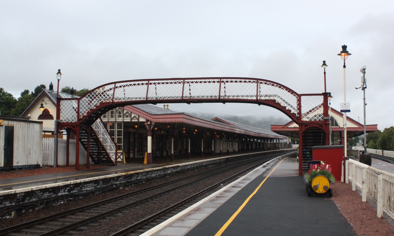
Aviemore railway station
Aviemore railway station serves the town and tourist resort of Aviemore in the Highlands of Scotland. The station, which is owned by Network Rail (NR)...
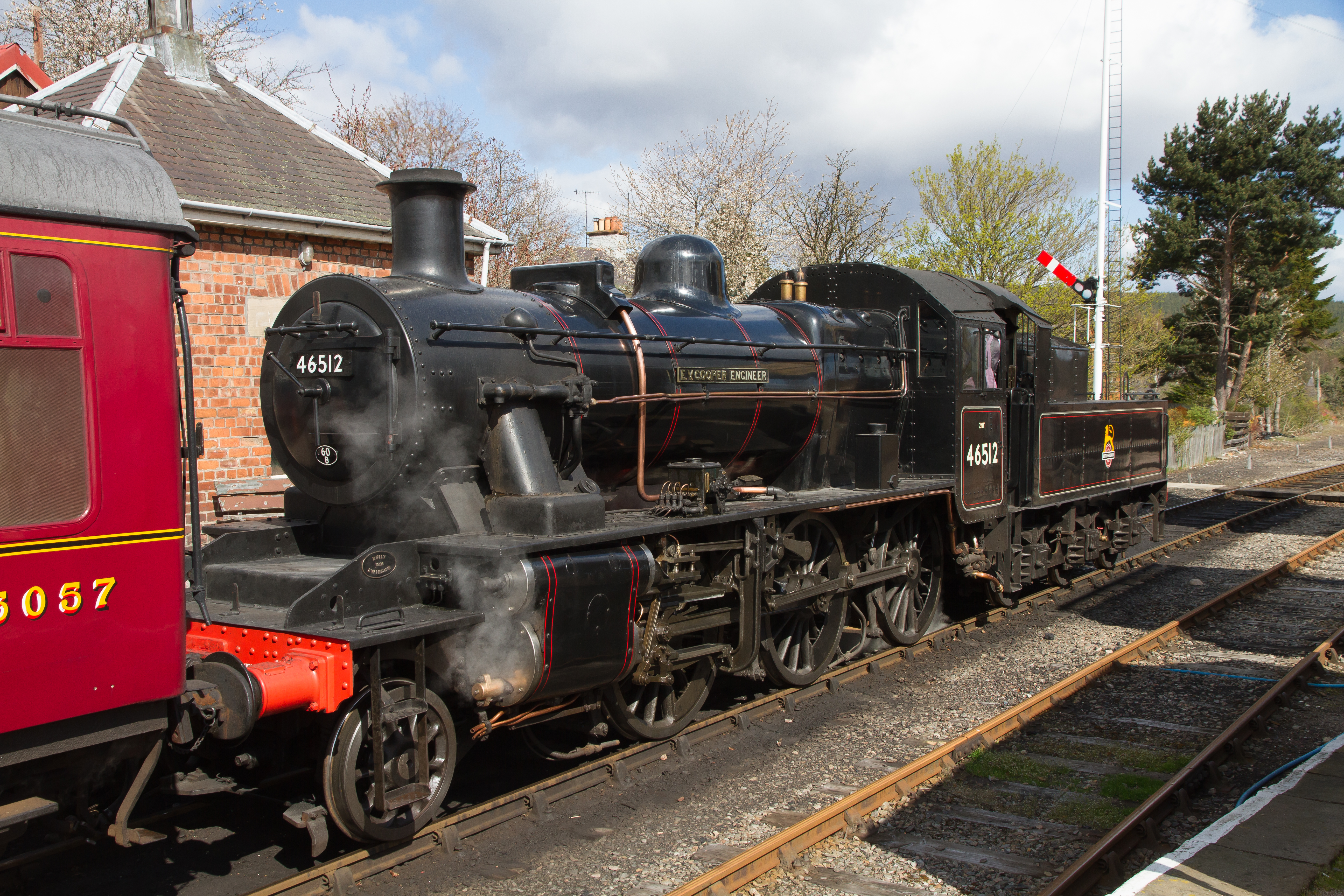
Highland Locomotive Company
The Highland Locomotive Company is a subsidiary of the Strathspey Railway Company. The Strathspey Railway Company operate and own most of the Strathspey...
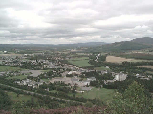
Aviemore
Aviemore ( ; Scottish Gaelic: An Aghaidh Mhòr [ən̪ˠ ˈɤːɪ ˈvoːɾ]) is a town and tourist resort, situated within the Cairngorms National Park in the Highlands...
Nearby Amenities
Located within 500m of 57.191762,-3.829013Have you been to An Aghaidh Mhòr?
Leave your review of An Aghaidh Mhòr below (or comments, questions and feedback).