Loch Urabhal

Lake, Pool, Pond, Freshwater Marsh in Ross-shire

Scotland

Loch Urabhal

Loch an Tobair With the TV mast at Acha Mòr in square NB3030 in the distance.
Loch an Tobair Credit: James Allan

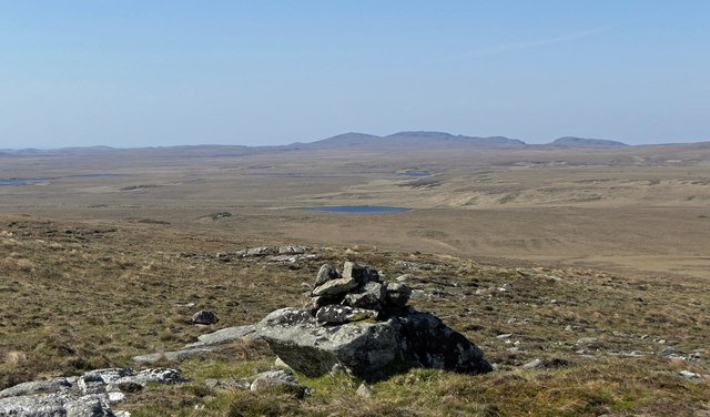
Loch Urabhal is a picturesque freshwater loch located in Ross-shire, Scotland. Nestled amidst the stunning Scottish Highlands, it covers an area of about 50 acres and is surrounded by lush greenery, rolling hills, and dramatic mountain peaks. The loch is situated near the village of Ullapool, making it easily accessible to visitors.

The water in Loch Urabhal is crystal clear and fed by several small streams that flow from nearby mountains. It is known for its exceptional purity, making it an ideal habitat for various species of fish, including brown trout and salmon. Fishing enthusiasts often flock to the loch to indulge in their favorite pastime.

Surrounding the loch is a diverse ecosystem comprising of marshes, reed beds, and wetlands. This vibrant freshwater marsh provides a sanctuary for a wide range of aquatic plants and animals, including waterfowl, otters, and dragonflies. Birdwatchers can spot an array of bird species, such as herons, ducks, and even ospreys, which are known to nest in the vicinity.

Loch Urabhal offers breathtaking views and a peaceful atmosphere, making it a popular destination for nature lovers and photographers. Visitors can enjoy leisurely walks along the loch's shore, taking in the panoramic vistas and observing the abundant wildlife. Additionally, the area surrounding the loch offers opportunities for hiking, mountain biking, and camping, making it an appealing spot for outdoor enthusiasts.

In summary, Loch Urabhal is a captivating freshwater loch in Ross-shire, Scotland, known for its pristine waters, diverse ecosystem, and stunning natural surroundings. Whether for fishing, birdwatching, or simply taking in the beauty of the Highlands, Loch Urabhal offers a memorable experience for all who visit.

If you have any feedback on the listing, please let us know in the comments section below.

Loch Urabhal Images

Images are sourced within 2km of 58.202003/-6.5873111 or Grid Reference NB3032. Thanks to Geograph Open Source API. All images are credited.

Loch an Tobair With the TV mast at Acha Mòr in square NB3030 in the distance.
Loch an Tobair
With the TV mast at Acha Mòr in square NB3030 in the distance.
On the Pentland Road Looking past Loch an Tobair to the mountains of North Harris.
On the Pentland Road
Looking past Loch an Tobair to the mountains of North Harris.
Rocks on moorland below Èitseal, Isle of Lewis Looking towards the Pentland Road Wind Farm.
Rocks on moorland below Èitseal, Isle of Lewis
Looking towards the Pentland Road Wind Farm.
Shieling hut by Loch Urabhal, Isle of Lewis Shielings were moorland summer grazings for cattle.  Shieling huts (often also referred to as shielings) were dwellings located within the shieling.  They were usually occupied from May until the “flitting” in September.  In early May the men of a village would go onto the moor to check and repair the shieling huts.  They would be joined by the women and children for one night before the men returned to the village to tend to crops or to travel away for summer work such as fishing.  The women and children would spend the summer at the shielings tending the cattle and making cheese and butter, some of which was for immediate use but most was salted to preserve it for the winter.  Peat cutting for fuel would also be done.  Evenings would be spent making music and story telling.  Visits were made between the shielings of different villages.

The shieling huts were made from materials available in the immediate vicinity.  They usually had walls made of stone or turf, turf roofs and compacted earth or clay floors.  In coastal areas and on the islands rafters would be made from locally collected driftwood.  Usually there would be a single doorway, facing away from the prevailing wind (although some shieling huts have two doors opposite each other), and often no windows.  Furniture built into shieling huts included stone or turf beds covered with heather, turf seats and cupboards and niches built into the stone wall, often one above the door.  Other furniture would be carried out onto the moor for the season.  In places where the practice of using shielings continued into the 20th century, shieling huts can be found which are constructed making more extensive use of timber than in the traditional type, along with other materials such as tin and bitumen.  There are also examples of buses and caravans used as shieling huts.

The Clearances and ongoing changes in agricultural methods meant that the shieling tradition had generally ended by the close of the nineteenth century.  In places it continued for longer and, particularly on Lewis, some shieling huts are still used today during the peat cutting season and as summer retreats.

The remains of shieling huts can be seen as

changes in vegetation: <a href="https://www.geograph.org.uk/photo/1962348">ND1340 : Shieling site by the Allt a' Cheracher</a> ;
shieling mounds where successive shieling huts have been built on the same site: <a href="https://www.geograph.org.uk/photo/5238987">NB5059 : Shieling mounds by the Abhainn Dhail, Isle of Lewis</a> ;
footings: <a href="https://www.geograph.org.uk/photo/5027765">NB5357 : Shieling footings beside the Feadan Mòr, Isle of Lewis</a> ; and
more substantial remains: <a href="https://www.geograph.org.uk/photo/5238993">NB3040 : Shieling above Gleann Leitir, Isle of Lewis</a> .

Examples of modern shielings are shown at:

<a href="https://www.geograph.org.uk/photo/5238999">NB5458 : Shieling, Airigh A' Bhealaich, Isle of Lewis</a> and <a href="https://www.geograph.org.uk/photo/5048077">NB5458 : Disused shieling, Airigh A' Bhealaich, Isle of Lewis</a> .
Shieling hut by Loch Urabhal, Isle of Lewis
Shielings were moorland summer grazings for cattle. Shieling huts (often also referred to as shielings) were dwellings located within the shieling. They were usually occupied from May until the “flitting” in September. In early May the men of a village would go onto the moor to check and repair the shieling huts. They would be joined by the women and children for one night before the men returned to the village to tend to crops or to travel away for summer work such as fishing. The women and children would spend the summer at the shielings tending the cattle and making cheese and butter, some of which was for immediate use but most was salted to preserve it for the winter. Peat cutting for fuel would also be done. Evenings would be spent making music and story telling. Visits were made between the shielings of different villages. The shieling huts were made from materials available in the immediate vicinity. They usually had walls made of stone or turf, turf roofs and compacted earth or clay floors. In coastal areas and on the islands rafters would be made from locally collected driftwood. Usually there would be a single doorway, facing away from the prevailing wind (although some shieling huts have two doors opposite each other), and often no windows. Furniture built into shieling huts included stone or turf beds covered with heather, turf seats and cupboards and niches built into the stone wall, often one above the door. Other furniture would be carried out onto the moor for the season. In places where the practice of using shielings continued into the 20th century, shieling huts can be found which are constructed making more extensive use of timber than in the traditional type, along with other materials such as tin and bitumen. There are also examples of buses and caravans used as shieling huts. The Clearances and ongoing changes in agricultural methods meant that the shieling tradition had generally ended by the close of the nineteenth century. In places it continued for longer and, particularly on Lewis, some shieling huts are still used today during the peat cutting season and as summer retreats. The remains of shieling huts can be seen as changes in vegetation: ND1340 : Shieling site by the Allt a' Cheracher ; shieling mounds where successive shieling huts have been built on the same site: NB5059 : Shieling mounds by the Abhainn Dhail, Isle of Lewis ; footings: NB5357 : Shieling footings beside the Feadan Mòr, Isle of Lewis ; and more substantial remains: NB3040 : Shieling above Gleann Leitir, Isle of Lewis . Examples of modern shielings are shown at: NB5458 : Shieling, Airigh A' Bhealaich, Isle of Lewis and NB5458 : Disused shieling, Airigh A' Bhealaich, Isle of Lewis .
Shieling hut above Loch nan Cnàmh, Isle of Lewis Shielings were moorland summer grazings for cattle.  Shieling huts (often also referred to as shielings) were dwellings located within the shieling.  They were usually occupied from May until the “flitting” in September.  In early May the men of a village would go onto the moor to check and repair the shieling huts.  They would be joined by the women and children for one night before the men returned to the village to tend to crops or to travel away for summer work such as fishing.  The women and children would spend the summer at the shielings tending the cattle and making cheese and butter, some of which was for immediate use but most was salted to preserve it for the winter.  Peat cutting for fuel would also be done.  Evenings would be spent making music and story telling.  Visits were made between the shielings of different villages.

The shieling huts were made from materials available in the immediate vicinity.  They usually had walls made of stone or turf, turf roofs and compacted earth or clay floors.  In coastal areas and on the islands rafters would be made from locally collected driftwood.  Usually there would be a single doorway, facing away from the prevailing wind (although some shieling huts have two doors opposite each other), and often no windows.  Furniture built into shieling huts included stone or turf beds covered with heather, turf seats and cupboards and niches built into the stone wall, often one above the door.  Other furniture would be carried out onto the moor for the season.  In places where the practice of using shielings continued into the 20th century, shieling huts can be found which are constructed making more extensive use of timber than in the traditional type, along with other materials such as tin and bitumen.  There are also examples of buses and caravans used as shieling huts.

The Clearances and ongoing changes in agricultural methods meant that the shieling tradition had generally ended by the close of the nineteenth century.  In places it continued for longer and, particularly on Lewis, some shieling huts are still used today during the peat cutting season and as summer retreats.

The remains of shieling huts can be seen as

changes in vegetation: <a href="https://www.geograph.org.uk/photo/1962348">ND1340 : Shieling site by the Allt a' Cheracher</a> ;
shieling mounds where successive shieling huts have been built on the same site: <a href="https://www.geograph.org.uk/photo/5238987">NB5059 : Shieling mounds by the Abhainn Dhail, Isle of Lewis</a> ;
footings: <a href="https://www.geograph.org.uk/photo/5027765">NB5357 : Shieling footings beside the Feadan Mòr, Isle of Lewis</a> ; and
more substantial remains: <a href="https://www.geograph.org.uk/photo/5238993">NB3040 : Shieling above Gleann Leitir, Isle of Lewis</a> .

Examples of modern shielings are shown at:

<a href="https://www.geograph.org.uk/photo/5238999">NB5458 : Shieling, Airigh A' Bhealaich, Isle of Lewis</a> and <a href="https://www.geograph.org.uk/photo/5048077">NB5458 : Disused shieling, Airigh A' Bhealaich, Isle of Lewis</a> .
Shieling hut above Loch nan Cnàmh, Isle of Lewis
Shielings were moorland summer grazings for cattle. Shieling huts (often also referred to as shielings) were dwellings located within the shieling. They were usually occupied from May until the “flitting” in September. In early May the men of a village would go onto the moor to check and repair the shieling huts. They would be joined by the women and children for one night before the men returned to the village to tend to crops or to travel away for summer work such as fishing. The women and children would spend the summer at the shielings tending the cattle and making cheese and butter, some of which was for immediate use but most was salted to preserve it for the winter. Peat cutting for fuel would also be done. Evenings would be spent making music and story telling. Visits were made between the shielings of different villages. The shieling huts were made from materials available in the immediate vicinity. They usually had walls made of stone or turf, turf roofs and compacted earth or clay floors. In coastal areas and on the islands rafters would be made from locally collected driftwood. Usually there would be a single doorway, facing away from the prevailing wind (although some shieling huts have two doors opposite each other), and often no windows. Furniture built into shieling huts included stone or turf beds covered with heather, turf seats and cupboards and niches built into the stone wall, often one above the door. Other furniture would be carried out onto the moor for the season. In places where the practice of using shielings continued into the 20th century, shieling huts can be found which are constructed making more extensive use of timber than in the traditional type, along with other materials such as tin and bitumen. There are also examples of buses and caravans used as shieling huts. The Clearances and ongoing changes in agricultural methods meant that the shieling tradition had generally ended by the close of the nineteenth century. In places it continued for longer and, particularly on Lewis, some shieling huts are still used today during the peat cutting season and as summer retreats. The remains of shieling huts can be seen as changes in vegetation: ND1340 : Shieling site by the Allt a' Cheracher ; shieling mounds where successive shieling huts have been built on the same site: NB5059 : Shieling mounds by the Abhainn Dhail, Isle of Lewis ; footings: NB5357 : Shieling footings beside the Feadan Mòr, Isle of Lewis ; and more substantial remains: NB3040 : Shieling above Gleann Leitir, Isle of Lewis . Examples of modern shielings are shown at: NB5458 : Shieling, Airigh A' Bhealaich, Isle of Lewis and NB5458 : Disused shieling, Airigh A' Bhealaich, Isle of Lewis .
Moorland pool below Druim Ucsabhat, Isle of Lewis Looking towards the transmitters on Èitseal.
Moorland pool below Druim Ucsabhat, Isle of Lewis
Looking towards the transmitters on Èitseal.
View across moorland near Gillebish, Isle of Lewis Looking towards the Pentland Road wind farm.
View across moorland near Gillebish, Isle of Lewis
Looking towards the Pentland Road wind farm.
Shieling hut footings, Gillebish, Isle of Lewis Looking towards the transmitters on Èitseal.
Shieling hut footings, Gillebish, Isle of Lewis
Looking towards the transmitters on Èitseal.
Bog on moorland below Beinn nan Surrag, Isle of Lewis
The Allt Ruadh, Isle of Lewis The OS Name Book of 1848-1852 describes the Allt Ruadh as follows: "A considerable stream having its source near the base of Beinn nan Surrag and empties itself into <a href="https://www.geograph.org.uk/photo/829082">NB3632 : Loch a' Chlachain</a>.  At this point there is a neat wooden bridge built over it.  Allt Ruadh signifies Red Stream".
The Allt Ruadh, Isle of Lewis
The OS Name Book of 1848-1852 describes the Allt Ruadh as follows: "A considerable stream having its source near the base of Beinn nan Surrag and empties itself into NB3632 : Loch a' Chlachain. At this point there is a neat wooden bridge built over it. Allt Ruadh signifies Red Stream".
Cairn, Beinn nan Surrag, Isle of Lewis OS maps with a scale of 1:25,000 or larger show there to be three cairns on or near the top of Beinn nan Surrag.  This one lies approximately 80m to the north of the highest point of the hill and is the only one of the three which is shown on the 1:50,000 map.


The OS Name Book of 1848-1852 notes that a Surrag is a part of a corn drying kiln and it is presumed that some part of the hill must resemble one.
Cairn, Beinn nan Surrag, Isle of Lewis
OS maps with a scale of 1:25,000 or larger show there to be three cairns on or near the top of Beinn nan Surrag. This one lies approximately 80m to the north of the highest point of the hill and is the only one of the three which is shown on the 1:50,000 map. The OS Name Book of 1848-1852 notes that a Surrag is a part of a corn drying kiln and it is presumed that some part of the hill must resemble one.
Loch Urabhal Beinn Mhaol Stacaiseal and Loch an Tobar in distance.
Look closely and you can see Coastguard Rescue helicopter right of centre of frame.
Loch Urabhal
Beinn Mhaol Stacaiseal and Loch an Tobar in distance. Look closely and you can see Coastguard Rescue helicopter right of centre of frame.
Loch an Tobair Moorland loch, south of the Pentland Road.
Loch an Tobair
Moorland loch, south of the Pentland Road.
Outflow from Loch Airigh nan Sloc The outflow from Loch Airigh nan Sloc.
Outflow from Loch Airigh nan Sloc
The outflow from Loch Airigh nan Sloc.
Loch nan Uidhean, Isle of Lewis The OS Name Book of 1848-1852 describes the loch as, "a small fresh water loch which is connected with Loch Airidh nan Sloch by a small stream.  NB This may signify the Loch of the Journey". Airidh nan Sloch is spelled Airigh nan Sloc on current maps.
Loch nan Uidhean, Isle of Lewis
The OS Name Book of 1848-1852 describes the loch as, "a small fresh water loch which is connected with Loch Airidh nan Sloch by a small stream. NB This may signify the Loch of the Journey". Airidh nan Sloch is spelled Airigh nan Sloc on current maps.
Loch nan Uidhean, Isle of Lewis The OS Name Book of 1848-1852 describes the loch as, "a small fresh water loch which is connected with Loch Airidh nan Sloch by a small stream. NB This may signify the Loch of the Journey". Airidh nan Sloch is spelled Airigh nan Sloc on current maps.
Loch nan Uidhean, Isle of Lewis
The OS Name Book of 1848-1852 describes the loch as, "a small fresh water loch which is connected with Loch Airidh nan Sloch by a small stream. NB This may signify the Loch of the Journey". Airidh nan Sloch is spelled Airigh nan Sloc on current maps.
Causeway in Loch nan Cnàmh, Isle of Lewis The causeway links the southern shore of the loch to the island and is shown on the OS 1:25,000 map.  The causeway is actually less complete than it appears in this photo: see <a href="https://www.geograph.org.uk/photo/6746573">NB2933 : Island in Loch nan Cnàmh, Isle of Lewis</a>.
Causeway in Loch nan Cnàmh, Isle of Lewis
The causeway links the southern shore of the loch to the island and is shown on the OS 1:25,000 map. The causeway is actually less complete than it appears in this photo: see NB2933 : Island in Loch nan Cnàmh, Isle of Lewis.
Island in Loch nan Cnàmh, Isle of Lewis The rocks in the water formed a causeway to the island which is shown on the OS 1:25,000 map and is more apparent in the photo at <a href="https://www.geograph.org.uk/photo/6746571">NB2933 : Causeway in Loch nan Cnàmh, Isle of Lewis</a>.
Island in Loch nan Cnàmh, Isle of Lewis
The rocks in the water formed a causeway to the island which is shown on the OS 1:25,000 map and is more apparent in the photo at NB2933 : Causeway in Loch nan Cnàmh, Isle of Lewis.
Show me another place!

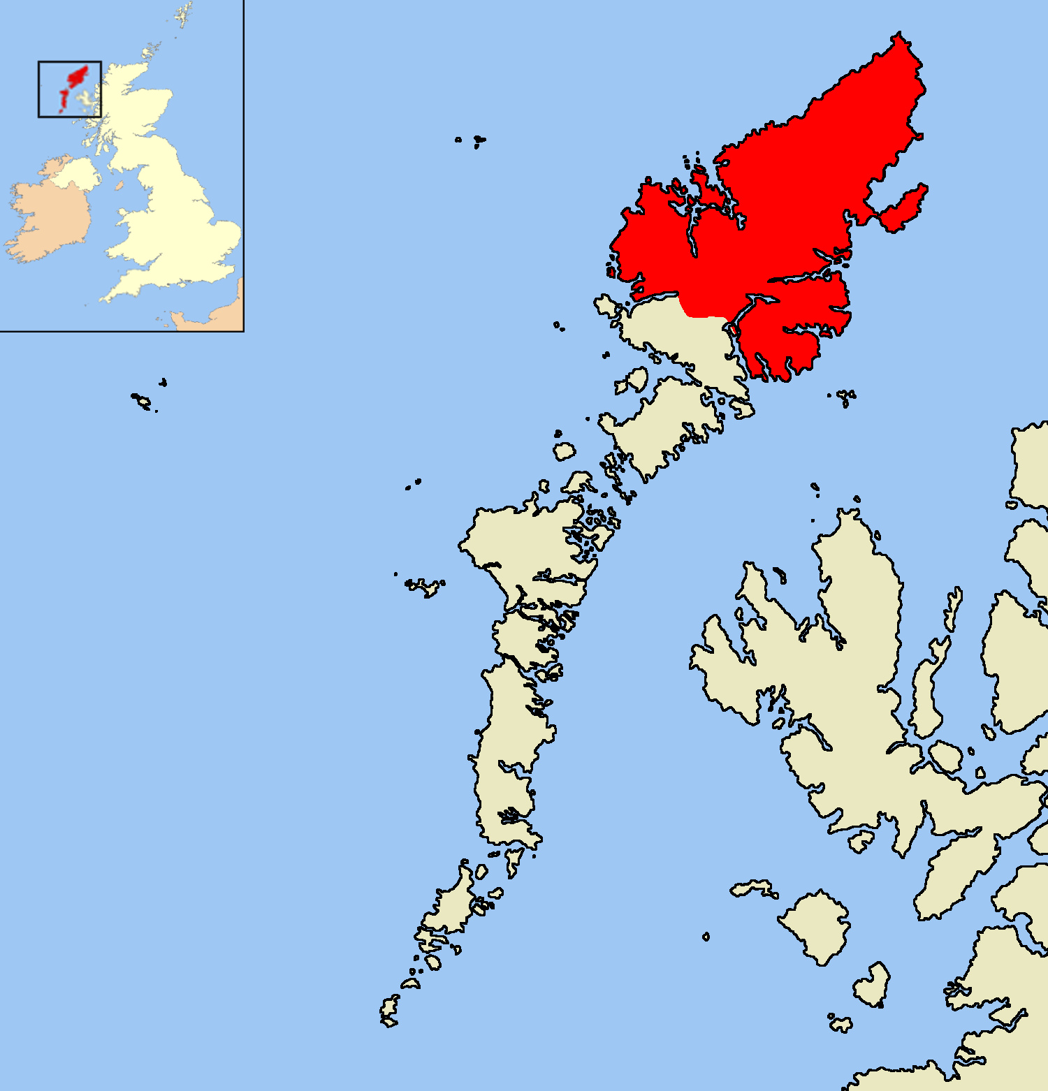
Loch Urabhal is located at Grid Ref: NB3032 (Lat: 58.202003, Lng: -6.5873111)

Unitary Authority: Na h-Eileanan an Iar

Police Authority: Highlands and Islands

What 3 Words

///muddy.tickets.lurching. Near Leurbost, Na h-Eileanan Siar

Nearby Locations

Loch Urabhal

Related Wikis

Isle of Lewis

The Isle of Lewis (Scottish Gaelic: Eilean Leòdhais) or simply Lewis (Scottish Gaelic: Leòdhas, pronounced [ˈʎɔːəs̪] ) is the northern part of Lewis and...

Achmore, Lewis

Achmore (Scottish Gaelic: An t-Acha Mòr; marked on some maps as Acha Mòr) is a village in the Scottish Outer Hebrides, on the Isle of Lewis. The name means...

Lewis Peatlands

Lewis Peatlands (Scottish Gaelic: mòinteach Leòdhais) is a large area of blanket bog covering more than one third of the Isle of Lewis, off the west coast...

Garynahine

Garynahine (Scottish Gaelic: Gearraidh na h-aibhne) is a settlement on Lewis, in the Outer Hebrides, Scotland. Garynahine is situated at a T-junction where...

Have you been to Loch Urabhal?

Leave your review of Loch Urabhal below (or comments, questions and feedback).