Loch Dubh Oìrtheanan

Lake, Pool, Pond, Freshwater Marsh in Ross-shire

Scotland

Loch Dubh Oìrtheanan

Dun in Loch an Dùnain Relatively well preserved dun close to the main road <span class="nowrap"><a title="https://canmore.org.uk/site/4092/lewis-loch-an-duin" rel="nofollow ugc noopener" href="https://canmore.org.uk/site/4092/lewis-loch-an-duin">Link</a><img style="margin-left:2px;" alt="External link" title="External link - shift click to open in new window" src="https://s1.geograph.org.uk/img/external.png" width="10" height="10"/></span>
Dun in Loch an Dùnain Credit: Sandy Gerrard

Loch Dubh Oìrtheanan is a picturesque freshwater lake located in Ross-shire, Scotland. Nestled amidst the stunning highland scenery, this tranquil body of water stretches across an area of approximately 100 acres. The name "Loch Dubh Oìrtheanan" translates to "Black Loch of the Shielings" in English, paying homage to the historical presence of shielings, or seasonal dwellings, in the surrounding area.

Surrounded by rolling hills and lush greenery, Loch Dubh Oìrtheanan offers a haven for nature enthusiasts and wildlife lovers. The lake is home to a diverse range of freshwater fauna and flora, providing a rich ecosystem for various species. Anglers are often drawn to the lake's abundant fish population, which includes brown trout, pike, and perch.

The shoreline of Loch Dubh Oìrtheanan is dotted with scattered trees and shrubs, creating a serene and idyllic atmosphere. The surrounding marshland acts as a natural filter, purifying the water and supporting an array of wetland plants. These marshes also serve as a habitat for numerous bird species, including ducks, swans, and herons, making it a popular spot for birdwatching.

Visitors to Loch Dubh Oìrtheanan can enjoy a peaceful stroll along its shores, taking in the breathtaking scenery and observing the abundant wildlife. The lake's reflective surface mirrors the changing colors of the sky, creating a captivating visual experience. Whether for fishing, birdwatching, or simply immersing oneself in nature's beauty, Loch Dubh Oìrtheanan offers a serene and enchanting escape in the heart of Ross-shire.

If you have any feedback on the listing, please let us know in the comments section below.

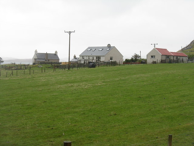
Loch Dubh Oìrtheanan Images

Images are sourced within 2km of 58.247156/-6.755942 or Grid Reference NB2138. Thanks to Geograph Open Source API. All images are credited.

Dun in Loch an Dùnain Relatively well preserved dun close to the main road <span class="nowrap"><a title="https://canmore.org.uk/site/4092/lewis-loch-an-duin" rel="nofollow ugc noopener" href="https://canmore.org.uk/site/4092/lewis-loch-an-duin">Link</a><img style="margin-left:2px;" alt="External link" title="External link - shift click to open in new window" src="https://s1.geograph.org.uk/img/external.png" width="10" height="10"/></span>
Dun in Loch an Dùnain
Relatively well preserved dun close to the main road LinkExternal link
Loch an Dùnain
Loch an Dùnain
Isle of Lewis, Loch an Dùnain
View towards Tolsta Chaolais
West Point
West Point
The Road to Tolsta Chaolais
Fish Farm Cages, Loch na Muilne
Loch na Muilne
Loch na Muilne
Port a' Chaoil Stream flowing from Loch a' Bhaile enters Loch Rog an Ear, a sea loch, at Aird na Moine.
Port a' Chaoil
Stream flowing from Loch a' Bhaile enters Loch Rog an Ear, a sea loch, at Aird na Moine.
Loch a' Bhaile The narrow loch, hemmed in by steep hillsides, flows out into Loch Rog an Ear, a sea loch, via a short river.
Loch a' Bhaile
The narrow loch, hemmed in by steep hillsides, flows out into Loch Rog an Ear, a sea loch, via a short river.
Loch a' Bhaile Loch a' Bhaile & Tolastadh a' Chaolais beyond.
Loch a' Bhaile
Loch a' Bhaile & Tolastadh a' Chaolais beyond.
Tolstachaolais: along the shore of Loch a' Bhaile Looking across the loch, which runs alongside the road through the village. However, this is the far side that we are looking along.
Tolstachaolais: along the shore of Loch a' Bhaile
Looking across the loch, which runs alongside the road through the village. However, this is the far side that we are looking along.
Tolstachaolais: postbox № HS2 62 This postbox stands more or less in the centre of the village, in front of a house that is set particularly well back from the road. The larger-scale map still marks that house as a post office, although it has actually (as reflected in the 1:50,000 and 1:25,000 map) relocated just over a kilometre to the north - see <a href="https://www.geograph.org.uk/photo/3086624">NB1939 : Tolstachaolais: the post office</a>.
Tolstachaolais: postbox № HS2 62
This postbox stands more or less in the centre of the village, in front of a house that is set particularly well back from the road. The larger-scale map still marks that house as a post office, although it has actually (as reflected in the 1:50,000 and 1:25,000 map) relocated just over a kilometre to the north - see NB1939 : Tolstachaolais: the post office.
Tolstachaolais: Loch a’ Bhaile Looking down this loch from its northern end, with the main part of the village visible far right.
Tolstachaolais: Loch a’ Bhaile
Looking down this loch from its northern end, with the main part of the village visible far right.
Tolstachaolais: hillside cows and Bernera view Looking across the sound separating the eastern side of Bernera from the Lewis mainland, beyond three cows grazing on the slopes to the south of Tolstachaolais village.
Tolstachaolais: hillside cows and Bernera view
Looking across the sound separating the eastern side of Bernera from the Lewis mainland, beyond three cows grazing on the slopes to the south of Tolstachaolais village.
Outlet from Loch a' Bhaile into Port a' Chaoil At the crofting community of Tolastadh a' Chaolais.
Outlet from Loch a' Bhaile into Port a' Chaoil
At the crofting community of Tolastadh a' Chaolais.
Loch a' Bhaile In the crofting community of Tolastadh a' Chaolais.
Loch a' Bhaile
In the crofting community of Tolastadh a' Chaolais.
Cnoc Feoal Part of the crofting community of Tolastadh a' Chaolais on the shores of Loch Ròg an Ear.
Cnoc Feoal
Part of the crofting community of Tolastadh a' Chaolais on the shores of Loch Ròg an Ear.
Show me another place!

Loch Dubh Oìrtheanan is located at Grid Ref: NB2138 (Lat: 58.247156, Lng: -6.755942)

Unitary Authority: Na h-Eileanan an Iar

Police Authority: Highlands and Islands

What 3 Words

///jiffy.domain.sliding. Near Carloway, Na h-Eileanan Siar

Related Wikis

Tolsta Chaolais

Tolsta Chaolais (also Tolastadh Chaolais, Tolstadh a' Chaolais) is a village on the Isle of Lewis, Scotland. It consists of about forty houses, clustered...

Breasclete

Breasclete (Scottish Gaelic: Brèascleit) is a village and community on the west side of the Isle of Lewis, in the Outer Hebrides, Scotland. Breasclete...

Dun Carloway

Dun Carloway (Scottish Gaelic: Dùn Chàrlabhaigh) is a broch situated in the district of Carloway, on the west coast of the Isle of Lewis, Scotland (grid...

Ceabhaigh

Ceabhaigh is a small island in an arm of Loch Ròg on the west coast of Lewis in the Outer Hebrides of Scotland. It is about 25 hectares (62 acres) in extent...

Have you been to Loch Dubh Oìrtheanan?

Leave your review of Loch Dubh Oìrtheanan below (or comments, questions and feedback).