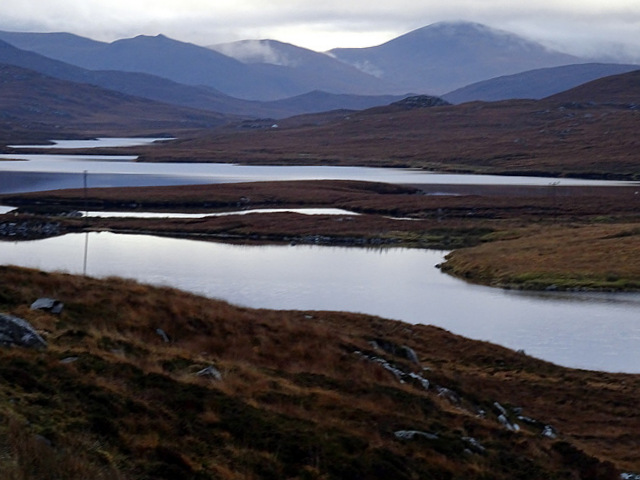
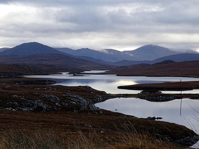
Loch Smuaisebhal

Lake, Pool, Pond, Freshwater Marsh in Ross-shire

Scotland

Loch Smuaisebhal

Loch Griomarstadh (Loch Grimersta) Loch Griomarstadh is a long narrow inlet of Loch Ceann Hulabhaig. It is tidal, and this view shows the sea a foot or so below high tide. In the distant, at left is Calanais (Callanish).
Loch Griomarstadh (Loch Grimersta) Credit: Anne Burgess

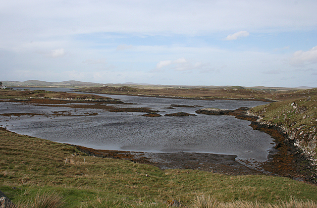
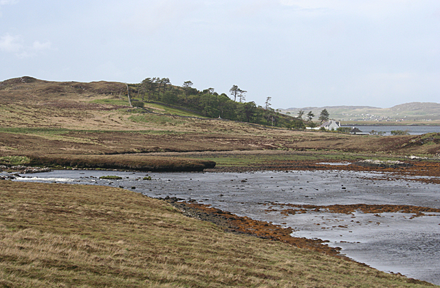
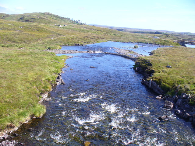
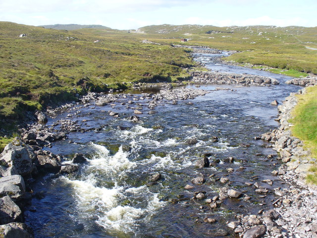
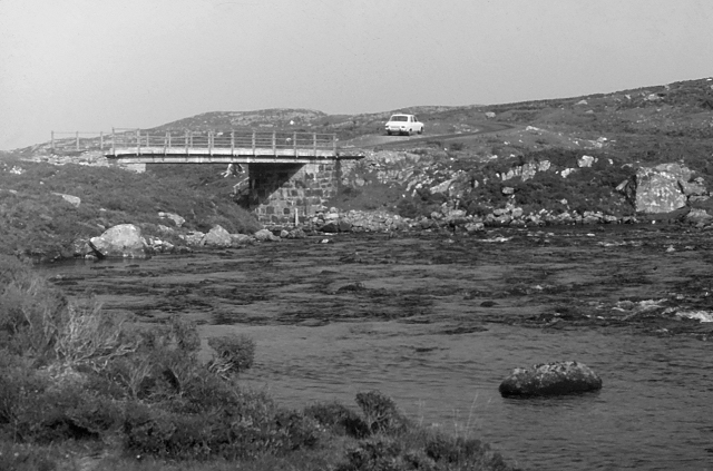
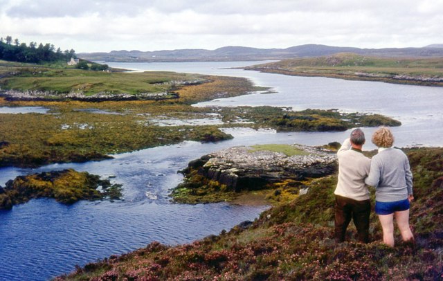
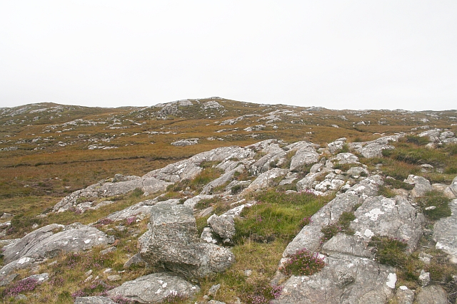
Loch Smuaisebhal is a picturesque freshwater loch located in Ross-shire, Scotland. It is situated amidst the stunning landscape of the Scottish Highlands, surrounded by rolling hills and dense forests. The loch spans over an area of approximately 150 acres and has a maximum depth of around 20 meters.

The name "Smuaisebhal" is derived from Gaelic and translates to "marshy hollow." This name is quite fitting as the loch is known for its lush freshwater marshes that line its shores. These marshes provide a rich habitat for a diverse range of flora and fauna, making it a haven for nature enthusiasts and wildlife photographers.

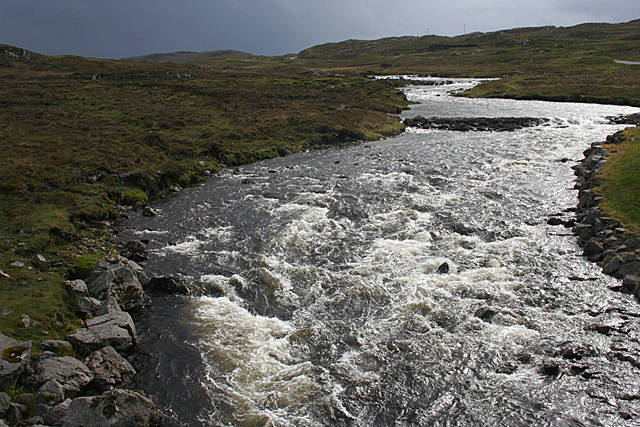
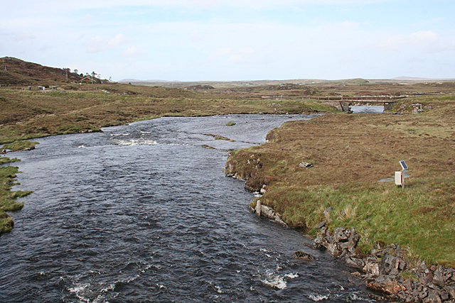
The water in Loch Smuaisebhal is crystal clear and teeming with various species of fish, including brown trout and pike. Anglers often visit the loch to indulge in fishing, taking advantage of the abundant fish population. Additionally, the loch attracts a variety of migratory birds, such as swans, geese, and ducks, which find solace in its tranquil surroundings.

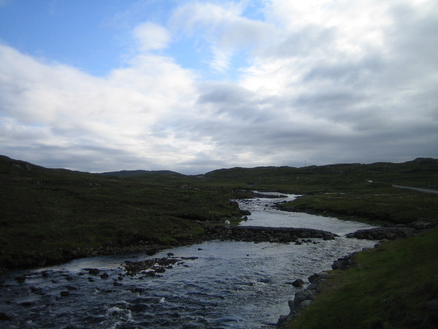
The surrounding area offers several walking trails and viewpoints, allowing visitors to soak in the breathtaking beauty of the loch and its surroundings. It is a popular destination for outdoor activities such as kayaking, canoeing, and swimming during the summer months.

Loch Smuaisebhal is a hidden gem in Ross-shire, offering a peaceful retreat for those seeking solace in nature's embrace. With its stunning vistas, diverse wildlife, and recreational opportunities, it is a must-visit destination for nature lovers and those looking to explore the untamed beauty of the Scottish Highlands.

If you have any feedback on the listing, please let us know in the comments section below.

Loch Smuaisebhal Images

Images are sourced within 2km of 58.171729/-6.7631945 or Grid Reference NB2030. Thanks to Geograph Open Source API. All images are credited.

Loch Griomarstadh (Loch Grimersta) Loch Griomarstadh is a long narrow inlet of Loch Ceann Hulabhaig. It is tidal, and this view shows the sea a foot or so below high tide. In the distant, at left is Calanais (Callanish).
Loch Griomarstadh (Loch Grimersta)
Loch Griomarstadh is a long narrow inlet of Loch Ceann Hulabhaig. It is tidal, and this view shows the sea a foot or so below high tide. In the distant, at left is Calanais (Callanish).
Griomarstadh Abhainn Ghriomarstaidh (River Grimersta) enters the sea here from the left. The house at Griomarstadh is in the next square, and in the distance are the crofting communities of Calanais and Breascleit.
Griomarstadh
Abhainn Ghriomarstaidh (River Grimersta) enters the sea here from the left. The house at Griomarstadh is in the next square, and in the distance are the crofting communities of Calanais and Breascleit.
Abhainn Ghriomarstaidh (Grimersta River) Dramatic lighting as storm clouds gather to the south-west. This river is possibly the best salmon fishing river in the Western Isles, and drains a large tract of southern Lewis. There was a lot of water today following a week of unsettled weather with frequent rain showers.
Abhainn Ghriomarstaidh (Grimersta River)
Dramatic lighting as storm clouds gather to the south-west. This river is possibly the best salmon fishing river in the Western Isles, and drains a large tract of southern Lewis. There was a lot of water today following a week of unsettled weather with frequent rain showers.
Abhainn Ghriomarstaidh (Grimersta River) Looking downstream from the new bridge which carries the B8011 over the river. The next bridge is the private access to Griomarstadh House and jetty.
Abhainn Ghriomarstaidh (Grimersta River)
Looking downstream from the new bridge which carries the B8011 over the river. The next bridge is the private access to Griomarstadh House and jetty.
Grimersta River Abhainn Ghriomarstaidh tumbling down to the sea at Loch Ceann Hulabhig. The old road and bridge are visible in mid distance.
Grimersta River
Abhainn Ghriomarstaidh tumbling down to the sea at Loch Ceann Hulabhig. The old road and bridge are visible in mid distance.
Grimersta River from the Bridge View upstream of a tumbling, Highland river (Abhainn Ghriomarstaidh) from the new B8011 road bridge.
Grimersta River from the Bridge
View upstream of a tumbling, Highland river (Abhainn Ghriomarstaidh) from the new B8011 road bridge.
Lewis style bus shelter (i)
Old road bridge over the Abhainn Ghriomarstaidh/Grimersta River When this photo was taken in 1975, the bridge seen carried the B road to west Lewis over the river. Since then, a replacement has been constructed a short distance downstream. Fairly recent imagery seen online suggests that the bridge is still standing, although it no longer lies on a public road.
Old road bridge over the Abhainn Ghriomarstaidh/Grimersta River
When this photo was taken in 1975, the bridge seen carried the B road to west Lewis over the river. Since then, a replacement has been constructed a short distance downstream. Fairly recent imagery seen online suggests that the bridge is still standing, although it no longer lies on a public road.
Loch Faoghail am Tuim Looking south towards the hills of West Lewis. The little house highlighted by a ray of sunshine is a boathouse, in the next square. The nearest hill on the left is Ciorabhal, and on the right is Geure Dubh Mhòr. On the distant skyline is Roineabhal.
Loch Faoghail am Tuim
Looking south towards the hills of West Lewis. The little house highlighted by a ray of sunshine is a boathouse, in the next square. The nearest hill on the left is Ciorabhal, and on the right is Geure Dubh Mhòr. On the distant skyline is Roineabhal.
Cycling the B8059 The hills of Harris on the skyline
Cycling the B8059
The hills of Harris on the skyline
B8059 and the lochs leading in to the Lewis-Harris borderlands This string of linked lochs have 'Faoghail' in their names; this is the Gaelic word for ford.
B8059 and the lochs leading in to the Lewis-Harris borderlands
This string of linked lochs have 'Faoghail' in their names; this is the Gaelic word for ford.
Looking south east from the old Ardroil road A short spur which has been bypassed by new road construction forms a convenient parking place to admire the view.
Looking south east from the old Ardroil road
A short spur which has been bypassed by new road construction forms a convenient parking place to admire the view.
Loch Griomarstadh (Loch Grimersta) Part of the intricate coastline of west Lewis.
Loch Griomarstadh (Loch Grimersta)
Part of the intricate coastline of west Lewis.
Lewis bus shelter
Lewis bus shelter
Loch Speireag Viewed from the B8059 road. The hills of North Harris in view.
Loch Speireag
Viewed from the B8059 road. The hills of North Harris in view.
Loch Sgàire Viewed from the B8059 road from Great Bernera.
Loch Sgàire
Viewed from the B8059 road from Great Bernera.
Grimersta River The most famous and productive salmon river in the Scottish islands. Also the most expensive! and booked up years in advance anyway.
Grimersta River
The most famous and productive salmon river in the Scottish islands. Also the most expensive! and booked up years in advance anyway.
Aird na Faoghalach Rocky landscape interspersed with peat bog.
Aird na Faoghalach
Rocky landscape interspersed with peat bog.
Show me another place!

Loch Smuaisebhal is located at Grid Ref: NB2030 (Lat: 58.171729, Lng: -6.7631945)

Unitary Authority: Na h-Eileanan an Iar

Police Authority: Highlands and Islands

What 3 Words

///descended.variously.whistling. Near Carloway, Na h-Eileanan Siar

Related Wikis

Callanish IV

The Callanish IV stone circle (Scottish Gaelic: Ceann Hulavig) is one of many megalithic structures around the better-known (and larger) Calanais I on...
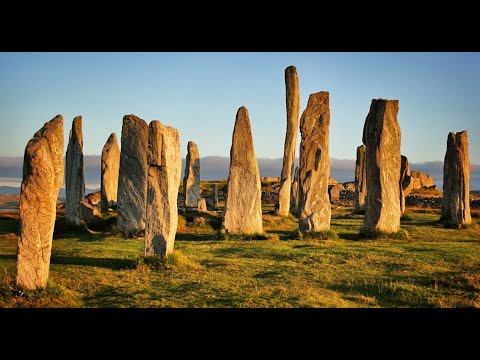
Callanish Stones

The Callanish Stones (or "Callanish I": Scottish Gaelic: Clachan Chalanais or Tursachan Chalanais) are an arrangement of standing stones placed in a cruciform...

Eilean Chearstaidh

Eilean Kearstay (Scottish Gaelic: Eilean Chearstaigh) is an uninhabited island in Loch Roag in the Outer Hebrides of Scotland. It lies south east of Great...
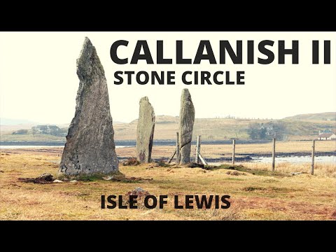
Callanish II

The Callanish II stone circle (Scottish Gaelic: Cnoc Ceann a' Gharaidh) is one of many megalithic structures around the better-known (and larger) Calanais...

Related Videos

Callanish Standing Stones With Music On History Visit To Isle Of Lewis Outer Hebrides Scotland

Tour Scotland short 4K travel video clip, with Scottish music, of Callanish Standing Stones circle on ancestry visit to Isle Of Lewis ...

Callanish Standing Stones Circle On History Visit To Isle Of Lewis Outer Hebrides Scotland

Tour Scotland 4K travel video, with Scottish music, of Callanish Standing Stones Circle on ancestry, history visit to Isle Of Lewis in ...

Callanish II Stone Circle | Isle of Lewis | Neolithic Age | History of Scotland | Before Caledonia

'Before Caledonia' - A journey through Scotland's Ancient Sites. ---------- FACEBOOK share photos, articles, review books and ...

Have you been to Loch Smuaisebhal?

Leave your review of Loch Smuaisebhal below (or comments, questions and feedback).