Lochan nan Clach-mòra

Lake, Pool, Pond, Freshwater Marsh in Inverness-shire

Scotland

Lochan nan Clach-mòra

Scaladale The river winds its waythrough wet grassland to Scaladale, on the sea shore at Bàgh Àird a' Mhulaidh.
Scaladale Credit: Anne Burgess

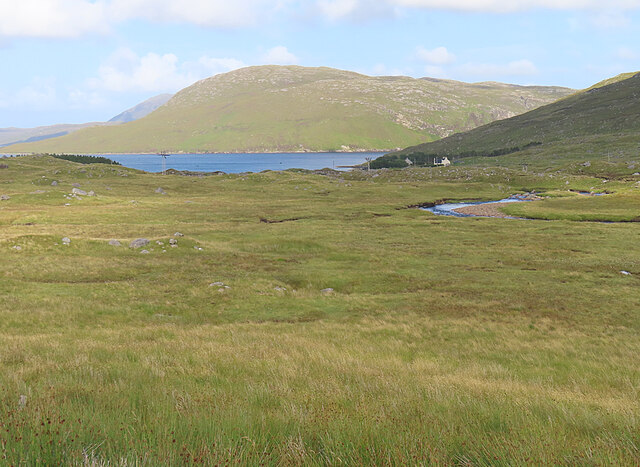
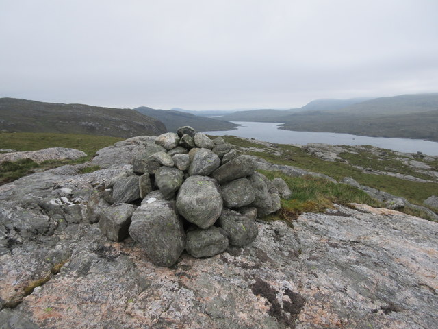
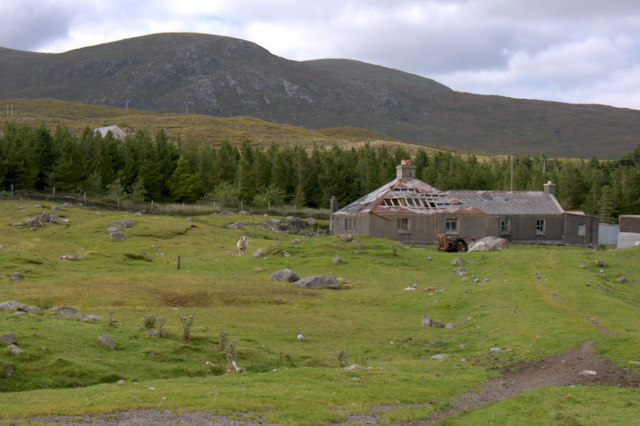
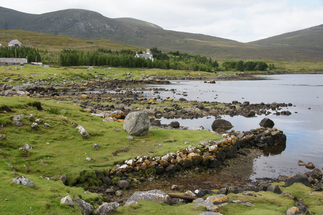
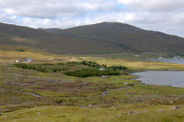
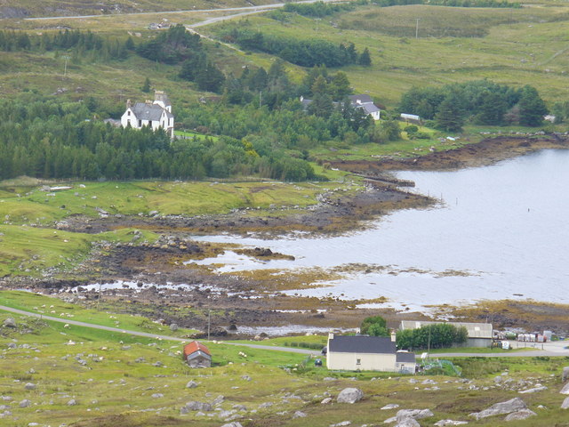
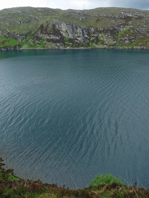
Lochan nan Clach-mòra, located in Inverness-shire, Scotland, is a picturesque freshwater loch nestled amidst the breathtaking Highland scenery. With its tranquil ambiance and stunning surroundings, it has become a popular destination for nature enthusiasts and hikers alike.

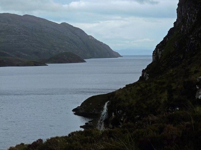
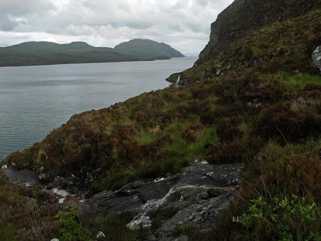
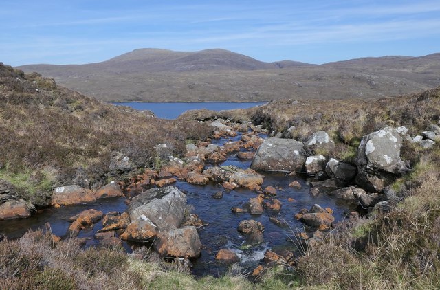
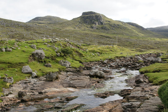
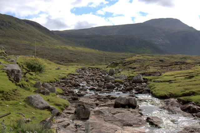
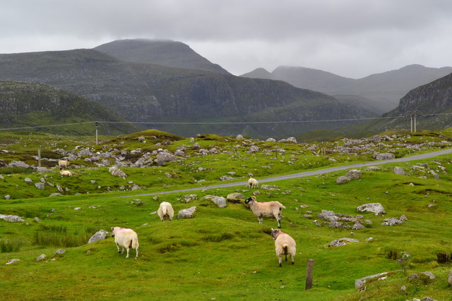
Covering an area of approximately 10 hectares, Lochan nan Clach-mòra is surrounded by rolling hills and dense forests, providing a serene and secluded atmosphere. The loch itself is relatively shallow, with an average depth of around 4 meters, and is fed by small streams and natural springs flowing from the surrounding mountains.

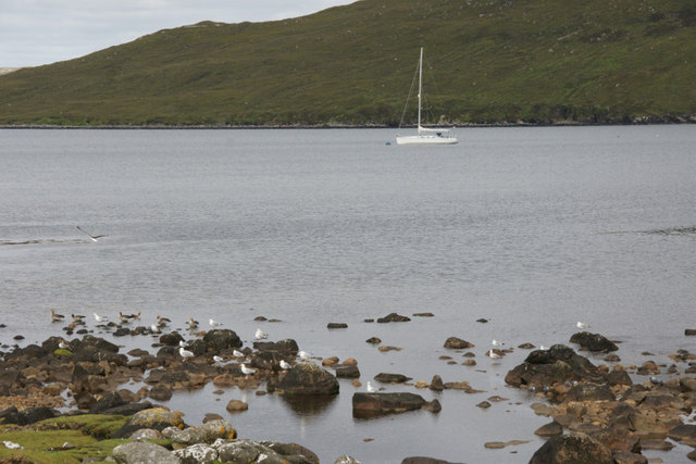
The calm, crystal-clear waters of Lochan nan Clach-mòra are home to a variety of freshwater fish species, including brown trout and pike. Fishing enthusiasts can often be found casting their lines from the shores, hoping to catch a prized fish.

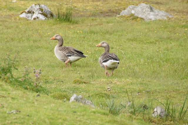
The loch is also a haven for a diverse range of bird species, making it a prime spot for birdwatching. Visitors can catch glimpses of majestic birds, such as ospreys, herons, and golden eagles, soaring above the waters or perched on the surrounding trees.

Surrounding the loch, there is a lush freshwater marsh, creating a unique ecosystem. This marshland is teeming with vibrant plant life, including reeds, sedges, and water lilies, providing a habitat for various amphibians, insects, and small mammals.

Lochan nan Clach-mòra is a place of tranquility and natural beauty, offering visitors an opportunity to immerse themselves in the picturesque Highland landscape and experience the rich biodiversity that thrives in this idyllic location.

If you have any feedback on the listing, please let us know in the comments section below.

Lochan nan Clach-mòra Images

Images are sourced within 2km of 57.978346/-6.7473376 or Grid Reference NB1908. Thanks to Geograph Open Source API. All images are credited.

Scaladale The river winds its waythrough wet grassland to Scaladale, on the sea shore at Bàgh Àird a' Mhulaidh.
Scaladale
The river winds its waythrough wet grassland to Scaladale, on the sea shore at Bàgh Àird a' Mhulaidh.
Waterfall below Creag na h-Iolaire, Harris Looking along Loch Seaforth/Loch Shiphoirt which forms the boundary between Harris and the Isle of Lewis.

Creag na h-Iolaire means Eagle's Rock.
Waterfall below Creag na h-Iolaire, Harris
Looking along Loch Seaforth/Loch Shiphoirt which forms the boundary between Harris and the Isle of Lewis. Creag na h-Iolaire means Eagle's Rock.
Unnamed burn below Creag na h-Iolaire, Harris Looking along Loch Seaforth/Loch Shiphoirt which forms the boundary between Harris and the Isle of Lewis.

Creag na h-Iolaire means Eagle's Rock.
Unnamed burn below Creag na h-Iolaire, Harris
Looking along Loch Seaforth/Loch Shiphoirt which forms the boundary between Harris and the Isle of Lewis. Creag na h-Iolaire means Eagle's Rock.
Above Loch Seaforth Looking north along Loch Seaforth.
Above Loch Seaforth
Looking north along Loch Seaforth.
The Allt Loch nan Eang, Isle of Lewis Looking towards Loch Seaforth/Loch Shìophoirt, the sea loch into which the burn flows.
The Allt Loch nan Eang, Isle of Lewis
Looking towards Loch Seaforth/Loch Shìophoirt, the sea loch into which the burn flows.
Ruined house at Scaladale
Greylag Geese (Anser anser), Scaladale In the mid 20th century the Outer Hebrides were the last refuge of native geese in Britain, but numbers, from various sources, are much larger these days.
Greylag Geese (Anser anser), Scaladale
In the mid 20th century the Outer Hebrides were the last refuge of native geese in Britain, but numbers, from various sources, are much larger these days.
Yacht in Loch Seaforth (Siophort) off Scaladale
Abhainn Sgaladail at Scaladale Looking towards the crag of Caisteal Ard.
Abhainn Sgaladail at Scaladale
Looking towards the crag of Caisteal Ard.
Abhainn Sgaladail at Scaladale Looking towards An Cliseam.
Abhainn Sgaladail at Scaladale
Looking towards An Cliseam.
Bagh Aird a' Mhulaidh at Scaladale Looking towards Ardvourlie Castle.
Bagh Aird a' Mhulaidh at Scaladale
Looking towards Ardvourlie Castle.
Ardvourlie Castle from Scaladale
Pier at Scaladale The hill of Beinn a' Mhuil is in the background, with the valley to the left marking the border between Harris and Lewis.
Pier at Scaladale
The hill of Beinn a' Mhuil is in the background, with the valley to the left marking the border between Harris and Lewis.
Aird a' Mhulaidh View of Ardvourlie Castle and its environs from the road above Scaladale.
Aird a' Mhulaidh
View of Ardvourlie Castle and its environs from the road above Scaladale.
Scaladale from the South Bayhead hamlet at the head of Ardvourlie Bay / Bagh Aird a' Mhulaidh. Beyond is Ardvourlie Castle, surrounded by woodland.
Scaladale from the South
Bayhead hamlet at the head of Ardvourlie Bay / Bagh Aird a' Mhulaidh. Beyond is Ardvourlie Castle, surrounded by woodland.
Sheep grazing beside road at Scaladale
Sheep resting in a rough lay-by beside the A859
Creag a' Chais, Eilean Shìophoirt, Harris The OS Name Book of 1848-1852 states that Creag a' Chais means Cheese Rock and describes it as, "A steep rocky cliff on the western shore of Seaforth Island.  It is 1/4 of a mile long and about 100 feet high and a small stream flows over it into Loch Seaforth".
Creag a' Chais, Eilean Shìophoirt, Harris
The OS Name Book of 1848-1852 states that Creag a' Chais means Cheese Rock and describes it as, "A steep rocky cliff on the western shore of Seaforth Island. It is 1/4 of a mile long and about 100 feet high and a small stream flows over it into Loch Seaforth".
Show me another place!

Lochan nan Clach-mòra is located at Grid Ref: NB1908 (Lat: 57.978346, Lng: -6.7473376)

Unitary Authority: Na h-Eileanan an Iar

Police Authority: Highlands and Islands

What 3 Words

///husky.machinery.lunged. Near Tarbert, Na h-Eileanan Siar

Related Wikis

Ardvourlie Castle

Ardvourlie Castle is a 19th-century country house on Harris, one of the Western Isles off the north-west coast of Scotland. The house was built beside...

Seaforth Island

Seaforth Island (Scottish Gaelic: Eilean Shìphoirt/Shìophoirt or Mulag) is an uninhabited island in the Outer Hebrides of Scotland. Unlike many other...

Loch Seaforth

Loch Seaforth (Scottish Gaelic: Loch Shiphoirt or Shìophoirt) is a sea loch in the Outer Hebrides of Scotland. It consists of three distinct sections;...

Uisgneabhal Mor

Uisgnabhal Mor (729 m) is a mountain in Harris, in the Outer Hebrides of Scotland. A complex mountain of several ridges and summits, it lies in the centre...

Nearby Amenities

Located within 500m of 57.978346,-6.7473376
Power: pole
Lat/Long: 57.9817988/-6.7520273
Power: pole
Lat/Long: 57.9811906/-6.751664
Power: pole
Lat/Long: 57.9804951/-6.7512687
Power: pole
Lat/Long: 57.978999/-6.750152
Power: pole
Lat/Long: 57.9784408/-6.749748
Power: pole
Lat/Long: 57.9777681/-6.7492384
Power: pole
Lat/Long: 57.9768009/-6.7492159
Power: pole
Lat/Long: 57.9762585/-6.7491995
Power: pole
Lat/Long: 57.9754896/-6.7491908
Power: pole
Lat/Long: 57.9747058/-6.7491756
Power: pole
Lat/Long: 57.9739733/-6.7491692
Cleit Ard
Corbett: no
Ele: 328
Graham: no
Marilyn: no
Munro: no
Name En: Clett Ard
Name Gd: Cleit Ard
Natural: peak
Lat/Long: 57.9773011/-6.7549565
Material: wood
Power: pole
Lat/Long: 57.9741918/-6.7469107
Material: wood
Power: pole
Lat/Long: 57.9749044/-6.7469536
Material: wood
Power: pole
Lat/Long: 57.9755103/-6.7470046
Material: wood
Power: pole
Lat/Long: 57.9760892/-6.7470502
Material: wood
Power: pole
Lat/Long: 57.9766866/-6.7470958
Material: wood
Power: pole
Lat/Long: 57.9772519/-6.7471418
Material: wood
Power: pole
Lat/Long: 57.9778144/-6.747174
Material: wood
Power: pole
Lat/Long: 57.9786062/-6.7472415
Material: wood
Power: pole
Lat/Long: 57.9792023/-6.7479624
Material: wood
Power: pole
Lat/Long: 57.9800948/-6.7486203
Material: wood
Power: pole
Lat/Long: 57.9807902/-6.749132
Material: wood
Power: pole
Lat/Long: 57.9813215/-6.7495145
Material: wood
Power: pole
Lat/Long: 57.9822121/-6.7501237
Noexit: yes
Lat/Long: 57.9777546/-6.7479987
The data included in this document is from www.openstreetmap.org. The data is made available under ODbL.

Have you been to Lochan nan Clach-mòra?

Leave your review of Lochan nan Clach-mòra below (or comments, questions and feedback).