Lochanan Beag

Lake, Pool, Pond, Freshwater Marsh in Ross-shire

Scotland

Lochanan Beag

Lewis style bus shelter (i)
Lewis style bus shelter (i) Credit: Peter Moore

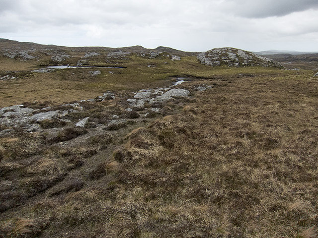
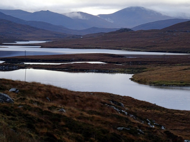
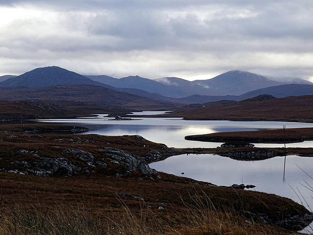
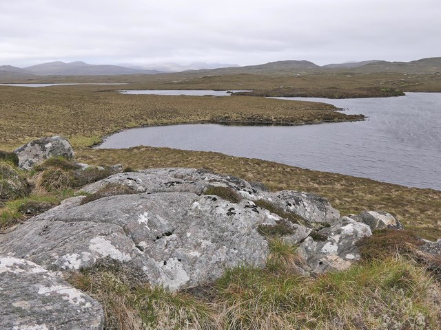
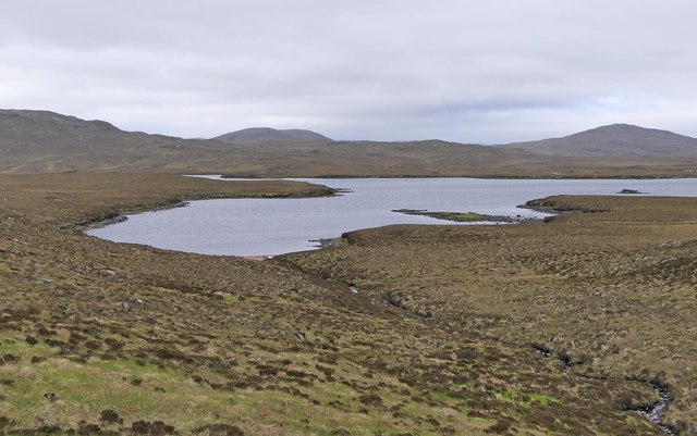
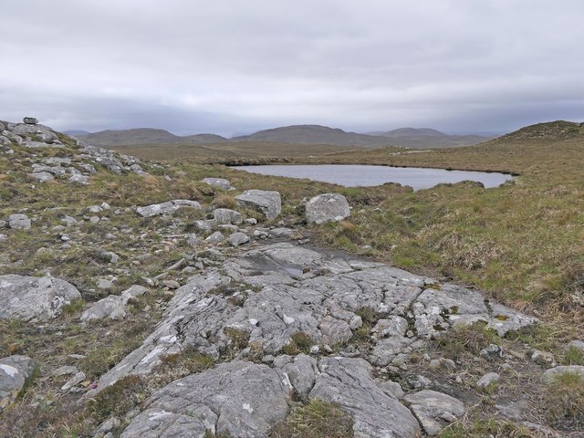
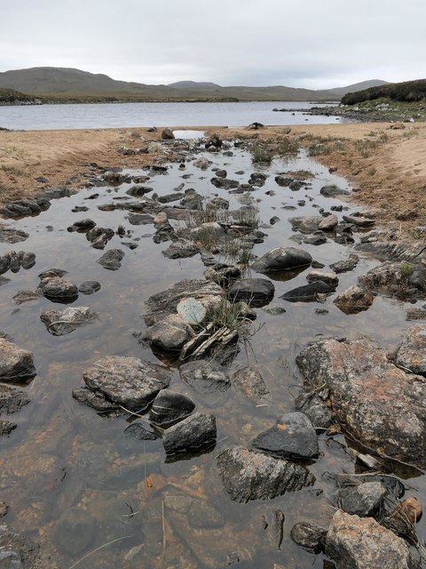
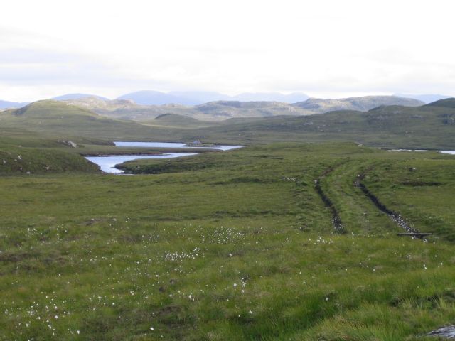
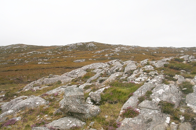
Lochanan Beag is a small freshwater loch located in Ross-shire, Scotland. Situated amidst the picturesque countryside, it covers an area of approximately 10 acres and is surrounded by lush vegetation, making it an idyllic spot for nature enthusiasts.

The loch is nestled within a gently sloping area, offering a tranquil and serene atmosphere. Its crystal-clear waters reflect the surrounding landscape, creating a mesmerizing sight. Lochanan Beag is known for its calm and still surface, which is ideal for various recreational activities such as fishing, boating, and birdwatching.

The loch is home to a diverse range of aquatic flora and fauna. The surrounding marshland provides a thriving habitat for numerous species of water plants, including reeds, water lilies, and various types of algae. These plants, in turn, attract a variety of wildlife, such as ducks, swans, and herons, which can often be spotted gracefully gliding across the water or diving for food.

Anglers are drawn to Lochanan Beag for its population of brown trout, which thrive in its nutrient-rich waters. The loch is regularly stocked to maintain a healthy population of fish, ensuring a rewarding fishing experience for enthusiasts.

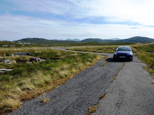
Surrounded by rolling hills and lush greenery, Lochanan Beag offers a picturesque setting for visitors to relax and immerse themselves in the natural beauty of the Scottish Highlands. Its peaceful ambiance and abundant wildlife make it a haven for those seeking a tranquil escape from the hustle and bustle of daily life.

If you have any feedback on the listing, please let us know in the comments section below.

Lochanan Beag Images

Images are sourced within 2km of 58.15313/-6.7846796 or Grid Reference NB1828. Thanks to Geograph Open Source API. All images are credited.

Lewis style bus shelter (i)
Loch Faoghail am Tuim Looking south towards the hills of West Lewis. The little house highlighted by a ray of sunshine is a boathouse, in the next square. The nearest hill on the left is Ciorabhal, and on the right is Geure Dubh Mhòr. On the distant skyline is Roineabhal.
Loch Faoghail am Tuim
Looking south towards the hills of West Lewis. The little house highlighted by a ray of sunshine is a boathouse, in the next square. The nearest hill on the left is Ciorabhal, and on the right is Geure Dubh Mhòr. On the distant skyline is Roineabhal.
Up above the old road This is not country in which to venture without navigations skills. It's boggy, and many of the ups and downs are not pronounced enough to generate contours. We were able to park on the old road - visible on the 1:25000 OS map - and it was a slightly boggy walk up onto rock. One of little lochans in the square can be seen, as can a typical "knock" of Lewisian gneiss. The (somewhat dilapidated) fence to my west could not be seen from where I took the photo.
Up above the old road
This is not country in which to venture without navigations skills. It's boggy, and many of the ups and downs are not pronounced enough to generate contours. We were able to park on the old road - visible on the 1:25000 OS map - and it was a slightly boggy walk up onto rock. One of little lochans in the square can be seen, as can a typical "knock" of Lewisian gneiss. The (somewhat dilapidated) fence to my west could not be seen from where I took the photo.
Cycling the B8059 The hills of Harris on the skyline
Cycling the B8059
The hills of Harris on the skyline
B8059 and the lochs leading in to the Lewis-Harris borderlands This string of linked lochs have 'Faoghail' in their names; this is the Gaelic word for ford.
B8059 and the lochs leading in to the Lewis-Harris borderlands
This string of linked lochs have 'Faoghail' in their names; this is the Gaelic word for ford.
Causeway and fishing bothy, Loch Faoghail an Tuim, Isle of Lewis Loch Faoghail an Tuim is part of the Grimersta salmon system (<span class="nowrap"><a title="https://www.grimersta.com/guide.htm" rel="nofollow ugc noopener" href="https://www.grimersta.com/guide.htm">Link</a><img style="margin-left:2px;" alt="External link" title="External link - shift click to open in new window" src="https://s1.geograph.org.uk/img/external.png" width="10" height="10"/></span> ).
Causeway and fishing bothy, Loch Faoghail an Tuim, Isle of Lewis
Loch Faoghail an Tuim is part of the Grimersta salmon system (LinkExternal link ).
Lewis bus shelter
Lewis bus shelter
Loch Speireag Viewed from the B8059 road. The hills of North Harris in view.
Loch Speireag
Viewed from the B8059 road. The hills of North Harris in view.
Loch Sgàire Viewed from the B8059 road from Great Bernera.
Loch Sgàire
Viewed from the B8059 road from Great Bernera.
Section of abandoned road next to the B8011
Rock slab, Dromannan Easa Ghil, Isle of Lewis Looking towards Loch Ruadh Gheure Dubh Mhòr, the south eastern part of which lies within the grid square.
Rock slab, Dromannan Easa Ghil, Isle of Lewis
Looking towards Loch Ruadh Gheure Dubh Mhòr, the south eastern part of which lies within the grid square.
Loch an Fhir Mhaoil, Isle of Lewis The burn flowing into the loch is the Os an Fhir Mhaoil flowing down from Loch Ruadh Gheure Dubh Mhòr.
Loch an Fhir Mhaoil, Isle of Lewis
The burn flowing into the loch is the Os an Fhir Mhaoil flowing down from Loch Ruadh Gheure Dubh Mhòr.
Rock slab, Cnoc na Clais, Isle of Lewis The OS Name Book of 1848-1852 describes Cnoc na Clais as, "a small, round, rocky, heathy hill" and says that its name means Furrows Hill.
Rock slab, Cnoc na Clais, Isle of Lewis
The OS Name Book of 1848-1852 describes Cnoc na Clais as, "a small, round, rocky, heathy hill" and says that its name means Furrows Hill.
Jetty and fishing bothy, Loch Faoghail an Tuim, Isle of Lewis Loch Faoghail an Tuim is part of the Grimersta salmon system (<span class="nowrap"><a title="https://www.grimersta.com/guide.htm" rel="nofollow ugc noopener" href="https://www.grimersta.com/guide.htm">Link</a><img style="margin-left:2px;" alt="External link" title="External link - shift click to open in new window" src="https://s1.geograph.org.uk/img/external.png" width="10" height="10"/></span> ).
Jetty and fishing bothy, Loch Faoghail an Tuim, Isle of Lewis
Loch Faoghail an Tuim is part of the Grimersta salmon system (LinkExternal link ).
Inflow to Loch an Fhir Mhaoil, Isle of Lewis The burn flowing into the loch is the Os an Fhir Mhaoil flowing down from Loch Ruadh Gheure Dubh Mhòr.

According to the OS Namebook of 1848-1852, Loch an Fhir Mhaoil means Loch of the Bald Headed Man.
Inflow to Loch an Fhir Mhaoil, Isle of Lewis
The burn flowing into the loch is the Os an Fhir Mhaoil flowing down from Loch Ruadh Gheure Dubh Mhòr. According to the OS Namebook of 1848-1852, Loch an Fhir Mhaoil means Loch of the Bald Headed Man.
Moorland Moorland and a track out to the loch at the head of the Grimersta river.
Moorland
Moorland and a track out to the loch at the head of the Grimersta river.
Aird na Faoghalach Rocky landscape interspersed with peat bog.
Aird na Faoghalach
Rocky landscape interspersed with peat bog.
Loch Faoghail an Tuim The rainbow strikes through the bothy on an islet in the Loch which is linked to the shore by stepping stones.
Loch Faoghail an Tuim
The rainbow strikes through the bothy on an islet in the Loch which is linked to the shore by stepping stones.
Show me another place!

Lochanan Beag is located at Grid Ref: NB1828 (Lat: 58.15313, Lng: -6.7846796)

Unitary Authority: Na h-Eileanan an Iar

Police Authority: Highlands and Islands

What 3 Words

///lizards.punctual.business. Near Carloway, Na h-Eileanan Siar

Related Wikis

Callanish IV

The Callanish IV stone circle (Scottish Gaelic: Ceann Hulavig) is one of many megalithic structures around the better-known (and larger) Calanais I on...

Eilean Chearstaidh

Eilean Kearstay (Scottish Gaelic: Eilean Chearstaigh) is an uninhabited island in Loch Roag in the Outer Hebrides of Scotland. It lies south east of Great...

Callanish Stones

The Callanish Stones (or "Callanish I": Scottish Gaelic: Clachan Chalanais or Tursachan Chalanais) are an arrangement of standing stones placed in a cruciform...

Callanish II

The Callanish II stone circle (Scottish Gaelic: Cnoc Ceann a' Gharaidh) is one of many megalithic structures around the better-known (and larger) Calanais...

Nearby Amenities

Located within 500m of 58.15313,-6.7846796
Passing Place
Lat/Long: 58.1492637/-6.7815093
Power: pole
Lat/Long: 58.1504255/-6.7778663
Power: pole
Lat/Long: 58.1502171/-6.7793041
Power: pole
Lat/Long: 58.1499704/-6.7807683
Power: pole
Lat/Long: 58.1497982/-6.7819762
Power: pole
Lat/Long: 58.1495267/-6.7833022
Power: pole
Lat/Long: 58.1492024/-6.7849354
Power: pole
Lat/Long: 58.1488961/-6.786495
Power: pole
Lat/Long: 58.1500171/-6.7787332
Power: pole
Lat/Long: 58.1497535/-6.7803233
Power: pole
Lat/Long: 58.1495281/-6.7816958
Power: pole
Lat/Long: 58.1493311/-6.7828104
Power: pole
Lat/Long: 58.1490462/-6.784285
Power: pole
Lat/Long: 58.1487684/-6.7856441
Passing Place
Lat/Long: 58.1487794/-6.7833979
The data included in this document is from www.openstreetmap.org. The data is made available under ODbL.

Have you been to Lochanan Beag?

Leave your review of Lochanan Beag below (or comments, questions and feedback).