Loch Dubh na h-Àirde

Lake, Pool, Pond, Freshwater Marsh in Ross-shire

Scotland

Loch Dubh na h-Àirde

Old milestone This milestone 14 miles south of Barvas on the A858 has gained a few more lichens since last being recorded for the Milestone Society. It is beneath Cnoc Leathann about 0.15 mile south of a cattle grid and halfway between Carloway (Càrlabhaigh) and Breasclete (Breascleit).
Old milestone Credit: Jon Glew

Loch Dubh na h-Àirde, located in Ross-shire, Scotland, is a picturesque freshwater loch encompassing an area of approximately 2 square kilometers. Surrounded by rolling hills and lush greenery, this natural water body offers a tranquil and idyllic setting for visitors and local wildlife alike.

The loch's name, Loch Dubh na h-Àirde, translates to "black loch of the height" in English, which aptly describes its dark-colored waters. The lake's depths remain relatively shallow, with an average depth of around 5 meters, making it an ideal habitat for various aquatic flora and fauna.

The surrounding area of Loch Dubh na h-Àirde is a haven for birdwatchers, as it attracts a diverse range of avian species throughout the year. Visitors can spot numerous waterfowl, such as ducks, swans, and geese, as well as rare and protected species like osprey and golden eagles. The loch also serves as a vital stopover point for migratory birds during their long journeys.

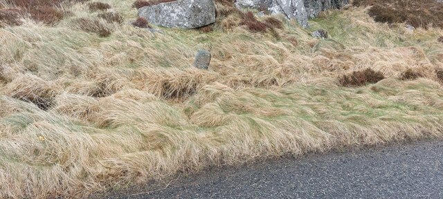
The diverse vegetation surrounding the loch includes reed beds, water lilies, and various types of grasses, creating a rich habitat for insects, amphibians, and small mammals. This biodiversity makes Loch Dubh na h-Àirde an important ecological site, contributing to the overall health and balance of the local ecosystem.

For those seeking outdoor activities, Loch Dubh na h-Àirde offers opportunities for fishing and boating. Anglers can find brown trout and perch in the loch's waters, providing a rewarding experience for fishing enthusiasts.

Overall, Loch Dubh na h-Àirde is a captivating and ecologically significant freshwater loch, attracting nature lovers, bird enthusiasts, and those seeking a peaceful retreat amidst Scotland's breathtaking landscapes.

If you have any feedback on the listing, please let us know in the comments section below.

Loch Dubh na h-Àirde Images

Images are sourced within 2km of 58.247096/-6.7969153 or Grid Reference NB1838. Thanks to Geograph Open Source API. All images are credited.

Old milestone This milestone 14 miles south of Barvas on the A858 has gained a few more lichens since last being recorded for the Milestone Society. It is beneath Cnoc Leathann about 0.15 mile south of a cattle grid and halfway between Carloway (Càrlabhaigh) and Breasclete (Breascleit).
Old milestone
This milestone 14 miles south of Barvas on the A858 has gained a few more lichens since last being recorded for the Milestone Society. It is beneath Cnoc Leathann about 0.15 mile south of a cattle grid and halfway between Carloway (Càrlabhaigh) and Breasclete (Breascleit).
Old milestone This shows how close to the edge of the A858 the milestone below Cnoc Leathann is. However it is beyond a shallow ditch.
Old milestone
This shows how close to the edge of the A858 the milestone below Cnoc Leathann is. However it is beyond a shallow ditch.
Dun in Loch an Dùnain Relatively well preserved dun close to the main road <span class="nowrap"><a title="https://canmore.org.uk/site/4092/lewis-loch-an-duin" rel="nofollow ugc noopener" href="https://canmore.org.uk/site/4092/lewis-loch-an-duin">Link</a><img style="margin-left:2px;" alt="External link" title="External link - shift click to open in new window" src="https://s1.geograph.org.uk/img/external.png" width="10" height="10"/></span>
Dun in Loch an Dùnain
Relatively well preserved dun close to the main road LinkExternal link
Doune Braes Hotel
Doune Braes Hotel
Loch an Dùnain
Loch an Dùnain
Isle of Lewis, Loch an Dùnain
View towards Tolsta Chaolais
West Point
West Point
The Road to Tolsta Chaolais
Port a' Chaoil Stream flowing from Loch a' Bhaile enters Loch Rog an Ear, a sea loch, at Aird na Moine.
Port a' Chaoil
Stream flowing from Loch a' Bhaile enters Loch Rog an Ear, a sea loch, at Aird na Moine.
Loch a' Bhaile The narrow loch, hemmed in by steep hillsides, flows out into Loch Rog an Ear, a sea loch, via a short river.
Loch a' Bhaile
The narrow loch, hemmed in by steep hillsides, flows out into Loch Rog an Ear, a sea loch, via a short river.
Loch a' Bhaile Loch a' Bhaile & Tolastadh a' Chaolais beyond.
Loch a' Bhaile
Loch a' Bhaile & Tolastadh a' Chaolais beyond.
Tolstachaolais: the post office While many post offices have a buzzer which sounds as the door opens, the postmistress here is alerted to the arrival of customers by the loud bark of the dog tethered to the outside wall.
Tolstachaolais: the post office
While many post offices have a buzzer which sounds as the door opens, the postmistress here is alerted to the arrival of customers by the loud bark of the dog tethered to the outside wall.
Tolstachaolais: along the shore of Loch a' Bhaile Looking across the loch, which runs alongside the road through the village. However, this is the far side that we are looking along.
Tolstachaolais: along the shore of Loch a' Bhaile
Looking across the loch, which runs alongside the road through the village. However, this is the far side that we are looking along.
Tolstachaolais: postbox № HS2 62 This postbox stands more or less in the centre of the village, in front of a house that is set particularly well back from the road. The larger-scale map still marks that house as a post office, although it has actually (as reflected in the 1:50,000 and 1:25,000 map) relocated just over a kilometre to the north - see <a href="https://www.geograph.org.uk/photo/3086624">NB1939 : Tolstachaolais: the post office</a>.
Tolstachaolais: postbox № HS2 62
This postbox stands more or less in the centre of the village, in front of a house that is set particularly well back from the road. The larger-scale map still marks that house as a post office, although it has actually (as reflected in the 1:50,000 and 1:25,000 map) relocated just over a kilometre to the north - see NB1939 : Tolstachaolais: the post office.
Tolstachaolais: Loch a’ Bhaile Looking down this loch from its northern end, with the main part of the village visible far right.
Tolstachaolais: Loch a’ Bhaile
Looking down this loch from its northern end, with the main part of the village visible far right.
Tolstachaolais: hillside cows and Bernera view Looking across the sound separating the eastern side of Bernera from the Lewis mainland, beyond three cows grazing on the slopes to the south of Tolstachaolais village.
Tolstachaolais: hillside cows and Bernera view
Looking across the sound separating the eastern side of Bernera from the Lewis mainland, beyond three cows grazing on the slopes to the south of Tolstachaolais village.
Outlet from Loch a' Bhaile into Port a' Chaoil At the crofting community of Tolastadh a' Chaolais.
Outlet from Loch a' Bhaile into Port a' Chaoil
At the crofting community of Tolastadh a' Chaolais.
Show me another place!

Loch Dubh na h-Àirde is located at Grid Ref: NB1838 (Lat: 58.247096, Lng: -6.7969153)

Unitary Authority: Na h-Eileanan an Iar

Police Authority: Highlands and Islands

What 3 Words

///affords.ankle.gambles. Near Carloway, Na h-Eileanan Siar

Related Wikis

Tolsta Chaolais

Tolsta Chaolais (also Tolastadh Chaolais, Tolstadh a' Chaolais) is a village on the Isle of Lewis, Scotland. It consists of about forty houses, clustered...

Dun Carloway

Dun Carloway (Scottish Gaelic: Dùn Chàrlabhaigh) is a broch situated in the district of Carloway, on the west coast of the Isle of Lewis, Scotland (grid...

Breaclete

Breacleit (or Roulanish; Scottish Gaelic: Breacleit; Old Norse: Breiðiklettr) is the central village on Great Bernera in the Outer Hebrides, Scotland....

Great Bernera

Great Bernera (; Scottish Gaelic: Beàrnaraigh Mòr), often known just as Bernera (Scottish Gaelic: Beàrnaraigh), is an island and community in the Outer...

Nearby Amenities

Located within 500m of 58.247096,-6.7969153
Creag Ruadh
Place: locality
Lat/Long: 58.2505442/-6.7942492
Cnocan Òis
Place: locality
Lat/Long: 58.2487488/-6.8010298
Sgeir a' Chàrrain
Place: locality
Lat/Long: 58.2492344/-6.8021027
Creag Àrd
Place: locality
Lat/Long: 58.2499119/-6.7998067
Druim Teanraigir
Place: locality
Lat/Long: 58.2514249/-6.798369
Loch Shiadair
Natural: bay
Lat/Long: 58.2491102/-6.7948714
Òs Shiadair
Natural: bay
Lat/Long: 58.2474616/-6.80118
Rubha Fianuis
Natural: cape
Lat/Long: 58.2455418/-6.8005792
Cnoc na Buaile Mòra
Place: locality
Lat/Long: 58.2449546/-6.7959014
Mol Mòr
Place: locality
Lat/Long: 58.2456774/-6.7976609
The data included in this document is from www.openstreetmap.org. The data is made available under ODbL.

Have you been to Loch Dubh na h-Àirde?

Leave your review of Loch Dubh na h-Àirde below (or comments, questions and feedback).