Loch nan Gèoidh

Lake, Pool, Pond, Freshwater Marsh in Argyllshire

Scotland

Loch nan Gèoidh

Memorial to Lieutenant David Lowe Macintyre David Lowe Macintyre VC, CB (18 June 1895 – 31 July 1967) was a Scottish recipient of the Victoria Cross.
Memorial to Lieutenant David Lowe Macintyre Credit: Andrew Abbott

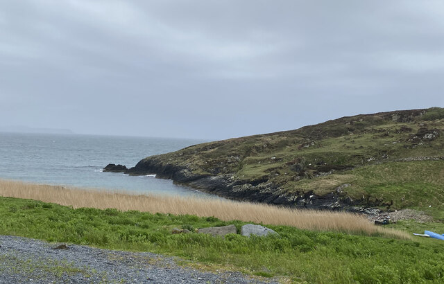
Loch nan Gèoidh is a picturesque freshwater lake located in Argyllshire, Scotland. Nestled amidst the stunning Scottish Highlands, the loch is surrounded by rolling hills, lush greenery, and an abundance of wildlife, making it a popular destination for nature enthusiasts and outdoor adventurers.

Covering an area of approximately 200 acres, Loch nan Gèoidh is a relatively small but deep body of water. Its crystal-clear waters are fed by nearby streams and springs, ensuring a constant flow of fresh water throughout the year. The lake is home to a variety of fish species, including trout and salmon, making it an ideal spot for anglers.

The shores of Loch nan Gèoidh are lined with dense vegetation, creating a haven for numerous bird species. Visitors can spot a range of birds, such as herons, ospreys, and various waterfowl, which nest and feed along the lakeside. The surrounding marshland provides a rich habitat for diverse plant life, including reeds, bulrushes, and water lilies.

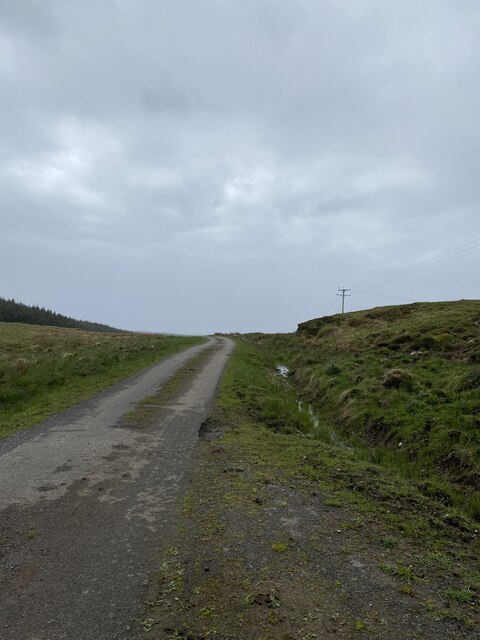
The tranquil atmosphere of Loch nan Gèoidh makes it a perfect location for recreational activities. Fishing enthusiasts can enjoy a peaceful day on the lake, while kayakers and canoeists can explore its serene waters. Additionally, the surrounding hills and trails offer opportunities for hiking and wildlife spotting, providing a well-rounded experience for outdoor lovers.

Overall, Loch nan Gèoidh is a hidden gem in Argyllshire, offering a serene and breathtaking environment for those seeking a peaceful escape in the heart of the Scottish Highlands.

If you have any feedback on the listing, please let us know in the comments section below.

Loch nan Gèoidh Images

Images are sourced within 2km of 55.683867/-6.482362 or Grid Reference NR1852. Thanks to Geograph Open Source API. All images are credited.

Memorial to Lieutenant David Lowe Macintyre David Lowe Macintyre VC, CB (18 June 1895 – 31 July 1967) was a Scottish recipient of the Victoria Cross.
Memorial to Lieutenant David Lowe Macintyre
David Lowe Macintyre VC, CB (18 June 1895 – 31 July 1967) was a Scottish recipient of the Victoria Cross.
Boat under repair
Boat under repair
Main Street, Port Wemyss/Bun Othan
Caolas na Cor-sgeire
Main Street, Port Wemyss/Bun Othan
Village Hall
Village Hall
Portnahaven
Portnahaven
Views out to sea Portnahaven
Portnahaven, Parish Church
OS Cut Mark - Portnahaven, Parish Church <span class="nowrap"><a title="https://www.bench-marks.org.uk/bm58120" rel="nofollow ugc noopener" href="https://www.bench-marks.org.uk/bm58120">Link</a><img style="margin-left:2px;" alt="External link" title="External link - shift click to open in new window" src="https://s1.geograph.org.uk/img/external.png" width="10" height="10"/></span>
OS Cut Mark - Portnahaven, Parish Church
View to Orsay from Port Wemyss
Port Ellister
Port Ellister
Location of Cnoc Undail OS Pipe <span class="nowrap"><a title="http://trigpointing.uk/trig/9482" rel="nofollow ugc noopener" href="http://trigpointing.uk/trig/9482">Link</a><img style="margin-left:2px;" alt="External link" title="External link - shift click to open in new window" src="https://s1.geograph.org.uk/img/external.png" width="10" height="10"/></span>
Location of Cnoc Undail OS Pipe
Road near Ellister
Road near Ellister
Former Portnahaven Coast Guard Lookout
Portnahaven
Portnahaven
Former school, Portnahaven Now a holiday let.
Former school, Portnahaven
Now a holiday let.
OS Cut Mark - Portnahaven, Old School <span class="nowrap"><a title="https://www.bench-marks.org.uk/bm58122" rel="nofollow ugc noopener" href="https://www.bench-marks.org.uk/bm58122">Link</a><img style="margin-left:2px;" alt="External link" title="External link - shift click to open in new window" src="https://s1.geograph.org.uk/img/external.png" width="10" height="10"/></span>
OS Cut Mark - Portnahaven, Old School
Show me another place!

Loch nan Gèoidh is located at Grid Ref: NR1852 (Lat: 55.683867, Lng: -6.482362)

Unitary Authority: Argyll and Bute

Police Authority: Argyll and West Dunbartonshire

What 3 Words

///should.crawling.guess. Near Portnahaven, Argyll & Bute

Related Wikis

Portnahaven

Portnahaven (Scottish Gaelic: Port na h-Abhainne, meaning river port) is a village on Islay in the Inner Hebrides, Scotland. The village is within the...

Easter Ellister

Easter Ellister (Aolastradh) is a settlement on the Rinns of Islay on Islay in the Inner Hebrides of Scotland. It lies just off the A847 road between Portnahaven...

Orsay, Inner Hebrides

Orsay (Scottish Gaelic: Orasaigh) is a small island in the Inner Hebrides of Scotland. It lies a short distance off the west coast of the island of Islay...

Eilean Mhic Coinnich

Eilean Mhic Coinnich, also known as Mackenzie Island (although recorded on the Land Register as McKenseys Island), is an uninhabited island of 17.3 hectares...

Related Videos

Lossit Bay sunset, Isle of Islay #shorts

A #shorts video from the west coast of Islay, a June evening sunset at beautiful Lossit Bay.

Portnahaven Sunset

Islay festival week 2019.

Exploring Lossit Bay, Isle of Islay, Scotland

A beautiful June evening on the west coast of the Isle of Islay in Scotland. We are in Lossit Bay, well away from any road or track, ...

Nearby Amenities

Located within 500m of 55.683867,-6.482362
Passing Place
Lat/Long: 55.6815716/-6.4829225
Passing Place
Lat/Long: 55.6813469/-6.4847283
Cnoc Mòr
Man Made: tower
Tower Type: communication
Lat/Long: 55.6820379/-6.4895716
Power: pole
Lat/Long: 55.6848103/-6.4763528
Power: pole
Lat/Long: 55.6824976/-6.476815
Power: pole
Lat/Long: 55.6819312/-6.4769238
Power: pole
Lat/Long: 55.680775/-6.4875651
Power: pole
Lat/Long: 55.6808796/-6.4857844
Power: pole
Lat/Long: 55.6811463/-6.4819973
Power: pole
Lat/Long: 55.6813049/-6.4796602
Power: pole
Lat/Long: 55.6814896/-6.4770293
Passing Place
Lat/Long: 55.6810173/-6.4861795
Passing Place
Lat/Long: 55.6843355/-6.4765399
Power: pole
Lat/Long: 55.6851419/-6.475259
Power: pole
Lat/Long: 55.6843453/-6.4764457
Power: pole
Lat/Long: 55.6837316/-6.4765684
Power: pole
Lat/Long: 55.6831132/-6.476692
Power: pole
Lat/Long: 55.6813935/-6.4783984
Power: pole
Lat/Long: 55.6812304/-6.4807577
Power: pole
Lat/Long: 55.6810632/-6.4831776
Power: pole
Lat/Long: 55.6809733/-6.4844542
Power: pole
Lat/Long: 55.6808255/-6.4867057
Cladh Eilisteir
Historic: archaeological_site
Lat/Long: 55.6833228/-6.476997
The data included in this document is from www.openstreetmap.org. The data is made available under ODbL.

Have you been to Loch nan Gèoidh?

Leave your review of Loch nan Gèoidh below (or comments, questions and feedback).