Loch na Bèiste

Lake, Pool, Pond, Freshwater Marsh in Ross-shire

Scotland

Loch na Bèiste

Up above the old road This is not country in which to venture without navigations skills. It's boggy, and many of the ups and downs are not pronounced enough to generate contours. We were able to park on the old road - visible on the 1:25000 OS map - and it was a slightly boggy walk up onto rock. One of little lochans in the square can be seen, as can a typical "knock" of Lewisian gneiss. The (somewhat dilapidated) fence to my west could not be seen from where I took the photo.
Up above the old road Credit: Neville Goodman

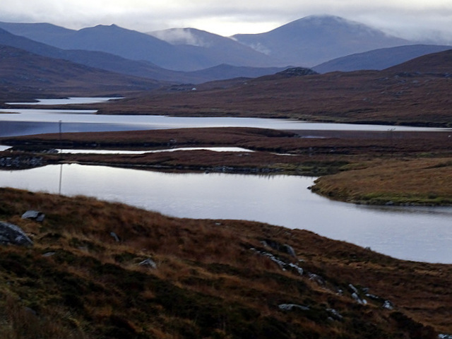
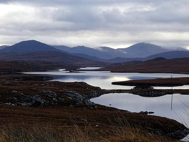
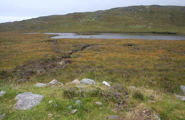
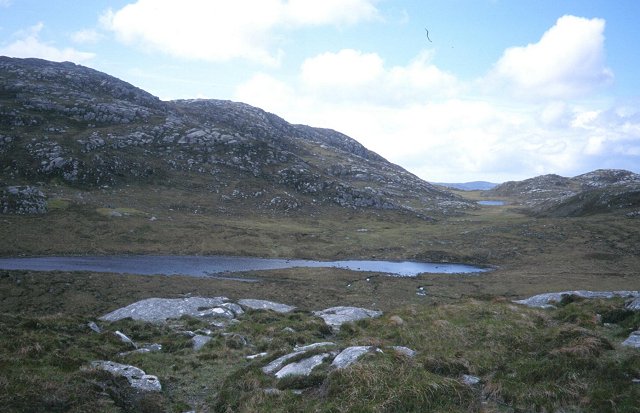
Loch na Bèiste is a picturesque freshwater loch located in Ross-shire, Scotland. Nestled amidst the stunning Scottish Highlands, the loch is known for its breathtaking natural beauty and tranquil ambiance.

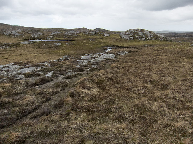
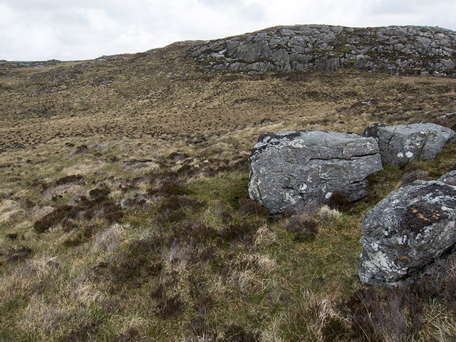
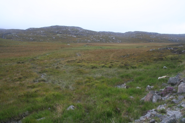
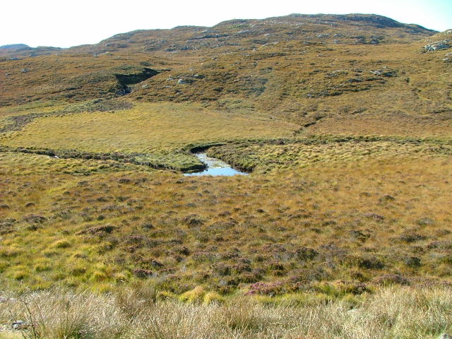
Spanning an area of approximately 10 hectares, Loch na Bèiste is surrounded by rolling hills and dense forests, creating a serene and secluded atmosphere. The loch itself is characterized by its crystal-clear waters, reflecting the surrounding landscape like a mirror. Its name, Loch na Bèiste, translates to "Loch of the Beast" in Gaelic, adding an air of mystery and intrigue to the location.

The loch is home to a diverse range of flora and fauna, creating a vibrant ecosystem. The surrounding marshes and wetlands attract a variety of bird species, making it a haven for birdwatchers and nature enthusiasts. Visitors can spot common species such as ducks, geese, and swans, as well as rarer sightings such as the elusive osprey.

For those interested in fishing, Loch na Bèiste offers an opportunity to catch brown trout, which thrive in its clear waters. Anglers can enjoy a peaceful day by the loch, casting their lines and appreciating the stunning surroundings.

Accessible via a scenic drive through the Scottish countryside, Loch na Bèiste is a hidden gem that offers a tranquil escape from the hustle and bustle of everyday life. Whether it's for birdwatching, fishing, or simply enjoying the beauty of nature, Loch na Bèiste is a must-visit destination for anyone seeking a peaceful retreat in the heart of Scotland's natural wonders.

If you have any feedback on the listing, please let us know in the comments section below.

Loch na Bèiste Images

Images are sourced within 2km of 58.165888/-6.7972908 or Grid Reference NB1729. Thanks to Geograph Open Source API. All images are credited.

Up above the old road This is not country in which to venture without navigations skills. It's boggy, and many of the ups and downs are not pronounced enough to generate contours. We were able to park on the old road - visible on the 1:25000 OS map - and it was a slightly boggy walk up onto rock. One of little lochans in the square can be seen, as can a typical "knock" of Lewisian gneiss. The (somewhat dilapidated) fence to my west could not be seen from where I took the photo.
Up above the old road
This is not country in which to venture without navigations skills. It's boggy, and many of the ups and downs are not pronounced enough to generate contours. We were able to park on the old road - visible on the 1:25000 OS map - and it was a slightly boggy walk up onto rock. One of little lochans in the square can be seen, as can a typical "knock" of Lewisian gneiss. The (somewhat dilapidated) fence to my west could not be seen from where I took the photo.
B8059 and the lochs leading in to the Lewis-Harris borderlands This string of linked lochs have 'Faoghail' in their names; this is the Gaelic word for ford.
B8059 and the lochs leading in to the Lewis-Harris borderlands
This string of linked lochs have 'Faoghail' in their names; this is the Gaelic word for ford.
Loch Speireag Viewed from the B8059 road. The hills of North Harris in view.
Loch Speireag
Viewed from the B8059 road. The hills of North Harris in view.
Loch Sgàire Viewed from the B8059 road from Great Bernera.
Loch Sgàire
Viewed from the B8059 road from Great Bernera.
Conostom The summit of Teathabhal (256m) looking northward.
Conostom
The summit of Teathabhal (256m) looking northward.
Loch Speireig The loch has a very interesting small circular island that could well be a man-made, iron age, dun or crannog.
Loch Speireig
The loch has a very interesting small circular island that could well be a man-made, iron age, dun or crannog.
Boggy and rocky Often in this type of country, getting up onto a bit of high ground reveals a lochan or just a little pool to add a bit of interest. Not here. The high ground is on the lower slopes of Beinn Sgarastaigh, but with a summit height of 98 m, and difficult navigation through peat hags, no one is likely to get excited about it.
Boggy and rocky
Often in this type of country, getting up onto a bit of high ground reveals a lochan or just a little pool to add a bit of interest. Not here. The high ground is on the lower slopes of Beinn Sgarastaigh, but with a summit height of 98 m, and difficult navigation through peat hags, no one is likely to get excited about it.
Loch Ruadh Under the small but very rocky peak of Teathabhal.
Loch Ruadh
Under the small but very rocky peak of Teathabhal.
Peat Bogs at the Source of the Lundale River The various streams form the river Lundale which flows north to Tob Lundale and into Loch Rog. Beyond the valley is the hill of Cnoc Mhi Neil.
Peat Bogs at the Source of the Lundale River
The various streams form the river Lundale which flows north to Tob Lundale and into Loch Rog. Beyond the valley is the hill of Cnoc Mhi Neil.
Lundale River Beneath Cleite na Cloich Ard.
Lundale River
Beneath Cleite na Cloich Ard.
Show me another place!

Loch na Bèiste is located at Grid Ref: NB1729 (Lat: 58.165888, Lng: -6.7972908)

Unitary Authority: Na h-Eileanan an Iar

Police Authority: Highlands and Islands

What 3 Words

///patrol.swims.gearing. Near Carloway, Na h-Eileanan Siar

Related Wikis

Eilean Chearstaidh

Eilean Kearstay (Scottish Gaelic: Eilean Chearstaigh) is an uninhabited island in Loch Roag in the Outer Hebrides of Scotland. It lies south east of Great...

Callanish Stones

The Callanish Stones (or "Callanish I": Scottish Gaelic: Clachan Chalanais or Tursachan Chalanais) are an arrangement of standing stones placed in a cruciform...

Callanish VIII

The Callanish VIII stone setting is one of many megalithic structures around the better-known (and larger) Calanais I on the west coast of the Isle of...

Callanish

Callanish (Scottish Gaelic: Calanais) is a village (township) on the west side of the Isle of Lewis, in the Outer Hebrides (Western Isles), Scotland. Callanish...

Nearby Amenities

Located within 500m of 58.165888,-6.7972908
Gearraidh Cleite Ghabhaidh
Place: locality
Lat/Long: 58.1639583/-6.8002911
The data included in this document is from www.openstreetmap.org. The data is made available under ODbL.

Have you been to Loch na Bèiste?

Leave your review of Loch na Bèiste below (or comments, questions and feedback).