Loch Rinn na Geòdha

Lake, Pool, Pond, Freshwater Marsh in Ross-shire

Scotland

Loch Rinn na Geòdha

Blackhouse Village at Garenin
Blackhouse Village at Garenin Credit: Colin Park

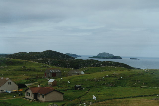
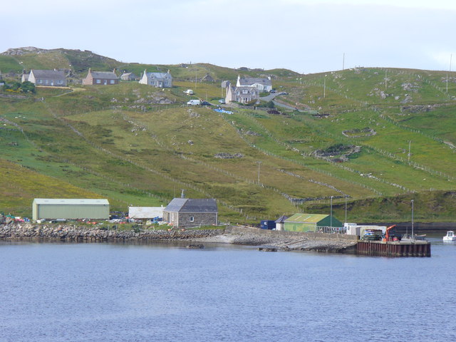
Loch Rinn na Geòdha, located in Ross-shire, Scotland, is a picturesque freshwater body encompassing a variety of natural features. Spanning an area of approximately 10 hectares, this inland water feature is often referred to as a "loch," although its size might classify it as a small lake or even a large pond.

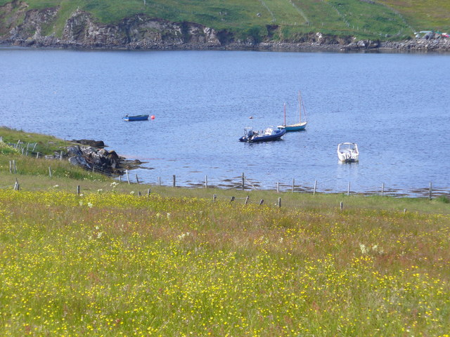
Surrounded by lush greenery and rolling hills, Loch Rinn na Geòdha offers a tranquil and serene environment. Its crystal-clear waters are fed by numerous freshwater streams that cascade down the surrounding slopes. The loch itself is relatively shallow, with depths ranging from a few meters to around 10 meters in certain areas.

One of the distinctive aspects of Loch Rinn na Geòdha is the presence of a freshwater marsh on its northern shoreline. This marshland is characterized by its waterlogged and nutrient-rich soil, supporting a diverse array of aquatic plant species. These plants, including reeds, rushes, and water lilies, provide vital habitat and nesting grounds for various bird species, such as ducks, grebes, and herons.

The loch is also home to an abundance of fish, including brown trout, pike, and perch. Anglers often visit Loch Rinn na Geòdha to enjoy the peacefulness of the surroundings while trying their luck at catching these freshwater species.

With its idyllic scenery and rich biodiversity, Loch Rinn na Geòdha serves as a haven for nature enthusiasts, photographers, and those seeking a peaceful retreat. Its tranquil waters, diverse plant life, and teeming wildlife make it a destination that showcases the beauty and tranquility of the Scottish countryside.

If you have any feedback on the listing, please let us know in the comments section below.

Loch Rinn na Geòdha Images

Images are sourced within 2km of 58.287447/-6.8151609 or Grid Reference NB1743. Thanks to Geograph Open Source API. All images are credited.

Blackhouse Village at Garenin
Ruin by Loch Garenin
Na Gearrannan The main road through the restored part of the old village of blackhouses. People lived in some of these houses up until 1974.
Na Gearrannan
The main road through the restored part of the old village of blackhouses. People lived in some of these houses up until 1974.
Buildings in Gearrannan Blackhouse Village
Loch Garenin Sea loch below the Black House Village.
Loch Garenin
Sea loch below the Black House Village.
Blackhouse Village at Garenin The village was occupied until 1974. Restored in the later years of the Century. The plaque commemorates the opening of the village as a visitor attraction by Princess Anne. Most of the black houses are let as self-catering holiday accommodation.
Blackhouse Village at Garenin
The village was occupied until 1974. Restored in the later years of the Century. The plaque commemorates the opening of the village as a visitor attraction by Princess Anne. Most of the black houses are let as self-catering holiday accommodation.
Cottage interior, Garenin Blackhouse Village
The view from Carloway Broch Taken on film in 2002.

The view from just below the broch that overlooks the small village (perhaps just a hamlet) of the same name.
The view from Carloway Broch
Taken on film in 2002. The view from just below the broch that overlooks the small village (perhaps just a hamlet) of the same name.
Garenin Blackhouses Museum Group of reconstructed blackhouses which give an excellent impression of what Hebridean hamlets would have looked like 200 years ago.
Garenin Blackhouses Museum
Group of reconstructed blackhouses which give an excellent impression of what Hebridean hamlets would have looked like 200 years ago.
Garenin Blackhouses Museum A reconstructed blackhouse settlement.
Garenin Blackhouses Museum
A reconstructed blackhouse settlement.
Historic shelter or shieling
Moorings by Cnoc na Crich Small craft moored on the south side of Loch Charlabhaigh / Carloway, at the foot of a flower-laden field.
Moorings by Cnoc na Crich
Small craft moored on the south side of Loch Charlabhaigh / Carloway, at the foot of a flower-laden field.
Crofts, Borghastan Traditional field strips descending to the Loch Charlabhaig shoreline, with pier, from the crofts above.
Crofts, Borghastan
Traditional field strips descending to the Loch Charlabhaig shoreline, with pier, from the crofts above.
Blackhouse Village, Gearrannan Unique holiday village and visitor centre on the west coast of Lewis, near Carloway.
<span class="nowrap"><a title="http://www.gearrannan.com/" rel="nofollow ugc noopener" href="http://www.gearrannan.com/">Link</a><img style="margin-left:2px;" alt="External link" title="External link - shift click to open in new window" src="https://s1.geograph.org.uk/img/external.png" width="10" height="10"/></span>
Blackhouse Village, Gearrannan
Unique holiday village and visitor centre on the west coast of Lewis, near Carloway. LinkExternal link
New Life at Blackhouse Village Gearrannan, where old blackhouses now have windows and chimneys - they have been totally refurbished as holiday cottages.
<span class="nowrap"><a title="http://www.gearrannan.com/" rel="nofollow ugc noopener" href="http://www.gearrannan.com/">Link</a><img style="margin-left:2px;" alt="External link" title="External link - shift click to open in new window" src="https://s1.geograph.org.uk/img/external.png" width="10" height="10"/></span>
New Life at Blackhouse Village
Gearrannan, where old blackhouses now have windows and chimneys - they have been totally refurbished as holiday cottages. LinkExternal link
Gearrannan, Blackhouse Village Abandoned in 1955 after 300 years of occupation, the old village has found new life as a museum and holiday cottages. Note the rounded ends of the houses - to help break the wind.
<span class="nowrap"><a title="http://www.gearrannan.com/" rel="nofollow ugc noopener" href="http://www.gearrannan.com/">Link</a><img style="margin-left:2px;" alt="External link" title="External link - shift click to open in new window" src="https://s1.geograph.org.uk/img/external.png" width="10" height="10"/></span>
Gearrannan, Blackhouse Village
Abandoned in 1955 after 300 years of occupation, the old village has found new life as a museum and holiday cottages. Note the rounded ends of the houses - to help break the wind. LinkExternal link
Loch Garenin Stony bay at the head of Loch Garenin which is open to north-westerly winds.
<span class="nowrap"><a title="http://www.gearrannan.com/" rel="nofollow ugc noopener" href="http://www.gearrannan.com/">Link</a><img style="margin-left:2px;" alt="External link" title="External link - shift click to open in new window" src="https://s1.geograph.org.uk/img/external.png" width="10" height="10"/></span>
Loch Garenin
Stony bay at the head of Loch Garenin which is open to north-westerly winds. LinkExternal link
Show me another place!

Loch Rinn na Geòdha is located at Grid Ref: NB1743 (Lat: 58.287447, Lng: -6.8151609)

Unitary Authority: Na h-Eileanan an Iar

Police Authority: Highlands and Islands

What 3 Words

///aunts.hack.fish. Near Carloway, Na h-Eileanan Siar

Related Wikis

Borrowston, Lewis

Borrowston (Scottish Gaelic: Borghastan), with a population of about 50, is a crofting township situated on the Isle of Lewis, on the Outer Hebrides of...

Garenin

Garenin (Scottish Gaelic: Na Gearrannan) is a crofting township on the west coast of the Isle of Lewis in the Outer Hebrides of Scotland. Garenin is in...

Dun Carloway

Dun Carloway (Scottish Gaelic: Dùn Chàrlabhaigh) is a broch situated in the district of Carloway, on the west coast of the Isle of Lewis, Scotland (grid...

Carloway

Carloway (Scottish Gaelic: Càrlabhagh [ˈkʰaːɾɫ̪ə.ɤː]) is a crofting township and a district on the west coast of the Isle of Lewis, in the Outer Hebrides...

Cealasaigh

Cealasaigh or Kealasay is an islet in outer Loch Ròg, Lewis, Scotland that lies north of Traigh Mhór on Little Bernera and south of Campaigh. To the west...

Campaigh

Campaigh or Campay is a steep and rocky islet in outer Loch Ròg, Lewis, Scotland that lies north of Cealasaigh and Little Bernera. A huge natural arch...

Little Bernera

Little Bernera (Scottish Gaelic: Beàrnaraigh Beag) is a small island situated off the west coast of the Isle of Lewis in the Outer Hebrides.Little Bernera...

Tolsta Chaolais

Tolsta Chaolais (also Tolastadh Chaolais, Tolstadh a' Chaolais) is a village on the Isle of Lewis, Scotland. It consists of about forty houses, clustered...

Have you been to Loch Rinn na Geòdha?

Leave your review of Loch Rinn na Geòdha below (or comments, questions and feedback).