Loch Àirigh Thormaid Lagaich

Lake, Pool, Pond, Freshwater Marsh in Ross-shire

Scotland

Loch Àirigh Thormaid Lagaich

Loch Ruadh Loch Ruadh on route to Beinn Mothal.
Loch Ruadh Credit: Rude Health

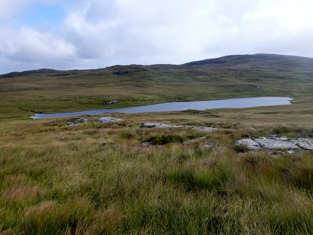
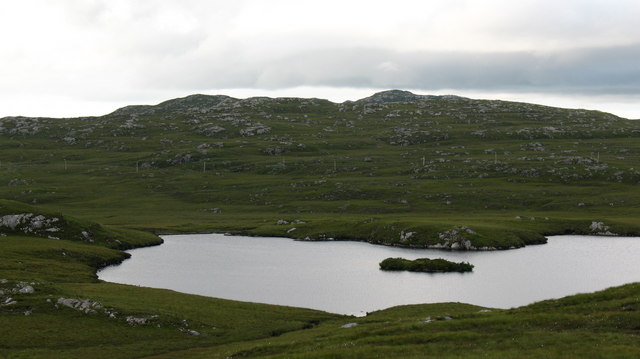
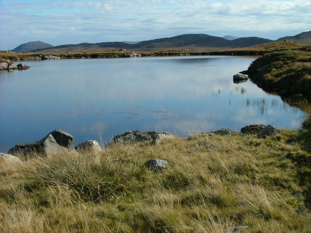
Loch Àirigh Thormaid Lagaich is a picturesque freshwater body located in Ross-shire, Scotland. Nestled amidst the scenic beauty of the Scottish Highlands, this lake, also known as a loch, offers a tranquil and serene setting for visitors to enjoy.

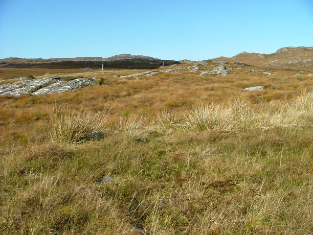
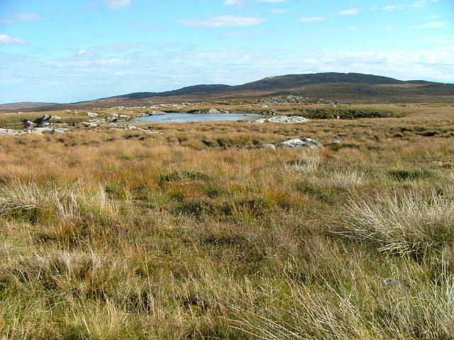
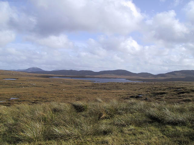
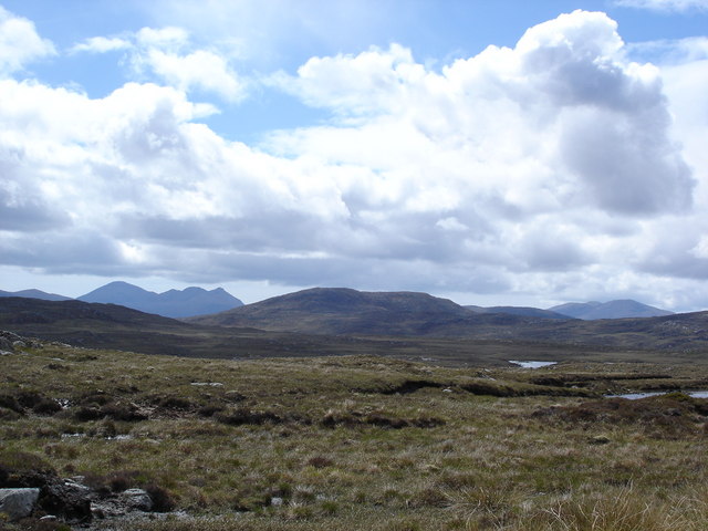
Covering an area of approximately 20 hectares, Loch Àirigh Thormaid Lagaich is surrounded by lush greenery and rolling hills, providing a stunning backdrop for outdoor enthusiasts and nature lovers. The loch is situated at an elevation of approximately 200 meters above sea level, which contributes to its pristine and untouched environment.

The water in Loch Àirigh Thormaid Lagaich is crystal clear, thanks to the absence of pollutants and the continuous flow from natural springs and streams. The lake is fed by several small tributaries, which help maintain its water level and sustain the diverse ecosystem that thrives within.

The surrounding marshes and wetlands of Loch Àirigh Thormaid Lagaich are home to a variety of flora and fauna. Visitors can spot an array of waterfowl, such as ducks, swans, and herons, gliding gracefully on the surface of the lake. The marshes are also a haven for various aquatic plants, including reeds and water lilies.

Apart from its natural beauty, Loch Àirigh Thormaid Lagaich offers recreational activities such as fishing and boating. Anglers can try their luck at catching brown trout, which are abundant in the lake. Boating enthusiasts can explore the calm waters and take in the breathtaking scenery.

Overall, Loch Àirigh Thormaid Lagaich is a hidden gem in Ross-shire, offering a peaceful retreat for those seeking to immerse themselves in the beauty of the Scottish countryside.

If you have any feedback on the listing, please let us know in the comments section below.

Loch Àirigh Thormaid Lagaich Images

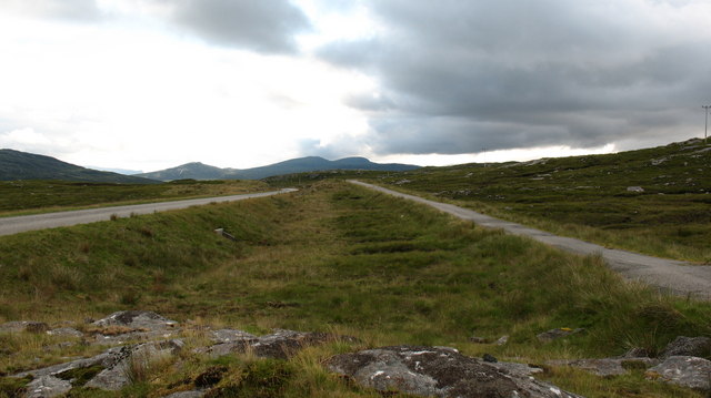
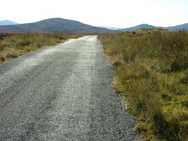
Images are sourced within 2km of 58.130044/-6.8176792 or Grid Reference NB1625. Thanks to Geograph Open Source API. All images are credited.

Loch Ruadh Loch Ruadh on route to Beinn Mothal.
Loch Ruadh
Loch Ruadh on route to Beinn Mothal.
Heading For Loch Ruah Descending from Coltraiseal Beag heading for Loch Ruadh and then Ben Mohal [Beinn Mothal].
Heading For Loch Ruah
Descending from Coltraiseal Beag heading for Loch Ruadh and then Ben Mohal [Beinn Mothal].
Loch Sùrstabhat at sunset Although looking almost due north, the sun was setting just off the left of this view, taken after 10 pm (summer time). The sunset hadn't yet developed the spectacular underlit cloudscape that followed 20 minutes or so later, but the little loch caught our eye as we became increasingly distracted from the road looking for a suitable foreground. Fortunately, there are sections of the old road to safely get off the highway and wander about with a camera !
Loch Sùrstabhat at sunset
Although looking almost due north, the sun was setting just off the left of this view, taken after 10 pm (summer time). The sunset hadn't yet developed the spectacular underlit cloudscape that followed 20 minutes or so later, but the little loch caught our eye as we became increasingly distracted from the road looking for a suitable foreground. Fortunately, there are sections of the old road to safely get off the highway and wander about with a camera !
Sunset over Loch Sùrstabhat As the sky cleared from the west, the sun started to underlight the cloud cover as we passed by the upper end of Loch Sùrstabhat. The perspective and the direction of clearance has produced one of those views where the horizon looks tilted one way when seen "broad-brush" but then seems tilted the other way when the water is looked at more closely. I find the effect somewhat disturbing, but have tried to get the real horizon as level as possible. It's not helped by those electric poles all leaning towards the long span of cable across the loch...
Sunset over Loch Sùrstabhat
As the sky cleared from the west, the sun started to underlight the cloud cover as we passed by the upper end of Loch Sùrstabhat. The perspective and the direction of clearance has produced one of those views where the horizon looks tilted one way when seen "broad-brush" but then seems tilted the other way when the water is looked at more closely. I find the effect somewhat disturbing, but have tried to get the real horizon as level as possible. It's not helped by those electric poles all leaning towards the long span of cable across the loch...
Section of abandoned road next to the B8011
Loch Surstabhat A small loch to the north of the B8011. The tiny island helps to identify it.
Loch Surstabhat
A small loch to the north of the B8011. The tiny island helps to identify it.
Old road/new road The rebuilt B8011 to the right with the original road on the left.
Old road/new road
The rebuilt B8011 to the right with the original road on the left.
Old and new roads. looking west along the B8011 in West Lewis with the new twin-track road on the left and the original single track road on the right.  At the moment the old road still has a reasonable tarred surface and is used by cyclists and walkers.
Old and new roads.
looking west along the B8011 in West Lewis with the new twin-track road on the left and the original single track road on the right. At the moment the old road still has a reasonable tarred surface and is used by cyclists and walkers.
Peat cutting, West Lewis. Peat cutting near the roadside - miles from any settlement.
Peat cutting, West Lewis.
Peat cutting near the roadside - miles from any settlement.
Unnamed Lochan South of the B8011 Road. There are countless unnamed Lochs and Lochans on West Lewis.
Unnamed Lochan South of the B8011 Road.
There are countless unnamed Lochs and Lochans on West Lewis.
Old Road Part of the old B8011 road looking west.
Old Road
Part of the old B8011 road looking west.
Open Moorland West of the B8011
Open Moorland
West of the B8011
Lochan on the Moorland Unnamed on the OS map.
Lochan on the Moorland
Unnamed on the OS map.
Old Road Part of the old B8011.
Old Road
Part of the old B8011.
Loch an Fir Mhaoil
Loch an Fir Mhaoil
North Harris from the Morsgail moor The Clisham on the left and Tirga Mhor on the right
North Harris from the Morsgail moor
The Clisham on the left and Tirga Mhor on the right
End of the double track Single track running starts again on the road to Uig.
End of the double track
Single track running starts again on the road to Uig.
Beinn Mocacleit and moorland Moorland off the road to Uig.
Beinn Mocacleit and moorland
Moorland off the road to Uig.
Show me another place!

Loch Àirigh Thormaid Lagaich is located at Grid Ref: NB1625 (Lat: 58.130044, Lng: -6.8176792)

Unitary Authority: Na h-Eileanan an Iar

Police Authority: Highlands and Islands

What 3 Words

///slipping.wanted.pursue. Near Carloway, Na h-Eileanan Siar

Related Wikis

Gisla Hydro-Electric Scheme

Gisla Hydro-Electric Scheme was a small scheme promoted by the North of Scotland Hydro-Electric Board on the Isle of Lewis, Outer Hebrides, Scotland. It...

Eilean Mòr, Loch Langavat

Eilean Mòr is an island in Loch Langavat on the Isle of Lewis in the Outer Hebrides of Scotland. == Footnotes ==

Callanish IV

The Callanish IV stone circle (Scottish Gaelic: Ceann Hulavig) is one of many megalithic structures around the better-known (and larger) Calanais I on...

Eilean Chearstaidh

Eilean Kearstay (Scottish Gaelic: Eilean Chearstaigh) is an uninhabited island in Loch Roag in the Outer Hebrides of Scotland. It lies south east of Great...

Have you been to Loch Àirigh Thormaid Lagaich?

Leave your review of Loch Àirigh Thormaid Lagaich below (or comments, questions and feedback).