Loch Sgeireagan Beag

Lake, Pool, Pond, Freshwater Marsh in Inverness-shire

Scotland

Loch Sgeireagan Beag

Long abandoned whaling station at Bunavoneader Viewed from across the water, with the bulk of Mònan rising beyond.

Whaling Station, 1904 Gaunt remains of a long-defunct industry, with a lone, tapering red brick chimney rising from the foundations of the boiling house/desiccator. Little else but the carcass ramp survives. Founded by Norwegian Karl Herlofsen, the factory was acquired by Lever Bros in 1922 when the market was declining, but was abandoned by them in 1929, a financial failure. Leverhulme never pursued his bizarre notion of turning whale meat into tinned sausages for Africans. The whaling station finally closed in 1951.

Taken from "Western Seaboard: An Illustrated Architectural Guide", by Mary Miers, 2008. Published by the Rutland Press.
Long abandoned whaling station at Bunavoneader Credit: Richard Dorrell

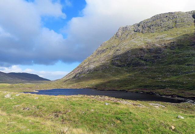
Loch Sgeireagan Beag is a small freshwater loch located in Inverness-shire, Scotland. Situated amidst the picturesque Scottish Highlands, this tranquil body of water offers a serene and scenic escape for nature enthusiasts and outdoor adventurers alike.

With a surface area of approximately 10 acres, Loch Sgeireagan Beag is surrounded by lush greenery and rolling hills, providing a breathtaking backdrop for visitors. The loch is fed by a number of small streams and springs, ensuring a constant flow of cool, clean freshwater. Its shallow depth and calm waters make it an ideal spot for a variety of activities such as fishing, boating, and wildlife observation.

The loch's ecosystem is rich and diverse, supporting a wide range of flora and fauna. The surrounding marshland is home to numerous species of water plants, including reeds and water lilies, which provide shelter and food for various aquatic animals. Birdwatchers will be delighted by the presence of several waterfowl species, such as ducks, swans, and herons, that frequent the area.

Access to Loch Sgeireagan Beag is relatively easy, with a small parking area available nearby. Visitors can take advantage of the well-maintained footpath that encircles the loch, allowing for leisurely walks and exploration of the surrounding natural beauty. It is worth noting that fishing permits are required for those interested in angling.

In summary, Loch Sgeireagan Beag is a captivating freshwater loch nestled within the stunning landscapes of Inverness-shire. Its tranquil waters, diverse wildlife, and picturesque surroundings offer an idyllic setting for outdoor enthusiasts seeking a peaceful retreat in the heart of the Scottish Highlands.

If you have any feedback on the listing, please let us know in the comments section below.

Loch Sgeireagan Beag Images

Images are sourced within 2km of 57.940153/-6.819566 or Grid Reference NB1404. Thanks to Geograph Open Source API. All images are credited.
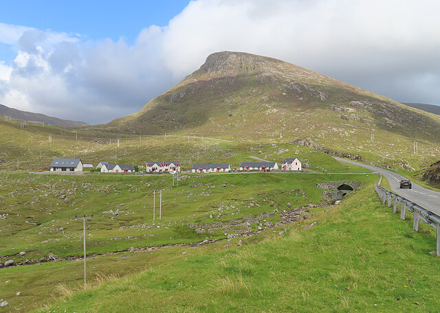
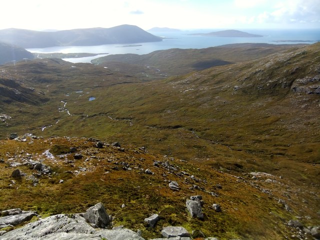
Long abandoned whaling station at Bunavoneader Viewed from across the water, with the bulk of Mònan rising beyond.

Whaling Station, 1904 Gaunt remains of a long-defunct industry, with a lone, tapering red brick chimney rising from the foundations of the boiling house/desiccator. Little else but the carcass ramp survives. Founded by Norwegian Karl Herlofsen, the factory was acquired by Lever Bros in 1922 when the market was declining, but was abandoned by them in 1929, a financial failure. Leverhulme never pursued his bizarre notion of turning whale meat into tinned sausages for Africans. The whaling station finally closed in 1951.

Taken from "Western Seaboard: An Illustrated Architectural Guide", by Mary Miers, 2008. Published by the Rutland Press.
Long abandoned whaling station at Bunavoneader
Viewed from across the water, with the bulk of Mònan rising beyond. Whaling Station, 1904 Gaunt remains of a long-defunct industry, with a lone, tapering red brick chimney rising from the foundations of the boiling house/desiccator. Little else but the carcass ramp survives. Founded by Norwegian Karl Herlofsen, the factory was acquired by Lever Bros in 1922 when the market was declining, but was abandoned by them in 1929, a financial failure. Leverhulme never pursued his bizarre notion of turning whale meat into tinned sausages for Africans. The whaling station finally closed in 1951. Taken from "Western Seaboard: An Illustrated Architectural Guide", by Mary Miers, 2008. Published by the Rutland Press.
Hydro-electric Power Station at Bun Abhainn Eadarra The nearby whaling station is visible in the background.
Hydro-electric Power Station at Bun Abhainn Eadarra
The nearby whaling station is visible in the background.
Abhainn Eadarra after heavy rain
Ceann an Ora A row of modern houses dwarfed by Sròn a' Sgaoth rising above.
Ceann an Ora
A row of modern houses dwarfed by Sròn a' Sgaoth rising above.
Loch na Sgeireagain Mòr The shoulder of Sgaoth Iosal rises steeply above the lochan.
Loch na Sgeireagain Mòr
The shoulder of Sgaoth Iosal rises steeply above the lochan.
On the old A859 The A859 road runs from the south of Harris to Stornoway. It has been improved and widened over the years and in several locations the old road has been left in situ to provide off road parking areas.
On the old A859
The A859 road runs from the south of Harris to Stornoway. It has been improved and widened over the years and in several locations the old road has been left in situ to provide off road parking areas.
Late winter blast at Loch na Ciste
The A859 on Harris Looking north to the bridges [old and new] over Abhainn Ceann an Ora and, on the left, the entrance to a quarry.
The A859 on Harris
Looking north to the bridges [old and new] over Abhainn Ceann an Ora and, on the left, the entrance to a quarry.
Rough grazing at Bun Abhainn Eadarra With electricity transmission poles; these seem to be replacements for those seen in Google Earth imagery of 2009.
Rough grazing at Bun Abhainn Eadarra
With electricity transmission poles; these seem to be replacements for those seen in Google Earth imagery of 2009.
Remains of whaling station at Bun Abhainn Eadarra Apart from the chimney, not much now remains of the whaling station on Loch Bun Abhainn Eadarra, near Ardhasaig.
Remains of whaling station at Bun Abhainn Eadarra
Apart from the chimney, not much now remains of the whaling station on Loch Bun Abhainn Eadarra, near Ardhasaig.
Old whaling station remains At Bun Abhainn Eadarra; little remains apart from the chimney <a href="https://www.geograph.org.uk/photo/5007689">NB1303 : Remains of whaling station at Bun Abhainn Eadarra</a> and concrete bases of buildings.
Old whaling station remains
At Bun Abhainn Eadarra; little remains apart from the chimney NB1303 : Remains of whaling station at Bun Abhainn Eadarra and concrete bases of buildings.
The B887 at Loch Bun Abhainn Eadarra Looking north, to the road end at Huisinis, about 20km further on. The hill is possibly Uisgneabhal Mòr, west of the main North Harris summit of An Cliseam.
The B887 at Loch Bun Abhainn Eadarra
Looking north, to the road end at Huisinis, about 20km further on. The hill is possibly Uisgneabhal Mòr, west of the main North Harris summit of An Cliseam.
Track by a burn near Bun Abhainn Eadarra Leading to Frith na Hearadh/Forest of Harris.
Track by a burn near Bun Abhainn Eadarra
Leading to Frith na Hearadh/Forest of Harris.
House and hillside At Bun Abhainn Eadarra
House and hillside
At Bun Abhainn Eadarra
Coire Dubh
Coire Dubh
New wind farm, Loch na Learga
Highest point on Tarsabhal
Bunavoneadar
Bunavoneadar
Show me another place!

Loch Sgeireagan Beag is located at Grid Ref: NB1404 (Lat: 57.940153, Lng: -6.819566)

Unitary Authority: Na h-Eileanan an Iar

Police Authority: Highlands and Islands

What 3 Words

///transmits.gurgling.saddens. Near Tarbert, Na h-Eileanan Siar

Related Wikis

Bun Abhainn Eadarra

Bun Abhainn Eadarra or Bunavoneadar is a hamlet adjacent to the Loch Bun Abhainn Eadarra, on the south shore of North Harris, in the Outer Hebrides, Scotland...

Ardhasaig

Ardhasaig (Scottish Gaelic: Àird Àsaig) is a settlement on the western coast of north Harris, in the Outer Hebrides, Scotland. Ardhasaig is also within...

Harris, Outer Hebrides

Harris (Scottish Gaelic: Na Hearadh, pronounced [nə ˈhɛɾəɣ] ) is the southern and more mountainous part of Lewis and Harris, the largest island in the...

Tarbert, Harris

Tarbert (Scottish Gaelic: An Tairbeart [ən̪ˠ ˈt̪ɛrʲɛbərˠʃt̪]) is the main community on Harris in the Western Isles of Scotland. The name means "isthmus...

Nearby Amenities

Located within 500m of 57.940153,-6.819566
Power: pole
Lat/Long: 57.9423967/-6.8194966
Power: pole
Lat/Long: 57.9434514/-6.8171977
Power: pole
Lat/Long: 57.9418875/-6.8206307
Power: pole
Lat/Long: 57.9410031/-6.8225872
Power: pole
Lat/Long: 57.9399696/-6.8248409
Power: pole
Lat/Long: 57.9391081/-6.8274187
Power: pole
Lat/Long: 57.9395908/-6.8259745
Power: pole
Lat/Long: 57.9402574/-6.8242133
Power: pole
Lat/Long: 57.9415285/-6.8214249
Power: pole
Lat/Long: 57.9428301/-6.8185521
Power: pole
Lat/Long: 57.9439597/-6.8161072
Passing Place
Lat/Long: 57.9403485/-6.8277711
Material: wood
Power: pole
Lat/Long: 57.9387002/-6.8272979
Material: wood
Power: pole
Lat/Long: 57.9390583/-6.8260372
Material: wood
Power: pole
Lat/Long: 57.9391359/-6.8251655
Material: wood
Power: pole
Lat/Long: 57.9392235/-6.8251159
Material: wood
Power: pole
Lat/Long: 57.9393445/-6.8250354
Material: wood
Power: pole
Lat/Long: 57.9393979/-6.8248718
Material: wood
Power: pole
Lat/Long: 57.943132/-6.8171781
Material: wood
Power: pole
Lat/Long: 57.9427276/-6.8180297
Material: wood
Power: pole
Lat/Long: 57.942228/-6.8190476
Material: wood
Power: pole
Lat/Long: 57.9417624/-6.8200614
Material: wood
Power: pole
Lat/Long: 57.9412791/-6.8210364
Material: wood
Power: pole
Lat/Long: 57.940889/-6.8218236
Material: wood
Power: pole
Lat/Long: 57.9404576/-6.8226981
Material: wood
Power: pole
Lat/Long: 57.9399557/-6.8237213
Material: wood
Power: pole
Lat/Long: 57.9436274/-6.8160958
Material: wood
Power: pole
Lat/Long: 57.9439612/-6.8154011
The data included in this document is from www.openstreetmap.org. The data is made available under ODbL.

Have you been to Loch Sgeireagan Beag?

Leave your review of Loch Sgeireagan Beag below (or comments, questions and feedback).